Gunung Panti, Johor: A Hiker's Guide (2026)
Gunung Panti sits inside the Panti Forest Reserve northeast of Kota Tinggi — one of the most biodiverse lowland forests left in Johor. At 531 m (most sources; a couple peg it at 520 m), it's not a big mountain by any measure, but don't let the numbers fool you. The ~958 m cumulative elevation gain and a near-vertical roped rock face near the top will sort out the unprepared pretty quickly.

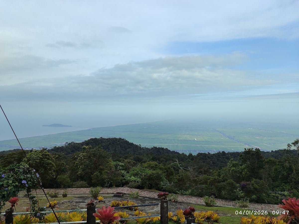
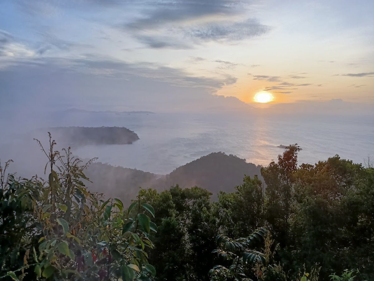
This is a hike that suits people who want a proper jungle experience without driving to Pahang or Kelantan. It's popular with Singaporeans on a weekend trip across the Causeway, JB locals, and Johor hikers who want something with a bit more bite than a park jog. The summit gives you views of the Sumalayang Mountain Range and on a clear day you can pick out Gunung Lambak way over in Kluang. There's even a wooden bench and table up top — carried up by the pioneer hikers who first made this trail — so you can sit and actually enjoy what you climbed for.
That said, Gunung Panti is a leech mountain through and through. Come wet season, or even after a few days of rain in the dry season, the trail turns into a muddy, slippery obstacle course with leeches absolutely everywhere. Plan your timing, prepare properly, and it's a genuinely rewarding Johor hike. Come underprepared and it'll chew you up.
Quick Facts
- Elevation: 531 m (majority of sources; 520 m noted in some trip reports)
- Elevation gain: ~958 m (AllTrails)
- Distance: ~14.6 km round trip (AllTrails); one trip report cites ~10 km one-way via a different measurement basis
- Duration: 2.5–5 hours round trip — fast experienced group around 2.5 hrs, moderate group 4–5 hrs
- Difficulty: Moderate to Moderate-Difficult depending on conditions and your fitness
- Permit required: Yes — through Jabatan Perhutanan Negeri Johor
- Guide: Recommended; tour operators include one as standard
- Trailhead location: North of Kota Tinggi, ~1 hr from JB, ~1.5 hrs from Singapore (add 2–3 hrs for immigration)
Getting There & Parking
From Kota Tinggi town, follow the signboard toward Air Terjun Kota Tinggi (Kota Tinggi Waterfall). Before you reach the small bridge over the river, look for a right turn about 50 metres before Kota Rainforest Resort. That's your trailhead. GPS coordinates: 1.808107, 103.845048.

From JB it's roughly an hour's drive. From Singapore, budget 1.5 hours driving time plus 2–3 hours total for immigration — so a 6am Singapore departure for a 9am hike start is realistic on a good day, not guaranteed. Factor in buffer time.
There's no formal car park here. You park along the main road at the roadside before the red barrier. Some hikers push further down small side roads for shade. No toilets at the start — sort yourself out before you leave town.
Permits & Fees
A permit is required to hike Gunung Panti, issued by Jabatan Perhutanan Negeri Johor. You'll need to submit a passport copy as part of the application — if you're joining a tour operator like SGTREK, they typically collect this about two weeks in advance, so don't leave it last minute.
The exact permit fee in RM wasn't confirmed in any source I could find — the official fee tables weren't accessible. Check directly at forestry.johor.gov.my for the current amount before you plan your trip.
One thing worth noting: Panti Forest Eco Park, a separate facility within the same reserve, operates Tuesday to Sunday, 8am–4:30pm. Whether those hours govern access to the summit trail is unconfirmed, so don't assume you can rock up on a Monday and start hiking.
Trail conditions and permit requirements change — always check with the local forestry office or park authority before you go. Checking a different gunung? Try our free permit checker — instant answer for 90+ Malaysian mountains. Or ask the TAHAN Hiking Community on WhatsApp — someone's usually been there that week.
The Trail: What to Expect
The main trail is an out-and-back route from the roadside trailhead to the summit. There's also an alternative descent via the Lukut Trail (covered below). Here's what the route looks like stage by stage.
Stage 1 – Plantation Approach
From roadside parking, you pass the red barrier and walk a flat plantation road. It's a gentle warm-up. Keep your eyes on the tree trunks — you're looking for trees marked with three red strokes, which is where the trail diverges from the plantation road into proper forest. Easy enough to follow if you're paying attention, easy enough to miss if you're not.

Stage 2 – Creek Crossing (~15 min from trailhead)
About 15 minutes in, you hit a small creek crossing. There's a fallen tree trunk bridge with a rope for assistance. It's not technical but it's the kind of thing that catches people off-guard if they're rushing — take it steady, especially if the trunk is wet. This is also your last confirmed water source on the trail. Treat any water here before drinking; don't drink it straight.
Stage 3 – Gradual Forest Ascent
After the creek crossing, the trail enters proper lowland jungle and the incline picks up steadily. The path is covered with lianas and tree roots — classic Malaysian jungle terrain. This is where leeches are most active and where the trail gets seriously slippery after rain. Watch your footing constantly; a rolled ankle out here is a problem. The biodiversity is genuinely impressive if you slow down enough to notice — Panti Forest hosts over 200 resident bird species and 30+ migratory species, plus the endemic Gunung Panti Bent-toed Gecko if you're lucky.

Stage 4 – Pre-Summit Roped Rock Face
This is the bit that separates Gunung Panti from a straightforward forest walk. Near the summit, you hit a near-vertical rock face with fixed ropes. The final scramble up takes around 10 minutes but it demands your full attention — both hands on rope, proper footwear gripping rock. If you have a fear of heights, this section will test you. Don't underestimate it. In wet conditions it becomes significantly more dangerous.

Stage 5 – Summit Plateau / Gunung Panti Barat
When you break into the first open area, don't stop and declare victory — that's not the true summit. Continue right (in the direction of the Lukut Trail) to reach the Gunung Panti Barat signboard and the wooden bench and table. The summit trees have an unusual coniferous look to them, not what you'd expect after a lowland jungle slog. Views take in the Sumalayang Mountain Range and the northwestern plains of Johor. On a clear day, Gunung Lambak in Kluang is visible in the distance.
If you're staying overnight (camping at the summit is reportedly possible), luminous fungi are visible at night and the air is noticeably cooler. Bring a headlamp either way — the TAHAN Luminate Multifunction Lantern works well here for summit camping as it doubles as a lantern and torch.

Descent & Safety
Going down is where most accidents happen on Gunung Panti. The roped rock face is more awkward on descent — take your time, face the rock, and use the rope properly. The rooted, liana-covered sections of Stage 3 become genuinely treacherous when wet. Trekking poles make a real difference here; the TAHAN 3-Section Foldable Hiking Stick V2 is compact enough to pack without bulk and gives you the stability you need on the steeper descents.
You can descend the same route you came up, or take the Lukut Trail down to Panti Tengah — a different trailhead, so you'll need to pre-arrange a pickup before you leave. Don't wing this; a taxi or second vehicle needs to be sorted in advance.
Key hazards to know before you start:
- Leeches: Expect them. Anti-leech socks, covered shoes, long pants, and salt or vinegar repellant are your defence. In wet conditions, they are relentless.
- Slippery/muddy terrain: The trail after rain becomes a very different hike. Multiple sources confirm this isn't a mild inconvenience — it's a genuine slip hazard.
- Vertical roped wall: Near-vertical fixed-rope section near the summit. Problematic for those with fear of heights and dangerous when wet.
- Snakes and wildlife: Malayan coral snake and other small snakes have been spotted, plus millipedes and the usual jungle critters. Watch where you put your hands and feet.
- Heat and humidity: Tropical heat in a dense jungle is no joke. Start early — most groups begin around 9–10am — and pace yourself.
Turn back if: Weather deteriorates significantly mid-trail, especially before the rock face section. A wet roped wall with no visibility and no guide is not a situation you want to be in. The mountain will be there next weekend.
What to Bring
Given the terrain profile — creek crossing, rooted ascent, near-vertical rock face, leeches — pack with intention:
- Water: Minimum 1.5 L per person. There are no confirmed reliable water sources beyond the creek near the start. A hydration bladder like the TAHAN TrailBladder 2L keeps water accessible without stopping to dig in your bag.
- Footwear: Trail shoes or hiking boots with proper grip. Sandals or running shoes are not appropriate for the rock face section.
- Anti-leech socks + long pants: Non-negotiable in anything but perfect dry conditions.
- Salt or vinegar: For leech removal. Old-school but effective.
- Snacks and energy food: No facilities on trail.
- Rain gear or dry bag: Weather in Johor changes fast.
- First aid basics: Blister pads, antiseptic, bandages.
- Headlamp or torch: If you're starting early or camping at the summit.
- Permit and passport copy: Have these sorted and accessible.
Check out our hiking gear guide for more on what's worth bringing on a hike like this, including when a knee guard actually earns its space in your bag.
FAQ
How hard is Gunung Panti?
Most sources rate it Moderate, but AllTrails reviewers push it toward Moderate-Difficult — and honestly that second rating reflects reality more accurately in wet conditions. The ~958 m total elevation gain is substantial for a 531 m peak (the trail goes up and down more than the summit elevation suggests), and the near-vertical roped rock face near the top is genuinely demanding. Fit hikers who do this regularly will find it manageable; beginners should come with a guide and on a dry day.
How long does Gunung Panti take?
Expect 2.5 to 5 hours round trip. A fast, experienced group can push it in around 2.5 hours. A moderate group — which is most people — should budget 4 to 5 hours. Factor in time at the summit and don't rush the descent.
Do I need a permit for Gunung Panti?
Yes. A permit is required through Jabatan Perhutanan Negeri Johor, and you'll need to submit a passport copy. Tour operators typically need this two weeks before your hike. The exact fee wasn't confirmed from any official source — check directly with the forestry office or at forestry.johor.gov.my before you commit to a date.
Do I need a guide for Gunung Panti?
A guide is strongly recommended and all tour operators include one as standard. Whether a guide is legally compulsory for independent hikers isn't clearly stated in any source I've found — some independent trip reports don't mention hiring one. That said, the trail has a few navigation points that are easy to miss and a vertical rope section that warrants proper supervision if you're not an experienced scrambler. If you're going independently for the first time, bring someone who knows the route.
Camp Nearby?
Making a weekend of it? Johor has some solid camping options within range. For jungle atmosphere close to Gunung Pulai, check out the review for Jungle X Camp, Gunung Pulai — good base if you want to combine a couple of hikes in one trip. If you prefer something with a bit more comfort after a hard day on the trail, HRF Glamping House, Senggarang Johor is worth a read. And for another Pulai-area option, Otternest Camp, Pulai is covered in full on the blog. Staying the night before near Kota Tinggi also means you can get an early start without the immigration rush — absolutely worth considering if you're coming from Singapore.
Trail conditions, permit updates, and hiking buddies for the weekend — all in one WhatsApp group. Just ask; someone was probably up there last week.
💬 Join the Hiking CommunityFree, one click. No spam — the occasional promo at most.
Gear tip: How to use a trekking pole (and set the height).
Mike has been camping across Malaysia for over 10 years — from jungle treks in Taman Negara to beach camps in Perhentian. He writes about it so you don't have to find out the hard way. Follow along on TAHAN Outdoor's blog for honest campsite reviews, every week.