Updated October 2026
Gunung Jerai is the highest peak in Kedah at 1,217 m (3,993 ft), sitting on the border of Kuala Muda and Yan districts near Gurun and Sungai Petani. You can't miss it from the North-South Highway: one lone mountain rising straight out of flat padi fields. You can drive up the tar road from Gurun (about 12 km, roughly 30 minutes by car) or hike up one of five trails, from an easy-ish road walk to a 9 to 10 hour jungle slog. There's no entrance fee, the Geopark car park costs RM 5.00 per car, and most routes don't need a permit. Boleh walk in, for most of them.
Coming from Alor Setar? It's roughly 1 hour 15 minutes by car, so a day trip is very doable. One thing to know before you go: the true summit is permanently closed to the public (telecommunications and military compound, gate, security guard, no photos). You'll top out at the gate area or around 986 m on the jungle routes, and honestly, the views of the Kedah rice plains and Penang Island on a clear day still make it worth it.

Who is this for? Almost anyone, depending on which route you pick. The Tar Road walk is family-friendly. Tangga Kenari suits casual hikers who want a proper workout without jungle navigation. The Merbok Trail and Trek Komando 69 are proper hard hikes for fit, experienced hikers. Gunung Jerai rewards matching the right route to your ability. Get that wrong and you'll be suffering on a trail that wasn't meant for you.
Jerai also has history. The forest has been protected since 1953, the area is now a Geopark containing the oldest rock in Peninsular Malaysia, and the mountain is tied to the ancient Bujang Valley civilisation. Not many Malaysian mountains come with that kind of backstory.
Quick Facts
- Summit elevation: 1,217 m (3,993 ft), highest in Kedah. True summit restricted
- Highest public access: gate area near the top via Tar Road (around 1,175 m per our earlier research); around 986 m via Tangga Kenari and Trek Komando 69
- Routes and distances: Tar Road ~5.5 km one-way | Tangga Kenari ~5.55 km one-way | Merbok Trail ~15.6 km out-and-back | Warisan Trail ~13 km return | Trek Komando 69 ~8.2 km one-way
- Duration: Tar Road 2 to 2.5 hrs return | Tangga Kenari 3 to 5 hrs one-way | Merbok Trail 9 to 10 hrs total | Trek Komando 69 7 to 9 hrs one-way | Warisan Trail not confirmed
- Elevation gain: Merbok ~1,184 m | Tar Road walk ~261 m | Warisan ~1,400 m cumulative (single source, treat with caution)
- Difficulty: Tar Road and Tangga Kenari, Moderate | Warisan Trail, Moderate | Merbok Trail, Hard | Trek Komando 69, Hard (advanced only)
- Permit: Not needed for most routes. Warisan Trail needs a mandatory permit and licensed MGP guide (1 guide per 7 hikers)
- Fees: No entrance fee. Geopark car park RM 5.00/car. Van up the mountain around RM 10/pax
- Weather up top: reportedly around 19 to 21°C, noticeably cooler than the plains
- Nearest town / train station: Gurun
Getting There: Alor Setar, Gurun & Sungai Petani
Gunung Jerai is in Kedah, between Gurun and Yan. Rough drive times:
- Alor Setar to Gunung Jerai: about 1 hour 15 minutes by car (around 32 miles). Head south on the North-South Highway and exit at Gurun.
- Sungai Petani: roughly an hour, depending on which trailhead you're heading to.
- From KL or Penang: come up the North-South Highway and exit at Gurun.
- No car? Gurun is the closest train station. From there you'll need a Grab or taxi to the trailhead. If flying, Penang International or Alor Setar airport both work.
Trailhead access depends on your route:
- Merbok Trail: starts from the car park at Lembah Bujang Archaeological Museum in Merbok. Arrive early and have a look around if you can, it's one of Malaysia's most important archaeological sites.
- Warisan Trail: trailhead is in Yan, Kedah. Permit and guide required, arrange this in advance.
- Tangga Kenari & Trek Komando 69: both start from the Jerai Geopark car park, where a van takes you to the respective trailheads. Search Hutan Lipur Titi Hayun on Google Maps for Tangga Kenari. Van descent is RM 10/pax or RM 80 for a whole van (prices reported by one source, confirm on the day).
- Tar Road: drive up from the Gurun side through Sungai Teroi Recreational Forest.
Parking at the Jerai Geopark car park is ample and costs RM 5.00/car (older reviews mention RM 3, so prices have moved). There may be a separate parking charge at the summit area, bring small change. The Titi Hayun (Hutan Lipur) area has free entry, managed by MPSPK. Weekends and public holidays get congested quickly, go on a weekday if you can.
Can You Drive Up Gunung Jerai?
Yes. The tar road from the Gurun side goes all the way up to the resort and summit area, around 10 to 12 km of climbing. But take it seriously: there are steep, sharp bends throughout, and some sections get narrow enough that passing oncoming cars is tight. Cyclists who ride it report gradients of 9 to 15%, with the last 3 km being the steepest. In practical terms:
- Check your brakes before going up. Not a joke.
- Use a low gear coming down instead of riding your brakes all the way.
- Expect mist, especially in the morning, and drive slowly.
- Not confident driving mountain roads? There's a van service up the mountain, around RM 10 per person. Check with the operator at the bottom for current times and prices.
Opening hours for the road and summit facilities couldn't be verified for 2026, so check with the operator or resort before you go, especially if you plan to arrive early or leave late.
What's at the Top (Ada Apa?)
Even if you're not hiking, there's enough up here for a day trip:
- The Regency Jerai Hill Resort, with a restaurant and food court. Handy for a proper meal after a hike.
- Muzium Hutan (Forestry Museum), free entry. It was reportedly closed on Sundays, but post-COVID status isn't confirmed.
- Alur Naga Waterfall, near the resort area, with a local legend of a dragon living in a cave behind the falls. Batu Kapal, a rock formation with its own local legend, is nearby.
- Telaga Tok Sheikh and Padang Tok Sheikh, named after a Muslim missionary.
- Strawberry farm and a Shiitake mushroom farm near the top.
- Activities reported at the summit area include Sky Bike View, wall climbing and paintball. Check what's actually running before you promise the kids.
- Pitcher plants along the road, no jungle trekking required to see them.
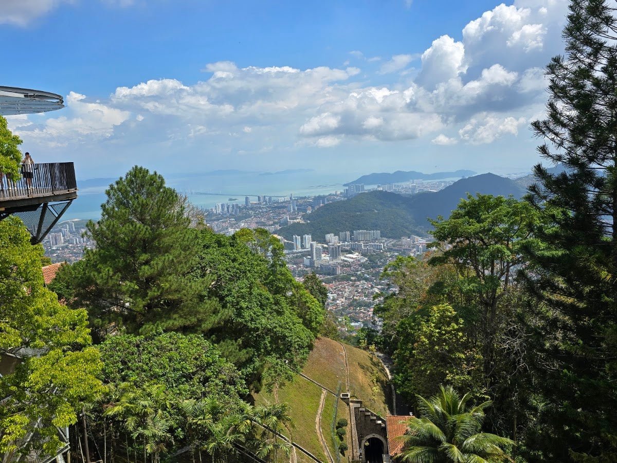
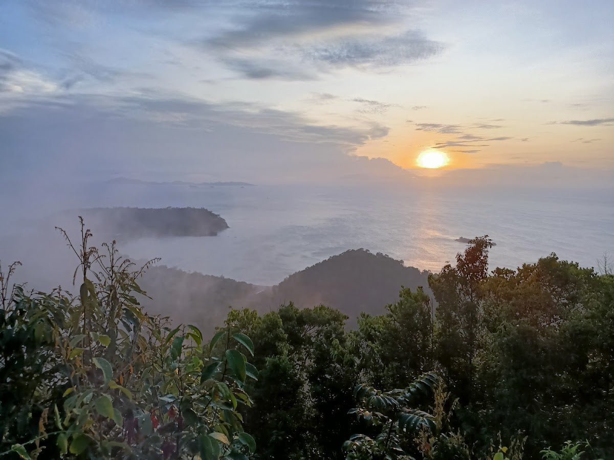
On a clear day the view covers the Kedah rice plains, Penang Island and Pulau Telor. If you like your waterfalls, we've also rounded up waterfalls near KL for when you're back down south.
Permits & Fees
For most routes (Merbok Trail, Tangga Kenari, Trek Komando 69 and the Tar Road walk), no permit or entrance fee is needed beyond the Geopark car park fee of RM 5.00/car.
The Warisan Trail is different. It requires a mandatory permit and a licensed MGP (Malaysian Geopark) guide, with a guide-to-hiker ratio of 1:7. The exact permit cost wasn't confirmed at time of writing, contact the relevant authority before planning this route. Don't just show up expecting to walk in.
Heads up: some official Kedah hiking permit lists mark Gunung Jerai as permit required ("Wajib"), which doesn't match what's happening on the ground for most routes. Rules can change without much notice, so use our gunung permit checker and confirm with Jabatan Perhutanan Kedah before you go.
Trek Komando 69 has no guide requirement listed, but it's rated hard and recommended for advanced hikers only. Common sense applies.
Trail conditions and permit requirements change, always check with the local forestry office or park authority before you go. Checking a different gunung? Try our free permit checker — instant answer for 90+ Malaysian mountains. Or ask the TAHAN Hiking Community on WhatsApp — someone's usually been there that week.
The Trails: What to Expect
Gunung Jerai has five distinct hiking routes with very different characters. Here's what each one actually involves, roughly from easiest to hardest is Tar Road, Tangga Kenari, Warisan, then Merbok and Trek Komando 69.

Tar Road Walk
Distance: ~5.5 km one-way. Time: 2 to 2.5 hrs return. Difficulty: Moderate. Elevation gain: ~261 m.
The most accessible option and the one for beginners. Walk up through Sungai Teroi Recreational Forest, past the Forestry Museum and the Alur Naga Waterfall area, up to the resort area. A gate and security post marks the end of public access. It's tarmac, but still steep, and you're sharing the road with cars on blind bends, so walk single file and stay visible.
Tangga Kenari / Titi Hayun Trail
Distance: ~5.55 km one-way. Time: 3 to 5 hours one-way. Difficulty: Moderate.
Van from the Geopark car park to the Kampung Titi Hayun trailhead. From there, it's a sustained climb up a lot of concrete steps (sources disagree wildly on how many, anywhere from 1,000 to far more, but either way your calves will file a complaint), then jungle trail to a high point of around 986 m.
The steps make it more accessible than a pure jungle trail, but don't mistake accessible for easy, steep is steep. Good for hikers who want a solid challenge without the technical hazards of the jungle routes. Descent is by van: RM 10/pax or RM 80 to charter the whole thing.

Warisan Trail
Distance: ~13 km return. Difficulty: Moderate (rated 5/10). Duration not confirmed.
Trailhead is in Yan. This route goes through Kem Kasut, Sisik Naga and Pacak Nora before reaching Puncak Kepala Angin, it does not reach the true summit. The cumulative elevation gain figure of ~1,400 m comes from a single source and appears to include undulating terrain rather than straight net gain, treat that number with caution.
Mandatory permit and licensed MGP guide required. Sort this out before you travel to the trailhead. No walking in unguided on this one.
Merbok Trail
Distance: ~15.6 km out-and-back. Total time: 9 to 10 hours. Difficulty: Hard. Elevation gain: ~1,184 m.
The most demanding jungle route on Jerai. You start from the Lembah Bujang Archaeological Museum car park, cross a bridge, and immediately hit steep stone steps. The trail climbs hard through jungle, passes Alur Naga Waterfall (a good spot to catch your breath), then continues up steep rocky sections with fixed ropes on the technical bits.
Higher up, the trail enters a mossy forest section around Puncak Kepala Angin. If you've only hiked groomed trails, this will surprise you: soft, quiet, and completely different from the lower jungle. The trail eventually meets the tar road.
Fallen trees have been reported blocking sections of this trail. Check recent hiker reports before you go, a single fallen tree can make a section significantly harder. Over 1,100 m of gain is substantial. Budget the full 9 to 10 hours and don't underestimate it.
Trek Komando 69
Distance: ~8.2 km one-way. Time: 7 to 9 hours one-way. Difficulty: Hard (advanced hikers only).
Van from the Geopark car park to the Tupah Water Treatment Plant area, then into the jungle. The route involves river crossings and passes checkpoints (CP7, CP9) before ending at around 986 m. Not suitable for beginners or anyone who hasn't done multiple hard jungle hikes before. The name isn't decorative.

Day Trip Plan
Gunung Jerai works well as a day trip from Alor Setar, Sungai Petani or even Penang if you leave early:
- Non-hikers or families: drive or take the van up, visit the Forestry Museum, waterfall and strawberry farm, eat at the resort, and head down before late afternoon storms roll in. Half a day is enough.
- Casual hikers: Tar Road walk or Tangga Kenari in the morning, lunch up top, van down.
- Hard routes (Merbok, Komando 69): technically a day trip, but a very long day. Start before sunrise and seriously consider sleeping nearby the night before (see campsites below).
Based in KL and want something shorter first to test your legs? Our list of easy hikes near KL is a good warm-up before committing to Jerai's longer routes.

Descent & Safety
Coming down is where people get hurt. On steep jungle trails like Merbok and Trek Komando 69, tired legs on wet roots and rocks are a serious injury risk. Take your time on the descent, rushing to beat the dark is how you end up with a twisted ankle mid-jungle.
Key hazards to know before you set foot on any trail here:
- Leeches: present on all jungle trails. Anti-leech socks and eucalyptus oil are non-negotiable.
- Scorpions: reported on trail. Watch where you put your hands, especially when grabbing roots and rocks.
- Slippery, muddy terrain: common across all routes, worse in the rainy season. Merbok Trail stone steps and rocky sections become genuinely dangerous when wet.
- Steep exposed tree roots: on every jungle trail. Good grip footwear is essential.
- Landslide risk: on steep slopes after prolonged heavy rain. If there's been sustained rain in the days before your hike, reconsider.
- River crossings: present on jungle routes. Slippery rocks plus a pack is a fall risk.
- Fallen trees: reported on Merbok Trail. Check recent trail condition reports.
- Sudden weather: Jerai gets rapid thunderstorms and thick mist, particularly in the mornings. If the weather turns ugly, turn back. No view is worth getting caught in a Kedah thunderstorm on an exposed ridge.
- Driving hazard: the road up has steep, sharp bends and narrow sections. Check your brakes before driving up. This is not an exaggeration.
- Do not hike at night: these trails are not lit and every hazard above gets significantly worse in the dark.
Water points: on the jungle trails, natural water is available in the lower sections and at stream crossings, but treat or filter before drinking. On the Merbok route, confirmed water access is only up to around 290 m elevation (Checkpoint 3). Above that, carry what you need. Food stalls and water are available at the resort/summit area if you're coming up by road.
Start early, before sunrise on the longer jungle routes. Not for sunrise photos, but because it buys you cooler hours before the heat builds, and it means you're not finishing a 9-hour hike in the dark.

What to Bring
Pack for the route you're actually doing, not a generic hiking list. That said, across all Jerai trails:
- Water: minimum 2 to 3 litres for the shorter routes; 3 to 4 litres for Merbok and Trek Komando 69. A hydration bladder keeps your hands free on technical terrain, the TAHAN TrailBladder 2L fits most packs and does the job well.
- Anti-leech socks: pack these even if you think you won't need them. You will.
- Eucalyptus oil: apply on socks, trouser hems and hands before entering the jungle.
- Trekking poles: useful on steep descents, especially Merbok Trail and the Tangga Kenari steps. The TAHAN 3-Section Foldable Hiking Stick V2 packs down small and holds up on rocky terrain.
- Good grip trail shoes or hiking boots: not sneakers, not sandals. Wet roots will send you down fast.
- Rain jacket or poncho: weather changes fast on Jerai.
- Light layer: it's cooler at the top, especially in mist and wind.
- Headlamp: even if you plan to finish before dark. Plans change.
- Snacks and real food: for Merbok and Trek Komando 69, you're out there most of the day.
- Basic first aid kit: plasters, antiseptic, bandage.
- Power bank and fully charged phone: GPS and emergency contact.
- Cash: van rides, car park fees and many stalls up top work on cash.
If you're unsure how to spec your poles and knee protection for different trail types, we put together our hiking gear guide specifically for Malaysian trail conditions, worth a read before a hard route like Merbok.
Camp Nearby?
Making a weekend of it? Gunung Jerai sits in the northern corridor between Kedah and Penang, with decent options within reach. For something relaxed and well-facilitated before an early start, check out our review of Nadi Glamping Suites, Penang, on the Penang side but close enough if you're coming from that direction. If you want to stay closer and more rugged, Sedim Signature Campsite is worth a look, Sedim River Recreation Park in Kedah is practically in Gunung Jerai's backyard. For a different vibe, we also reviewed KIF Campsite Baling. A night nearby means you're rested and can hit the trailhead before dawn, which on a long route like Merbok makes a real difference. Heading back down south after? Here are the best campsites near KL.
Common Questions
How hard is hiking Gunung Jerai?
Depends entirely on the route. The Tar Road walk is moderate and fine for beginners with basic fitness. Tangga Kenari and the Warisan Trail are moderate, with sustained climbing. Merbok Trail (~1,184 m gain over ~15.6 km, rope sections) and Trek Komando 69 (7 to 9 hours one-way, river crossings) are hard. Don't attempt those two unless you regularly do hard jungle hikes.
Do I need a permit for Gunung Jerai? Boleh walk in?
For most routes, boleh walk in. Tar Road, Tangga Kenari, Merbok Trail and Trek Komando 69 don't currently require a permit, only the RM 5.00/car Geopark parking. The Warisan Trail needs a mandatory permit and licensed MGP guide. Some official Kedah lists still show Jerai as permit required, so confirm with the forestry office or our permit checker before you go.
Can I drive up to Gunung Jerai?
Yes, the tar road from the Gurun side goes up to the resort and summit area, about 30 minutes from Gurun. It's steep with sharp bends and narrow sections, so check your brakes and use low gear coming down. Not keen to drive? A van service goes up for around RM 10 per person.
How far is Gunung Jerai from Alor Setar?
Roughly 1 hour 15 minutes by car (about 32 miles). Take the North-South Highway south and exit at Gurun. Easy enough for a day trip.
How long does the hike take?
Tar Road: 2 to 2.5 hours return. Tangga Kenari: 3 to 5 hours one-way. Merbok Trail: 9 to 10 hours total. Trek Komando 69: 7 to 9 hours one-way. Warisan Trail duration isn't confirmed. Fitness makes a big difference, those ranges are real.
Can I reach the true summit?
No. The 1,217 m true summit is a telecommunications and military compound with a gate and security guard, and photography is prohibited there. Public access ends at the gate area via the road, or around 986 m on the jungle trails.
Is Gunung Jerai the same as Bukit Jerai?
Yes, people use both names, plus "Jerai Hill" and "Mount Jerai". It's the same mountain in Kedah.
Trail conditions, permit updates, and hiking buddies for the weekend — all in one WhatsApp group. Just ask; someone was probably up there last week.
💬 Join the Hiking CommunityFree, one click. No spam — the occasional promo at most.
Gear tip: How to use a trekking pole (and set the height).
Mike has been camping across Malaysia for over 10 years, from jungle treks in Taman Negara to beach camps in Perhentian. He writes about it so you don't have to find out the hard way. Follow along on TAHAN Outdoor's blog for honest campsite reviews, every week.