Gunung Arong, Johor: A Hiker's Guide (2026)
Gunung Arong is one of those hikes that punches above its weight. At roughly 274 m, it's not going to challenge your altitude record — in fact, it's cited as one of the third lowest peaks in Johor — but what it delivers is genuinely hard to find elsewhere: a jungle climb, rope sections, panoramic South China Sea views from the summit, and if you do the traverse, a finish on a beach where you can jump straight into the water. That's a full morning's adventure packed into a short trail, and it explains why this Mersing District gem has built such a loyal following among hikers from Singapore and Johor Bahru.

The standard out-and-back from Kampung Tanjung Resang suits beginners and families looking for their first real jungle hike. The loop and traverse routes add coastal terrain, a tidal river crossing, and some genuinely steep rope work that bumps things up to moderate territory. Know which route you're doing before you leave — the loop is tide-dependent and getting the timing wrong can strand you at a river mouth you can't cross.
Best time to go is March to October, outside the East Coast monsoon. December to early February brings high chances of rain and rough weather on this coastline. The trail is listed as open year-round, but monsoon season on the East Coast is no joke — slippery roots, swollen streams, and poor summit visibility are real possibilities.
Quick Facts
- Elevation: ~274 m (most operator sources; HikersForLife cites 273 m, TripZilla 240 m — figures vary by source)
- Distance: Standard out-and-back (Kampung Tanjung Resang): ~8.5 km | Loop route: ~6.6 km | Full traverse to Teluk Gorek: ~5.5 km | Longer alternate out-and-back: ~10.8 km (all figures from user-generated sources)
- Duration: Most hikers report 2–3 hours return on the standard route; longer 10.8 km variant takes 4–4.5 hours; loop ~2–2.5 hours
- Difficulty: Easy to slightly moderate (standard out-and-back); moderately challenging (loop, due to coastal and river section); Grade 1A per Ace Adventure
- Permit required: Yes — RM10 per person (fee from ~2016 sources; verify current amount)
- Trailheads: Kampung Tanjung Resang (main) or Teluk Gorek beach (alternate)
- Best season: March to October
Getting There & Parking
Gunung Arong sits in Mersing District, Johor — roughly 17 km from Mersing town and 22 km from Endau. From Singapore, budget 2.5–3 hours drive. From Johor Bahru, it's around 1.5 hours. Public transport doesn't reach the trailhead, so you need your own wheels.
Navigate to Tanjung Resang via Waze or Google Maps. Coming from the main road, turn into the village road at the signboard and take the right fork at the Y-junction near a small shophouse. You'll pass through a rustic kampung and oil palm plantation before reaching the trail base. Parking is available near the resting hut at the base camp area at the Kampung Tanjung Resang entrance. If you're starting or finishing at Teluk Gorek, there's also parking near the campsite there — useful if you're doing the full traverse and need to arrange a car shuttle between the two ends.

Permits & Fees
A permit is required — rangers patrol the trail regularly and can issue fines if you're caught without one. The fee reported across multiple sources is RM10 per person, but that figure comes from reports dating back to around 2016, so treat it as a starting point and confirm the current amount before you go.
Permits are issued by the East Johor District Forest Office (Pejabat Hutan Daerah Johor Timur), located on Jalan Ibrahim in Mersing town centre. Office hours are Monday to Friday, 8:00am–4:00pm. One older source flags Monday as a possible forest maintenance day and Friday as prayer day, so there may be reduced availability on those days — worth a call ahead. Weekend permit access is unclear across all sources we found, so don't assume you can just show up on a Saturday morning without having sorted this first.
Contact numbers on record are +607-798 1030 and +607-799 3363, but these are unverified 2016 details — use them as a starting point and confirm they're current. There's also reportedly a small shop near the trailhead that may serve as an on-site registration counter, though this is a single unconfirmed source.
One more thing: at least one hiker reports being told a guide is required to enter. Mainstream sources including tour operators describe self-guided hiking without flagging this as mandatory, but it's an unresolved question. Sort it out with the forest office before you drive all the way out there.
Trail conditions and permit requirements change — always check with the local forestry office or park authority before you go. Checking a different gunung? Try our free permit checker — instant answer for 90+ Malaysian mountains. Or ask the TAHAN Hiking Community on WhatsApp — someone's usually been there that week.
The Trail: What to Expect
The route description below follows the standard Kampung Tanjung Resang out-and-back, with notes on the traverse and loop variants where the trail diverges.
Trailhead: Kampung Tanjung Resang
After parking near the resting hut, the trail starts with a walk through the village and oil palm plantation. It's a gentle warm-up before the jungle takes over. Lace up here, sort your pack, and make sure you've got enough water on you — there's a small stream near the trail base but no confirmed potable water sources further up, so don't bank on it.

Lower Trail: First 30 Minutes
The trail begins beside a small stream and hits a consistent 30–40° incline almost immediately. This isn't a casual stroll — your legs will know they're working within the first few minutes. The terrain here is rooted and can be muddy after rain. Pace yourself; this gradient sustains for roughly the first 30 minutes and it's tempting to go out too hard.
Mid-Section: Stairs, Roots, Ropes
This is where Gunung Arong earns its keep. Steep wooden stairs, exposed roots, a wooden bridge, and rope sections make up the mid-trail. The ropes are load-bearing — use them, especially on wet days. Multiple TripAdvisor reviewers specifically flag the rope sections, so don't underestimate them just because the peak elevation looks modest on paper. Watch your footing on the wooden stairs; they get slick when damp.

Upper Trail: Gradient Eases
After the hard mid-section, the gradient eases and the trail opens up as you approach the top. You'll start getting glimpses through the canopy. Keep moving — you're close.
Summit (~274 m): Views of the South China Sea
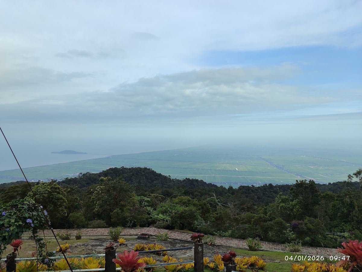
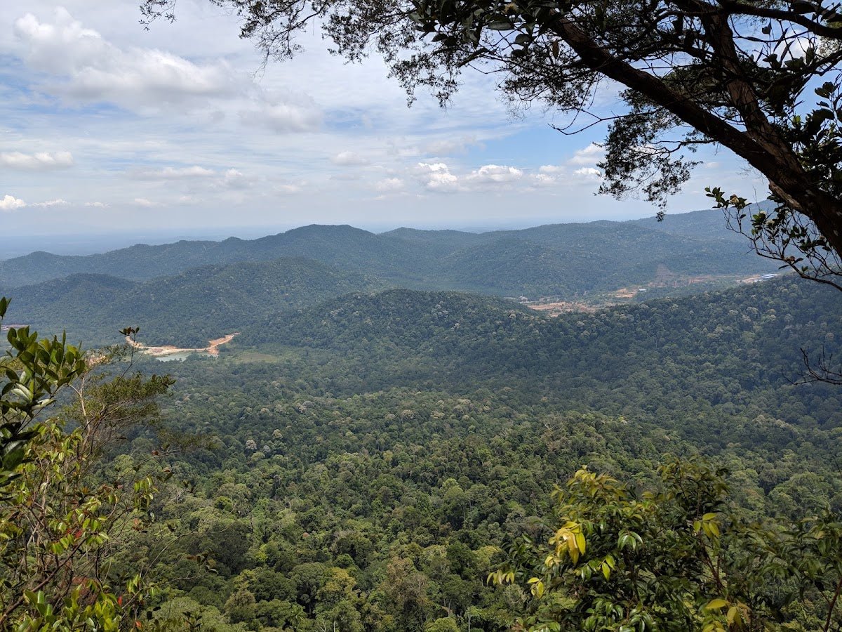
The summit delivers. On a clear day you get panoramic views of the South China Sea and Pulau Tioman in the distance. There are reports of a striking view of the coastline — worth the climb on a clear morning. Hikers who push for sunrise (some start as early as 4:30am from the carpark) report spectacular light over the sea if the weather cooperates. From here you can also detour to a False Summit and a notable Big Tree — both worth a look if you have time.

[Traverse/Loop Only] Post-Summit Descent to Coast
If you're continuing on the traverse or loop rather than turning back, the terrain immediately after the summit drops steeply with rope sections again — arguably trickier than the ascent side. Take your time here. Below that, the Lover's Bridge boardwalk is a highlight: a wooden walkway with open views of the South China Sea and nearby islands. There's also a cliff viewpoint nearby worth a short stop.
From there, the traverse finishes with roughly 200 m of coasteering over large red boulders and a river mouth crossing to reach Teluk Gorek beach and the outdoor resort nearby. If you're on the loop, this beach and coastal rock section extends to about 2 km — and the river mouth crossing at the end is entirely tide-dependent. At high tide, it's described as nearly impossible. Check the tide table before you commit to this route, not when you're already standing at the water's edge.

Descent & Safety
Coming down the Kampung Tanjung Resang side, the same rope sections and rooted stairs that challenged you on the way up become more demanding on tired legs. Descents on wet jungle trails cause more injuries than ascents — slow down, use the ropes, and step deliberately on those wooden stairs.
Key hazards to know before you go:
- Steep slippery descent with ropes — particularly on the traverse side post-summit; requires care even in dry conditions
- Exposed roots and wooden stairs — throughout the trail; extremely slick when wet
- River mouth crossing on loop route — near-impassable at high tide; check tide tables and plan your timing before you start
- Tidal beach section on loop — the entire coastal route is tide-dependent; don't attempt the loop without knowing the tide schedule
- Monsoon weather (December–early February) — high chance of rain, slippery terrain, and poor visibility on the summit
- Leeches — standard for Johor jungle, especially after rain; bring salt or a leech sock
- Wildlife — silver-leaf monkeys, macaques, and water monitor lizards have been spotted; don't feed them, don't provoke them
If weather turns bad mid-hike — heavy rain, thunder, dropping visibility — turn around. The summit view isn't going anywhere. A slippery rope section in a downpour is not the place to test your luck. This applies doubly on the traverse route where you're committing to a longer, more complex finish.
What to Bring
Gunung Arong is a short hike but the terrain demands proper preparation. Here's what you actually need for this trail:
- Water — bring enough from the start; at least 1.5–2 litres. There's a stream at the base but no confirmed potable sources on trail. A hydration bladder keeps your hands free on the rope sections — the TAHAN TrailBladder 2L is a solid, affordable option for a trail like this
- Good grip footwear — trail shoes or hiking boots with proper grip. Sandals or running shoes on wet roots and wooden stairs is asking for trouble
- Hiking poles — not essential on the ascent, but genuinely useful on the steep rooted descent, especially if your knees feel it. The TAHAN 3-Section Foldable Hiking Stick V2 folds compact enough to clip to your pack when you hit the rope sections. Check out our hiking gear guide if you're unsure whether poles or a knee guard makes more sense for you
- Headlamp or torch — if you're doing a sunrise start (4:30am trailhead time is reported), you need light for the approach and lower trail
- Snacks and a proper meal — it's a short hike but the coastal section or traverse adds time; don't skip food
- Rain jacket or poncho — afternoon rain in Johor is common outside monsoon season too
- Leech socks or salt sachet — for after-rain conditions especially
- Dry bag or waterproof liner — protect your phone, documents, and permit; coastal and river sections on the traverse mean spray is possible
- Tide table printout — if you're doing the loop or traverse. This is not optional
- Permit — sorted in advance from the Mersing forest office, not assumed at the trailhead
FAQ
How hard is Gunung Arong?
The standard out-and-back is easy to slightly moderate — Ace Adventure grades it 1A, and it's commonly described as beginner-friendly. That said, there are genuine rope sections and steep stairs in the mid-trail that will surprise hikers expecting a casual walk. The loop route bumps up to moderately challenging due to the coastal terrain and tide-dependent river crossing. Don't let the 274 m elevation fool you into underpreparing.
How long does Gunung Arong take?
Most hikers complete the standard out-and-back in 2–3 hours. Fast hikers have clocked under 90 minutes total; a more relaxed pace with stops at the summit runs 2.5–3 hours. The loop route takes around 2–2.5 hours. The longer 10.8 km alternate out-and-back is reported at 4–4.5 hours. Sunrise hikers typically start from the trailhead around 4:30am to catch first light at the summit.
Do I need a permit for Gunung Arong?
Yes. A permit is required and rangers do check — fines are issued for non-compliance. The reported fee is RM10 per person, though that figure comes from sources dating to around 2016, so verify the current amount. Permits are issued at the East Johor District Forest Office in Mersing town (Mon–Fri, 8:00am–4:00pm). Weekend permit access is unclear — don't assume you can collect one on Saturday morning without confirming first.
When is the best time to hike Gunung Arong?
March to October is the recommended window, outside the East Coast monsoon. December to early February brings significantly higher chances of rain and rough weather. The trail is listed as open year-round, but monsoon conditions mean slippery terrain, poor visibility, and a much less enjoyable summit experience. Sunrise hikes are popular — the sea view from the top in good morning light is the payoff most people are chasing.
Camp Nearby?
Making a weekend of it? Mersing and the surrounding Johor area have decent camping options if you want to arrive the evening before for an early start — far better than a 4am drive from KL or Singapore. For reviewed spots worth considering in the region, check out Jungle X Camp, Gunung Pulai for a jungle camping experience, HRF Glamping House, Senggarang Johor if you want something more comfortable, or Otternest Camp, Pulai for another solid Johor option. Staying nearby the night before means you hit the trailhead fresh, permit in hand, before the heat builds.
Trail conditions, permit updates, and hiking buddies for the weekend — all in one WhatsApp group. Just ask; someone was probably up there last week.
💬 Join the Hiking CommunityFree, one click. No spam — the occasional promo at most.
Gear tip: Water bladder or bottle on a humid trail.
Mike has been camping across Malaysia for over 10 years — from jungle treks in Taman Negara to beach camps in Perhentian. He writes about it so you don't have to find out the hard way. Follow along on TAHAN Outdoor's blog for honest campsite reviews, every week.