Gunung Lambak, Kluang: A Hiker's Guide (2026)
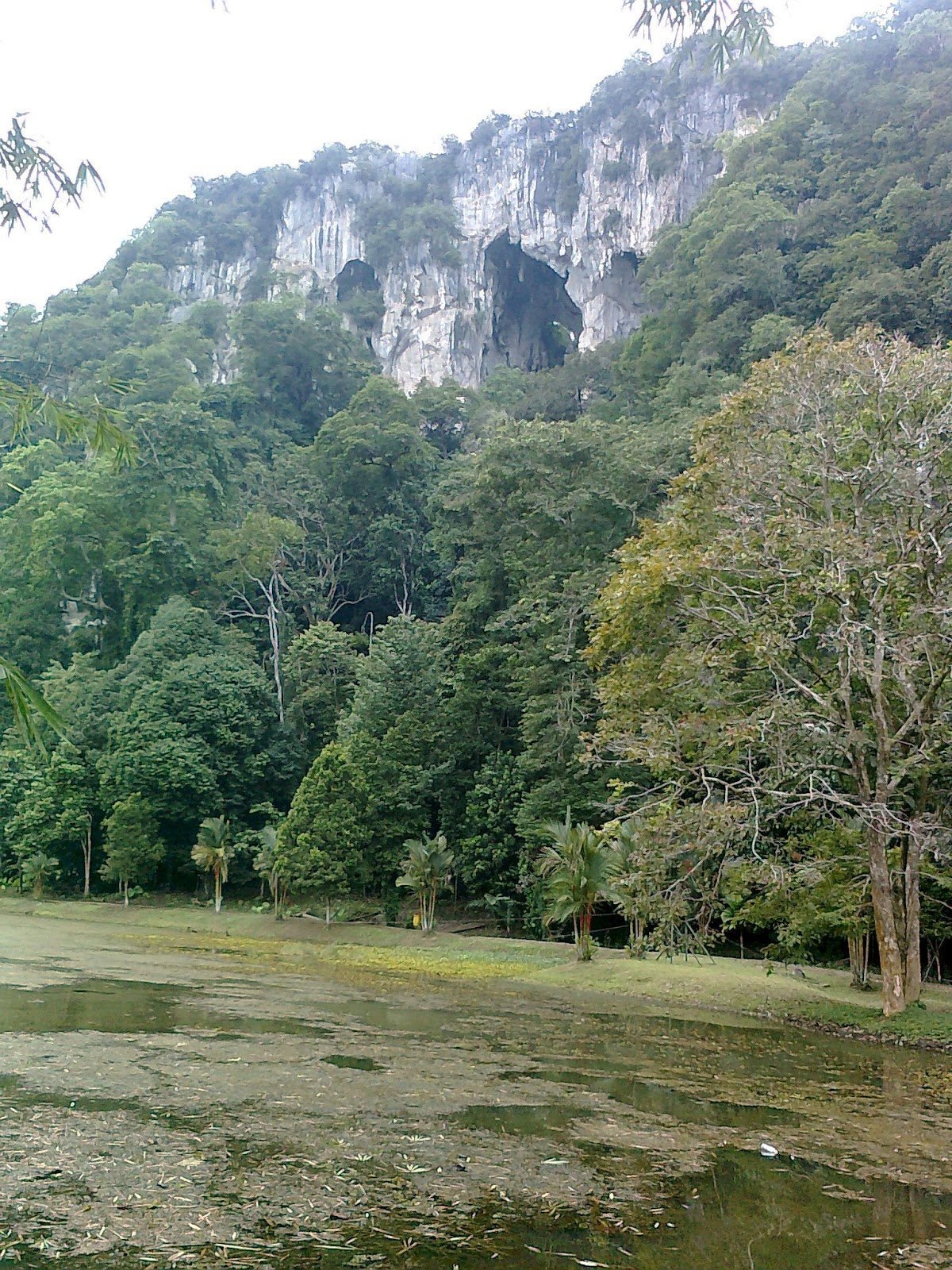
Gunung Lambak is Kluang's backyard mountain — the one locals climb before breakfast on weekends, and the one that quietly humbles first-timers who checked "Easy" on AllTrails and showed up in sandals. At 510 m, it's not tall by Malaysian standards, but the upper section has steep, rope-assisted scrambles that will work your grip, your quads, and your ego. This is a proper jungle hill hike with real terrain, not a nature walk.

It suits beginners who are reasonably fit and want their first real summit experience, and it suits regulars who want a quick, satisfying workout close to Kluang town. The twin-peak option adds spice for those who want more. What you get at the top: a 510 m signboard, a comms tower, and a wide view over Kluang town that makes the rope-pulling worthwhile.
One important heads-up before you plan: Majlis Perbandaran Kluang (MPK) has previously issued a temporary closure notice for maintenance and conservation. No confirmed reopening date was stated in that notice. Always verify the trail is open before you make the drive out.
Quick Facts
- Summit elevation: 510 m (1,673 ft)
- Trail distance: Loop ~5.1–6.3 km; trailhead to summit ~2 km one-way
- Elevation gain: ~120 m (standard loop)
- Duration: Ascent ~1–1.5 hours; full round trip 2–4 hours depending on fitness and route
- Difficulty: Moderate (officially rated Easy on AllTrails, but multiple trip reports and Malaysia-Traveller call it deceptively tough — Moderate is the honest rating for the full route)
- Permit required: No
- Admission fee: No
- Guide required: No
- Managed by: Jabatan Perhutanan Negeri Johor — Pejabat Hutan Daerah Johor Tengah, Kluang (Tel: 07-772 5944)
Getting There & Parking
The trailhead is at the car park of Gunung Lambak Water Park / Gunung Lambak Eco Resort, Susur 1 Kampung Yap Tau Sah, 86000 Kluang, Johor. GPS coordinates: 2.027163, 103.357568. It's roughly 5 km from Kluang town centre — about 15 minutes by car.
Parking is free and there's ample space for cars and even coaches. Street parking is also available just past the Eco Resort if the main lot fills up on busy weekends. Early morning on a weekday? You'll have your pick of spots. Saturday morning at 8 AM? Arrive early or expect a bit of a scramble for parking.
There's no direct public transport to the trailhead. From Kluang town or KTM Kluang Station, grab a Grab or a taxi — it's the most practical option. Don't bank on walking from town.

Permits & Fees
No permit, no registration, no admission fee. This is one of the most accessible hikes in Johor from a paperwork standpoint. Just rock up, sign nothing, pay nothing, and start walking. The mountain is managed by Jabatan Perhutanan Negeri Johor (Pejabat Hutan Daerah Johor Tengah, Kluang) and their contact is 07-772 5944 if you need to check anything.
Trail conditions and permit requirements change — always check with the local forestry office or park authority before you go. Checking a different gunung? Try our free permit checker — instant answer for 90+ Malaysian mountains. Or ask the TAHAN Hiking Community on WhatsApp — someone's usually been there that week.
The Trail: What to Expect
There are route choices at the junction near the base, so understand the options before you commit. The trails converge at the summit, but how hard you work to get there is entirely up to you.
Stage 1 — Concrete Path from Car Park
You start on a paved road running alongside a stream — flat, shaded, comfortable. The first ~400 m is genuinely easy and suitable for the whole family. Rest shelters line the route, including the Tea House Shelter on the right, which is where the trail splits into three. Enjoy the flat while it lasts.

The Junction: Pick Your Route
At the Tea House Shelter junction, three options branch off. Left is Laluan Awam — the gentler, distance-marked route, roughly 1.5 hours to the summit. Middle is a very steep variant. Right is Laluan Xtreme — the steepest option, rope-assisted throughout, and about 30 minutes to the summit if you've got the legs for it. Most people doing Laluan Xtreme for the first time will use more than 30 minutes. That's fine. There's no shame in taking your time on ropes.
Stage 2 — Jungle Trek (Mid-Section)
Whichever route you choose, the mid-section is proper jungle hiking — soil, tree roots, concrete steps in places, railings where the trail gets steep. The canopy provides good shade throughout, which matters when you're working hard. The terrain gets increasingly demanding as you gain elevation. This is where the "Easy" rating starts to feel optimistic.
Stage 3 — Upper Section
Rocky and sandy terrain, very steep, and rope-assisted scrambling is required. You're using hands and feet here — both going up and coming down. One recent hiker described steps as high as waist height and needing all fours at times. That's accurate. The sandy trail becomes genuinely treacherous when wet, so if it rained the night before, this section demands serious respect.

Peak 1 — Summit (510 m)
The summit has a communications and TV broadcasting mast, a summit signboard with the elevation marker (the photo spot everyone comes for), and a small shelter hut. The views over Kluang town are wide and satisfying — worth every metre of rope-pulling. Take your time here before deciding whether to push on to Peak 2.
Peak 2 — Secondary Peak (~470 m)
One source puts the secondary peak at around 470 m, with roughly 35 minutes of hiking between the two peaks. The approach from Peak 1 is reportedly steeper, and route-finding between the peaks can be confusing — multiple hikers have reported trail confusion in this section. Don't attempt Peak 2 if you're already tired, the weather is turning, or you're short on time. There's also reportedly a vertical pole at the top for those who want a truly dramatic vantage point — but that's entirely your call.

Descent & Safety
Coming down Gunung Lambak is where people get hurt. The upper rocky and sandy section is significantly more dangerous on the descent, especially if there's been any rain. Multiple hikers have reported slipping on this section. Take it slow, use the ropes going down as much as going up, and watch your foot placement on every step.
Key hazards to know before you go:
- Slippery rocky and sandy trail after rain — this is confirmed dangerous when wet, not just inconvenient. If it rained recently, seriously reconsider or take the gentler route.
- Steep rope-assisted sections — gloves are recommended to avoid rope abrasion on your palms. Wear them on the way down too.
- Wild monkeys on trail — don't feed them, don't approach them, and keep food secured.
- Route confusion between peaks — if you're heading to Peak 2, pay close attention to trail markers. Going off-route on this section is a real possibility.
- Suspension bridge at base — previously reported as closed due to disrepair. Verify the current condition on arrival; don't assume it's open.
- Safety warnings on certain trail structures — take any posted warnings seriously.
If weather deteriorates — rain starts, thunder in the distance — turn back immediately. The upper section becomes a very different mountain in the rain. No summit view is worth a fall on wet rope.
Best time to hike is early morning — locals start from 6 AM on weekends. Avoid December to early February when the Northeast Monsoon brings heavy rain. March to October is the recommended window, though always check conditions closer to your visit date.
What to Bring
Gunung Lambak is a half-day hike, not an expedition, but the upper section is physically demanding and the terrain punishes hikers who cut corners on gear.
- Water: Carry 1.5–2 litres minimum. There's reportedly at least one water tap on the loop trail, but don't rely on it as your only source. There's also a small stream at the base.
- Shoes: Proper trail shoes or hiking boots with grip. Not sandals. Not Converse. The upper section on wet sand will destroy your confidence in flat-soled shoes.
- Gloves: Lightweight work gloves or hiking gloves for the rope sections — your palms will thank you.
- Snacks: No food stalls on the trail. Eat before you start, carry something for the summit. The fruit stalls at the base are there for after, not during.
- Trekking poles: Not mandatory, but very useful for the descent. The TAHAN 3-Section Foldable Hiking Stick V2 (RM99) folds compact for the rope sections and opens back up when you need it on the descent.
- Knee support: If your knees feel the descent on any hike, bring it. The TAHAN Kinetix Knee Guard With Spring Support (RM79) is genuinely useful on the steep downhill sections here.
- Rain jacket or poncho: Weather can shift quickly. A light layer takes up almost no space.
- Sunscreen and hat: The summit area is exposed.
- Fully charged phone: For navigation, emergencies, and the summit selfie.
Not sure what else to pack for a hike like this? Check out our hiking gear guide — covers the essentials without overcomplicating it.

FAQ
How hard is Gunung Lambak?
Harder than the AllTrails "Easy" rating suggests for the full route. The lower concrete section earns that Easy label, but once you hit the jungle trail and especially the upper rope-assisted section, you're dealing with Moderate terrain at minimum. Malaysia-Traveller calls it "deceptively tough" — that's fair. Go in prepared for real climbing, not a stroll, and you'll be fine.
How long does it take to hike Gunung Lambak?
Ascent to Peak 1 takes most people 1–1.5 hours. Full round trip, including rest time at the summit, runs 2–4 hours depending on your fitness, your route choice, and whether you add Peak 2. If you're taking Laluan Xtreme and pushing for both peaks, budget towards the higher end.
Do I need a permit for Gunung Lambak?
No permit, no registration form, no fee. Just turn up. If you want to confirm current trail status (especially given past closure notices from MPK), call Jabatan Perhutanan Negeri Johor at 07-772 5944 before your trip.
Is Gunung Lambak suitable for beginners?
It can be a good first real summit experience if you're reasonably fit and take the Laluan Awam (gentler) route. But "beginner" doesn't mean unprepared — wear proper shoes, bring enough water, and don't attempt the Laluan Xtreme route on your first time out. The upper section on any route involves steep terrain and rope work that will surprise people expecting a casual nature trail.
Camp Nearby?
Making a weekend of it? Johor has some solid camp and stay options within reasonable distance. For jungle camping vibes, check out our reviews of Jungle X Camp, Gunung Pulai and Otternest Camp, Pulai — both in the Pulai area and worth the trip. If you'd rather sleep somewhere with more comfort after a hard day's hiking, HRF Glamping House, Senggarang Johor is worth a look. Staying the night nearby also means you can hit Gunung Lambak at 6 AM with the locals — which is honestly the best way to do it before the weekend crowds arrive.
Trail conditions, permit updates, and hiking buddies for the weekend — all in one WhatsApp group. Just ask; someone was probably up there last week.
💬 Join the Hiking CommunityFree, one click. No spam — the occasional promo at most.
Gear tip: How to use a trekking pole (and set the height).
Mike has been camping across Malaysia for over 10 years — from jungle treks in Taman Negara to beach camps in Perhentian. He writes about it so you don't have to find out the hard way. Follow along on TAHAN Outdoor's blog for honest campsite reviews, every week.