Gunung Belumut: A Hiker's Guide (2026)
Gunung Belumut holds a special place on the Malaysian hiking map — at 1,010 m, it's widely regarded as the southernmost peak above 1,000 m on Peninsular Malaysia, sitting deep in Johor's forests about 32 km from Kluang. That alone makes it a bucket-list tick for Johoreans and Singaporeans alike, and on weekends the car park fills up with groups who've made the 2.5-hour drive across the Causeway just for this one climb.

This is not a beginner mountain. Yes, it's a day hike — and yes, people do finish it in under 6 hours — but the terrain between CP3 and the summit demands hands-and-feet scrambling, and the trail turns genuinely treacherous when wet. It suits hikers who are reasonably fit, comfortable on steep jungle trail, and disciplined enough to respect a hard turnaround rule. If that's you, Belumut rewards with proper views, a cool breeze at the top, and one of Johor's best jungle experiences.
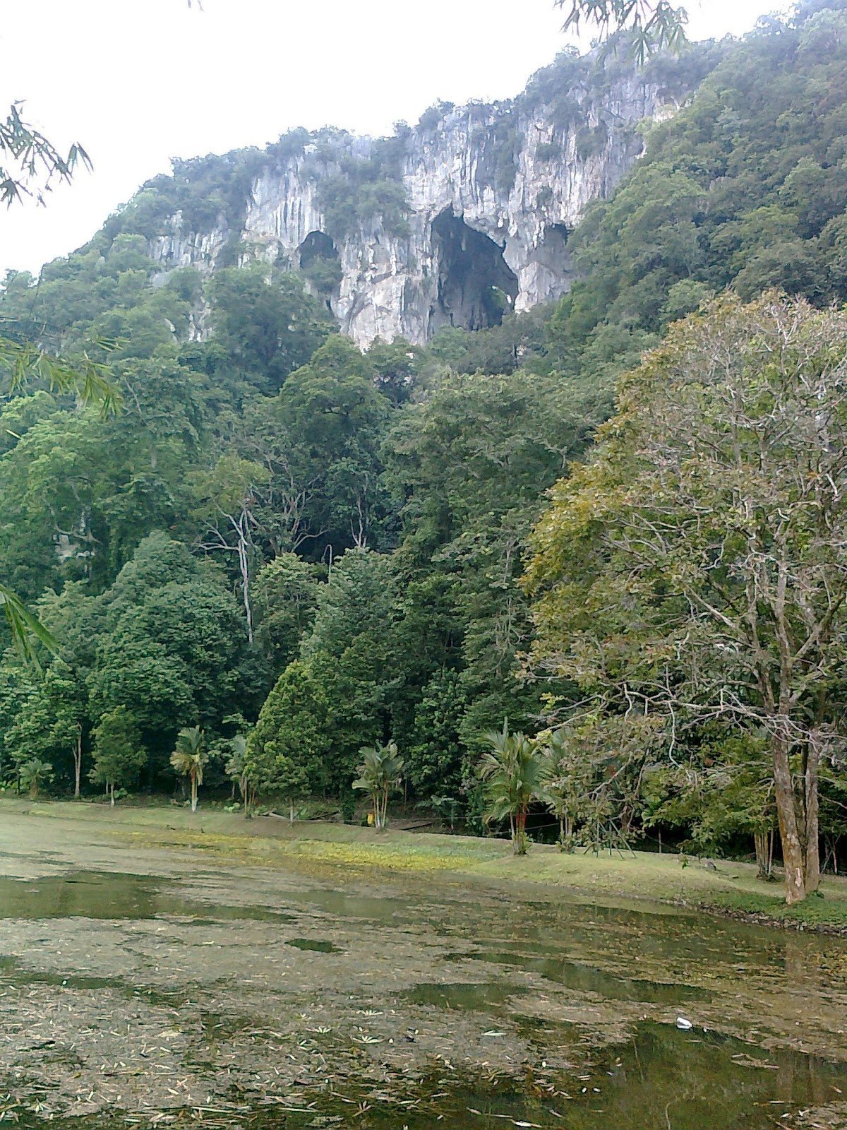
The name 'Belumut' itself refers to smooth mossy rocks — and you'll understand why once you're deep in the forest, surrounded by lush moss-covered boulders. The trail passes through Taman Eko Rimba Gunung Belumut, a gazetted recreational forest, and the whole experience feels properly wild for a peak this accessible from a major city.
Quick Facts
- Summit elevation: 1,010 m asl
- Elevation gain: ~959 m (trailhead at ~51 m asl)
- Distance: ~12 km out-and-back (~6 km one-way)
- Duration: Ascent 3.5–6 hrs; full round trip 6–10 hrs depending on fitness
- Difficulty: Challenging / Hard — steep throughout, with technical scrambling near the summit
- Permit: Mandatory (Jabatan Perhutanan Negeri Johor)
- Trailhead: Ulu Dengar, ~32 km from Kluang; ~125–137 km from Johor Bahru
- Parking: Available at Taman Eko Rimba Gunung Belumut base
Getting There & Parking
The trailhead is at Ulu Dengar, roughly 32 km from Kluang town along Jalan Kluang-Mersing. From Johor Bahru it's about 125–137 km, and from Singapore you're looking at around 2.5 hours by car. GPS coordinates for the trailhead and forest office: N2.0666°, E103.5255°.
There is no public bus service to the trailhead — you need your own transport or a hired driver. The access road may require a 4WD vehicle according to MPKluang's official portal, though this isn't confirmed as a hard rule. If you're driving a regular car, check with the forestry office first before committing to the drive, especially after rain. Parking is available at the Taman Eko Rimba Gunung Belumut base — there's a proper car park at the recreational forest entrance. The base also has 23 camping units available at RM10 per tent, which is handy if you want an early start the next morning.

Permits & Fees
A permit is mandatory, issued by Jabatan Perhutanan Negeri Johor (Johor State Forestry Department). You must arrange your permit before entering the trail, and hikers are required to report at the park office to have permits verified before setting off.
There's a daily quota on climbing slots, so this isn't a just-show-up situation. During school holidays and public holidays, slots reportedly fill up 2–3 weeks in advance — plan accordingly.
On fees: sources conflict significantly here. Older data shows RM10 (Malaysians) / RM30 (foreigners) as a walk-in rate, while a more recent 2024 update reports RM150 per participant via e-permit. These are very different numbers, so don't budget based on either figure until you've confirmed directly. Check forestry.johor.gov.my for the current rate.
On guides: older sources state a guide is mandatory alongside the permit. More recent trip reports don't explicitly mention this requirement, but organised groups from Singapore still hire guides as standard practice. This is worth confirming directly with Jabatan Perhutanan Negeri Johor before you book anything.
Trail conditions and permit requirements change — always check with the local forestry office or park authority before you go. Or ask the TAHAN Hiking Community on WhatsApp — someone's usually been there that week. Checking a different gunung? Try our free permit checker — instant answer for 90+ Malaysian mountains.
The Trail: What to Expect
Gunung Belumut has five checkpoints (CP1 through CP5, with the summit at CP5). The first half is manageable; the second half earns the 'Hard' rating. Here's how it breaks down:
Car Park / Base (51 m asl) — Starting Out
You begin at the recreational forest base, crossing a suspension bridge over a stream before a flight of stairs leads you up onto the jungle trail proper. There's a picnic area, chalets, and camping units here — it's a proper recreational forest setup, not just a clearing in the jungle. Get your permit verified at the park office before you cross that bridge.

Trailhead → CP1 Lata Tengkorak (197 m asl) — ~2 km, ~45–60 min
This opening stretch is the most forgiving section of the whole hike. The trail is relatively flat, the canopy is thick, and you'll hit several stream crossings in the first 45 minutes or so — refreshing early on, though they can make boots waterlogged. At around the 44-minute mark you'll reach Lata Tengkorak, or Skull Cascade Waterfall. Yes, the name is dramatic. The waterfall is genuinely nice — a cool, mossy spot to rest before things get serious. This is the last confirmed water source on the trail, so top up your water here.
CP1 → CP2 Batu Kerang (Shell Rock) — ~1 hr
The gradient shifts noticeably from CP1 onwards. Expect a consistent ~30-degree slope through here — it's steady climbing rather than technical, but your legs will know about it. CP2 is marked by a distinctive large shell-shaped rock formation, Batu Kerang. It's a good spot to catch your breath and check your time against the turnaround rule (more on that below).

CP2 → CP3 Bukit Botak (Bald Hill) — ~1 hr
Bukit Botak translates to 'Bald Hill' and elevation continues to climb steadily through this section. The jungle trail here is rooted and can be slippery. Pace yourself — the hardest section is still ahead, and you want legs in reserve.
CP3 → CP4 → Summit (1,010 m) — Most Demanding Section
This is where Gunung Belumut earns its Black Diamond rating on TrailForks. The section from CP3 to CP4 requires genuine hands-and-feet scrambling — you're not just hiking steeply, you're using your arms to haul yourself up rock faces. As one hiker put it, 'CP3 to 4 is the steepest and so slippery when it rains' — that's not an exaggeration. Near CP4 there's a viewpoint with views across to Gunung Chemendong, which is a good morale boost when your arms are burning.
The summit at 1,010 m features a large rock boulder, a small rest area, and — on clear days — panoramic views of surrounding mountains and valleys. Note that there's a military installation near the summit and photography is prohibited per 2024 signage. Respect the rules; this isn't negotiable. Summit capacity is limited to around 15 persons at any one time, so if it's busy, wait your turn.

⏰ The Turnaround Rule — Non-Negotiable
This matters enough to call out separately. You must reach CP3 before 12:30 pm or turn back immediately. Regardless of whether you've reached the summit, the mandatory turnaround is 2:00 pm. Recommended start time is before 10:00 am — organised groups from Singapore aim for the trailhead by 7:30–8:00 am. If you're starting after 9:30 am, you're cutting it fine. The light drops fast in the jungle after 5:00 pm and you do not want to be descending CP3–CP4 in the dark.
Descent & Safety
The descent follows the same route back — no loops here, it's an out-and-back. Coming down takes most hikers 3–4 hours. Don't let the downhill fool you into rushing; the roots and mud on the steeper sections between CP3 and CP1 cause more injuries than the ascent. Take your time, use your poles or find solid handholds, and watch your footing on every root crossing.
You need to be off the mountain before approximately 5:00 pm when light fades. Factor this into your summit timing. If you hit CP3 at 12:29 pm, summit, and turn around immediately, you've got a tight window. A few key hazards to keep in mind:
- Leeches: Common throughout the forested trail — wear long sleeves and apply insect repellent before you start
- Muddy, slippery trail after rain: Exposed roots throughout, worst on descent — trekking poles are not optional luxury here
- CP3–CP4 scrambling: Hands and feet required; wet rock here is seriously dangerous — if conditions are bad, turn back at CP3
- Turnaround rule: 2:00 pm hard stop regardless of where you are — missing this risks being caught on the trail after dark
- Running on descent: Don't. The injury risk is real on this terrain
- Photography near summit: Military installation nearby — photography is prohibited
- Road access: May require 4WD — verify with forestry office before driving up, especially in wet season
If weather turns bad — heavy rain, mist, or thunderstorm — turn back from wherever you are. The scrambling sections become genuinely dangerous when wet. No summit view is worth a bad fall on wet rock.

What to Bring
Gunung Belumut is nearly 1,000 m of elevation gain over jungle terrain. Pack accordingly:
- Water: Minimum 2–3 litres per person. There's no confirmed potable water above CP1 — carry everything you need for the full round trip. A hydration bladder like the TAHAN TrailBladder 2L keeps your hands free on the scrambling sections, which matters from CP3 onwards.
- Trekking poles: Highly recommended for this trail — both ascent and descent. The TAHAN 3-Section Foldable Hiking Stick V2 packs down small enough to clip to your bag when you need both hands free for the scramble. Check out our hiking gear guide if you're unsure what to look for.
- Footwear: Proper hiking boots with ankle support and grippy soles — not trail runners, not cross-trainers. The root-covered slopes demand it.
- Rain gear: Windbreaker or light rain jacket — the summit can be cool and windy, and afternoon rain is common. Hikers report needing a windbreaker at the top even on clear days.
- Headlamp: Mandatory even for day hikes. If anything goes wrong and you're descending after 5:00 pm, you need it.
- Leech socks or gaiters: Worth wearing from the start — leeches are active throughout the forested lower sections.
- Snacks and lunch: High-energy food for sustained effort over 6–10 hours. There are no stalls or shops at the trailhead.
- First aid kit: Basic kit including blister treatment and antiseptic — roots and scrambling mean scrapes happen.
- Permit: Don't leave the car park without it verified at the office.
FAQ
How hard is Gunung Belumut?
Hard — genuinely. It's rated Black Diamond on TrailForks with an average grade of 16.1%, and AllTrails classifies it as 'challenging'. The CP3-to-summit section requires hands-and-feet scrambling and becomes seriously dangerous in wet conditions. This is not a beginner hike. If you've done Gunung Datuk or Gunung Panti and found them manageable, you're probably ready — but don't underestimate the scrambling section here.
How long does Gunung Belumut take?
Most hikers take 6–10 hours for the full round trip. The ascent alone is 3.5–6 hours depending on fitness. AllTrails shows an average round trip of about 5 hours 31 minutes, but that's skewed by faster hikers — a family group reported 4 hours up and 3 hours down, totalling 7 hours. Plan for the longer end if this is your first time on the mountain or if you're going during or after rain.
Do I need a permit for Gunung Belumut?
Yes, a permit is mandatory from Jabatan Perhutanan Negeri Johor. You cannot enter the trail without one, and hikers must report at the park office for permit verification before starting. There's a daily quota on slots, so book ahead — especially during school holidays and public holidays where demand fills up 2–3 weeks in advance. Current fees are conflicting across sources, so verify at forestry.johor.gov.my before you go.
Is there water on the trail?
There are stream crossings and Lata Tengkorak waterfall in the early sections of the trail, but there are no confirmed potable water sources above CP1. Carry all the water you need for the full round trip — a minimum of 2–3 litres per person. Don't rely on streams above CP1.
Camp Nearby?
Making a weekend of it? The base camp at Taman Eko Rimba Gunung Belumut has 23 camping units at RM10 per tent — practical if you want to drive up the evening before and start early the next morning without rushing. For something with more character around the Johor region, check out our reviews of Jungle X Camp, Gunung Pulai and Otternest Camp, Pulai for jungle camping close to home, or HRF Glamping House, Senggarang Johor if someone in your group wants a proper bed after the hike.
Trail conditions, permit updates, and hiking buddies for the weekend — all in one WhatsApp group. Just ask; someone was probably up there last week.
💬 Join the Hiking CommunityFree, one click. No spam — the occasional promo at most.
Gear tip: How to use a trekking pole (and set the height).
Mike has been camping across Malaysia for over 10 years — from jungle treks in Taman Negara to beach camps in Perhentian. He writes about it so you don't have to find out the hard way. Follow along on TAHAN Outdoor's blog for honest campsite reviews, every week.