Bukit Selantai, Mersing: A Hiker's Guide (2026)
Bukit Selantai is Mersing's answer to a quick coastal hike — a short, punchy trail that rewards you with panoramic views of Air Papan Beach and the blue waters of Perairan Mersing without demanding a full-day commitment. This is a moderate trail, not a casual stroll, but it's the kind of hike you can do in a morning and still have time for a seafood lunch in town after.

The trail draws a mixed crowd — families with older kids, cyclists on mountain bikes, and weekend hikers from JB looking for something different. The jungle-meets-coast character is genuinely unique: you're climbing through singletrack with tree roots underfoot while you can hear ocean waves through the canopy. If you're based in Mersing or adding this to a Pulau Tioman trip, Bukit Selantai is worth a morning of your time.
That said, don't let the short distance fool you. Exposed roots, loose rocks, steep sections, and shared bike traffic mean you still need to pay attention. Come prepared, not casual.
Quick Facts
- Distance: 2.3 mi (3.7 km) main route; variants range 2.2–3.2 mi (3.5–5.1 km)
- Elevation Gain: 113 m (Air Papan–Mersing route); 148 m (Bubble Bay variant); 259 m (circle loop)
- Duration: 1–1.5 hours (main route); ~1 hour 8 min (Bubble Bay variant); ~2 hours 47 min (circle loop)
- Difficulty: Moderate
- Permit: Yes — application through Jabatan Perhutanan Negeri Johor required
- Trailhead: Bukit Selantai, Jalan Air Papan, 86800 Mersing, Johor
Getting There & Parking
The primary trailhead is accessed via the Air Papan Beach wooden portal entrance along Jalan Air Papan. If you're using GPS, the Jalan Pak Salleh trailhead coordinates are 2.51067, 103.83945 — plug that in and you'll find it. There's also a secondary entry point from Telok Buih via Fishing Bay Resort if you're planning the Bubble Bay variant or a loop.
Parking is informal — pull up near the public toilets at the trailhead entrance. There's no formal car park, so arrive early on weekends before the spot fills up. On a busy Saturday morning, you'll be parking further down the road and walking in. Not a big deal, but worth knowing.
Permits & Fees
A permit application is mandatory through the Jabatan Perhutanan Negeri Johor (Johor State Forestry Department). As of March 2025, a QR code registration system was in place at the trailhead — scan and register before you head in. Enforcement has been inconsistent based on what hikers report, but that's not a reason to skip it. The permit exists for a reason, and forest authorities do check.
The Johor-specific fee hasn't been officially published in any source I can find. For reference, other Malaysian state forest reserves typically charge around RM10 per person, but don't quote me on that for Johor — confirm before you go.
Trail conditions and permit requirements change — always check with the local forestry office or park authority before you go. Or ask the TAHAN Hiking Community on WhatsApp — someone's usually been there that week. Checking a different gunung? Try our free permit checker — instant answer for 90+ Malaysian mountains.
The Trail: What to Expect
Bukit Selantai runs as a singletrack through coastal jungle. The main route is the Air Papan entry to the summit and back. You can also do the Bubble Bay variant or a fuller circle loop if you want more time on trail. Here's how each stage plays out.
Stage 1: Air Papan Beach Wooden Portal to Jungle Entry
You start at the wooden portal entrance — hard to miss. The first stretch eases you in with relatively flat jungle terrain. What gets you immediately is the sound: you can hear the sea even as the canopy closes over you. It's a nice touch. Keep to the hiking path — the trail is shared with mountain bikers, and there are separate lines. Follow the markers and stay on the right track from the start.

Stage 2: Jungle Singletrack — Roots, Rocks, Climb Begins
This is where Bukit Selantai shows its character. The singletrack tightens up, and you start gaining elevation through exposed tree roots and loose rocks underfoot. This section catches people off guard — the trail looks manageable, but one wrong foot placement on a wet root and you're down. Slow and deliberate beats fast and careless here. Watch for bikes coming through; they move quickly and the trail doesn't always give you much room to step aside.

Stage 3: Steep Sections Before the Summit
The steeper pitches come in bursts rather than one long grind. Elevation gain on the main route is 113 m — not enormous, but on a humid Johor morning it will make you work. Take breaks, stay hydrated. The jungle does provide shade for most of this section, which helps.

Stage 4: Summit — Views of Air Papan and Perairan Mersing
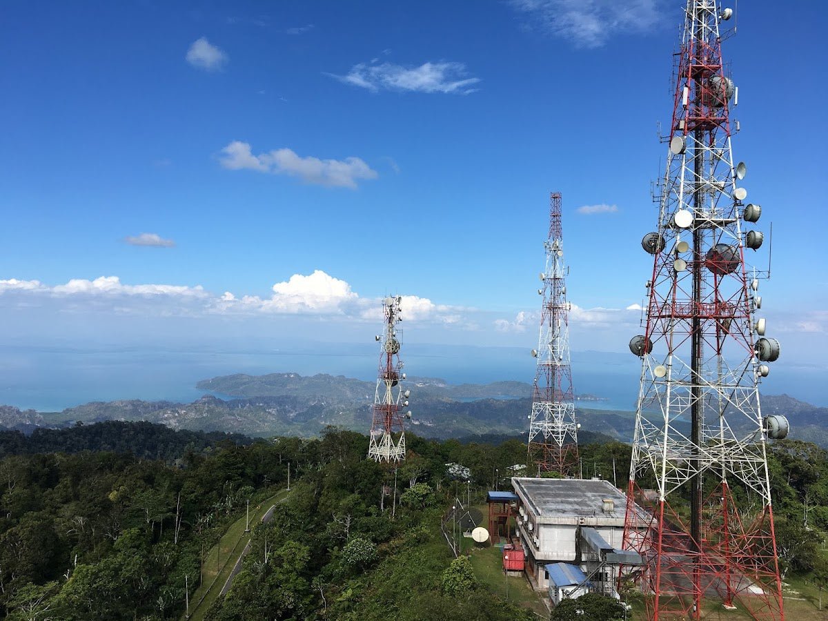
The summit opens up to clear views of Air Papan Beach, the rocky coastline, and Perairan Mersing stretching out to the islands. On a dry day, this view justifies every root you tripped over on the way up. Note: hikers have flagged that the summit signboard is weathered and the text is barely legible — don't count on it for navigation or information. The view is the reward, not the signage.

Stage 5: Extended Viewpoints or Return / Loop Option
From the summit you can push on for extended viewpoints along the ridge. If you're doing the circle loop (2 h 47 min, 259 m total elevation gain), continue through to the Telok Buih / Fishing Bay Resort exit. The Bubble Bay variant gives you a detour to a secluded beach with camping potential — worth it if you have the time and dry conditions. Otherwise, retrace to the Air Papan portal for the standard out-and-back.

Descent & Safety
Going down is where most people slip up — literally. Those same exposed roots and loose rocks that challenged you on the way up are now sloped in the wrong direction. Take your time on the descent. Poles help a lot on this kind of technical singletrack.
Key hazards to keep front of mind:
- Slippery, muddy conditions during rainy season — the trail becomes genuinely dangerous when wet. This is not a light warning.
- Exposed tree roots throughout — uneven, unpredictable, ankle-roll territory
- Loose rocks on the surface — especially on steeper sections
- Mountain bike traffic — trail is shared. Listen for bikes, step aside when you hear them coming
- Insects — bring repellent, not optional
- Litter near beach access points — not a safety hazard, but worth knowing: pack out what you bring in
If the weather turns during your hike — rain, dark clouds building over the coast — turn back. A wet descent on this trail is a fall waiting to happen. The summit view is not worth a twisted ankle or worse.
What to Bring
This is a short hike but it's still jungle terrain with real hazards. Pack accordingly:
- Water — there are no confirmed water points on the trail. Bring enough for the full route. A hydration pack keeps your hands free on the rooty sections.
- Insect repellent — mandatory, not optional
- Hiking shoes or trail shoes — not sandals, not sneakers with worn soles. Grip matters here.
- Trekking poles — the rooty, rocky descent is significantly safer with poles. The TAHAN 3-Section Foldable Hiking Stick V2 (RM99) is compact enough to pack on a day trip and gives you real stability on the way down.
- Knee support — if your knees are not happy on descents, the TAHAN Kinetix Knee Guard with Spring Support (RM79) is worth putting on before you start going downhill, not after the pain starts.
- Light snack — it's a short hike, but eat something before you go
- Sun protection — the summit is exposed
- Rain jacket or poncho — weather on the coast changes fast
- Fully charged phone — for navigation and emergencies
Not sure what to prioritise for Malaysian trail conditions? Have a read through our hiking gear guide — it covers the basics for hikes like this one.
FAQ
How hard is Bukit Selantai?
Moderate. The distance is short — 3.7 km on the main route — but the exposed tree roots, loose rocks, and steep sections in places make it more demanding than the numbers suggest. Beginners can handle it, but go slow, wear proper shoes, and don't attempt it in wet conditions if you're not experienced on technical trail.
How long does Bukit Selantai take?
The main Air Papan route takes most hikers 1 to 1.5 hours. The Bubble Bay variant comes in around 1 hour 8 minutes. If you do the full circle loop, budget around 2 hours 47 minutes. Add time if you plan to stop at the summit and take in the views properly — rushing through defeats the point.
Do I need a permit for Bukit Selantai?
Yes. A permit application is required through Jabatan Perhutanan Negeri Johor. There's a QR code registration system at the trailhead. Sort this out before you arrive — check with the Johor State Forestry Department for the current process and any fees, as the specifics haven't been consistently published online.
Is Bukit Selantai suitable for families?
For families with older kids who are comfortable on uneven terrain, yes. The trail is short and the payoff view is worth it for kids who can handle roots and some steeper sections. Not suitable for toddlers or very young children, and skip it entirely with young ones during or after rain when the trail is muddy and slippery.
Camp Nearby?
Making a weekend of it? Mersing and the surrounding Johor area have some solid options for a night before or after your hike. For a proper jungle camping experience in Johor, check out our review of Jungle X Camp, Gunung Pulai. If you'd rather something more comfortable, HRF Glamping House, Senggarang Johor is a good glamping option in the state. And for another natural setting, have a look at Otternest Camp, Pulai. An early start on Bukit Selantai is much easier when you're already in Johor the night before.
Trail conditions, permit updates, and hiking buddies for the weekend — all in one WhatsApp group. Just ask; someone was probably up there last week.
💬 Join the Hiking CommunityFree, one click. No spam — the occasional promo at most.
Gear tip: How to use a trekking pole (and set the height).
Mike has been camping across Malaysia for over 10 years — from jungle treks in Taman Negara to beach camps in Perhentian. He writes about it so you don't have to find out the hard way. Follow along on TAHAN Outdoor's blog for honest campsite reviews, every week.