Gunung Inas (Kedah): A Hiker's Guide (2026)
Gunung Inas sits at 1,801m in the Bintang range of Kedah — deep rainforest, serious elevation gain, and the kind of trail that weeds out people who underestimate it. This is not a casual weekend outing. The main route from Ulu Sedim covers 28 km with nearly 1,942m of cumulative elevation gain, passing through multiple forest zones before you reach the summit and its surveyor's metal tripod — one of only two in the entire Bintang range.

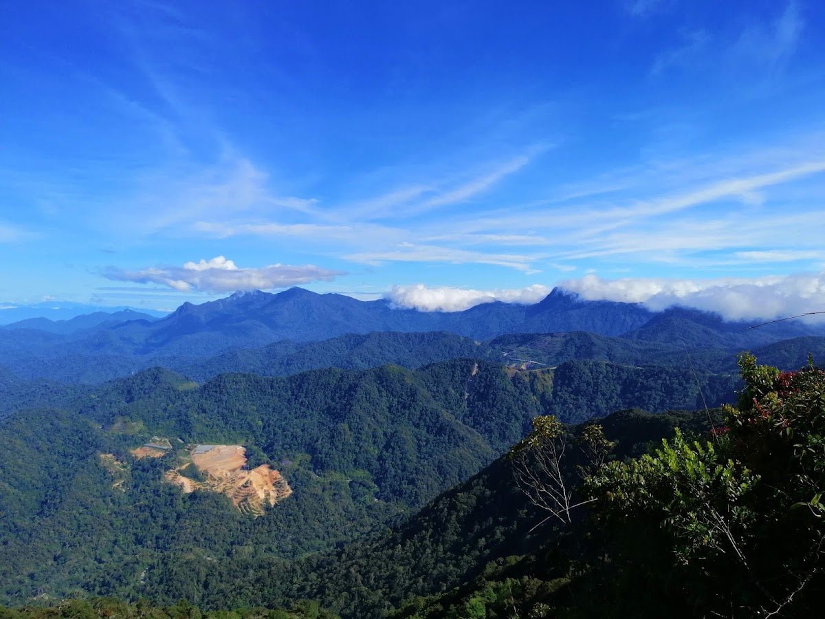
Gunung Inas suits experienced hikers who are comfortable with long days in the jungle, river crossings, and the possibility of sharing the forest with sun bears, elephants, and snakes. It's not a peak you tick off on a whim. But if you put in the preparation, it rewards you with lush dipterokarp forest, a scenic camping area at Taman Bunian, and summit views over Lunas and the green expanse of Kedah's interior.
Most hikers tackle Gunung Inas as part of a multi-peak traverse through the Bintang range rather than a standalone summit. Either way, the Ulu Sedim route is the main reference point — that's what this guide covers.
Quick Facts
- Summit elevation: 1,801m
- Total distance: ~28 km (Ulu Sedim–Gunung Bintang Trail main route)
- Elevation gain: ~1,942m (Ulu Sedim route)
- Duration: 12–13 hours typical; 8 hours reported in at least one trip report — fitness and conditions vary significantly
- Difficulty: Hard
- Trailhead: Ulu Sedim (~110m elevation), ~28 km from Kulim town, ~90 minutes from Penang airport
- Permit: Required — RM10 per person
Getting There & Parking
The main trailhead is at Ulu Sedim, roughly 28 km from Kulim town and about 90 minutes from Penang airport — making this accessible as a day trip from Penang if you're willing to start very early. A secondary access point exists at Sungai Sedim, which also has the well-known treetop walk, but the main Ulu Sedim trailhead is what you want for Gunung Inas.
Parking is available at the Ulu Sedim parking lot. Drive in, park up, sort your gear, and don't leave anything valuable in the car. Standard jungle trailhead caution applies.

Permits & Fees
A permit is required to hike this trail. The issuing authority is Pejabat Hutan Daerah Kedah Selatan (South Kedah District Forestry Office) in Kulim. The permit fee is RM10 per person.
There is an online e-Permit option through Kedah forestry's 'i-Forest' system, but recent hikers have described the application process as challenging to navigate unless you arrange it locally or go through a guide. Honest advice: don't leave this to the night before. Sort the permit at least a few days ahead, and if the online system gives you grief, call the Kulim forestry office directly.
Whether a licensed guide is mandatory for Gunung Inas specifically — the facts aren't clear enough for me to give you a definitive answer. Check with the forestry office when you call about the permit.
Trail conditions and permit requirements change — always check with the local forestry office or park authority before you go. Or ask the TAHAN Hiking Community on WhatsApp — someone's usually been there that week. Checking a different gunung? Try our free permit checker — instant answer for 90+ Malaysian mountains.
The Trail: What to Expect
The Ulu Sedim route is a long, sustained push. Expect a full day out — plan your start time around finishing in daylight, which means pre-dawn departures are normal for this one. Here's how the route breaks down.
Ulu Sedim Trailhead
You start on an old cemented logging road at around 110m elevation. The early going is deceptively manageable — don't let it fool you into setting a pace you can't hold for 12+ hours. The forest here is classic lowland dipterokarp, humid and dense. Get your rhythm early.

Stream & Waterfall Section (~800m elevation)
This section gives you the most reliable water access on the entire route. There are several streams and waterfalls here, and this is your last confirmed clean water source. Fill up properly — don't ration yourself and think you'll manage. From here onwards, water becomes a real issue.
The terrain through this section involves river path walking. In the rainy season, water levels can rise significantly. Leeches will be doing their thing too — sock up, spray up, accept your fate.
Bukit Tonggek
The trail gets more demanding past the waterfall section. Bukit Tonggek is a notable waypoint on the climb — expect steeper ground and denser forest as you gain elevation. Fallen trees are a regular obstacle along this route, so your footing needs full attention.

Taman Bunian Camping Area (~1,555m)
Taman Bunian is the major checkpoint and camping area at about 1,555m — roughly 550m below the summit. This is where most groups planning a multi-day traverse will camp overnight. The area has a scenic atmosphere that more than one hiker has described as having a beautiful evening quality to it.
Important water note: there is reportedly a water hole near Taman Bunian, but the water quality is poor. Don't rely on it. Carry sufficient water from the waterfall section down below — that means planning your water load carefully before you leave the 800m zone.
Bukit Redbull
From Taman Bunian, the route continues upward through Bukit Redbull. If your legs aren't feeling the burn yet, they will be. The terrain remains steep and technical in sections. This is upper montane forest territory now — the vegetation changes noticeably as you climb.
Bonzai Garden Camping Spot
A distinctive stop on the upper section of the route. The Bonzai Garden is named for the stunted, twisted vegetation characteristic of the higher elevation forest. It serves as another potential camping spot and a welcome visual break from the endless tree trunks. Nice spot to pause and eat something before the final push.

Bintang Kecik (Anak Bintang)
A sub-peak on the way to the main summit — Bintang Kecik is part of the Bintang range traverse. From here, the summit of Gunung Inas is within reach. Keep moving steadily; this is not the place to blow your remaining energy.
Gunung Inas Summit (1,801m)
The summit sits at 1,801m and is marked by a surveyor's metal tripod (beirut) — one of only two peaks in the Bintang range with this feature. Views from the top cover the surrounding lowlands including Lunas and a wide expanse of Kedah's green forest interior. On a clear day, it earns its effort. Sign the logbook if there is one, take your photos, and then start thinking about getting down.

Descent & Safety
The descent on a 28 km route with 1,942m of elevation gain is not a recovery walk — it's another several hours of hard work on tired legs. Knee stress on the way down is real, especially on the steeper sections between Taman Bunian and the trailhead.
A few things to take seriously on this hike:
- Sun bears (beruang madu): Confirmed presence in this forest. Make noise on the trail, especially around fruiting trees. If you encounter one, do not run.
- Elephants: Yes, elephants. Kedah's forests still have wild elephant populations. Fresh dung, broken branches, and flattened undergrowth are signs — back off quietly if you see them.
- Snakes: Watch where you put your hands and feet, especially around logs and rocks.
- Wild boars: Generally more scared of you than you are of them, but don't corner them.
- Large felines and rhinoceros: Possibly present in this range — sightings are not common, but the habitat supports it.
- Fallen trees: Regular obstacle along the route, especially after storms. Watch your footing.
- Leeches: Rainy season leeches are aggressive here. Leech socks and repellent are not optional extras — bring them.
- Water: Carry enough from the 800m waterfall section. The water hole at Taman Bunian is not reliable for quality.
Turn back if the weather turns bad mid-hike. River crossings that were ankle-deep in the morning can become dangerous after heavy rain. There is no summit view worth a flash flood crossing. Give yourself a firm turnaround time and stick to it — on a 12–13 hour hike, losing daylight on the descent in remote jungle is a serious problem. Bring a headlamp regardless; you may need it.
What to Bring
This is a Hard-rated, 28 km jungle hike with nearly 2,000m of elevation gain. Pack accordingly — don't cut corners on gear for this one.
- Water: Carry at least 3–4 litres from the waterfall section onward. A water filter or purification tablets as backup. The TAHAN TrailBladder 2L Water Bladder works well here — hands-free drinking keeps you moving without stopping to dig out a bottle.
- Trekking poles: Highly recommended for this trail. Steep ascents and long descents on tired legs — poles earn their weight. The TAHAN 3-Section Foldable Hiking Stick V2 packs down small and handles rough terrain well.
- Headlamp + spare batteries: Non-negotiable on a 12–13 hour hike. Early starts mean pre-dawn trail time; late finishes mean the same.
- Food: High-calorie, easy to eat. Energy gels, nuts, dates, nasi lemak bungkus if you're starting before dawn. Don't underestimate how much you'll burn over 12+ hours.
- Leech socks and insect repellent: Especially if you're going during or after rain.
- Rain jacket: Mountain weather in Malaysia can change fast at elevation. A lightweight packable rain jacket is not dead weight.
- First aid kit: Blister treatment, antiseptic, bandage, antihistamine. Keep it accessible.
- Navigation: Download the trail on AllTrails or Maps.me before you go. Don't rely solely on phone signal in here.
- Emergency contacts and permit: Leave your itinerary with someone not on the hike. Carry your permit documentation.
For a broader look at what to bring on Malaysian jungle hikes, check out our hiking gear guide — covers sticks, knee support, and what actually holds up in tropical conditions.
FAQ
How hard is Gunung Inas?
It's rated Hard, and that rating is accurate. You're looking at 28 km and close to 1,942m of elevation gain, mostly in dense jungle with no shortcuts. Steep sections, river crossings, fallen tree obstacles, and wildlife hazards. This is for experienced hikers with solid fitness — not a first jungle hike.
How long does Gunung Inas take?
Most hikers report 12–13 hours on the Ulu Sedim route. There is at least one trip report of 8 hours, but that likely reflects exceptional fitness or a partial route. Plan for a full day — 12 hours is the realistic benchmark, and you should be timing your start accordingly.
Do I need a permit for Gunung Inas?
Yes. The permit costs RM10 per person and is issued by Pejabat Hutan Daerah Kedah Selatan (South Kedah District Forestry Office) in Kulim. There's an online i-Forest system, but it's reportedly not the most straightforward process — sorting this through the forestry office directly or via a local guide is the easier path. Don't show up without one.
Are there camping spots on the Gunung Inas trail?
Yes — Taman Bunian at approximately 1,555m is the main camping area, and the Bonzai Garden higher up is another option. Most people doing the full traverse camp at Taman Bunian overnight. If you're camping, remember the water situation: fill up properly at the waterfall section (~800m) because the water source near Taman Bunian is poor quality.
Camp Nearby?
Making a weekend of it? The Ulu Sedim area has options nearby for before or after your hike. The Sedim Signature Campsite is the most obvious choice — right in the area, good for staging an early start the next morning. If you want something a bit more comfortable after a hard day on the mountain, check out the Nadi Glamping Suites, Penang as a recovery base given how close Penang is to this trailhead. And if you're exploring the broader Kedah/Perak border area, the KIF Campsite Baling is worth a look — Baling is in the same general region and makes a solid base for exploring further.
Trail conditions, permit updates, and hiking buddies for the weekend — all in one WhatsApp group. Just ask; someone was probably up there last week.
💬 Join the Hiking CommunityFree, one click. No spam — the occasional promo at most.
Mike has been camping across Malaysia for over 10 years — from jungle treks in Taman Negara to beach camps in Perhentian. He writes about it so you don't have to find out the hard way. Follow along on TAHAN Outdoor's blog for honest campsite reviews, every week.