Gunung Suku: A Hiker's Guide (2026)
Gunung Suku sits in the Cameron Highlands fringe area near Pos Selim, Perak — straddling the Perak-Pahang border at 1,797 m. It's not the most famous mountain in Malaysia, but among Perak hikers it has a solid reputation: brutal slopes, mossy forest near the top, and on a clear day, sweeping 360-degree views over Banjaran Titiwangsa that make you forget how much your legs hurt on the way up. This is a mountain that earns its summit.

Gunung Suku suits fit, experienced hikers who want a proper challenge without a multi-day expedition. The trail is clear and doesn't require a guide, but the 45–90 degree slopes throughout mean this is absolutely not a beginner's mountain. If you're still getting comfortable on trails like Bukit Kutu or Broga, add more experience first before attempting Suku. For those ready for it, though — worth every step.
A quick note on the numbers you'll find online: distance figures vary between sources (3 km, 4.7 km, even 6.5 km one-way or round-trip depending on how people count). The elevation gain is consistently around 901–950 m one-way. Work with the time estimates rather than obsessing over distance on this one.
Quick Facts
- Summit elevation: 1,797 m (5,896 ft) — some sources list 1,789 m
- Elevation gain: ~901–950 m one-way
- Distance: Approximately 4.7 km one-way (round-trip figures vary — plan for a full out-and-back)
- Duration: Ascent 3–3.5 hours; descent 2.5–3 hours. Total round-trip roughly 4–8 hours depending on your pace and stops
- Difficulty: Moderate to Hard — steep 45–90 degree slopes, 90% uphill, not suitable for beginners
- Permit: Yes, mandatory (Perak Forestry Department or MGP Perak)
- Guide required: No — trail is clear enough to navigate independently
- Trailhead: Pos Selim, Perak — roadside on A181 highway
- From KL: Approximately 2.5 hours
Getting There & Parking
The trailhead is roadside on the A181 highway near Pos Selim, Perak — roughly the Cameron Highlands area, close to Simpang Pulai. GPS coordinates: 4.555596, 101.322949. From Kuala Lumpur, budget about 2.5 hours driving. The route takes you through Simpang Pulai and up toward the Perak-Pahang border — scenic drive, but the road conditions near the trailhead area can deteriorate during and after heavy rain, especially in monsoon season.
Parking is roadside. The convention is to park on the opposite side of the road where there's more space. No facilities at the trailhead — no toilet, no stall, nothing. Sort everything before you arrive. Don't block traffic; other vehicles use this road and locals are not impressed by hikers who park inconsiderately.

Permits & Fees
A hiking permit is mandatory for Gunung Suku. You need to get this from either the Perak Forestry Department or the Persatuan Malim Gunung Negeri Perak (MGP). Permit cost has been quoted at RM10–RM20 per person — but some of the sources with these figures are a few years old, so verify the current rate when you contact them. Historically, the Forestry Department required in-person payment before your hiking date, so don't leave this to the last minute or assume you can settle it on the day.
The mountain was temporarily closed in May 2022 following a dangerous water surge from heavy rain. No current closures are known as of August 2026, but conditions change. Trail conditions and permit requirements change — always check with the local forestry office or park authority before you go. Or ask the TAHAN Hiking Community on WhatsApp — someone's usually been there that week. Checking a different gunung? Try our free permit checker — instant answer for 90+ Malaysian mountains.
The Trail: What to Expect
Gunung Suku is essentially one long, relentless climb. There's no warm-up flat section — the gradient hits you almost immediately and doesn't let up until you're at the top. The trail is well-marked enough that you won't lose your way, but mentally prepare for a sustained effort from start to finish.
Trailhead — First Steps (A181 Roadside)
You start at road level on the A181. The entry point is obvious enough but make sure you've confirmed the GPS beforehand — roadside trailheads can be easy to miss if you're driving past. Sign in if there's a register; it matters for your safety.

The Initial Climb — Steep From the Start
No easing in here. The slope kicks up steeply almost from the first steps. Expect 45-degree gradients or steeper on significant portions of this section. The trail surface is a mix of earth, roots, and rocks. In dry conditions it's tough; after rain, it becomes genuinely treacherous. Take your time, watch foot placement, and don't rush the early section just because you feel fresh — you'll need that energy higher up.
One hiker summed it up honestly: "90% of the trail is steep climb. Challenging and rewarding." That's accurate. Don't say you weren't warned.
Halfway Viewpoint — First Glimpse of the Summit
About halfway up, there's a viewpoint where you get your first clear look at the Suku summit in the distance. It's a psychological milestone — and a useful one, because it gives you a reference for how far you still have to go. Catch your breath here, have some water, and reset mentally for the second half.

Rest Point & Last Water Point
Also around the halfway mark is the only water point on the trail — a spot where you can refill from fresh mountain water. This is it. There's no other water source on the route. Refill here if you need to, but don't rely on this being the plan — always carry sufficient water from the start. If it's been dry for a while, output from natural water sources can vary. Treat or filter the water before drinking.
T-Junction — Don't Go Right By Accident
Before you reach the summit, you'll hit a T-junction. Left goes to the summit. Right goes to the campsite. This is a simple but important fork — stay left if you're heading for the top. The junction is the clearest navigation decision point on the trail, so note it on the way up so you remember it on the way down too.
False Summit — Mossy Forest Section
Past the T-junction, the terrain shifts noticeably. You enter mossy forest — the kind with thick exposed roots carpeting the ground and a cool, damp atmosphere even on warm days. Beautiful, but the moss and roots make this section slippery and tiring on the ankles. The false summit here catches some hikers off guard. If you arrive at a high point and it doesn't feel like a true 360-degree viewpoint, keep going — the real summit is just beyond.

True Summit — 1,797 m
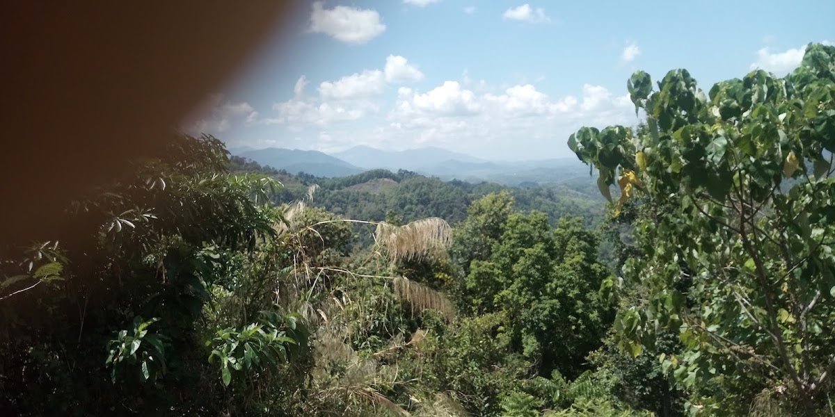
The true summit is exposed and open — what locals call a "botak" peak (bald, cleared top). This is where the views open up: 360 degrees overlooking Gunung Irau, Banjaran Titiwangsa, and the mountain valleys below. Summit is usually cloudy, so clear views aren't guaranteed — but on a good morning, it's a proper reward. The exposed peak means it can also be hot under afternoon sun, so an early start isn't just about avoiding crowds, it's practical.
Keep an eye out for wildlife up here too. At least one hiker has reported wasps in the area, and apparently wild lemon trees along the trail — not something you find on most Malaysian mountains.

Descent & Safety
Coming down Gunung Suku takes most hikers 2.5–3 hours. The same slopes that made the ascent hard make the descent genuinely dangerous if you're not careful. This is where knees take a beating and where slips happen — especially on the mossy and rooty sections near the upper trail.
Go slow on the descent. Use trees and roots as handholds where the gradient is severe, and don't try to make up time on the way down. The trail is steep enough that a fall could be serious.
Key hazards to keep in mind:
- Steep 45–90 degree slopes throughout — both ways
- Very slippery terrain in wet conditions — mud, moss, wet roots
- Exposed roots are a constant trip hazard in the upper section
- False summit creates navigation confusion — don't assume you've arrived
- Muddy trails after rain make any section significantly more dangerous
- Monsoon season (November–January): landslide risk on both roads and trails — consider postponing if there's been heavy recent rain
- Exposed summit can be hot in afternoon sun — time your descent to avoid lingering at the top too late
- Historical water surge incident (May 2022) — heavy rain can cause dangerous runoff conditions on this trail
- Wasps reported in the area — watch where you put your hands on vegetation
If the weather turns bad on the way up — heavy rain, thunder, low visibility — turn back. The summit is not worth the risk. Gunung Suku will still be there on your next trip. The monsoon window (November–January) is the most obvious period to avoid, but sudden afternoon storms can happen any time of year in this part of Malaysia.
What to Bring
Gunung Suku is a one-day hike, but the steep terrain and exposed summit mean your kit matters. Here's what I'd bring for this specific trail:
- Water: Minimum 2–3 litres from the trailhead. There's one refill point halfway but don't count on it as your primary strategy. A hydration bladder setup means you can sip hands-free on the steep sections — practical on a climb this unrelenting.
- Trekking poles: Non-negotiable on 45–90 degree slopes. The TAHAN 3-Section Foldable Hiking Stick V2 is compact enough to stash when the trail gets technical and solid when you need the support — RM99 and it earns its keep on a mountain like this.
- Knee support: That descent is long and steep, and unprepared knees suffer for days after. If your knees aren't bulletproof, the TAHAN Kinetix Knee Guard With Spring Support (RM79) is worth wearing on the way down especially. Check out our hiking gear guide for more on what to look for.
- Footwear: Proper hiking boots with grip. Trail runners can work for experienced hikers but you want real ankle support on those root-covered upper sections. Nothing flat-soled.
- Rain gear: Lightweight waterproof jacket, always. Summit area is frequently cloudy and wet.
- Food and snacks: High-energy snacks for the climb — energy bars, nuts, dates. No food stalls anywhere near this trailhead.
- Headlamp: If your pace is slower or you start late, you could be descending in low light. Always carry one.
- First aid kit: Basic kit including blister plasters and antiseptic. Wasp sting treatment too, given the reports.
- Permit: Bring proof of your permit. Don't assume verbal confirmation is enough.
- Fully charged phone with offline maps: Download the trail on AllTrails or Wikiloc before you go. No signal cannot be assumed in this area.
FAQ
How hard is Gunung Suku?
Moderate to Hard, and it leans toward Hard if conditions are wet or you're not used to sustained steep climbing. The trail is 90% uphill with slopes ranging from 45 to 90 degrees. It's not technical climbing, but it is relentlessly steep. If you haven't done any hills harder than Broga or Tabur recently, work up to this one first. Experienced hikers who train regularly will find it challenging but manageable in a day.
How long does Gunung Suku take?
Ascent typically takes 3–3.5 hours. Descent 2.5–3 hours. Budget a full day — total round-trip is realistically 4–8 hours depending on your pace, how long you spend at the summit, and trail conditions. Start early (pre-7 AM if possible) to avoid afternoon heat on the exposed summit and to give yourself buffer time.
Do I need a permit for Gunung Suku?
Yes. A hiking permit is mandatory. You get it from the Perak Forestry Department or Persatuan Malim Gunung Negeri Perak (MGP). Cost has been cited as RM10–RM20 per person but verify the current rate directly with them — some of the figures floating around online are dated. Historically, payment needed to be made in person before your hiking date, so plan ahead.
Is Gunung Suku suitable for beginners?
No. Multiple sources, and the trail itself, are consistent on this: Gunung Suku is not suitable for beginners. The 45–90 degree slopes throughout and the sustained elevation gain of nearly 1,000 m in a short distance make this a mountain for people who already hike regularly and have some harder trails under their belt. Bring a beginner here and you're setting them up for a bad experience at best, a dangerous situation at worst.
Camp Nearby?
Making a weekend of it? Pos Selim and the surrounding Perak area have decent options within driving range. Check out Seven Beret Campsite, Batu Kurau if you want somewhere in Perak to base yourself — good for the night before an early summit push. For something a bit different, The Hideout Gopeng is worth a look if you're coming up through Gopeng — Gopeng to Pos Selim isn't a massive detour and The Hideout is a solid spot to recover after the hike. WildRock Campsite Padang Rengas is another Perak option if you want to explore the broader area. An early start is genuinely important on Suku, so staying nearby the night before beats driving up bleary-eyed from KL at dawn.
Trail conditions, permit updates, and hiking buddies for the weekend — all in one WhatsApp group. Just ask; someone was probably up there last week.
💬 Join the Hiking CommunityFree, one click. No spam — the occasional promo at most.
Mike has been camping across Malaysia for over 10 years — from jungle treks in Taman Negara to beach camps in Perhentian. He writes about it so you don't have to find out the hard way. Follow along on TAHAN Outdoor's blog for honest campsite reviews, every week.