Updated October 2026
Broga Hill (Bukit Broga, also called Bukit Lalang) is a 400 m hill in Semenyih, Selangor, about 40 to 60 minutes' drive from KL. It's probably the most-hiked hill in Selangor. Most people reach the main viewpoint in 30 to 40 minutes and finish the whole thing in 1.5 to 2 hours. On a clear morning the summit serves up a "carpet of clouds" rolling across the Semenyih valley that'll make you forget you woke up at 4am. The open lalang grass slopes, left behind by an old forest fire, give it a character unlike most Malaysian hills, where you're usually staring at tree trunks the whole way up.
Yes, you need a permit. Since April 2025, Broga Hill has needed a mandatory e-permit from the Selangor Forestry Department's SeForest portal, because the hill sits inside the Bukit Sungai Putih Forest Reserve. It's RM 5 per person, apply at least 48 hours ahead, and pay within 24 hours of approval. Entrance via the MPKJ public trail is free with free parking. The older private estate route charges RM 5 entrance plus RM 5 parking. Full details on both below.

This is a beginner-to-intermediate hike. The main peak (Peak 2) is well within reach for anyone reasonably fit, and most people are back at the car before 9am. That said, don't take it lightly on a wet day: the slopes turn slippery fast, and Peak 3 has a genuine rock scramble that demands respect. If you're chasing the Gunung Tok Wan extension, that's a different hike altogether.
There are three peaks to bag here, and each one is a step up in effort and commitment. Most casual hikers head for Peak 1 or Peak 2 and turn back. That's fine, the views from Peak 2 are the best on the whole trail anyway. Here's everything you need to know before you go.
Quick Facts
- Elevation: 400 m (1,312 ft) ASL at Peak 3 / Summit
- Elevation gain: ~249–255 m (~816–836 ft)
- Distance: ~3.5–3.9 km round trip (MPKJ trail, full out-and-back); ~1.7 km one-way to Peak 3
- Duration: 30–40 min to first/main peak; 1.5–2 hours total (up and down)
- Difficulty: Easy to moderate for Peak 1–2; moderate with Dragonback climbs for Peak 3; moderate to tough for the full Gunung Tok Wan extension
- Permit required: Yes, mandatory e-permit via SeForest portal, RM 5 per person
- Entrance fee: Free on the MPKJ trail (free parking too); RM 5 entrance plus RM 5 parking on the private estate route
- Opening hours: Commonly listed as 4am to 6:30pm daily, but some sources say 7am to 6pm, so check your permit details before you go
- Best time to arrive: 5:00–5:30am for sunrise
- State: Selangor (the town of Broga itself is across the border in Negeri Sembilan, but the hill is on the Selangor side)
Permits & Fees
As of April 2025, a permit is mandatory to hike Broga Hill. You apply online through the SeForest portal run by the Selangor Forestry Department (Jabatan Perhutanan Negeri Selangor / JPNS): forestry.selangor.gov.my/permit/home. Bukit Broga is one of around 70 locations covered by the system. The fee is RM 5 per person. Apply at least 48 hours before your hike and pay within 24 hours of approval. Miss that window and the application is automatically cancelled, so don't sit on it.
The quick version:
- Register on the SeForest portal.
- Pick Bukit Broga and your hike date, at least 48 hours ahead.
- Add everyone in your group (each person needs to be on the permit).
- Wait for approval, then pay RM 5 per person within 24 hours.
- Save the permit on your phone or print it, and bring it on the day.
Not sure if another hill on your list needs a permit too? Our gunung permit checker saves you the guesswork.
Don't think you can sneak in without one. Hiking without a permit under the National Forestry Act 1984 carries a fine of up to RM 30,000 or up to 5 years in prison. That's not a soft warning, that's the actual law.
Entrance and parking costs depend on which way you go in:
| Route | Entrance | Parking | Toilets |
|---|---|---|---|
| MPKJ public trail (opened March 2022) | Free | Free | Check on arrival |
| Private estate route | RM 5 | RM 5 per vehicle | About RM 1 |
Budget the RM 5 SeForest permit on top of whichever entrance you use.
A guide is not confirmed as mandatory specifically for Broga Hill, but check the SeForest portal when you apply, guide requirements are listed per trail and can change. Trail conditions and permit requirements change, always check with the local forestry office or park authority before you go. Checking a different gunung? Try our free permit checker — instant answer for 90+ Malaysian mountains. Or ask the TAHAN Hiking Community on WhatsApp — someone's usually been there that week.
Getting There & Parking
The trailhead is at Jalan Broga, 43500 Semenyih, Selangor (the MPKJ entrance is commonly listed as 836, Jalan Broga). GPS coordinates to aim for: 2.940747, 101.903612 (main entrance area). Some navigation apps will take you to a slightly different point, 2.939591, 101.900808 is an alternate pin used by some hikers. Either will get you close enough. Broga Hill is roughly 40–50 km from KL, around 40–60 minutes by car depending on traffic.
There's no direct public transport. The closest you can get by transit is MRT Kajang Line to Kajang MRT station, then a Grab or taxi for the remaining ~17 km (~20 min). If you're relying on ride-hailing, sort it out the night before. Don't expect easy availability at 4:30am in Semenyih, and think about how you're getting home too.
For parking, you have two options. Option A is the private paid lot inside the oil palm estate, RM 5 per vehicle, with toilets available on-site for about RM 1. Option B is the free MPKJ lot, located roughly 500 m from the main road, no parking fee, no entrance fee. Follow the signboard and turn left; you'll know you're on the right track when you see the tiled pathway and rope-fenced sections marking the MPKJ trailhead. On weekends the free lot fills fast, so don't be surprised if you end up roadside parking regardless.
Food-wise, don't expect anything before about 6am. After that, vendors at the foot of the hill usually sell breakfast, hot tea and coffee and energy drinks, but bring your own water and snacks for the climb.

The Trail: What to Expect
The MPKJ trail is well-marked and self-navigable, with steel poles, ropes on the trickier bits, directional signs and information boards. The overall route is straightforward, but the terrain changes significantly as you gain elevation, from shaded forest to exposed open slopes under full sun. Here's the breakdown stage by stage.

Car Park to Signboard (~300 m, ~10 min)
From the car park, it's a flat ~300 m walk to the 'Selamat Datang Ke Bukit Broga' signboard. Nothing strenuous here, use this time to sort your headlamp if it's still dark, tighten your laces, and maybe grab a coconut juice from the stalls if they're operating (weekends only). Beyond the signboard is where the trail proper begins.
Signboard to Forest Trail Entry
The first ~250 m inside the forest is a gradual upslope, the warm-up. The path is relatively shaded here. Nothing technical, but the ground can be slippery after rain even at this early stage, so tread carefully if you've had recent wet weather.
The Steep Cross-Junction
You'll hit a narrow, steep section where it's one person at a time. If this feels sketchy, especially going up with a crowd coming down, there's a less-steep bypass about 25 m to your right. No shame in taking it. It's not marked as the 'easy route', it's just the smart option in wet conditions or if you're not confident with steep, narrow paths.
Forest Section to Open Grassland
About 120 m after the steep upslope, the forest starts to open up. You'll cross roughly 270 m before fully exiting the tree cover. This is where Broga Hill reveals itself: suddenly you're on open lalang grass slopes with sky above you. If you're hiking pre-dawn, the darkness makes this transition feel dramatic. The lalang (cogon grass) has sharp edges, so wear long pants on this section. From here up, there is no shade at all.

Y-Junction → Peak 1 (~268 m / 880 ft)
At the Y-junction, take the right fork, it's a steep upslope that brings you to Peak 1. This is the first proper panoramic viewpoint. Most casual hikers and many first-timers stop here for sunrise, which is a perfectly valid call. The views are already good, it's less crowded than Peak 2, and if you're not confident continuing, this is your natural turnaround point. Catch your breath before deciding whether to push on.
Peak 1 → Peak 2 (~270 m, gradual ascent)
The ridge walk from Peak 1 to Peak 2 is a gradual ~270 m ascent. This is the Dragonback section, exposed ridgeline with drops on either side. It looks more intimidating than it is on a clear day, but in strong wind or after rain, move carefully and stay centred on the path.
Peak 2 (~351 m / 1,150 ft), The Best Views on the Hill
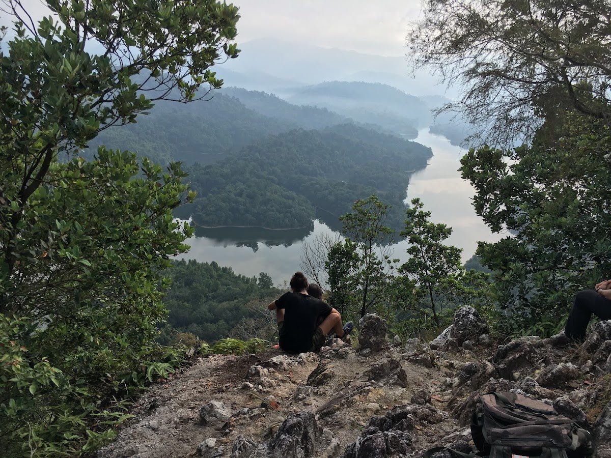
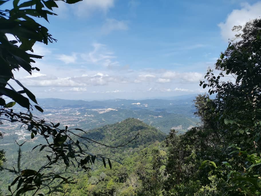
Peak 2 is an oblong plateau, flat enough to sit comfortably, wide enough to move around, and offering the best 360° panoramic views on the entire route. You can see Semenyih town, oil palm plantations stretching to the horizon, surrounding rainforest, and distant mountains. On clear mornings, the mist filling the Semenyih valley below, the famous 'carpet of clouds', shows up best from here. This is where most serious hikers stop, and honestly, it's hard to argue with that decision.

Peak 2 → Peak 3 / Summit (~280 m)
The final push to Peak 3 is ~280 m and includes a genuine rock scramble to reach the very top. One reviewer described a fall here as potentially fatal. That's a single-source comment, but it's not an unreasonable description of exposed rocky terrain. Use your hands, move slowly, test your footing before committing weight. There is an alternative bypass to the left if the rock face looks too committing. The summit itself (400 m / 1,312 ft) has partially obstructed views due to trees and rocks. Better than nothing, but Peak 2 is still the view winner.
Optional: Gunung Tok Wan and Puncak 18
If Peak 3 wasn't enough, you can push on to Gunung Tok Wan, roughly 4 km further, about 1.5 hours, at 675 m elevation. From there, Puncak 18 is another ~1.2 km / ~45 min at 809 m. Both are forested with no open views. This extension is rated moderate to tough and is a serious commitment on top of what you've already done. Don't attempt it unless you've started early and have the fitness and supplies for a long day, and check that your permit covers where you're going.

Descent & Safety
The descent is where most accidents happen on any hill, and Broga is no exception. The open grassland slopes and the rock section near Peak 3 get significantly more dangerous when wet. Go slower than you think you need to. Face inward on rocky sections. Trekking poles help a lot on the steeper downhill stretches.
Key hazards to know going in:
- Slippery, muddy slopes after rain, particularly on the approach to Peak 1 and the rock section at Peak 3. If it's rained in the last 24 hours, treat every slope as a slip hazard.
- Exposed summit, full sun after 9am: the open lalang slopes have zero shade. Heat exhaustion is a real risk if you're up there late morning. Aim to be off the open slopes by 9am and avoid the 11am–3pm window on sunny days.
- Peak 3 rock face: steep scramble. If you're not confident, take the bypass on the left. No views are worth a fall.
- Lalang grass with sharp edges: wear long pants on the upper open slopes.
- Darkness before dawn: headlamp is non-negotiable for pre-dawn starts. Don't rely on your phone torch.
- Monkeys near the summit: don't feed them, don't leave food out, don't make eye contact and back away slowly if they approach aggressively.
- Flip-flops: not suitable on any day, full stop. Proper grip shoes on wet days minimum.
If the weather turns bad, heavy rain, thunder, lightning, turn back immediately. You are on an exposed ridgeline with no shelter. That's not a drill. The views will still be there next week.
What to Bring
Broga Hill is short, but short hikes in Malaysian heat still demand proper preparation. Barang apa nak bawa? Here's what you actually need:
- Water: Bring at least 1 litre. There are no natural water sources or streams on the MPKJ trail. Coconut juice stalls operate at the entrance on weekends, but don't count on them for your main supply.
- Headlamp: Essential for pre-dawn starts. A phone torch is not adequate for uneven trail terrain in the dark.
- Grip shoes: Trail shoes or hiking shoes with decent grip. Wet conditions make the slopes treacherous in anything less.
- Long pants: For the lalang grass sections on the upper slopes.
- Snacks: The hike is short but the early start is brutal on an empty stomach, and nothing is open before 6am. Bring something light.
- Trekking poles: Optional going up, genuinely useful coming down on the steeper sections. The TAHAN 3-Section Foldable Hiking Stick V2 collapses down small enough to pack in a daypack, worth having for the descent from Peak 3.
- Knee support: If your knees complain on downhill, and many people's do, the TAHAN Kinetix Knee Guard With Spring Support is worth throwing in the bag, especially for the steeper descent stages.
- Sunscreen and hat: The open grassland slopes are brutal once the sun is up. No shade, no mercy.
- Permit: Printed or on your phone, ready to show. Don't leave the car without it.
For a broader look at what gear makes sense for Malaysian hill hikes, check out our hiking gear guide, covers poles, knee guards and more. If Broga goes well and you want more short ones, here's our list of easy hikes near KL.
Camp Nearby?
Making a weekend of it? There are a few solid options within reasonable distance. Nature Escape Campsite, Hulu Langat is a popular pick for those wanting a proper overnight in Selangor before an early morning drive to Broga. If you want to stay a bit further afield in a lush setting, Templer Park Rainforest Retreat is worth checking out. And if you're open to a longer weekend loop north of KL, Mori Leka Campsite, Serendah is one of our favourite laid-back jungle camps in the region. More ideas in our roundup of campsites near KL, and if you want to cool off after a hot morning on the lalang, try one of these waterfalls near KL. Staying the night before means you wake up fresh, drive in without the highway stress, and actually enjoy that 5am trailhead arrival instead of surviving it.
Common Questions
Do I need a permit to hike Broga Hill in 2026?
Yes. A permit has been mandatory since April 2025. Apply via the SeForest portal at forestry.selangor.gov.my/permit/home, fee is RM 5 per person. Apply at least 48 hours before your hike and pay within 24 hours of approval. Hiking without a permit risks a fine of up to RM 30,000 or up to 5 years in prison under the National Forestry Act 1984. Step-by-step application guide: how to apply on SeForest.
How much is the Broga Hill entrance fee?
The MPKJ public trail is free to enter with free parking. The private estate route charges RM 5 entrance plus RM 5 parking, with toilets for about RM 1. On top of either, everyone pays the RM 5 SeForest permit.
Is Broga Hill good for beginners?
Yes, up to Peak 1 or Peak 2, as long as you're reasonably fit and wearing proper grip shoes. Peak 3 adds a rock scramble that pushes it into moderate territory, and the Gunung Tok Wan extension is moderate to tough. On a wet day, every stage gets noticeably harder because of slippery terrain.
How long does the Broga Hill hike take?
Most hikers reach the first or main peak in 30 to 40 minutes. A full up-and-down to Peak 3 and back takes about 1.5 to 2 hours. Going on to Gunung Tok Wan or Puncak 18 adds several more hours, so plan accordingly.
What's the best time to hike Broga Hill?
Early morning. Aim to be at the trailhead by 5:00 to 5:30am. Sunrise is around 7:00 to 7:15am, which gives you time to reach Peak 1 or Peak 2 before the sky lights up. Be off the open slopes by around 9am to avoid the heat. Weekends get very crowded from 6am onward, so weekday mornings are noticeably more pleasant.
What are the Broga Hill opening hours?
It's commonly listed as 4am to 6:30pm daily, but other sources say 7am to 6pm. Check the details on your SeForest permit or with the forestry office before planning a very early start.
Is Broga Hill in Selangor or Negeri Sembilan?
The hill is in Selangor, near Semenyih, inside the Bukit Sungai Putih Forest Reserve. The small town of Broga that it's named after sits just across the border in Negeri Sembilan, which is why people get confused.
Trail conditions, permit updates, and hiking buddies for the weekend — all in one WhatsApp group. Just ask; someone was probably up there last week.
💬 Join the Hiking CommunityFree, one click. No spam — the occasional promo at most.
Gear tip: How to use a trekking pole (and set the height).
Mike has been camping across Malaysia for over 10 years, from jungle treks in Taman Negara to beach camps in Perhentian. He writes about it so you don't have to find out the hard way. Follow along on TAHAN Outdoor's blog for honest campsite reviews, every week.
⛺ Featured in: 10 Easy Hikes Near KL for First-Timers (2026)
⛺ Featured in: The 10 Best Hikes in Selangor (2026)