Bukit Tabur: A Hiker's Guide (2026)
Bukit Tabur sits just outside Kuala Lumpur in the Gombak district, and it has a reputation that punches way above its elevation. This is a jagged quartz ridge — part of one of the longest quartz ridges in the world at roughly 22 km — and it gives you full KL skyline views, dramatic ridge scrambling, and a genuine sense of exposure that a lot of day hikers from the city are simply not prepared for.

There are two main options: the West trail and the East (sometimes called Extreme) trail. The West is the more popular loop; the East is steeper, more exposed, and gets you to the ridge faster. Neither is suitable for beginners or children, full stop. Summits.com has called this Malaysia's Most Dangerous Dayhike, and that label is earned — there have been fatalities here. What makes Bukit Tabur worth doing is exactly what makes it unforgiving: it's raw, exposed, and genuinely technical for a day hike this close to the city.
This guide covers everything you need to plan a safe trip — route stages, permit requirements, hazards, and what to pack. Read it properly before you go.
Quick Facts
- Location: Taman Melawati, Gombak district, Selangor — approx. 20–23 km / 30-min drive from KL city centre
- East Peak Elevation: ~275 m asl
- Elevation Gain (East/Extreme trail): ~337 m
- Trail Distance: West trail: 7–8 km total (one source gives ~3.4 km one-way — figures conflict; see trail section). East/Extreme trail: ~6.3 km.
- Duration: West trail: 3–4 hours (fit hikers), 4–6 hours (average fitness). East trail: 1.5–2 hours to summit. Extreme trail: 2.5–3 hours. Full range across all routes and fitness levels: 1 hour to 6 hours.
- Difficulty: Challenging (consensus). Not suitable for beginners or children.
- Permit: Required — RM5 per person via SeForest e-Permit System. Apply at least 48 hours before your visit.
- Registered Guide: Mandatory — must hire a Malim Gunung from Jabatan Perhutanan Negeri Selangor (JPNS). Max 7 participants per guide.
- Max Hikers Per Day: 100
- Water on Trail: None. Carry minimum 1.5 litres.
Getting There & Parking
The West trailhead is at GPS 3.234052, 101.749211 near Taman Melawati — look for stairs on the left side of the road near a dead-end gate and the Puncak Niaga facilities. The East trailhead is near Jalan Melawati 18, about 1 km from the West trailhead.
From KL, the fastest option is Grab or taxi — roughly 30 minutes. By public transport: LRT to Wangsa Maju station, then grab a Grab or taxi for the remaining ~5 km. There's also Bus T304 from Wangsa Maju to Taman Melawati (GPS 3.228510, 101.748112), then a 10-minute walk to the trailhead.
Parking is the honest problem here. There is no dedicated carpark — roadside only, on a narrow road that gets genuinely jammed on weekends. If you're going in a group of two or more, just take Grab. You'll save yourself the stress.

Permits & Fees
As of 1 April 2025, permits must be applied online via the SeForest e-Permit System at forestry.selangor.gov.my/permit/home. Submit your application at least 48 hours before your visit and complete payment within 24 hours of approval via FPX online banking. The fee is RM5 per person.
A registered guide (Malim Gunung) is also mandatory — this has been the rule since 1 February 2023. Your guide can typically handle the permit application on your behalf for the group. Guides wear official red Malim Gunung Perhutanan t-shirts with the yellow logo — if your guide isn't wearing one, that's a red flag. Guide fees are agreed between hiker and guide; no fixed published rate is available for Bukit Tabur specifically, so ask upfront.
Maximum 100 hikers are allowed per day across all trails. Book early, especially for weekends.
Important: Hiking Bukit Tabur without a permit is illegal under the National Forestry Act 1984. Fines run up to RM30,000 and/or imprisonment up to 5 years. This is not a formality. The trail was officially closed from around October 2016 following deaths and injuries, and only conditionally reopened in February 2023 under this permit-and-guide system. As of late 2024, some visitors report enforcement as inconsistent, but the legal risk is very real.
Trail conditions and permit requirements change — always check with the local forestry office or park authority before you go. Checking a different gunung? Try our free permit checker — instant answer for 90+ Malaysian mountains. Or ask the TAHAN Hiking Community on WhatsApp — someone's usually been there that week.
The Trail: What to Expect
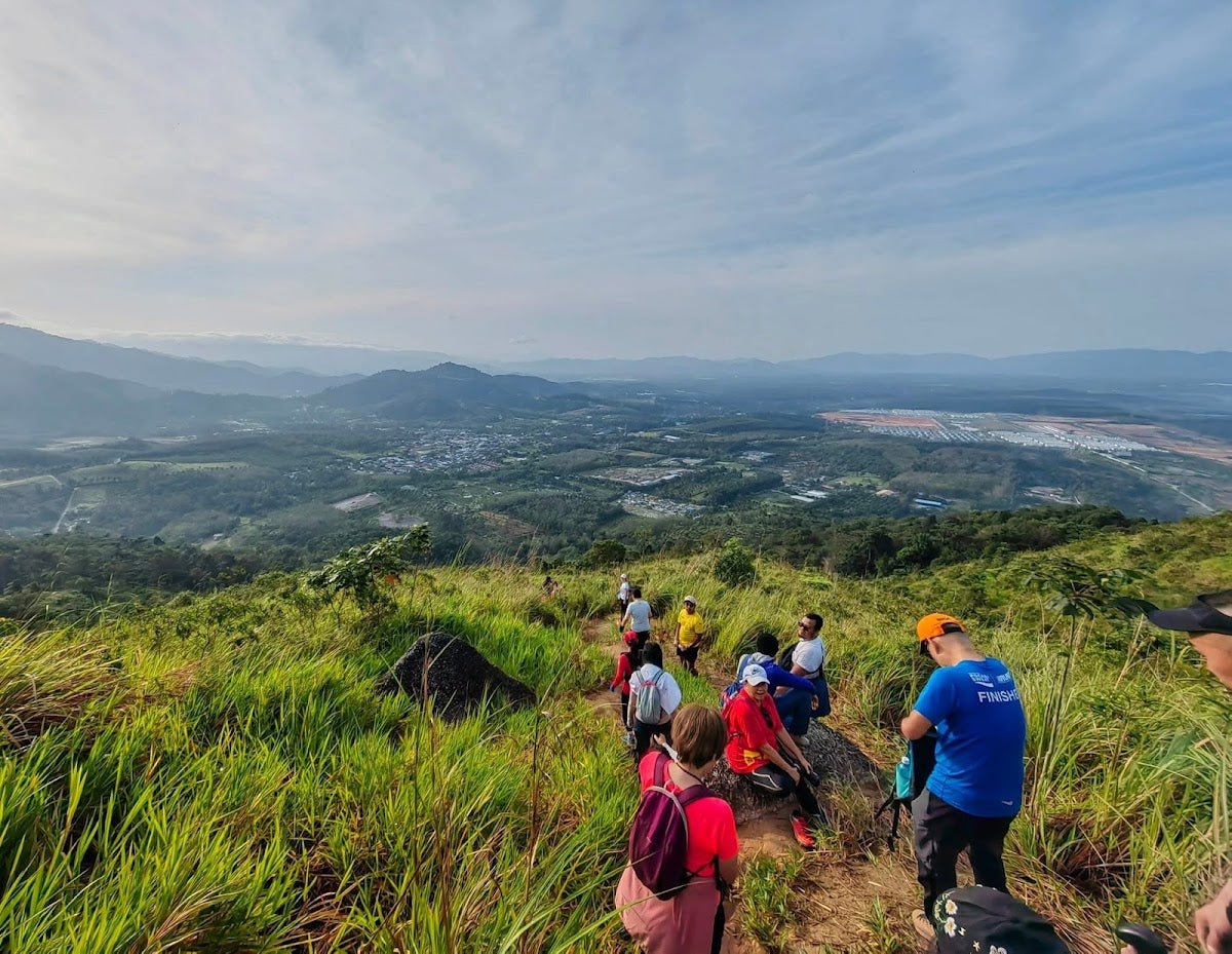
Both trails start from the Taman Melawati area and access the same quartz ridge system. The West trail is the more common choice for a loop; the East trail is shorter but hits you harder, faster. Start early — locals recommend 4:00–6:30 AM to catch sunrise and avoid afternoon heat on that exposed ridge.

West Trail — Stage 1: Trailhead to Forest Entry
Start at the dead-end gate near Taman Melawati. The trail is marked by stairs on the left side of the road. Your guide will brief you here. This is your last flat ground for a while — check your laces and water.
West Trail — Stage 2: Forest Ascent
The first stretch takes you through dense forest with bamboo and tree cover. It's a gradual ascent and the most forgiving part of the whole route. Leeches are possible here, especially after rain — tuck your socks and keep moving. Enjoy the shade; you won't have it for long.
West Trail — Stage 3: Steepening and Rocky Transition
The trail gets noticeably steeper and the path narrows. You're transitioning from soil and roots to quartz rock. Start thinking about your footing. Wet quartz is genuinely dangerous — if it's been raining recently, this is where you reassess whether today is the right day.
West Trail — Stage 4 & 5: Rope Sections
Two separate steep rock cliff sections with old fixed ropes. These are not gym climbing walls. One reviewer noted anchor screws pulling out of rock on similar sections. Use the ropes as a guide and for balance, but find your own footholds and don't put your full weight on the rope alone. Your guide will talk you through it — listen to them.

West Trail — Stage 6: The Exposed Ridge
This is the crux of Bukit Tabur. A narrow quartz crest with vertical drop-offs on both sides. You will be using all four limbs. There is minimal safety infrastructure. Some stairs and rings have been installed in recent years, which helps, but do not go in expecting a handrail the whole way. If heights bother you, this will test you hard. Move deliberately, one point of contact at a time.
West Trail — Stage 7: Summit and Descent
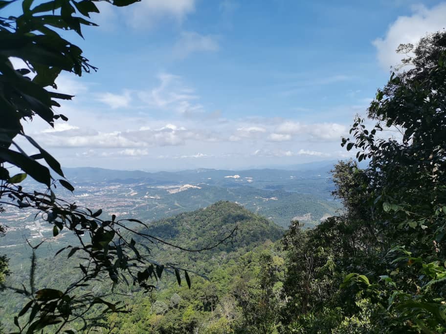
The ridge top rewards you with panoramic views of the KL skyline — Petronas Towers, KL Tower, Exchange 106 on clear days — plus the Klang Gates Dam and the Gombak Forest Reserve spreading out below. You've earned this view. Descent can be done via road to Bukit Tabur Retreat as an optional loop — your guide will advise the best route for the day.

East Trail — An Alternative Route
The East trail starts near Jalan Melawati 18. You cross a small stream at the base — not potable, but a useful landmark. What follows is a steep, relentless ascent directly up next to a fence to the ridge. No warmup, no gradual build — it goes straight up. The ridge section is jagged quartz with precipitous drops and a rope-assisted rock cliff section (handholds cut into the rock also usable). The East Peak at ~275 m gives you the same KL skyline payoff. Most fit hikers report 1.5–2 hours to summit; very fit hikers do it in under an hour. It's harder than the West — anyone telling you otherwise is working from bad information.
Descent & Safety
Coming down is where most accidents happen on quartz ridges. Your legs are tired, your focus drops, and steep quartz with tired feet is how people get seriously hurt. Take your time. Use your guide's advice on route and pacing.
Key hazards to keep in your head throughout:
- Falls from height — the primary danger. Multiple fatalities recorded. Vertical drop-offs on both sides of the ridge with little to no safety infrastructure.
- Wet quartz — extremely slippery after rain. If it's rained in the past 24 hours, seriously consider postponing.
- Unreliable fixed ropes — anchor integrity is not guaranteed. Do not trust your full weight to them.
- Loose quartz — handholds and footholds can crumble. Test before you commit.
- No trail markers — without your guide, disorientation risk is real.
- No shade on ridge — UV exposure and heat are serious, especially between 10 AM and 3 PM. This is one reason the early start is not optional, it's smart.
- Leeches — lower forest sections, especially on wet days.
- Vertigo — the exposed crest is genuinely high-anxiety even for experienced hikers. Know your limits before you commit to the ridge.
Turn back if weather closes in. Rain on this ridge is not 'hike in the rain' territory — it's 'someone could die' territory. Your guide has the authority to call the hike; back them up.
What to Bring
Bukit Tabur is a short hike by distance but demands proper gear because of the technical terrain and full sun exposure on the ridge. Pack smart:
- Water: Minimum 1.5 litres. There are no water points on the trail. A hydration bladder is the easiest way to keep drinking hands-free on technical terrain — the TAHAN TrailBladder 2L Water Bladder fits most packs and keeps you sorted without stopping to dig for a bottle.
- Trekking poles: Useful on the forest sections and descent. On the technical ridge sections, you'll stow them and go hands-free — poles that fold away quickly matter here. The TAHAN 3-Section Foldable Hiking Stick V2 collapses to a compact size, which is exactly what you want when you need your hands for the rocks.
- Footwear: Proper hiking shoes or trail runners with grip. Do not do this in sneakers or sandals. Seriously.
- Gloves: Thin grippy gloves help on the rope and quartz sections. Quartz edges are rough on bare hands.
- Headlamp or torch: If you're starting at 4–5 AM, you'll be hiking in the dark for the first section. Non-negotiable.
- Sunscreen and cap: The ridge is fully exposed. No shade, full tropical UV. Don't skip this.
- Light snacks: Energy bars or bananas. There's nothing to buy at the trailhead.
- Rain jacket: Compact and light. If weather turns, you'll be glad you have it.
- Permit confirmation: Have it on your phone or printed. Your guide will manage this, but keep a copy yourself.
For a full breakdown on trekking poles, knee guards, and other essentials for technical hikes, read our hiking gear guide.

FAQ
How hard is Bukit Tabur?
Challenging — that's the consensus from the majority of hikers and trail reports. AllTrails rates it Moderate on one variant, but that's an outlier and not representative of the full experience. The exposed quartz ridge involves four-limb scrambling, rope sections with questionable anchor reliability, and vertical drop-offs on both sides. It has a recorded history of fatalities. Not suitable for beginners, children, or anyone uncomfortable with heights.
How long does Bukit Tabur take?
Depends on your route and fitness. West trail: 3–4 hours for fit hikers, 4–6 hours for average fitness. East trail: 1.5–2 hours to summit (under 1 hour for very fit hikers). Extreme trail: 2.5–3 hours. Full range across all routes is 1 to 6 hours — plan conservatively, especially if it's your first time.
Do I need a permit for Bukit Tabur?
Yes, and a registered guide is also mandatory. Apply online via the SeForest e-Permit System (forestry.selangor.gov.my/permit/home) at least 48 hours before your visit. Fee is RM5 per person. Hiking without a permit can result in fines up to RM30,000 and/or imprisonment up to 5 years under the National Forestry Act 1984. Your guide can usually handle the permit application for the group — confirm this when you book. Step-by-step application guide: how to apply on SeForest.
Is Bukit Tabur open in 2026?
The trail conditionally reopened in February 2023 under the mandatory permit and guide system after being officially closed since around October 2016. As of late 2024, some visitors report inconsistent enforcement of closure signage, but the permit requirement is legally binding regardless. Trail status can change — contact JPNS directly via forestry.selangor.gov.my or webjpnselangor@forestry.gov.my before your trip to confirm current status.
Camp Nearby?
Bukit Tabur is a day hike, but if you're making a weekend of it around Selangor, there are solid camping options nearby worth looking at. Templer Park Rainforest Retreat is one of the closer options to the Gombak area and a good base if you want to arrive the evening before for an early start. Further afield but worth the drive, Mori Leka Campsite, Serendah and Nature Escape Campsite, Hulu Langat are both solid choices for a proper overnight before or after your hike.
Trail conditions, permit updates, and hiking buddies for the weekend — all in one WhatsApp group. Just ask; someone was probably up there last week.
💬 Join the Hiking CommunityFree, one click. No spam — the occasional promo at most.
Gear tip: Water bladder or bottle on a humid trail.
Mike has been camping across Malaysia for over 10 years — from jungle treks in Taman Negara to beach camps in Perhentian. He writes about it so you don't have to find out the hard way. Follow along on TAHAN Outdoor's blog for honest campsite reviews, every week.
⛺ Featured in: The 10 Toughest Hikes in Peninsular Malaysia (2026)