Gunung Angsi: A Hiker's Guide (2026)
Gunung Angsi is the kind of mountain that Malaysians keep coming back to — and you'll understand why the moment you're on the trail. At 825 m, it's not going to break any altitude records, but it punches well above its weight in terms of character. Two distinct routes, a proper scramble section, river crossings, rich jungle canopy, and a summit with actual views. All of this sitting about an hour from KL and 20–30 minutes from Seremban town. That's a hard combination to beat.

Angsi suits beginners who are genuinely ready to work for it — this isn't a stroll, especially if you take the Ulu Bendul route. It also suits regulars who want a quick weekday fix, and groups doing their first trans-hike. The Bukit Putus route is the popular entry point: shorter, more forgiving, and well-marked. Ulu Bendul is longer, wetter, and has a scramble section called Bukit Botak that will wake you up properly. Both routes meet at the same 825 m summit.
One thing Angsi is famous for that doesn't make the Instagram posts: it gets absolutely packed on weekends. Some regulars treat it like a morning jog — hikers have been spotted going up and down multiple times in one morning. If you want the mountain to yourself, come on a Tuesday. If you're okay with company, just start early.
Quick Facts
- Summit elevation: 825 m (2,702 ft)
- Distance (Bukit Putus, one-way): ~4.2–4.5 km
- Distance (Ulu Bendul, one-way): ~5.5 km
- Distance (Trans-hike, one-way): ~10–14 km depending on route start points
- Elevation gain (Bukit Putus): ~575 m
- Elevation gain (Ulu Bendul): ~665 m
- Duration (Bukit Putus, up only): 1–3 hours (most hikers: 2–3 hours; fit hikers: 1–1.5 hours)
- Duration (Ulu Bendul, up only): ~2 hrs 45 min – 5 hours
- Duration (Trans-hike): ~4 hrs 15 min – 6.5 hours
- Difficulty: Easy to moderate; Bukit Putus easier and beginner-friendly; Ulu Bendul more challenging with river crossings and exposed scramble
- Permit: Yes — RM5 per person, required
- Guide required: No — trail is well-marked throughout
- Entry cutoff: No hiking permitted to start after 11 am
Getting There & Parking
Angsi has two trailheads, and which one you use depends on your plan for the day.
Bukit Putus trailhead sits on Jalan Kuala Pilah (Route 51), the road that runs between Seremban and Kuala Pilah. It's approximately 20–30 minutes from Seremban town centre and about an hour from KL. GPS coordinates: approximately 2.727492, 102.058330 — plug this in, but verify on the ground as coordinates for this spot vary slightly across sources.
Ulu Bendul trailhead is the entrance to Ulu Bendul Recreational Park, about 20 km from Seremban. GPS approximately 2.730539, 102.078471. The park has proper facilities at the entrance including toilets (50 sen) and a snack/drink stall — useful before you head in.
The two trailheads are roughly 3 km apart by road, which matters if you're planning the trans-hike — you'll want two cars, one at each end, or arrange pick-up.
Parking is free at both trailheads, and there are more parking lots on the Bukit Putus side. That said, on weekends and public holidays, both can fill up fast. Aim to arrive by 7 am if you don't want to be parking on the roadside or circling.
By public transport: the nearest KTM stations are Seremban and Senawang, but getting from either station to the trailhead isn't straightforward. Your best bet is Grab from Seremban — just factor in the cost both ways.
Permits & Fees
A permit is required to hike Gunung Angsi. The fee is RM5 per person, issued by Jabatan Perhutanan Negeri Sembilan (the Negeri Sembilan Forestry Department).
You can get your permit in person at the ranger or registration counter at either trailhead. The counter opens at 8 am on weekdays and 6 am on weekends and public holidays. No hiking is permitted to start after 11 am — this is a hard cutoff, not a suggestion. Late arrivals get turned away.
Online payment is also available via the N9PAY government platform (search for 'Jabatan Perhutanan Negeri Sembilan'). As of 1 July 2024, online payment is by bank transfer to CIMB Islamic account no. 8605848026. The description format to use is: PNNS35 [Location] [Date] — for example, 'PNNS35 Gunung Angsi 01072024'. Verify these details are still current on the N9PAY platform before you go, as payment systems do get updated.
Hiking without a permit can result in a fine of up to RM10,000. Don't test this.
Trail conditions and permit requirements change — always check with the local forestry office or park authority before you go. Checking a different gunung? Try our free permit checker — instant answer for 90+ Malaysian mountains. Or ask the TAHAN Hiking Community on WhatsApp — someone's usually been there that week.
The Trail: What to Expect

Three ways to do Angsi. Route A (Bukit Putus) is the most popular and the logical choice for first-timers. Route B (Ulu Bendul) is longer and tougher, with river crossings and the Bukit Botak scramble. The trans-hike combines both — Bukit Putus up, Ulu Bendul down — and is probably the most satisfying way to experience the mountain if you have the logistics sorted.
Route A — Bukit Putus (Popular, Shorter)
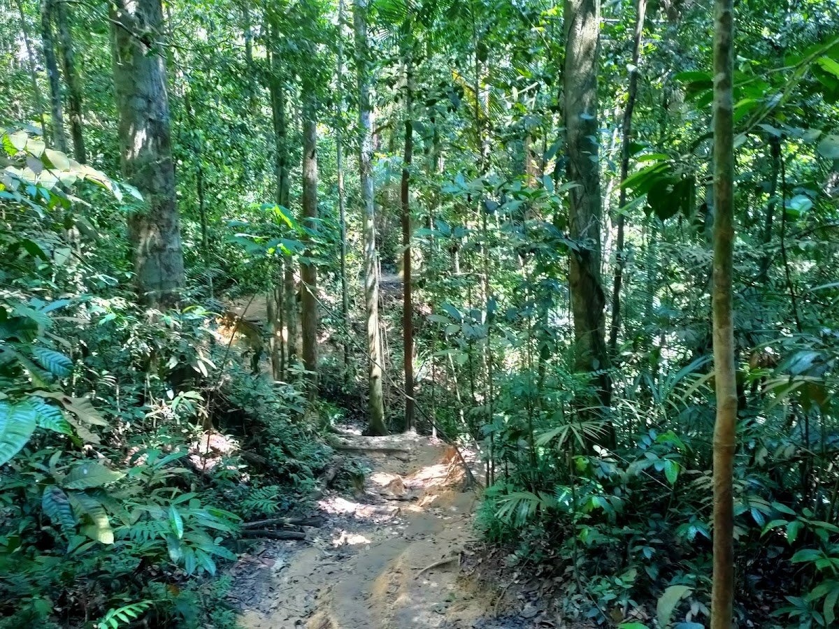
Start at the Bukit Putus ranger station where you register and get your permit stamped. The first stretch runs alongside a stream and water pipe — relatively flat and easy, a gentle warm-up before things get serious.
At around the 25-minute mark you'll hit a roofed rest area with benches. Good spot to adjust your pack and catch your breath because the trail starts earning its keep from here. The initial ~2 km of the Bukit Putus route is the steepest section — cement steps and metal steps get you started near the base, then it's clear wide forest trail with rope-aided steep sections.

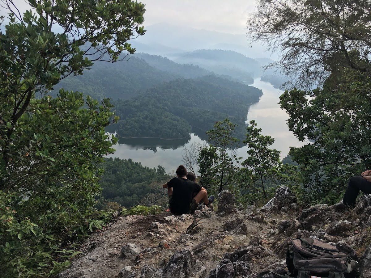
Around 50 minutes in, you reach Viewpoint 1. On a clear morning this is worth a proper pause — panoramic views that remind you why you left the bed at 6 am. After this, the trail includes a steep gully section with exposed tree roots and fixed ropes at roughly the 70-minute mark. Take these carefully, especially if it rained recently. The roots are genuinely slippery when wet.
At around 105 minutes, you reach the 'Reservoir View' rest area — views looking toward the Sungai Terip reservoir. This is a good morale checkpoint. From here it's a continued push to the summit.
The summit at 825 m has a flat rest area, a pavilion/gazebo, and a pyramid-shaped summit marker. Views on a clear day include Senawang town, the Jelebu mountain range, and the Titiwangsa range in the distance. On weekends it can get busy up top — don't be surprised to share the gazebo with thirty other people.
Route B — Ulu Bendul (Longer, More Challenging)

Enter via Ulu Bendul Recreational Park. About 5 minutes in, stop at the guard house to pay your RM5 fee. The lower trail follows a pipeline alongside the river — shaded, pleasant, and deceiving about what's coming.
At around 50–60 minutes you reach Kem Tangga Batu, a large open camp area by the river that doubles as your first river crossing point. The river crossings — there are 2 to 3 of them, some rope-aided — can be knee-deep depending on recent rainfall. Expect wet feet. Plan for it. The tree canopy thins out as you gain elevation, and educational tree-species tags along this stretch are a nice touch if you're into that sort of thing.
Then comes Bukit Botak. At roughly 2 hours from the start, the trail breaks out of the forest onto an exposed section of red clay boulders. There are fixed ropes and a ladder to help, but this is a real hands-and-feet scramble. It's fully open to the sun with zero shade. If it's a hot day and you start late, this section will punish you. Don't underestimate it. From Bukit Botak it's a steep, unrelenting continuous ascent with no flat sections to catch your breath — right up to the summit at 825 m. Depending on your pace, expect 2 hours 45 minutes to 5 hours from the park entrance.
Trans-Hike — Bukit Putus Up, Ulu Bendul Down
The classic traverse. Ascend via Route A (Bukit Putus), summit, then descend via Route B (Ulu Bendul) in reverse. The descent to Ulu Bendul includes a viewpoint with a waterfall view that you'd miss if you only did one route. Coming down through Bukit Botak on tired legs demands full attention — those red clay boulders and the eroded narrow sections on the lower descent are where slips happen. Hold the ropes. Take your time.
Total trail time is roughly 4 hours 15 minutes to 6.5 hours depending on pace. You need two cars (one at each trailhead) or someone picking you up, because the 3 km of tarmac road between the two trailheads makes walking between them impractical after a full hike.

Descent & Safety
Descending Angsi, particularly via Ulu Bendul, is where most incidents happen. The trail is steep, rooted, and in sections quite eroded. After rain it becomes significantly more slippery — the kind of slippery where one wrong foot placement ends your weekend early.
- Leeches: Present throughout, especially on the Ulu Bendul river sections. They will find gaps in your socks. Leech socks are not optional on that route — they're standard kit.
- Slippery trail: Studded or lugged hiking shoes, not running shoes. The trail rewards grip and punishes smooth soles.
- Bukit Botak: Exposed red clay, fixed ropes, ladder. Scramble section that requires both hands. Don't rush it.
- River crossings: Can be knee-deep. Don't attempt if the river is visibly flooded or running fast after heavy rain.
- Wildlife: Siamangs, langurs, and gibbons are around — you'll likely hear them before you see them. Large spiders and centipedes are common. Give them space and they'll give you space.
- Heat and sun exposure: Bukit Botak is brutally exposed. If you're on Ulu Bendul route, make sure you're through that section before the midday heat peaks.
- Entry cutoff is 11 am — if you show up at 10:45, you may be turned away. Don't risk it.
If it's raining heavily, or the sky looks like it's about to — turn back. The steep gully on Bukit Putus and the Bukit Botak scramble on Ulu Bendul both become genuinely dangerous in wet conditions. There's no summit view worth a broken ankle.
What to Bring
Angsi is a half-day hike, not an overnight — but this is still a proper jungle trail with real elevation gain. Pack accordingly.
- Water: Carry at least 1.5–2L. There are natural water sources on both routes, but purification is needed and you shouldn't rely on them. A hydration bladder keeps your hands free on the steeper sections — the TAHAN TrailBladder 2L does this job well at a reasonable price.
- Hiking shoes: Lugged soles, not trail runners or gym shoes. Non-negotiable on Ulu Bendul.
- Leech socks: If you're doing Ulu Bendul or the trans-hike, bring them.
- Trekking poles: Particularly useful on the steep descent sections. If you don't own a pair, check out TAHAN's 3-Section Foldable Hiking Stick V2 — compact, light, and handles the terrain well. We cover what to look for when buying poles and knee guards in our hiking gear guide.
- Rain jacket or poncho: Weather in the hills changes fast. The trail gets slippery fast too.
- Snacks: Bring your own — there's food and drinks at the Ulu Bendul park entrance but nothing on the trail itself.
- Sun protection: Sunscreen, cap, sunglasses — especially if you're tackling Bukit Botak.
- Cash: RM5 for the permit, 50 sen for toilets at Ulu Bendul. Have small notes.
- First aid basics: Blister plasters, antiseptic wipes, and something for leech bites.
- Fully charged phone: For navigation, emergency contact, and that summit photo you've already planned.
FAQ
How hard is Gunung Angsi?
Easy to moderate, depending on which route you take. The Bukit Putus route is beginner-friendly, with a steep initial 2 km that then eases off — doable for someone who doesn't hike regularly but is reasonably fit. Ulu Bendul steps it up considerably: river crossings, full-sun scramble on Bukit Botak, and a longer, steeper overall climb. The trans-hike has been rated around 4.5 out of 10 by one source, which feels about right — challenging enough to be satisfying, accessible enough that it won't wreck you.
How long does Gunung Angsi take?
On the Bukit Putus route, most hikers take 2–3 hours going up and 1–2 hours coming down. Fit hikers have done the ascent in 1–1.5 hours. Ulu Bendul up is typically 2 hours 45 minutes to 5 hours. The full trans-hike comes in at around 4 hours 15 minutes to 6.5 hours. Add time for breaks, permit registration, and the summit — so plan your full day around the longer end of these ranges.
Do I need a permit for Gunung Angsi?
Yes. RM5 per person, issued by Jabatan Perhutanan Negeri Sembilan. You can get it at the trailhead counter (opens 6 am weekends, 8 am weekdays) or pay online via N9PAY in advance. No hiking after 11 am — that's an absolute cutoff. Hiking without a permit risks a fine of up to RM10,000.
Is Gunung Angsi suitable for first-time hikers?
Via Bukit Putus, yes — with the caveat that the first 2 km is genuinely steep and sections can be slippery. Wear proper shoes, start early, and don't push yourself past your comfort zone. The Ulu Bendul route is not the one to pick for your first ever hike. Do Bukit Putus first, see how you feel, then come back for Ulu Bendul.

Camp Nearby?
Making a weekend of it? Negeri Sembilan has a decent spread of camping options if you want to arrive the night before and start fresh in the morning. Last Post D'Rimba Campsite, Negeri Sembilan is worth checking if you want to keep it in the state. If you're open to something a bit more comfortable, De Star Glamping, Lenggeng is close enough to make an early Angsi start realistic. And if you're exploring further into Negeri Sembilan, Berhulucamp, Jempol is another solid option to consider.
Trail conditions, permit updates, and hiking buddies for the weekend — all in one WhatsApp group. Just ask; someone was probably up there last week.
💬 Join the Hiking CommunityFree, one click. No spam — the occasional promo at most.
Gear tip: Water bladder or bottle on a humid trail.
Mike has been camping across Malaysia for over 10 years — from jungle treks in Taman Negara to beach camps in Perhentian. He writes about it so you don't have to find out the hard way. Follow along on TAHAN Outdoor's blog for honest campsite reviews, every week.