Kota Damansara Community Forest: A Hiker's Guide (2026)
Kota Damansara Community Forest (KDCF) is proof that you don't need to drive two hours to get a proper forest fix. Tucked inside one of Selangor's busiest suburbs, this 400-acre lowland dipterocarp reserve has a 14 km trail network built in partnership with Temuan Orang Asli and Jabatan Perhutanan Selangor — and it punches well above its weight. The trails range from a gentle 30-minute stroll to a full peak assault that'll leave your legs talking to you the next morning.

What makes KDCF genuinely special is the stacked-loop design. You decide on the day how far you want to go — short loop for the kids, intermediate combo for weekend fitness, or grind all the way to Tiga Puteri Peak if you want a proper challenge. That said, don't let the "community forest" label fool you into showing up in sandals. The upper trails are steep, rooty, and demand real attention. This forest respects hikers who come prepared, and it has no patience for those who don't.
KDCF suits families with young children on the lower trails, intermediate hikers looking for a sweaty weekday morning, and trail runners who want a technical circuit close to KL. If you're gunning for Tiga Puteri Peak, treat it like a proper hike — not a casual walk in the park.
Quick Facts
- Total trail network: 14 km (individual routes from ~2 km up to 10+ km depending on combination)
- Elevation gain: Varies by route — roughly 319–389 m depending on which GPS source and trail combo you follow
- Duration: 30–45 min (Scouts' Trail only); 60–80 min (Scouts' + Temuan); 90–120 min (Scouts' + Temuan + Sahabat); 2–3 hrs (full loop to Tiga Puteri Peak)
- Difficulty: Beginner (Petaling, Scouts', Temuan Trails) → Intermediate (Harmoni, Sahabat, Serenity) → Hard (Unity Peak, Denai Tiga Puteri)
- Overall rating: Moderate (AllTrails); peak sections rated Hard by GPS apps
- Permit required: No — but registration at entrance is mandatory
- Entry fee: RM2 adults, RM1 children 12 and under
- Guide required: No — trails are well-marked; signboards and apps (ViewRanger, Komoot) assist navigation
- Parking: No designated parking — street parking only, limited
Getting There & Parking
The primary trailhead is at Jalan Merbah 10/1, Section 10, Kota Damansara — look for the shelter opposite SMK Seksyen 10. There's also a secondary entrance near Taman Rimba Riang public park in Section 9, which gives you direct access to the Harmoni and Unity Trails. Google Maps will serve you better than memory here — the roads around this area are a bit maze-like if you don't know the neighbourhood.
Parking is the honest weak point of KDCF. There is no designated carpark. Street parking exists along the roads nearby, but it fills up fast — double-parking is a regular occurrence on weekends. If you're arriving after 8 AM on a Saturday, there's a real chance you'll be circling for a spot. The KDCF Committee is working with authorities on alternatives, but for now, the practical advice is: arrive early or arrange a drop-off. The forest is accessible enough from the surrounding residential area that some regulars take a Grab to the trailhead.

Permits & Fees
No special hiking permit needed. What you do need to do is register at the entrance before you head in — this is mandatory, not optional. Entry is RM2 for adults and RM1 for children aged 12 and under. The forest is managed by the KDCF Society in consultation with Jabatan Perhutanan Selangor.
Opening hours vary depending on which source you trust — different hiking sites list different times, and they don't all agree. The most commonly cited hours are around 7:30–8:00 AM opening with a midday cutoff, but please verify the current hours at kotadamansaraforest.org before you go — arriving late and getting caught inside when the forest closes is not a situation you want to be in.
Trail conditions and permit requirements change — always check with the local forestry office or park authority before you go. Checking a different gunung? Try our free permit checker — instant answer for 90+ Malaysian mountains. Or ask the TAHAN Hiking Community on WhatsApp — someone's usually been there that week.
The Trail: What to Expect
KDCF runs on a stacked-loop system — each trail connects to the next, so you can bail out or add on as you go. Here's how it builds from the entrance to the summit.

Stage 1: Registration & Entrance (Jalan Merbah 10/1, Section 10)
Sign in at the shelter near the SMK Seksyen 10 entrance. Pay your RM2, note the closing time for the day, and check the trail map. There's a small lake near this entrance — worth a look before you head into the canopy. Don't skip registration thinking it's just a formality; it exists so they know who's in the forest.
Stage 2: Petaling Trail / Scouts' Trail
This is where everyone starts. Easy, wide-ish path through lowland dipterocarp forest — great canopy cover, manageable terrain. A standalone loop takes 30–45 minutes and is genuinely suitable for beginners and young kids. Free-roaming monkeys are common here; keep food out of sight and don't engage with them. If you're just here for a forest walk, this loop delivers without any drama.
Stage 3: Temuan Trail
Add this on and you're looking at a ~4 km combined distance and 60–80 minutes total. The Temuan Trail is an undulating 2 km loop with picnic benches at the midpoint — a decent rest stop before you decide whether to push further. Terrain is more varied here, with some rooty sections that reward proper footwear. This trail carries the name of the Orang Asli community who helped build it, which is worth remembering as you walk through.
Stage 4: Sahabat Trail
Stacked above Temuan, Sahabat is another 2 km loop where the gradient starts to bite. The combined Scouts' + Temuan + Sahabat route comes to about 6 km and 90–120 minutes — this is solidly intermediate territory. If your knees aren't your strongest asset, this is the stage where you'll start to feel the descent on the way back.

Stage 5: Unity Trail
A 2 km link trail running under forest canopy, connecting Sahabat to the Harmoni area and Section 9 entrance. Watch out for mountain bikers on this section — the trail is shared, and they move fast. Stay alert, give way when you hear them coming, and stick to your side of the trail.
Stage 6: Unity Peak — The Climb Begins
The climb to Unity Peak is where casual hikers start separating from the summit-bound ones. Gradient increases noticeably here. Take your time, watch your footing on rooty and uneven ground, and don't rush this section just because you're excited about the top.
Stage 7: Denai Tiga Puteri Trail — No Bikes, Proper Obstacles
This is the section that catches people off guard. The Denai Tiga Puteri Trail involves actual obstacles — a large log to clamber over, low overhangs to duck under, and genuinely technical terrain. Bicycles are not permitted past this point. The last 500 m to the summit is steep steps and ladders. Ropes are in place to help. One recent hiker described it as feeling like rock climbing in parts, and that's not an exaggeration. Bees have been reported near the peak — don't swat, don't panic, keep moving steadily.

Stage 8: Tiga Puteri Peak (Summit)
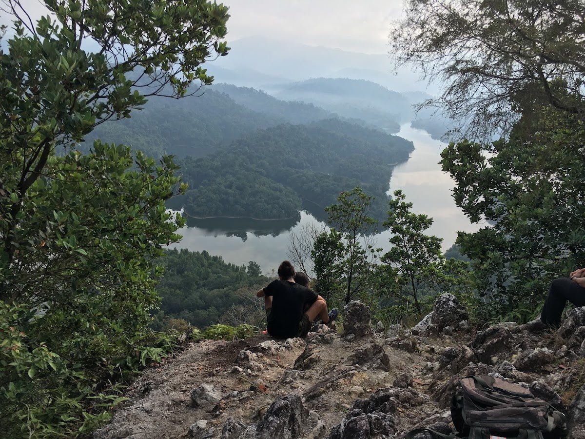
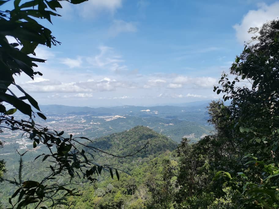
Highest point in the forest reserve. The views are genuinely rewarding — you can see the NKVE highway from up here, which is oddly satisfying given that you've just climbed through the middle of suburban Selangor to get there. Catch your breath, take your photos, and eat something before the descent. Don't linger too long if you set off late — that midday closing time is real.

Descent & Safety
Coming down Denai Tiga Puteri is where most people have trouble. Steep steps and ladders are harder on the way down — your weight is working against you, your legs are already tired, and those same roots and rocks that were minor inconveniences on the way up are now genuinely slippery hazards. Take it slow. Use the ropes and fixed aids provided. Do not rush the descent because you're worried about closing time — rushing is how sprains happen.
Key hazards to be aware of:
- Mountain bikers: Sharing the trail on most routes. Stay aware, especially on the Unity Trail and lower sections.
- Steep steps and ladders: The last 500 m to Tiga Puteri Peak in both directions. Not suitable for people with significant knee issues without proper support.
- Monkeys: Free-roaming and bold. Secure your food and don't try to feed or photograph them at close range.
- Leeches: Lowland rainforest, regular rainfall — assume leeches are present even if it hasn't been raining that morning. Wear leech socks or tuck trousers into socks.
- Closing time: The forest closes at midday on some days. Being inside when it closes is not just inconvenient — it's a safety issue. Know your closing time before you set off and plan backwards from it.
- No water sources on trail: None mentioned in any source. Whatever you carry in is all you have.
If the weather turns — heavy rain especially — the technical sections on Denai Tiga Puteri become significantly more dangerous. Wet steps and ladders on a steep slope with tired legs is not the place to be stubborn. Turn back if conditions deteriorate and return on a better day.
What to Bring
- Water: There are no water points or refill stations in the forest. For a 2–3 hour peak loop in Malaysian heat, bring at least 1.5–2 litres per person. A hydration bladder like the TAHAN TrailBladder 2L keeps your hands free and makes it easy to sip without stopping — useful on the technical sections.
- Proper trail shoes: Not running shoes, not sandals. You need grip on wet roots and confidence on those peak ladders.
- Trekking poles: Optional on the lower trails, genuinely helpful on the Denai Tiga Puteri ascent and especially the descent. The TAHAN 3-Section Foldable Hiking Stick V2 collapses small enough to clip to your bag on the flatter sections and deploys fast when the trail tilts. Worth having for anyone doing the full peak route. Check our hiking gear guide if you're unsure what to look for.
- Leech protection: Leech socks or long socks pulled over trouser cuffs. Salt or repellent if you have it.
- Light snack: Energy for the upper trail section. Keep food sealed and in your pack — monkeys will investigate otherwise.
- Small first aid kit: Plasters, antiseptic, blister coverage.
- Fully charged phone: For navigation apps (Komoot, ViewRanger work well here) and emergency contact.
- Rain jacket or poncho: Lowland forest, afternoon showers are always possible even if the morning looks clear.
FAQ
How hard is Kota Damansara Community Forest?
Depends entirely on where you go. The Scouts' and Petaling Trails are genuinely easy — suitable for families and beginners. Sahabat and Harmoni are intermediate. The Denai Tiga Puteri Trail to the summit is legitimately hard — steep ladders, physical obstacles, and technical footing. Don't go by the "community forest" name and assume the whole place is a stroll. The upper section demands real fitness and some confidence on technical terrain.
How long does it take to hike to Tiga Puteri Peak?
Most sources put it at 2–3 hours for the full peak loop, though this varies quite a bit with fitness level and which trail combination you take. A fit hiker moving without long stops might manage it in 2 hours. Budget 3 hours if you're not sure, and factor in the closing time — you need to be out before the forest shuts for the day.
Do I need a permit to hike Kota Damansara Community Forest?
No hiking permit required. You do need to register at the entrance before entering — that's mandatory. Entry fee is RM2 for adults and RM1 for children 12 and under. The forest is managed by the KDCF Society with Jabatan Perhutanan Selangor. Step-by-step application guide: how to apply on SeForest.
Is Kota Damansara Community Forest suitable for beginners?
For the lower trail loops (Scouts', Petaling, Temuan), yes — these are beginner-friendly and family-suitable. For the summit trail (Denai Tiga Puteri and Tiga Puteri Peak), no. The final 500 m involves steep steps, ladders, a large log obstacle, and low overhangs. Beginners should work up to it, not start with it.
Camp Nearby?
KDCF doesn't have overnight camping within the forest, but if you want to make a proper outdoor weekend of it, there are solid options within Selangor. Making a weekend of it? Check out Templer Park Rainforest Retreat for a rainforest camping experience not too far from the KL area, or head a bit further for Mori Leka Campsite, Serendah which is popular with hikers looking for a chill base after a hard morning on the trails. If you're willing to go to the other side of Selangor, Nature Escape Campsite, Hulu Langat is worth the drive. Any of these make a natural companion to an early KDCF morning — hike first, camp after, sleep well.
Trail conditions, permit updates, and hiking buddies for the weekend — all in one WhatsApp group. Just ask; someone was probably up there last week.
💬 Join the Hiking CommunityFree, one click. No spam — the occasional promo at most.
Gear tip: How to use a trekking pole (and set the height).
Mike has been camping across Malaysia for over 10 years — from jungle treks in Taman Negara to beach camps in Perhentian. He writes about it so you don't have to find out the hard way. Follow along on TAHAN Outdoor's blog for honest campsite reviews, every week.