Gunung Telapak Buruk: A Hiker's Guide (2026)
Gunung Telapak Buruk is the highest peak in the Berembun range and the most prominent summit in Negeri Sembilan — sitting at 1,193 m at the exact tripoint where Jelebu, Seremban and Kuala Pilah districts meet. It's not a famous peak, but those who've made it to the top will tell you it earns its reputation. Dense jungle, steep rope sections, a WWII aircraft crash site halfway along the ridge, and a trail that has seen serious flood damage — this is a mountain that demands respect and, crucially, up-to-date information before you set foot on it.

This guide covers the main Kampung Pantai route (the most documented approach) and gives you what you need to know about the TM Tower / Bukit Tangga route as well. The hike suits intermediate to experienced hikers. Beginners can target Gunung Berembun peak as a shorter goal — but even that is no Sunday walk. Full summit via the main route is a long, hard day out.
IMPORTANT before you plan anything: The trail from the Kampung Pantai / Berembun side to the Telapak Buruk summit was reported closed since approximately 2020–2021 due to major flood damage. As of mid-2023, reopening status was unconfirmed. This guide is written for when the trail is open — but you must verify current status with Jabatan Perhutanan Negeri Sembilan or the ranger office at Kampung Pantai before you go. Do not assume it's open. Seriously.
Quick Facts
- Summit elevation: 1,193 m (3,914 ft)
- Elevation gain: ~1,651 m via Kampung Pantai / Berembun loop; ~1,473 m via Bukit Tangga out-and-back
- Distance (Kampung Pantai to summit, one-way): ~12.29 km
- Distance (full loop): ~36.29 km
- Distance (TM Tower / Bukit Tangga, one-way): ~5.5 km (sources vary significantly)
- Duration — Kampung Pantai, full return to summit: ~12 hours
- Duration — Kampung Pantai to crash site and back only: 7–8 hours
- Duration — Bukit Tangga out-and-back to summit: 9.5–10.5 hours
- Duration — TM Tower short route to crash site only: 1.5–2 hours (one-way, single source)
- Difficulty: Intermediate to hard; not suitable for beginners on full summit route
- Permit required: Yes
- Guide compulsory: No — but someone familiar with the trail is recommended
- State: Negeri Sembilan (Berembun Forest Reserve, Banjaran Titiwangsa)
Getting There & Parking
There are two main trailheads. Most hikers use Kampung Pantai as the starting point.
Trailhead 1 — Kampung Pantai (recommended start): GPS 2.801997, 102.022832. Access via Federal Route FT 86 (Jalan Jelebu). Both trailheads are within about an hour's drive from Kuala Lumpur. Parking is free roadside parking — no formal carpark. No public toilets, no eateries at the trailhead. There's a river nearby for a good scrub-down after the hike, which you will want.
Trailhead 2 — TM Tower / Dataran Bukit Tangga: GPS 2.840246, 102.068981. Access via a small single-lane road off FT 86, following the Telekom Malaysia signboard, approximately 13.8 km from the junction past Empangan and Kampung Pantai. A 4WD vehicle is strongly recommended for this access road — the tarmac is broken and the road condition is rough. One recent hiker put it plainly: the broken tarmac is not suitable for a normal car. If you're driving a Myvi or a Viva, reconsider or plan a longer walk-in.

Permits & Fees
A permit is required before you start hiking — this is confirmed by multiple sources. The permit fee is RM5 per person (single source; verify this hasn't changed). You can get your permit on the spot at the Gunung Berembun ticket office at the Kampung Pantai trailhead. Online applications to Jabatan Perhutanan Negeri Sembilan (PHD Negeri Sembilan) are also accepted.
For the TM Tower / Bukit Tangga entrance, permit requirements are less clear — there is at least one older source suggesting no permit is needed via the TM road, but the majority of sources say a permit is required. Assume you need one and check before you go.
Trail conditions and permit requirements change — always check with the local forestry office or park authority before you go. Or ask the TAHAN Hiking Community on WhatsApp — someone's usually been there that week. Checking a different gunung? Try our free permit checker — instant answer for 90+ Malaysian mountains.
The Trail: What to Expect
The route described here follows the main Kampung Pantai approach. Note that distances and durations come from GPS track data across multiple sources — figures can vary, so treat them as solid estimates rather than exact measurements. The trail is not heavily signposted on the Kampung Pantai side; having a GPS track downloaded is a good idea.

Stage 1: Kampung Pantai Trailhead to Lata Berembun (~2.25 km, ~354 m asl)
Register at the ticket office, pay your permit fee, and get moving early — full summit days are long. The first stretch to Lata Berembun waterfall is the friendliest part of the whole route: a wide, mostly flat path through dense tropical rainforest. Don't be fooled into thinking the whole thing is like this. Lata Berembun is your first campsite option and a reliable water point. Top up here. Leeches are active throughout this section, especially after rain — get your leech socks on before you even start.
Stage 2: Lata Berembun to Gua Kambing (~4.59 km from start, ~652 m asl, ~90 min from trailhead)
Past Lata Berembun, the trail starts to mean business. There are multiple river crossings between here and Gua Kambing — straightforward in dry conditions, genuinely tricky when water levels are up. Wet shoes from this point onwards are basically guaranteed. Gua Kambing is a sheltered rock cave that doubles as a campsite, with a small waterfall providing water. This is also where the real climbing begins — the gradient sharpens noticeably from here. Leeches continue to be enthusiastic company.
Stage 3: Gua Kambing to Gunung Berembun Peak (~5.69 km from start, ~1,014 m asl, ~2.5 hours total)
This is the steep section. Rope-assisted climbs feature between Gua Kambing and the Gunung Berembun summit — these are not just for comfort, they're genuinely needed on some pitches. Take your time, keep three points of contact, and don't rush. The Berembun peak sits at around 1,014 m and offers limited views from the summit itself. For hikers who turned back here, this is a legitimate standalone target — it's still a solid climb. For those pressing on to Telapak Buruk, this is roughly the halfway point.

Stage 4: Gunung Berembun Peak to WWII Aircraft Crash Site (~8.73 km from start, ~989 m asl, ~45 min from Berembun peak)
The ridge descent from Berembun towards the crash site is one of the most unique stretches of trail in Peninsular Malaysia. After roughly 45 minutes of ridge walking, you hit the WWII aircraft wreckage — fuselage, engine, wing debris spread over a wide area. The wing debris is about 200 m further downhill; the tail section is another 100 m beyond that via a small river. There is a burial area for the crew. Treat this site with full respect — don't touch, don't move, don't take anything. Historically and culturally, this is significant ground.
On the TM Tower approach side of the crash site, distance markers appear every 50 m, which makes navigation somewhat easier from that direction. A small stream near the tail section provides water.
Leech warning: Multiple sources flag the area around and after the crash site as particularly heavy for leeches. Check yourself thoroughly.

Stage 5: WWII Crash Site to Gunung Telapak Buruk Summit (~12.29 km from Kampung Pantai, 1,193 m)
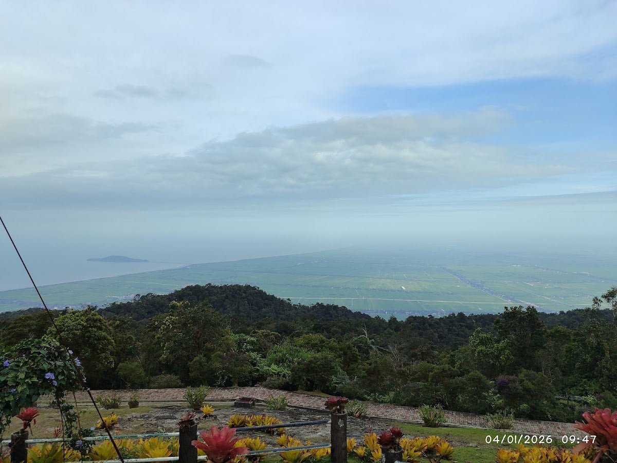
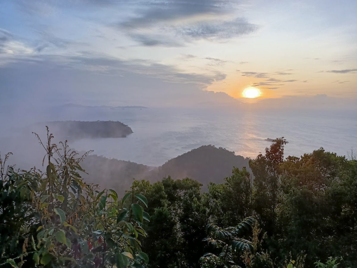
The final push from the crash site to the summit continues along the ridge. One source reports landslides, fallen trees and overgrown vegetation in the roughly 2 km before the summit — this is also consistent with the flood damage that closed this section of trail around 2020–2021. When the trail is open, the summit is marked by TM and telco communication towers. Views on a clear day cover Gunung Angsi, Rembau, Bukit Payong and surrounding peaks across Negeri Sembilan, Pahang and Selangor. The tripoint marker for Jelebu, Seremban and Kuala Pilah districts is here too — a neat bit of geography to stand on.
Descent & Safety
Coming down the way you came (Kampung Pantai out-and-back) means facing that steep Gua Kambing–Berembun section in reverse, on tired legs, on what will likely be muddy trail. Take the rope sections seriously on descent — more accidents happen going down than going up. Allow full time for the return; the ~12-hour total estimate for the Kampung Pantai out-and-back assumes a steady pace with minimal rest stops.
If you're doing a one-way trans to the TM Tower / Bukit Tangga end, sort vehicle logistics in advance — someone needs to be at the other end, and that access road requires a 4WD. Don't assume you can arrange this on the day.
Key hazards to know going in:
- Leeches: Significant throughout, worst near Lata Berembun and post-crash site. Wear leech socks from the start, not from when you first feel one.
- River crossings: Multiple crossings between Lata Berembun and Gua Kambing. Avoid after heavy rain if levels are high.
- Mud and slippery trail: Throughout the route, significantly worse after rain. Grip-sole boots are not optional here.
- Rope sections: Between Gua Kambing and Berembun peak. Fixed ropes on jungle trails wear out — test before you trust.
- Landslides and overgrown sections: Reported in the ~2 km approach to the summit. Trail condition here is directly linked to the flood damage closure.
- Trail closure: The summit route from the Berembun side has been closed since ~2020–2021. Do not attempt without confirmed reopening status.
- No facilities at either trailhead: No toilets, no food stalls. Arrive self-sufficient.
Turn back if: weather deteriorates sharply (thunderstorms in the jungle are not a situation you want to be in on exposed ridge sections), if you hit the crash site later than your planned turnaround time, or if trail conditions ahead look genuinely impassable. The summit will be there another day. Getting stuck on a damaged trail after dark is a rescue call, not an adventure story.
What to Bring
This is a long, physically demanding hike with significant elevation gain, river crossings, leeches, mud, and rope sections. Pack accordingly.
- Water: Minimum 2.5L recommended (confirmed source). Natural water sources exist at Lata Berembun, Gua Kambing and near the crash site tail — bring water treatment tablets or a filter. Do not drink untreated jungle stream water.
- Boots: Waterproof trail boots with solid grip. Not trail runners, not sneakers — boots. Your feet will be wet regardless, but ankle support matters on the rope sections.
- Leech socks: Put them on before you start, not after your first leech. Long pants tucked in.
- Trekking poles: Highly recommended for both the steep ascents and the descents on tired legs. The TAHAN 3-Section Foldable Hiking Stick V2 packs down small and is solid enough for rope-section terrain — I'd rather have poles on this one than not.
- Knee support: Descending 1,600+ m of elevation gain is what breaks knees. If yours are suspect, consider the TAHAN Kinetix Knee Guard with Spring Support — the spring support makes a real difference on long descents. See also our hiking gear guide for more on choosing the right kit.
- Headlamp + spare batteries: On a 12-hour day, there is a realistic chance some of your return is in reduced light. Don't rely on phone torch.
- Food: Pack more than you think you need. Long climbs burn through energy fast and there's nothing to buy anywhere near this trail.
- Rain gear / dry bag: Weather in the Titiwangsa range changes fast. Keep electronics and dry clothes in a dry bag.
- First aid kit: Blister treatment, antiseptic for leech bites, any personal medication.
- GPS / downloaded track: Trail signage on the Kampung Pantai side is limited. Download a track before you leave.
- Emergency contact: Tell someone your plan, your expected return time, and the trailhead GPS coordinates.
FAQ
How hard is Gunung Telapak Buruk?
On the full summit route via Kampung Pantai, this is a hard hike — AllTrails rates it Hard, and the elevation gain figures back that up (1,473–1,651 m depending on route). There are rope-assisted steep sections, river crossings, and a very long day on trail. It's rated intermediate to experienced; beginners should not attempt the full summit. If you want a shorter challenge, Gunung Berembun peak is the more accessible target, though still a proper climb.
How long does it take to hike Gunung Telapak Buruk?
It depends heavily on which route and how far you're going. Kampung Pantai out-and-back to the summit is around 12 hours. The same route just to the crash site and back is 7–8 hours. Via Bukit Tangga out-and-back to summit, most hikers report 9.5–10.5 hours. The TM Tower short route to the crash site area only is 1.5–2 hours one-way (single source). Build in buffer time — jungle trails always take longer than expected.
Do I need a permit for Gunung Telapak Buruk?
Yes, a permit is required. You can get it on the spot at the Gunung Berembun ticket office at the Kampung Pantai trailhead. The fee is reported at RM5 per person (verify this is still current). The permit situation at the TM Tower entrance is less clear from available sources — assume you need one and confirm with Jabatan Perhutanan Negeri Sembilan ahead of your trip.
Is the trail to Gunung Telapak Buruk currently open?
This is the most important question. The trail from the Berembun / Kampung Pantai side to the Telapak Buruk summit was confirmed closed due to major flood damage around 2020–2021. As of the time this guide was written, reopening status was unconfirmed. Contact Jabatan Perhutanan Negeri Sembilan or the ranger office at Kampung Pantai directly before making any plans. Do not just show up and hope for the best.
Camp Nearby?
Making a weekend of it? Negeri Sembilan has some decent options within range. Last Post D'Rimba Campsite, Negeri Sembilan is worth looking at if you want to base yourself in the state. De Star Glamping, Lenggeng is a comfortable option if you're coming from the Nilai / Seremban direction and want a proper rest before an early start. Heading further into the interior, Berhulucamp, Jempol is another solid choice if you're exploring the Jempol area. Given the 12-hour nature of the full hike, arriving the evening before and camping nearby is genuinely worth considering over driving up at 4am.
Trail conditions, permit updates, and hiking buddies for the weekend — all in one WhatsApp group. Just ask; someone was probably up there last week.
💬 Join the Hiking CommunityFree, one click. No spam — the occasional promo at most.
Mike has been camping across Malaysia for over 10 years — from jungle treks in Taman Negara to beach camps in Perhentian. He writes about it so you don't have to find out the hard way. Follow along on TAHAN Outdoor's blog for honest campsite reviews, every week.