Gunung Tebu, Terengganu: A Hiker's Guide (2026)
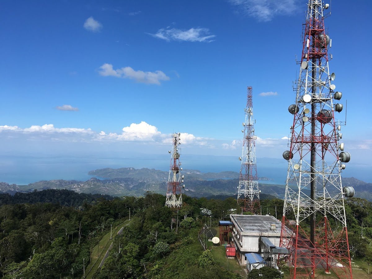
Gunung Tebu is Terengganu's tallest peak and one of the most rewarding hikes in the northeast — not because it's easy, but because what's waiting at the top is genuinely special. On a clear morning you'll see the South China Sea stretching out below you, with Pulau Redang, Pulau Perhentian Besar and Kecil, and Pulau Lang Tengah all laid out like a postcard. The summit is blanketed in a natural bonsai garden of stunted, moss-covered trees that feels completely otherworldly after hours of slogging through dipterocarp forest. This is a hike worth doing properly.

Gunung Tebu suits fit hikers who have some mountain experience under their belt. The ascent is sustained and steep — there are not many flat sections to catch your breath — and the terrain demands focus throughout. It is not a beginner's trail. But if you've done a few mountains in Malaysia and you're looking for something less crowded than Nuang or Ledang, Tebu is exactly the kind of gem you've been looking for. The fact that it's deep in Besut district, Terengganu, keeps the crowds manageable.
This guide covers everything you need: getting there, permits, what the trail actually looks like stage by stage, gear, and the real hazards. Read it, prepare properly, and you'll have a great time up there.
Quick Facts
- Elevation: 1,039 m
- Elevation gain: ~1,076 m
- Distance: 7–8 km one-way; roughly 14–15 km out-and-back
- Duration: Most hikers report 4–4.5 hours up, 2.5–3 hours down. Some sources say 5–8 hours to summit. Budget 6.5–8 hours for the full round trip depending on your pace.
- Difficulty: Moderate-hard. Sustained steep ascent, slippery rocky terrain, multiple stream crossings.
- Permit required: Yes
- Guide required: Yes
- Trailhead: Hutan Lipur Lata Belatan (Lata Tembakoh/Lata Belatan Recreational Forest), Besut District, Terengganu
- Best time to go: Late May–September (Southwest Monsoon). Avoid November–March.
Getting There & Parking
The trailhead is at Hutan Lipur Lata Belatan in Besut District — about 24 km from Jertih and roughly 118 km from Kuala Terengganu. From Kuala Lumpur it's a long haul: expect 5.5–6 hours of driving. The nearest airport is Kota Bharu (Sultan Ismail Petra Airport), which is closer and worth considering if you're flying in.
If you're coming by public transport, buses run to Besut town and from there you'll need to grab a cab to the trailhead. It's the most remote part of this trip to sort out, so confirm your cab in advance — don't assume you'll find one easily at Besut.
Parking at the trailhead is ample and free. GPS coordinates: 5.639235, 102.587762. Park gates open at 7am, so plan your arrival accordingly.

Permits & Fees
You need a permit for Gunung Tebu, and you also need a local guide — this is not optional. Both are a requirement, not a suggestion. Register at the forestry lodge at the trailhead before you start climbing.
Permits are issued by the Terengganu State Forestry Office (Jabatan Perhutanan Negeri Terengganu). The contact listed for Pejabat Hutan Daerah Terengganu Utara is 09-6667473 / 09-6672834, but note these numbers are from older sources and may have changed. Counter hours are 8am–5pm.
Fees as recorded: RM5 per person for the hiking permit; RM5 per night for camping; RM2 per person entrance to the waterfall/picnic area (RM1 for children aged 5–12).
A practical shortcut: BP Hikers organise guided hikes up Gunung Tebu and offer a combined permit-and-guide package for RM50. Contact them via Facebook at www.facebook.com/bp.hiker or WhatsApp +60 10 948 1145 (ask for Shaa Al Aydrus). Many hikers use this route rather than sorting the permit independently, and it works well.
Trail conditions and permit requirements change — always check with the local forestry office or park authority before you go. Or ask the TAHAN Hiking Community on WhatsApp — someone's usually been there that week. Checking a different gunung? Try our free permit checker — instant answer for 90+ Malaysian mountains.
The Trail: What to Expect
The route is well-marked with distance countdown signage, which helps a lot psychologically on the long ascent. The forest is dense Hill and Upper Dipterocarp throughout — expect shade but also humidity. Here's what you'll encounter stage by stage.
River Crossing at Lata Belatan
Right from the start, the trail crosses the river at Lata Belatan. You'll either balance across rocks or wade through shallow water depending on the water level. After rain, this crossing gets trickier — take your time, don't rush it, and keep your footing. Trekking poles are genuinely useful here.

Batu Mat Hasan
Early in the climb you reach Batu Mat Hasan — a dramatic cluster of towering boulders named after a local ascetic figure. It's a good early landmark and a spot worth pausing at. The boulders are impressive, and it signals you're properly into the jungle now.
Jendela Pandang
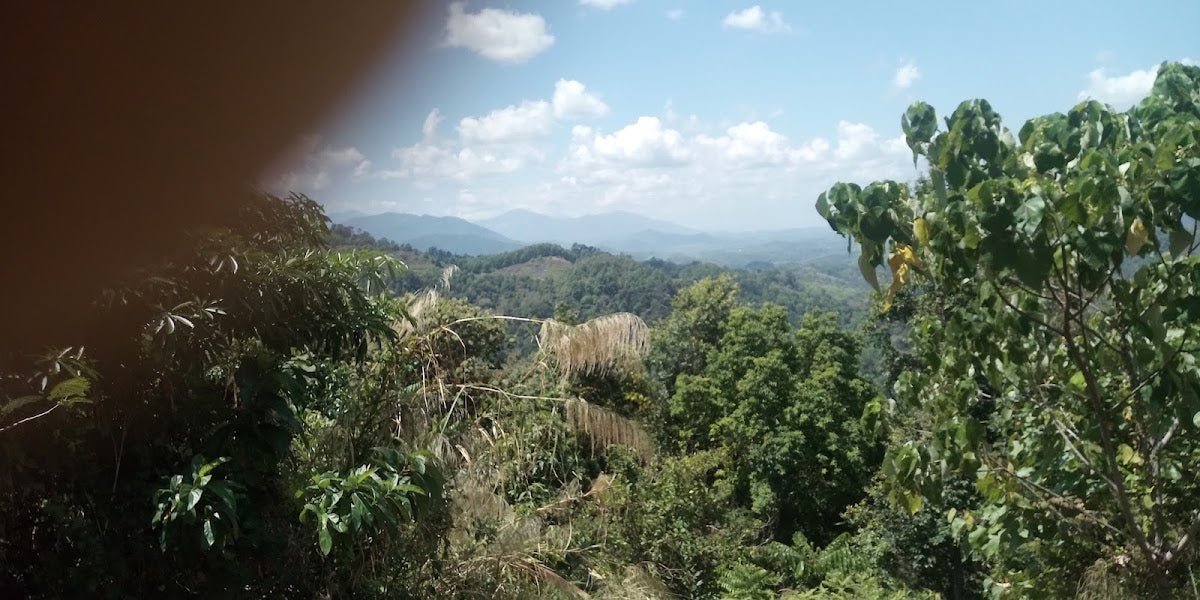
Jendela Pandang — literally "viewing window" — is one of those spots that rewards the effort. You get a break in the canopy and views out over the surrounding hills. Good place to stop, breathe, and take in where you are before pushing on.
Batu Mahkamah & Batu Pelana Kuda
The trail continues through more rocky terrain. Batu Mahkamah ("courthouse rock") and Batu Pelana Kuda ("horse saddle rock") are notable formations along the way — these named boulders serve as trail markers and give the route a sense of character beyond just "more jungle." Terrain is rocky and can be slippery; keep your eyes on your footing.

Batu Bomba — The Halfway Mark
Batu Bomba is the halfway point and there are campsites here. If you're planning a multi-day trip or if the group is tired and the weather looks uncertain, this is a valid place to set up camp rather than pushing to the summit. Don't underestimate what's still ahead from here — the toughest section of the climb begins roughly 2.5 km before the summit.
Batu Madrasah, Telaga Afdal & Kubur Panjang
These three landmarks mark the upper section of the trail. The climb gets more demanding through here — steeper, rockier, and more exposed roots and boulders to negotiate. Telaga Afdal is a notable waypoint; Kubur Panjang ("long grave") carries some local legend. The forest begins to change character as you gain elevation. Stay focused — this is where tired legs make mistakes.

The Summit
The summit of Gunung Tebu at 1,039 m is covered in stunted, moss-covered trees — a natural bonsai garden that looks nothing like the forest below. On a clear day the views are extraordinary: South China Sea, Pulau Redang, Pulau Perhentian Besar and Kecil, Pulau Lang Tengah, Bukit Keluang, Kuala Besut. Sunrise from up here over the South China Sea is one of those views that justifies the whole climb.
The summit campsite can accommodate 50+ twin-sharing tents. Water is available from a brook about 15 minutes from the main campsite (bear right from the main site). There's also a larger campsite accessible via a left-trail descent from the summit — worth knowing if the summit camp is crowded.

Descent & Safety
Descending takes most hikers 2.5–3 hours. The same terrain that made the ascent tough makes the descent hard on the knees — rocky, uneven ground that requires constant attention. Don't rush it. Post-summit energy drops combined with slippery trails is exactly when injuries happen.
Real hazards to take seriously:
- River crossings: Multiple crossings throughout the route. If it's been raining heavily, river levels rise fast. Do not attempt crossings in flood conditions.
- Steep, slippery terrain: The ascent is sustained with minimal flat sections. Rocky and root-covered ground throughout requires constant focus.
- Toughest section near summit: The mountainside roughly 2.5 km from the summit is the most technically demanding stretch. Save energy for it.
- Summit weather: The summit campsite is exposed. Heavy rain and strong winds have been reported — hikers have had tents blown away. If you're camping up top, peg your tent properly and bring a shelter that can handle real weather.
- Leeches: Present but not overwhelming. Standard precautions apply — tuck socks over trouser legs, use salt or leech socks.
Turn back if the weather closes in significantly, especially if there's heavy rain forecast or you're already seeing rising water levels at stream crossings. The mountain will be there next time. Getting down safely is always the priority.
Avoid the trail entirely during the Northeast Monsoon (November–March). The safest window is generally late May through September. Always check the weather forecast before you set off and confirm current trail conditions with the forestry office or your guide.
What to Bring
Gunung Tebu is a long, steep climb with stream crossings, rocky terrain, and a summit exposed to real weather. Pack accordingly:
- Water: Minimum 2–3 litres for the ascent. A hydration bladder keeps you drinking without stopping — the TAHAN TrailBladder 2L is a solid choice for a hike like this.
- Food: High-calorie snacks and proper trail food for the duration. Don't underpack on this one.
- Trekking poles: Strongly recommended — for the river crossing at the start, the rocky ascent, and especially the knee-punishing descent. The TAHAN 3-Section Foldable Hiking Stick V2 packs down small and handles terrain like this well.
- Footwear: Trail shoes or hiking boots with proper grip. No lifestyle sneakers.
- Rain gear: A decent rain jacket and pack cover. The summit weather can change fast.
- Headlamp: Essential if you're starting early or camping. Spare batteries too.
- First aid kit: Basics at minimum — blister pads, antiseptic, bandages.
- Leech protection: Leech socks or salt. Simple and worth it.
- Camping gear: If you're summiting overnight, bring a tent rated for wind and rain — see the summit weather hazard above.
Not sure what to prioritise on your packing list? Check out our hiking gear guide for a full breakdown of what actually matters on Malaysian mountain trails.
FAQ
How hard is Gunung Tebu?
It's moderate to hard. The trail itself is well-maintained and there's signage throughout, but the ascent is long and sustained — there's not much flat ground to recover on. The terrain is rocky and can be slippery. If you've done a few Malaysian mountains and you're reasonably fit, you'll manage it. If Gunung Tebu is your first mountain, it's not the right starting point.
How long does it take to hike Gunung Tebu?
Duration varies quite a bit depending on your fitness and pace. Most hikers report 4–4.5 hours going up and 2.5–3 hours coming down. Other sources put the total round trip at 6.5–7 hours, while some list 5–8 hours to the summit alone. Budget a full day and don't plan anything tight afterwards. If you're camping at the summit, obviously that changes things entirely.
Do I need a permit and guide for Gunung Tebu?
Yes to both. A permit from the Terengganu State Forestry Office is required, and a local guide is mandatory. Register at the forestry lodge at the trailhead before you start. The BP Hikers package (RM50 covers permit and guide) is a straightforward option — contact them via Facebook (www.facebook.com/bp.hiker) or WhatsApp +60 10 948 1145. Don't show up without sorting this in advance.
When is the best time to hike Gunung Tebu?
Late May through September is generally the better window, during the Southwest Monsoon. Avoid November through March during the Northeast Monsoon — Terengganu gets hammered by the northeast monsoon and river crossings and trail conditions become genuinely risky. Always check the weather forecast before you go regardless of the month.
Camp Nearby?
Making a weekend of it? Terengganu has some great options depending on what you're after. If you want to combine the Tebu climb with some island time, check out the SEM Campsite Lang Tengah Island review — Lang Tengah is visible from the summit on a clear day, which makes it a satisfying full-trip combination. Back on the mainland, TWCampstay Kuala Terengganu is worth a look if you want a comfortable base near the state capital before or after your climb. And if you're heading south down the coast, Shukor Campsite, Dungun rounds out your Terengganu camping options nicely. Many hikers also come in the night before and camp at the trailhead recreational forest itself for an early 7am gate start — worth considering if you want to maximise your time on the mountain.
Trail conditions, permit updates, and hiking buddies for the weekend — all in one WhatsApp group. Just ask; someone was probably up there last week.
💬 Join the Hiking CommunityFree, one click. No spam — the occasional promo at most.
Mike has been camping across Malaysia for over 10 years — from jungle treks in Taman Negara to beach camps in Perhentian. He writes about it so you don't have to find out the hard way. Follow along on TAHAN Outdoor's blog for honest campsite reviews, every week.