Denai Tiga Puteri, Kota Damansara: A Hiker's Guide (2026)
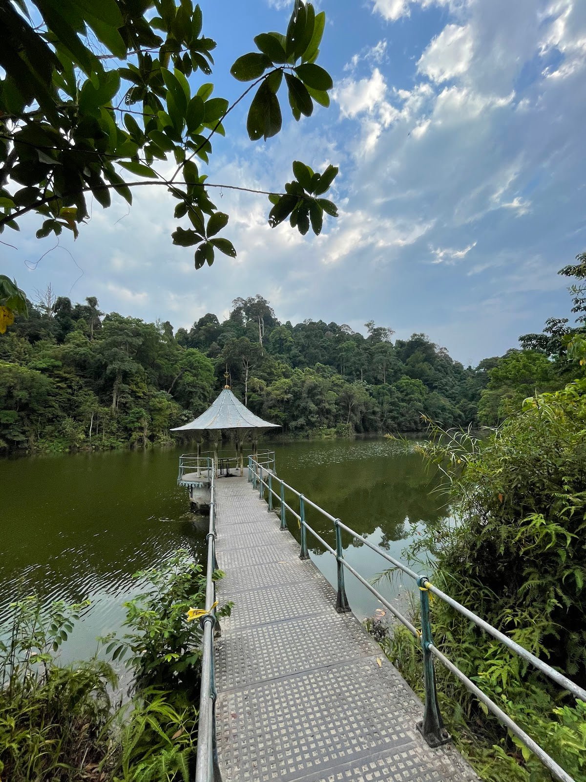
Denai Tiga Puteri is one of those trails that sneaks up on you — literally. It sits inside the Kota Damansara Community Forest Reserve (KDCF), right on the edge of a busy Selangor suburb, and most people drive past it every day without knowing there's a real forest hike hiding behind those trees. For a trail so close to the city, it punches well above its weight.

This is a beginner-to-moderate trail that most averagely-fit hikers can complete in 2-3 hours round-trip. The bulk of the route is pleasant, shaded forest walking through old-growth dipterocarp trees — some genuinely impressive specimens with signboards calling them out by name. Then the final push to Puncak Tiga Puteri hits you with a steep, technical climb that'll remind you this isn't just a Sunday stroll in the park. That contrast — easy forest walk to suddenly-very-steep summit — is exactly what you need to prepare for.
It suits first-timers who want a proper forest experience without driving two hours out of KL, families with older kids who can handle some scrambling, and experienced hikers looking for a quick weekday sweat session. If you're returning from a long break from hiking, this is a solid reintroduction to what your knees are capable of.
Quick Facts
- Distance: 7-7.5 km round-trip (full circuit); Tiga Puteri + Unity sub-loop only is 3.5 km
- Elevation Gain: 303-350 m (varies by route taken)
- Duration: 2-3 hours typical round-trip (range: 1-4 hours depending on route and pace)
- Difficulty: Beginner to Moderate — mostly easy forest paths, but the final section to the peak is steep and technical
- Permit Required: No permit, but entrance fee of RM 2 per adult / RM 1 per child (under 12). Mandatory logbook sign-in at the registration office.
- Guide Required: No — trails are well-marked with signboards and colour-coded markers
- Trailhead: Kota Damansara Community Forest Reserve, Section 10 entrance, Kota Damansara, Selangor
Getting There & Parking
The main trailhead is at the KDCF Section 10 entrance, off the Jalan Merbah/Jalan Cecawi area in Kota Damansara. There's also an alternative entry point via the Section 9 Harmoni Trail if you want to vary your approach. Your closest landmark for navigation is the 7-Eleven on Jalan Cecawi 6/33 — plug that into Waze and you're sorted.
Parking is the honest pain point here. There is no dedicated carpark. Street parking along the roadside near the entrance fills up fast on weekends — and residents in the area are not shy about expressing their frustration. The practical move: park at the 7-Eleven Kota Damansara on Jalan Cecawi 6/33 and walk 10-15 minutes to the entrance. It keeps the peace with locals and you get a warm-up walk thrown in. Go early on weekends — this is an urban forest trail popular with the whole neighbourhood, and by 8-9am the roadside spots are already disappearing.

Permits & Fees
No hiking permit required — but since 1 January 2022, there is an entrance fee: RM 2 per adult, RM 1 per child under 12. Pay this at the registration office at the trailhead, where you also need to sign the mandatory logbook with your name, phone number, start time, expected return time, and group size. Don't skip the logbook — it exists so that if something goes wrong, people know to look for you.
Some trails within KDCF are periodically closed for maintenance, and there is an unconfirmed report that the trail may close at 2 PM — this has not been verified against official operating hours, so don't rely on it either way. Trail conditions and permit requirements change — always check with the local forestry office or park authority before you go. Checking a different gunung? Try our free permit checker — instant answer for 90+ Malaysian mountains. Or ask the TAHAN Hiking Community on WhatsApp — someone's usually been there that week.
The Trail: What to Expect
The KDCF trail network is well-signposted with colour-coded markers, but there are multiple junctions and it's genuinely easy to take a wrong turn if you're moving fast and not reading the signs. Take your time at every junction, follow the signboards, and supplement with a navigation app like Komoot or ViewRanger. Here's how the main route breaks down:
Trailhead & Registration (Section 10 Entrance)
Start at the registration office — pay your RM 2, sign the logbook, and make sure you have everything you need. There are no water points on this trail at all. Whatever you're carrying out of the car park is what you've got for the entire hike. Sort this before you set off.
Temuan Trail (~30 minutes)
The first section eases you in. The Temuan Trail is steady, well-maintained, and shaded. Good forest canopy, pleasant walking. This is where you find your rhythm before the terrain starts asking more of you. Watch out for aggressive ants along this section — they're small and they mean business, so stay on the path and don't stand in one spot too long.

Sahabat Trail (~20 minutes, becomes challenging)
The Sahabat Trail is where the forest really opens up in terms of character. This is old-growth dipterocarp territory — some of the trees here are spectacular, and the Jabatan Perhutanan Selangor has actually marked Petaling tree specimens with signboards along the way. Worth pausing here. The trail starts to get more demanding as you move through, with large logs and low overhangs requiring some ducking and climbing. Not dangerous, but you're no longer just walking.
Unity Trail (~30 minutes, steeper)
The Unity Trail steps up the difficulty. Steeper gradients, rougher underfoot, and if it's rained recently the path gets noticeably slippery. There's a secondary peak along this loop — Unity Peak — which offers its own views and is worth tagging if you have the time and legs. This section will start to sort out the casual walkers from the people who came prepared.

Signboard: 'Had Sempatan Lebuhraya' (Highway Border Marker)
You'll hit a signboard marking the highway border — you're now just minutes from the peak. This is a useful psychological checkpoint: you're close, but the hardest section is directly ahead. Catch your breath here.
Denai Tiga Puteri Signboard & Final Climb (~20 minutes, rope-assisted)
Here's the part nobody should be surprised by: the final section to Puncak Denai Tiga Puteri is steep. We're talking 60-90 degree gradient in places. There's rope assistance present at the summit section, but its permanence is not guaranteed — treat it as a helpful aid, not a fixed facility. Before the final climb you'll cross a large drain (longkang) near the base — a useful landmark to confirm you're on the right line.
If you're coming in wet shoes, are not comfortable with exposed climbing, or it's rained in the last 12-24 hours, seriously consider whether to push to the top. This section becomes genuinely dangerous when wet. No view is worth a bad fall.

Puncak Denai Tiga Puteri (Summit)
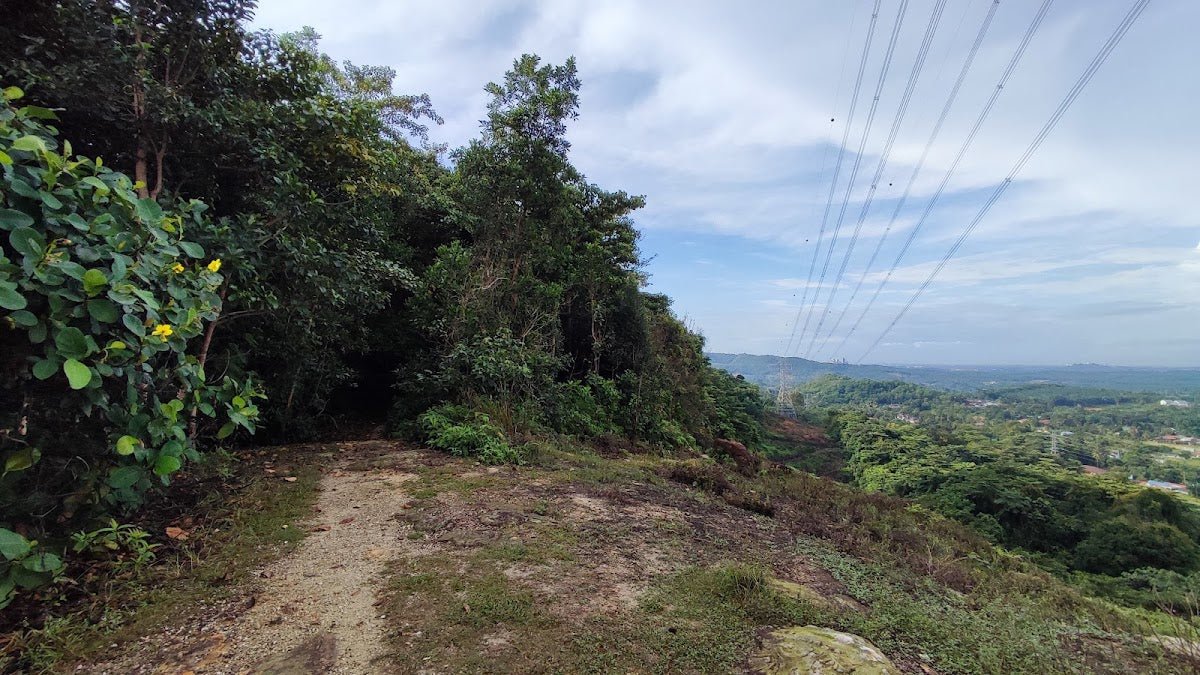
The summit is a man-made clearing — the hill was cut back to create a ledge for the NKVE highway below, which is how you get that open panoramic view of the highway and the Kota Damansara landscape spreading out to the south. It's not a wilderness summit view — it's an urban forest summit view. Somehow that makes it more interesting, not less. Sign in at whatever register is up there, take your photos, and then remember that you now have to get back down the same steep section you just came up.
Descent & Safety

Coming down the Tiga Puteri final section is where most accidents happen on trails like this. The gradient that felt manageable going up feels very different when gravity is working against you. Take it slow, face the slope if you need to, use the rope if it's there, and do not rush. Wet conditions make this exponentially more sketchy — after rain, the soil here turns into a slip hazard fast.
Key hazards to be aware of on this trail:
- Steep, slippery final section: 60-90° gradient, especially dangerous after rain. Avoid hiking within 12-24 hours of heavy rainfall.
- Large logs and low overhangs: on the Tiga Puteri Trail — watch your head and footing.
- Macaques: they roam freely and can block the trail. Don't feed them, don't approach them, just give them space and move on.
- Snakes: present in the undergrowth. Stay on the marked path, especially in wet conditions when snakes move more.
- Aggressive ants: on the first section — stay moving, don't stop on the path unnecessarily.
- Multiple trail junctions: easy to take a wrong turn. Follow every signboard, use a navigation app as backup.
- No water points: carry enough water for 3-4 hours even if you plan a shorter hike. Dehydration hits harder in humid forest heat than most people expect.
If weather deteriorates — sudden rain, thunder — do not push for the summit. Turn around, get off the steep sections, and wait it out lower on the trail. An urban forest is still a forest, and lightning in the trees is not something to gamble on.
What to Bring
This trail's profile — mostly manageable with one very steep, technical section — means a few things matter more than others:
- Water: Minimum 1.5-2 litres per person. There are zero water points on trail. A hydration bladder keeps your hands free for the scrambling sections — the TAHAN TrailBladder 2L is a solid, no-fuss option for a hike this length.
- Footwear: Trail shoes or hiking boots with grip. Not sandals, not casual sneakers — especially if there's any chance of wet ground.
- Hiking poles: Optional on the way up, genuinely useful on the way down the steep final section. The TAHAN 3-Section Foldable Hiking Stick V2 folds down small enough to clip to your bag when you don't need it. Check our hiking gear guide if you're figuring out whether poles or knee guards make more sense for your situation.
- Light rain jacket: Tropical weather is unpredictable. A packable layer takes up no space.
- Snacks: Bring something — energy bars, dates, whatever you favour. It's a short hike but the heat drains you.
- Fully charged phone: For navigation apps (Komoot, ViewRanger) and emergency contact. Save the KDCF registration office number before you go.
- First aid basics: Plasters, antiseptic wipes. Scrapes happen on rocky, rooted terrain.
- Start early: The midday heat in a Malaysian forest is no joke. Before 8am is ideal, especially on weekends.
FAQ
How hard is Denai Tiga Puteri?
Most of the trail is beginner-friendly — steady paths, good shade, well-marked. But the final section to the peak is genuinely steep (60-90° in places) and requires rope assistance. Overall rating is beginner to moderate, but don't let the beginner label fool you into under-preparing. If you've never hiked before and someone tells you it's an easy hike, they're probably remembering only the first half.
How long does Denai Tiga Puteri take?
Most hikers complete the round-trip in 2-3 hours. If you go slowly, stop often, or do the full circuit, budget up to 4 hours. If you're fit and just doing the short Tiga Puteri + Unity sub-loop (3.5 km), you can be done in under 2 hours. Go with your own pace — there are plenty of spots to rest along the way.
Do I need a permit for Denai Tiga Puteri?
No permit required. There is an entrance fee of RM 2 per adult and RM 1 per child under 12, paid at the registration office at the trailhead. You also need to sign the mandatory logbook — name, phone number, start and estimated return time, group size. Don't skip it. Step-by-step application guide: how to apply on SeForest.
Is parking available at Denai Tiga Puteri?
There's no dedicated carpark. Roadside parking near the entrance exists but fills up quickly on weekends and residents in the area aren't happy about it. Best move: park at the 7-Eleven on Jalan Cecawi 6/33 and walk 10-15 minutes to the entrance. Arrive early on weekends to avoid the scramble.
Camp Nearby?
Denai Tiga Puteri doesn't have overnight camping, but if you're making a weekend of it in Selangor and want to pair a hike with a proper outdoor stay, here are a few options worth checking out. Templer Park Rainforest Retreat is the closest in spirit — forested, accessible from the Klang Valley, and a solid base if you want to explore multiple trails across a weekend. Further afield, Mori Leka Campsite, Serendah is a good shout for a more kampung-style overnight, while Nature Escape Campsite, Hulu Langat suits those who want riverside greenery and a bit more distance from the city buzz. Any of these work well as a Friday night stay before an early Saturday morning start at KDCF.
Trail conditions, permit updates, and hiking buddies for the weekend — all in one WhatsApp group. Just ask; someone was probably up there last week.
💬 Join the Hiking CommunityFree, one click. No spam — the occasional promo at most.
Mike has been camping across Malaysia for over 10 years — from jungle treks in Taman Negara to beach camps in Perhentian. He writes about it so you don't have to find out the hard way. Follow along on TAHAN Outdoor's blog for honest campsite reviews, every week.
⛺ Featured in: The 10 Best Hikes in Selangor (2026)