Bukit Tunggul, Selangor: A Hiker's Guide (2026)
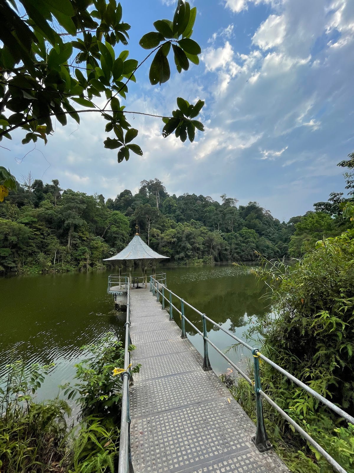
Bukit Tunggul sits in the Bukit Beirut area of Dengkil, about 30 minutes from Cyberjaya, and it punches above its weight for a hill that tops out at 278 m. The UKM-managed Nature Education Forest at the base gives it a surprisingly lush, educational feel — scientifically labelled trees, good canopy cover on the lower sections — and the exposed summit rewards you with views of the Putrajaya and KL skyline to the north and kampung paddy fields stretching south. It's a genuinely pleasant hike that doesn't get the hype of Nuang or Datuk, which means it's still relatively uncrowded if you time it right.

This hike suits beginners looking for their first proper jungle trail, regulars wanting a quick weekday leg-burner, and trail runners who can apparently blitz the short route in under an hour. That said, "beginner-friendly" doesn't mean "just wear selipar jepun" — the final ascent is steep, the summit is fully exposed, and the trail junctions past the stream crossing will get you properly lost without a GPS app. Know what you're signing up for, plan your route before you leave home, and you'll have a good time.
There are a few route options here ranging from a 3.3 km out-and-back to 9 km loops, so this guide covers the main considerations for all of them. Pick your route based on your fitness level and how much time you have.
Quick Facts
- Summit elevation: 278 m
- Distance: 3.3–9 km depending on route (short out-and-back to peak ~5 km; loops 4.4–9 km)
- Elevation gain: 282–607 m depending on route (shorter routes ~282–319 m; full loops up to 607 m)
- Duration: 1.5–4.5 hours depending on route and pace (short out-and-back ~1.5–2 hours; full loops ~3–4.5 hours)
- Difficulty: Moderate (majority consensus); suitable for beginners on shorter routes; popular with trail runners
- Permit: Historically not required — but verify on SeForest portal before you go (see Permits section)
- Guide required: No — but a trail app (AllTrails, Wikiloc) is essential
- Trailhead: Lorong Bahagia, Bukit Beirut area, 43000 Dengkil, Selangor
- Parking: Free, at trailhead — limited on weekends
Getting There & Parking
The main trailhead is at the end of Lorong Bahagia in the Bukit Beirut residential area, 43000 Dengkil, Selangor (Plus Code: VPPR+97, Kampung Bukit Piatu). Waze and Google Maps both recognise "Bukit Tunggul" or "Beirut starting point" — either works. From Cyberjaya it's roughly 30 minutes by car. No public transport option has been confirmed for this trailhead, so personal vehicle is your only realistic way in.
There's also a secondary approach from Jalan Tok Abu, Kampung Jenderam Hilir to the south, which enters through oil palm plantation — this is used for some of the longer loop routes. If you're planning a loop, decide your entry and exit points before you leave.
Parking is free at the top of Lorong Bahagia. One important note: do not park opposite the link houses at the bottom of the lane — it's a narrow residential road and you will annoy the residents (and probably get blocked in). Arrive early on weekends; spots fill up fast. There's no formal car park, no public toilet at the trailhead, but there's reportedly a water stall near the start and a Shell station nearby if you need to sort yourself out before heading in.

Permits & Fees
Historically, Bukit Tunggul has not required a permit. However, Selangor launched the SEFOREST e-permit system on 1 April 2025, covering 70 forest reserves statewide at RM5 per person with 48 hours advance notice required. As of mid-2025, Bukit Tunggul has not been explicitly confirmed in the published SEFOREST listing — but its status is unclear. If it is classified as a permanent forest reserve, entering without a permit could mean fines of up to RM30,000 or up to 5 years imprisonment under the National Forestry Act 1984. That is not a risk worth taking for RM5.
Check the SeForest portal and verify with the Selangor Forestry Department before your trip. Trail conditions and permit requirements change — always check with the local forestry office or park authority before you go. Checking a different gunung? Try our free permit checker — instant answer for 90+ Malaysian mountains. Or ask the TAHAN Hiking Community on WhatsApp — someone's usually been there that week.
The Trail: What to Expect
There are multiple routes, but they all share the same first section from the Lorong Bahagia trailhead. The key decision points are at the junctions after the Sungai Romania stream crossing — this is where a GPS app stops being optional and starts being mandatory. Faded or unclear signage past that point has been noted as recently as mid-2025.

Stage 1: Trailhead to Forest Edge (Lorong Bahagia)
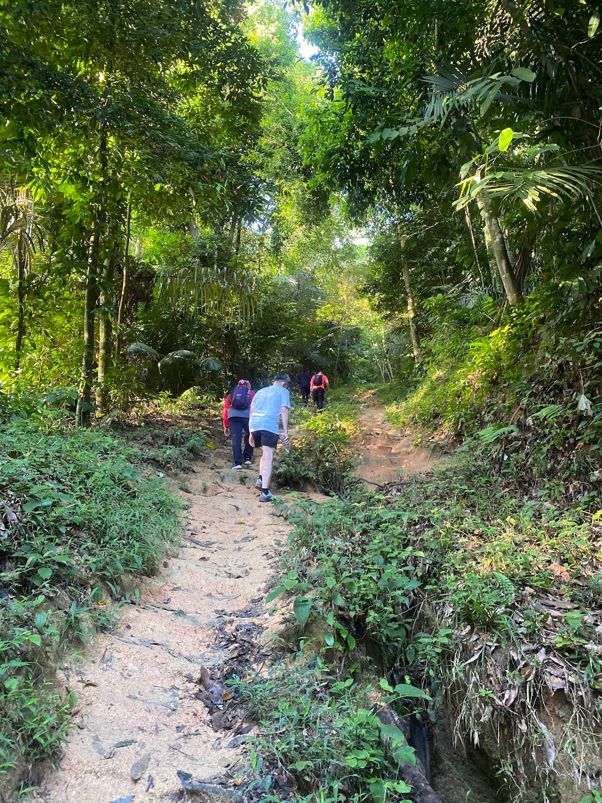
The start is clean and easy to find — the trailhead at the top of Lorong Bahagia is clear, and there's usually an usher on busier mornings helping with parking. You'll enter the UKM Nature Education Forest almost immediately. This section has good canopy cover and scientifically labelled trees, which makes it genuinely interesting if you slow down enough to read them. The path is well-defined here. Enjoy it while it lasts.
Stage 2: Sungai Romania Stream Crossing
You'll hit the Sungai Romania stream crossing with marked signage — this is a useful landmark. The rocks can be slippery so watch your footing. The water here has a rusty, iron-rich appearance — do not drink it without filtration or boiling. It's not safe straight from the stream no matter how thirsty you are. This is also where you should double-check your GPS before continuing, because the junctions after this point are where people go wrong.
Stage 3: Junction Maze — Stay on Your GPS
Past the stream, the trail fractures into multiple criss-crossing paths with faded or missing markers. This is Bukit Tunggul's biggest practical challenge — not the elevation, but the navigation. Download your route on AllTrails or Wikiloc before you go and keep it open from this point. If you're doing one of the longer loops, you'll pass through a series of named hills: Bukit Janda, Bukit Bujang, Bukit Cuak, Bukit Kacang, and Bukit 3 Beradik before the final push to the summit. On weekends especially, you'll also share some of these trails with motocross and dirt bike riders — they appear suddenly and they're loud. Stay aware.

Stage 4: Final Ascent to Bukit Tunggul Summit (278 m)
The final push to the peak is steep and unshaded. The substrate is loose gravel and laterite soil — the red stuff that becomes genuinely treacherous when wet. This section earns Bukit Tunggul its "Moderate" rating; it's not a casual stroll. Take your time, watch your footing, and don't rush this part especially on the way down. At the top you'll find the 'Beirut' trig marker and beacon structure. On a clear morning, the views north toward Putrajaya and KL are excellent, and looking south you get kampung and paddy field scenery. The summit is fully exposed, so cool breezes are your reward — but so is full sun, so hydrate.

Descent & Safety
You can return the same way you came up (most straightforward) or complete a loop back via the tar road through Jenderam Hilir. If you're looping, make sure your route is planned and loaded before the descent — don't try to figure it out at the junction with tired legs.
The steep, loose-gravel final section is harder going down than up. Knee stress is real on loose substrate, especially on longer routes. Take it slow. Here are the hazards you need to know about on this trail:
- Loose gravel and slippery laterite on steep sections — critical when wet. Sturdy trail shoes with grip, not casual sneakers.
- Trail navigation confusion — multiple junctions with faded signage past the stream crossing. GPS app is non-negotiable.
- Motocross/dirt bike riders — especially on weekends. They share the trail. Listen out and give way.
- Heat and sun exposure at the summit — no shade at the peak. Start early (7 am is ideal) and carry enough water.
- Sungai Romania crossing — generally shallow but rocks are slippery.
- Leeches — present but reportedly rare to occasional. Bring repellent just in case.
- Snakes — possible encounters, especially in vegetation. Watch where you step and where you put your hands.
- Mosquitoes — bring repellent.
- Monkeys — reportedly absent between 7–11 am. If you're bothered by them, that's another reason to start early.
If weather turns bad — heavy rain especially — turn back. The red laterite soil on this trail becomes a slip hazard fast, and the stream crossing becomes less predictable after significant rainfall. There is no shame in calling it and coming back another day.

What to Bring
For the shorter out-and-back this is a half-day hike, but don't treat it casually. The exposed summit and warm Selangor climate mean heat management is real even on a 278 m hill.
- Water: Carry more than you think you need. The stream water is not safe to drink without treatment, and the summit is unshaded. At minimum 1.5–2 litres for the short route, more for loops. A hydration bladder like the TAHAN TrailBladder 2L keeps you drinking consistently without stopping to fish out a bottle.
- Trail shoes or hiking boots: Proper grip is essential on the steep, loose final ascent — especially if there's been recent rain. No selipar, no flat-soled sneakers.
- GPS/trail app: Download your route on AllTrails or Wikiloc before you leave. Phone signal can be patchy. This is not optional past the stream crossing.
- Trekking poles: Useful on the steep loose descent. The TAHAN 3-Section Foldable Hiking Stick V2 packs down small and comes out when the gradient demands it — practical for a trail like this where you don't want to carry full-length poles the whole way.
- Insect repellent: Leeches and mosquitoes are present. Bring it and apply before you start.
- Light snacks: Energy for longer loops especially.
- Rain jacket or poncho: Weather in Selangor moves fast. A light layer adds nothing to your pack weight but matters if it turns.
- Small first aid kit: Basic essentials — plasters, antiseptic wipes.
For general hiking gear advice — what's actually worth bringing and what's just weight — check out our hiking gear guide for a practical breakdown.
FAQ
How hard is Bukit Tunggul?
Most sources rate it Moderate, and that's fair for the shorter out-and-back routes. The difficulty is concentrated in the steep, unshaded final ascent with loose gravel underfoot — it's not a casual walk, but it's manageable for someone reasonably fit who doesn't hike regularly. The longer loop routes (up to 9 km with 607 m elevation gain) are a proper workout. One hiker rated their route Hard, which may reflect a longer loop or simply a tougher day. Either way, wear proper shoes and don't skip the water.
How long does Bukit Tunggul take?
For the short out-and-back to the peak, most hikers take 1.5–2 hours. The full loops can take 3–4.5 hours depending on pace and route. Trail runners do the short route in under an hour, but that's not a benchmark for most of us. Plan for your own pace and build in time to enjoy the summit views.
Do I need a permit for Bukit Tunggul?
Historically, no permit was required. However, Selangor's SEFOREST e-permit system launched in April 2025 covers 70 forest reserves at RM5 per person (48 hours advance booking). Bukit Tunggul's status under this system hasn't been explicitly confirmed in published sources, but the penalties for entering a classified forest reserve without a permit are serious — up to RM30,000 fine or 5 years imprisonment. Check the SeForest portal and contact the Selangor Forestry Department before your trip. Step-by-step application guide: how to apply on SeForest.
Is there parking at Bukit Tunggul?
Yes — free parking at the top of Lorong Bahagia. Don't park opposite the link houses at the bottom of the lane. It fills up on weekends, so arrive early (before 7 am if you can). No formal car park or toilets at the trailhead, but there's reportedly a water stall nearby and a Shell station in the area.
Camp Nearby?
Bukit Tunggul is close enough to the Klang Valley that most people do it as a day trip. But if you want to make a proper weekend of it, there are some solid options not too far away. Making a weekend of it? Mori Leka Campsite, Serendah is worth a look for a proper green escape, or head to Nature Escape Campsite, Hulu Langat if you want something with a bit more river action. Templer Park Rainforest Retreat is another solid pick — well-established, good facilities, and close enough to do Bukit Tunggul the next morning on fresh legs after an early night.
Trail conditions, permit updates, and hiking buddies for the weekend — all in one WhatsApp group. Just ask; someone was probably up there last week.
💬 Join the Hiking CommunityFree, one click. No spam — the occasional promo at most.
Gear tip: Water bladder or bottle on a humid trail.
Mike has been camping across Malaysia for over 10 years — from jungle treks in Taman Negara to beach camps in Perhentian. He writes about it so you don't have to find out the hard way. Follow along on TAHAN Outdoor's blog for honest campsite reviews, every week.
⛺ Featured in: 10 Easy Hikes Near KL for First-Timers (2026)
⛺ Featured in: The 10 Best Hikes in Selangor (2026)