Bukit Kembara, Ampang: A Hiker's Guide (2026)
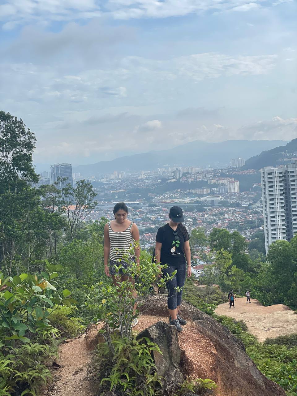
Bukit Kembara is one of those rare spots where a short jungle hike punches well above its weight. Tucked inside the Bukit Sungai Putih Forest Reserve in Ulu Kelang, this modest hill above Ampang rewards you not with a dramatic summit panorama — the top is a shaded clearing, viewless — but with something arguably better: the stunning Empangan Tasik Hijau, a mirror-flat reservoir with reflections of Bukit Antarabangsa and Taman Melawati that'll have your phone camera working overtime.

Three route options mean you can dial the outing to exactly what you want — a quick 1.5-hour burn up to the summit and back, a more satisfying 2-hour summit-plus-lake loop, or a proper 3.5-hour extended trek if you want to earn your post-hike teh tarik. The lake circuit alone is worth the trip. Bukit Kembara suits beginners stepping up their game, families wanting a real jungle feel without a full-day commitment, and regulars looking for an honest weekday fix near KL.
That said — leeches, slippery descents, a territorial monkey at the trailhead, and permit requirements mean this is not a casual stroll in your Converse. Come prepared and you'll have a great time. Come unprepared and the jungle will remind you who's boss.
Quick Facts
- Location: Bukit Sungai Putih Forest Reserve, Ulu Kelang, Ampang Jaya, Selangor
- Elevation: Approximately 240–270 m (sources vary; no official survey figure available)
- Route A — Summit Only: 2.25 km | 229 m gain | 1–1.5 hours | Moderate
- Route B — Summit + Lake Loop: 3.4 km | 273 m gain | 1.5–2 hours | Moderate
- Route C — Extended: 6.9 km | 497 m gain | 3–3.5 hours | Hard/Challenging
- Permit required: Yes — Selangor Forestry Department (Jabatan Perhutanan Selangor)
- Guide required: No
- Parking: Free street parking; no dedicated car park
- Best time: Dry season, early morning weekdays
Getting There & Parking
The main trailhead is at Cangkat Bukit Indah 2, opposite Emerald Hill Condominium, Ulu Kelang, 68000 Ampang Jaya, Selangor. GPS coordinates: 3.158312, 101.775266. You won't miss the entrance — it's marked by a bright red shrine. Plug that GPS in because the Ampang road network can be confusing if you're new to the area.
There's also an alternate approach via Jalan 1 (Taman TAR / Kelab Darul Ehsan golf course direction), but note that this route leads to the reservoir area only — it won't get you to the summit trailhead. Stick to Cangkat Bukit Indah 2 unless the reservoir is your sole destination.
Parking is free street parking only — no dedicated car park exists. On weekends and public holidays this gets tight fast. Arrive early (think pre-7am) or just come on a weekday. Parking stress before the hike is real; don't say I didn't warn you.
Permits & Fees
Hiking within Bukit Sungai Putih Forest Reserve requires a permit from the Selangor Forestry Department (Jabatan Perhutanan Selangor). This is confirmed — skipping it isn't an option if you want to be on the right side of the law inside a gazetted forest reserve.
The permit fee amount and the exact application process were not available at the time of writing — the information kept coming up blank across official sources. Don't just show up and hope for the best. Trail conditions and permit requirements change — always check with the local forestry office or park authority before you go. Checking a different gunung? Try our free permit checker — instant answer for 90+ Malaysian mountains. Or ask the TAHAN Hiking Community on WhatsApp — someone's usually been there that week.
The Trail: What to Expect
Bukit Kembara's trail is well-worn but not always well-marked. The hosepipe stretches bolted into the slope do a lot of the navigational heavy lifting, but a few junctions are genuinely unclear. Pay attention at every fork. Here's how the route breaks down:
Trailhead: Red Shrine at Cangkat Bukit Indah 2
The red shrine at the roadside marks your starting point. From here the jungle closes in quickly — dense canopy, roots underfoot, and humidity that hits you like a wet towel. This is real Selangor jungle; enjoy the transition from suburban road to forest in about 30 seconds flat.
Fair warning: a reportedly aggressive monkey has been seen near the trailhead area, particularly around 11am and the 4–5pm window. Don't run if you spot it. Don't feed it. Give it space and move on calmly.

The Fork: Left or Right?
Shortly into the hike you'll hit a fork. Left fork is steeper with steps — harder on the quads going up but generally more stable underfoot. Right fork is longer, more gradual, but reported to be slippier and has known snake and monitor lizard activity. There have also been partial closures on the right path due to landslide damage; check conditions before committing. Most hikers take left going up, right coming down — or avoid the right path entirely during wet weather.
Jungle Ascent: Dense Canopy to Summit
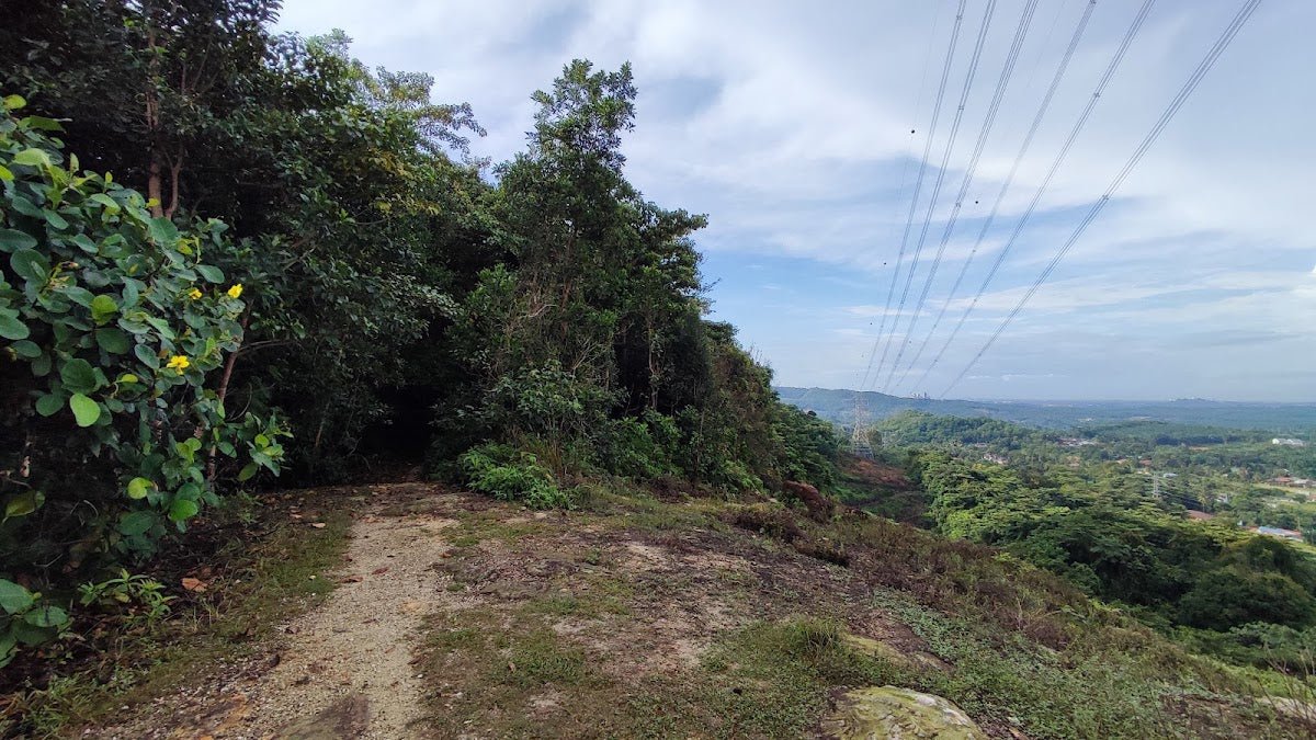
The climb up is where Bukit Kembara earns its moderate rating. It's not a brutal slog, but the combination of steep sections, exposed roots, and humidity means you will sweat. The good news: the canopy is thick enough to provide near-total shade for most of the ascent, which makes a big difference on a warm Malaysian morning.
Watch your footing on root sections — they're slick even without rain. The hosepipe guides help; use them. Leeches are present throughout the trail, and more so after rain. Do your leech checks every 15–20 minutes. More on that below.

Summit Clearing
The summit area tops out at somewhere between 240 and 270 m — sources don't agree and there's no official surveyed figure. What you get up top is a clearing with benches and a pull-up bar, which is either charming or funny depending on your mood. Don't come expecting a dramatic 360-degree view; the summit itself is viewless, surrounded by trees. The reward is what lies below — and you get that on the descent toward the reservoir.
If you're doing Route A, this is your turnaround. For Route B and C, continue down toward the reservoir.
Descent to the Reservoir: Ropes, Mud, and Pay Attention
The descent from the summit toward the Ampang Impounding Reservoir is steep and muddy, with rope and hosepipe assists along the way. Use them — this is not the section to be macho. Wet conditions make this significantly more dangerous. Take your time, face the slope when needed, and watch for water crossings marked with yellow caution tape.

Ampang Impounding Reservoir (Empangan Tasik Hijau)
This is the payoff. The Ampang Impounding Reservoir — built in 1892 as Kuala Lumpur's first water supply, with a reported capacity of over 37 million gallons — is genuinely beautiful. The water surface is glassy and reflective, ringed by jungle, with views across to Bukit Antarabangsa, Taman Melawati, and Hulu Langat. An old pergola sits at the water's edge; find a spot, catch your breath, and just sit with it for a bit.
The lake circuit can be done clockwise or counter-clockwise, with a rest hut along the way. It's flat, pleasant, and popular enough that runners use it regularly. Small streams and a mini waterfall on the northern side feed into the reservoir catchment — scenic, but not potable water. Bring your own supply.

Optional Extensions (Route C)
If you've got the legs and the time, Route C adds the Rain Station trail extension (marked as C-1), which is more secluded and quieter. Be aware: this extension is reportedly the leech hotspot of the entire area, especially during and after rain. Go prepared or give it a miss on wet days. There's also a further extension toward Apek Hill for those interested in camping options — see the Camp Nearby section below.
Descent & Safety
The descent back from the summit is where most people have trouble. The slope is steep, the mud is real, and tired legs make mistakes. Use the ropes and hosepipes provided. If conditions are wet, seriously consider whether it's worth pushing on — a twisted ankle in here is a bad day for everyone.
Key hazards to stay sharp about:
- Leeches — present throughout, heavily concentrated on the rain station extension. Tuck your socks over your pants. Carry salt or leech-off spray. Check regularly.
- Steep, muddy descent sections — ropes provided but slippery when wet. Take your time.
- Slippery roots and slopes — even in dry weather, shaded roots stay damp.
- Aggressive monkey near trailhead — reported around 11am and 4–5pm. Don't run. Don't make sudden movements. Don't have food visible.
- Snakes and monitor lizards — particularly on the right fork. Watch where you step and where you put your hands.
- Water crossings — marked with yellow caution tape. Don't dismiss these when the water is running fast after rain.
- Partial trail closures — landslide damage on the right path; check current status before you go.
- No public toilets on the trail — plan accordingly.
If the weather turns bad mid-hike — heavy rain, thunder, visibility dropping — turn back. The descent becomes genuinely dangerous when wet. Bukit Kembara will still be there next weekend.

What to Bring
For Route A or B, you're looking at under 2 hours in dense jungle. For Route C, treat it like a proper half-day hike. Pack accordingly:
- Water — minimum 1.5L for Routes A/B, 2–3L for Route C. No potable water on trail. A hydration bladder like the TAHAN TrailBladder 2L keeps your hands free and makes drinking on steep sections much easier.
- Hiking poles or a stick — not mandatory for Routes A/B, but on that steep muddy descent they earn their keep. The TAHAN 3-Section Foldable Hiking Stick V2 folds compact enough to clip to your pack when you don't need it. Check our hiking gear guide if you're unsure what to look for.
- Leech socks and leech-off spray — non-negotiable. Tuck long socks over your pants. This matters more in rainy season, but leeches don't take school holidays.
- Grip shoes — trail runners or hiking boots with actual grip. Not road runners, not sandals.
- Light rain jacket or poncho — Selangor afternoon rain is sudden and heavy.
- Snacks — energy bar, fruit, whatever keeps you going for your chosen route duration.
- First aid basics — antiseptic, plasters, and something for bites/stings.
- Fully charged phone — GPS and emergency contact. WhatsApp your family your trailhead location before you start.
- Permit documents — bring proof of your Jabatan Perhutanan Selangor permit.
FAQ
How hard is Bukit Kembara?
Routes A and B are rated Moderate — accessible for reasonably fit beginners, but not flat. The summit descent is steep and can be muddy; that's where people underestimate it. Route C is rated Hard/Challenging — nearly 500 m of total elevation gain over 6.9 km — treat it seriously. The jungle conditions (humidity, leeches, slippery roots) add difficulty that raw numbers don't fully capture.
How long does Bukit Kembara take?
Route A (summit only): 1–1.5 hours. Route B (summit + lake loop): 1.5–2 hours. Route C (extended): 3–3.5 hours. These are active hiking times for a reasonably fit pace — factor in breaks, photos at the reservoir, and a slower pace if it's your first jungle hike.
Do I need a permit to hike Bukit Kembara?
Yes. The trail runs through Bukit Sungai Putih Forest Reserve, and a permit from the Selangor Forestry Department (Jabatan Perhutanan Selangor) is required. The fee amount and application process weren't confirmed at time of writing — contact the department directly for current details before your visit. Step-by-step application guide: how to apply on SeForest.
Are there leeches at Bukit Kembara?
Yes, and don't underestimate them. They're present year-round but more intense during and after rain. The rain station trail extension (Route C) is particularly known for heavy leech activity. Wear long socks pulled over your pants, use leech deterrent spray, and do regular checks every 15–20 minutes on the trail. One recent hiker summed it up well: come prepared with tight pants and long socks, especially if you're watching for snakes too.
Camp Nearby?
Making a weekend of it? Bukit Kembara is an easy day hike, but the Selangor/KL fringe has some solid camping options worth pairing with a trip here. For a greener, laid-back vibe north of KL, have a look at Mori Leka Campsite, Serendah. If you want to stay closer to the Hulu Langat jungle feel, Nature Escape Campsite, Hulu Langat is worth reading up on. And if you fancy proper rainforest atmosphere with a bit more infrastructure, Templer Park Rainforest Retreat is a classic for a reason. Base yourself at any of these the night before for an early trailhead start — the parking situation alone makes this worthwhile.
Route C also extends toward Apek Hill, which has camping options if you're keen on a proper overnight in the forest. Get your permit sorted and check current trail conditions with the forestry department before committing to that one.
Trail conditions, permit updates, and hiking buddies for the weekend — all in one WhatsApp group. Just ask; someone was probably up there last week.
💬 Join the Hiking CommunityFree, one click. No spam — the occasional promo at most.
Gear tip: Water bladder or bottle on a humid trail.
Mike has been camping across Malaysia for over 10 years — from jungle treks in Taman Negara to beach camps in Perhentian. He writes about it so you don't have to find out the hard way. Follow along on TAHAN Outdoor's blog for honest campsite reviews, every week.
⛺ Featured in: The 10 Best Hikes in Selangor (2026)