Bukit Besi, Selangor: A Hiker's Guide (2026)
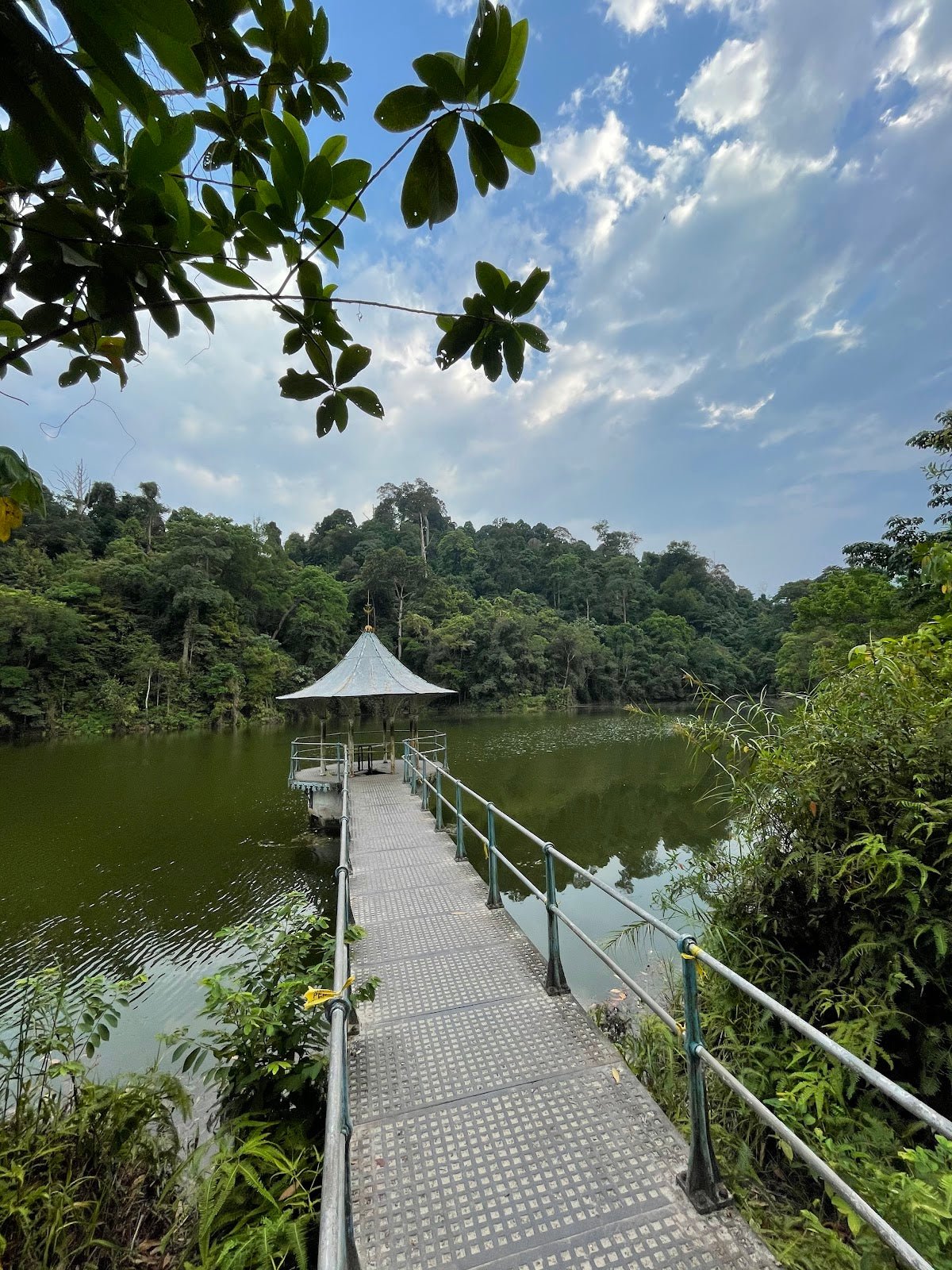
Bukit Besi is one of those spots that surprises people. You're in Alam Damai, Cheras — surrounded by condos and traffic — and then suddenly you're in a 4 km² pocket of actual jungle, sweating through ferns and grabbing knotted ropes to haul yourself up to a summit where the Petronas Twin Towers stare right back at you. That contrast is the whole appeal.

This is an urban hill hike — short, accessible, and genuinely enjoyable if you know what you're walking into. At 291m with 188m of elevation gain over a 2.7 km out-and-back, it's not going to take your whole day. But "short" doesn't mean "trivial" — the steep rope sections near the top and slippery roots throughout demand real footwear and a bit of respect. Fitness-wise, this suits regular walkers and above. If Bukit Kiara is part of your weekly routine, you'll find Bukit Besi a nice step up.
The main crowd here is urban hikers and joggers doing a quick morning session before the KL heat kicks in. There are loop variants too if you want to extend the outing. Either way, morning starts are strongly recommended — the trail is partly exposed and the city heat builds fast.
Quick Facts
- Summit elevation: 291m
- Elevation gain: 188m
- Distance: 2.7 km out-and-back (main route); loop variants 3.6–3.75 km
- Duration: 1–1.5 hours (main route); 2–2.5 hours (extended loop)
- Difficulty: Moderate to Easy — AllTrails rates it Moderate, Wikiloc rates it Easy (4/10). Honest answer: easy for regular hikers, moderate for beginners.
- Permit: RM5.00 per person (see Permits section — jurisdiction matters here)
- Best time to go: Year-round; mornings. Avoid wet seasons (Oct–Jan, Mar–Apr)
Getting There & Parking
The trailhead is in the Alam Damai area of Cheras, accessed via Persiaran Alam Damai near the Altitude 236 Condominium. The trail starts at or near water tank infrastructure along that road — you'll pass the first large water tank about 175m in, then continue another 100m of tarmac to a second large water tank where the road ends and the proper forest trail begins.

For parking, the facts sheet doesn't give a specific lot — this is an urban trailhead and availability changes. Your best bet is to check recent hiker reports on AllTrails or Facebook groups before you go, or arrive early enough that street parking near the Altitude 236 area is still available. Don't block resident driveways — Alam Damai is a residential neighbourhood and it gives urban hiking a bad name.
Permits & Fees
Here's where Bukit Besi gets a bit complicated, so pay attention. The Selangor Forestry Department (JPNS) requires an e-Permit via the SeForest system, costing RM5.00 per person. You need to apply between 48 hours and up to 1 month in advance — you can't just rock up and go.
However — and this is important — Bukit Besi straddles the KL Federal Territory and Selangor border, and different sources list it under different jurisdictions. The SeForest permit only applies to Selangor forest reserves. If your trailhead is technically in KL Federal Territory, the permit requirement may be different. Before you apply anything, verify which jurisdiction your entry point falls under. Apply at the wrong portal and you could be technically non-compliant even with a paid permit.
For guide requirements: a specific mandatory guide requirement for Bukit Besi wasn't confirmed in available sources. Check the SeForest portal directly to be sure. If guides are required, the Selangor Forestry Mountain Guide Association can be reached at 013-4952933, or the Hulu Selangor Mountain Guide Association at 019-9194471 (guide-to-hiker ratio is capped at 1:7).
Trail conditions and permit requirements change — always check with the local forestry office or park authority before you go. Or ask the TAHAN Hiking Community on WhatsApp — someone's usually been there that week. Checking a different gunung? Try our free permit checker — instant answer for 90+ Malaysian mountains.
The Trail: What to Expect
The route breaks down cleanly into a few stages. Here's what you'll actually encounter.
Stage 1: Trailhead to First Water Tank (~175m on tarmac)
You start on a tarred road. It's steeper than it looks — several hikers specifically call out that the tarmac section has a real incline to it. This isn't a warm-up stroll; it's already working your calves. The first large water tank is your first landmark. Note that these are sealed utility infrastructure — not drinking water sources.

Stage 2: First to Second Water Tank (~100m on tarmac)
Continue up the tarmac for another 100m to the second large water tank. This is where the road ends. From here you're looking at the forest trail junction, with two route options branching off. There have been reports of encroachment affecting the preferred left path near the second tank — conditions may have changed, so pay attention to recent trail notes before committing to a direction.
Stage 3: Into the Jungle
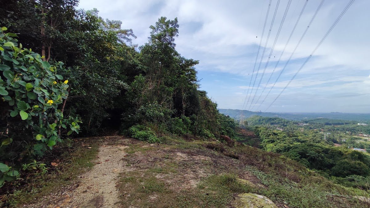
Once you're off the tarmac, the trail character changes completely. You're into dense jungle — ferns, tree roots across the path, and thorny vegetation that will catch exposed skin. Watch your ankles on the roots. This section is shaded, which is a relief, but it means the trail stays damp and slippery long after rain. Footholds are uneven throughout — one hiker put it plainly: "The footholds are not great... a little dangerous if it rained the night before or if you don't have shoes with good grip." Grippy trail shoes are not optional here.

Stage 4: Telco Tower Landmark
A telecommunications tower along the route is a key landmark — and also where trail markings effectively end. Past this point, navigation becomes less intuitive. If you don't have a GPS track or offline map loaded before you leave home, download one. There's no excuse to get confused on a 2.7 km trail, but it does happen when markings disappear in urban jungle like this.
Stage 5: Rope Sections & Summit Push
The final approach to the summit involves steep sections with fixed knotted ropes. You'll need to use them — this isn't decorative. Pull with your arms, push with your legs, keep three points of contact. Take your time. At the top, another telecommunications tower marks the summit at 291m, and the viewpoint delivers: on a clear morning, you get a direct sightline to the Petronas Twin Towers and KL Tower. Worth every meter of the climb.

Descent & Safety
The way down on Bukit Besi demands more focus than the ascent. The rope sections that felt manageable going up become significantly more technical when you're descending — lower yourself carefully, don't rush, and make sure the person ahead of you has cleared the section before you start down.
Roots and ferns that you stepped over on the way up are tripping hazards on the way down, especially if your legs are already tired. Slow is smooth, smooth is fast.
Real hazards on this trail:
- Tree roots and fern-covered ground — ankle roll risk throughout
- Thorny vegetation — wear long pants or at minimum long socks
- Steep rope-assisted descent — high-consequence if you rush it
- Unclear trail markings beyond the telco tower — have GPS/offline map ready
- Slippery conditions after rain — the wet seasons (Oct–Jan, Mar–Apr) make this trail genuinely sketchy underfoot
- Leeches — the habitat is right for them; do a check before you get back in the car
- Partial sun exposure — some sections are open; heat builds quickly after 9am
Turn back if: visibility drops, you hear thunder, the trail is significantly wetter than expected, or anyone in your group is struggling with the rope sections going up. On a hill this short, there is zero shame in a turnaround. The summit view isn't worth a twisted ankle on a slippery descent.

What to Bring
Bukit Besi is short but the terrain earns its kit list. Don't let the 2.7 km distance make you sloppy about preparation.
- Footwear: Trail shoes with actual grip. Not running flats, not sandals. The roots and rope sections will expose poor footwear fast.
- Water: Minimum 1.5L. There are no confirmed water points on the trail — the water tanks are sealed infrastructure. Bring everything you need from the car.
- Trekking poles: Optional for the main route, but genuinely useful on the descent rope sections and root-covered trail. The TAHAN 3-Section Foldable Hiking Stick V2 folds compact enough to clip to your pack when you need both hands free for the ropes.
- Knee support: If you have any existing knee issues, a short steep descent is exactly where they flare up. The TAHAN Kinetix Knee Guard With Spring Support is worth throwing in your bag — better to have it and not need it.
- Long pants or gaiters: Thorny vegetation + potential leeches. Protect your legs.
- Offline map / GPS track: Non-negotiable past the telco tower. Download before you leave home.
- Snacks: It's a short hike but eat something before you go. Morning starts on an empty stomach and steep tarmac don't mix well.
- First aid basics: Plasters, antiseptic wipe, blister patches. Minor cuts from thorns happen.
For a broader breakdown of hiking poles and knee support for Malaysian trails, check out our hiking gear guide — it covers what to look for based on trail type and fitness level.
FAQ
How hard is Bukit Besi?
Depends who you ask — literally. AllTrails rates it Moderate; Wikiloc rates it Easy (4/10). Honest answer: if you hike regularly, you'll find it manageable with a few challenging moments at the rope sections. If you're new to hiking, the steep tarmac start and the uneven forest terrain will feel genuinely demanding. Plan for Moderate and be pleasantly surprised if it feels easy.
How long does the Bukit Besi hike take?
The main out-and-back route takes most hikers 1–1.5 hours. If you do one of the loop variants (3.6–3.75 km), budget 2–2.5 hours. Factor in time at the summit viewpoint — the Twin Towers view is worth a few minutes, not a quick glance.
Do I need a permit for Bukit Besi?
Likely yes — RM5.00 per person via the SeForest e-Permit system, applied 48 hours to 1 month in advance. But there's a genuine jurisdiction question here: Bukit Besi sits on the KL/Selangor border and different sources list it under different authorities. The SeForest permit covers Selangor forest reserves specifically. Verify which authority covers your entry point before applying. Check the SeForest portal and contact the Selangor Forestry Department directly if you're unsure. Step-by-step application guide: how to apply on SeForest.
Is Bukit Besi safe for beginners?
With caveats. The distance and elevation are beginner-friendly. The terrain is not always beginner-friendly — roots, thorns, steep rope sections, and unclear markings past the telco tower all require some awareness. A beginner hiking with an experienced friend in dry weather on a clear-marked day: probably fine. A true first-timer going alone after rain: not recommended. Go with someone who's done it before for your first visit.
Camp Nearby?
Bukit Besi is a half-day hike at most, so camping on the hill itself isn't the point. But if you want to turn it into a longer outdoor weekend in the region, there are a few solid options worth knowing about.
Making a weekend of it? Nature Escape Campsite, Hulu Langat is the closest in character — jungle surroundings, not far from the Cheras/Hulu Langat corridor. Mori Leka Campsite, Serendah is a bit further north but worth it if you want a proper overnight with river access. And if you're heading toward the Rawang side, Templer Park Rainforest Retreat pairs well with a Bukit Besi morning — do the hike early, drive up, set up camp before dark.
Trail conditions, permit updates, and hiking buddies for the weekend — all in one WhatsApp group. Just ask; someone was probably up there last week.
💬 Join the Hiking CommunityFree, one click. No spam — the occasional promo at most.
Gear tip: Water bladder or bottle on a humid trail.
Mike has been camping across Malaysia for over 10 years — from jungle treks in Taman Negara to beach camps in Perhentian. He writes about it so you don't have to find out the hard way. Follow along on TAHAN Outdoor's blog for honest campsite reviews, every week.
⛺ Featured in: 10 Easy Hikes Near KL for First-Timers (2026)