Bukit Lagong: A Hiker's Guide (2026)
Bukit Lagong is one of the Klang Valley's most accessible forest reserves — sitting right on the edge of Selayang, less than 30 minutes from KL on a good day. At 572 m, it's not going to break any altitude records, but don't let the numbers fool you. Pick the right route and this place will humble you. The Jalan Bidara Loop has 861 m of elevation gain packed into 10.3 km, which means you're going up, then coming back down — repeatedly — through real jungle terrain with rope sections, exposed roots, and the kind of mud that'll claim a shoe if you're not paying attention.

Bukit Lagong suits intermediate to experienced hikers who want a solid jungle workout without driving three hours from KL. There are gentler options (the Big Loop, the Pipeline Trail) if you're building fitness or bringing newer hikers along. Wildlife is genuinely impressive here — over 100 species of birds and mammals have been recorded in the reserve, and birders in particular love the Pipeline Trail. The Jalan Bidara Loop is the most popular route by far, and for good reason: it gives you the full Bukit Lagong experience, summit views, bamboo groves, lush primary jungle, and the satisfaction of a proper slog.
One important note before we get into it: the Jalan Idaman route has been closed since July 2024 due to obstructions, with no confirmed reopening date. Don't plan around it. Stick to the routes listed as open below.
Quick Facts
- Summit elevation: 572 m
- Jalan Bidara Loop: 10.3 km | 861 m elevation gain | 5–5.5 hours | Hard
- Jalan Bidara Extended: 10.9 km | 5 hours 15 minutes | Hard
- Big Loop: 7.9 km | 470 m elevation gain | 3–3.5 hours | Moderate
- Pipeline Trail: 5.3 km | 487 m elevation gain | ~2 hours 38 minutes | Moderate
- Via Kuang: 17.9 km | 1,256 m elevation gain | 8–8.5 hours | Hard
- Jalan Idaman: CLOSED (as of July 2024)
- Permit required: Yes — RM5 per person via SeForest (forestry.selangor.gov.my)
- Guide required: No
- Parking: Free at Jalan Bidara trailhead
Getting There & Parking
The main trailhead is at Jalan Bidara, near the Batu Caves area in Selayang. If you're coming by public transport, take the KTM Komuter to Batu Caves station and grab a Grab or taxi from there. Honestly though, personal transport or carpooling makes life much easier here — especially if you want an early start, which you should.
Parking at the Jalan Bidara trailhead is free and the lot is reasonably large, but one recent hiker noted that it fills up fast. Come early. If you're planning to hike the Pipeline Trail, that one starts at Jalan Symington. For the Via Kuang route, the alternative trailhead is at Surau Al-Hidayah Kampung Orang Asli Ulu Kuang — searchable on Waze.

Permits & Fees
A permit is required to hike Bukit Lagong — no exceptions. The fee is RM5 per person, issued by Jabatan Perhutanan Negeri Selangor (JPNS). You apply through the SeForest online platform at forestry.selangor.gov.my, and you need to do this at least 48 hours before your hike. Once approved, payment via FPX or online banking must be completed within 24 hours.
This is not optional paperwork. Hiking without a permit carries a penalty of up to RM30,000 or up to 5 years imprisonment under the National Forestry Act 1984. Sort your permit before you plan anything else.
Trail conditions and permit requirements change — always check with the local forestry office or park authority before you go. Checking a different gunung? Try our free permit checker — instant answer for 90+ Malaysian mountains. Or ask the TAHAN Hiking Community on WhatsApp — someone's usually been there that week.
The Trail: What to Expect
The Jalan Bidara Loop is the benchmark route and what most of this section focuses on. It's the most reviewed, best understood, and gives you the most complete picture of what Bukit Lagong is about. Where the other routes differ significantly, I'll flag it.
Start: Jalan Bidara Parking Lot to First Ascent
The trail begins at the Jalan Bidara parking lot. Early on, the path is wide and well-marked, which lulls some people into thinking this is going to be easy. The lower section takes you through bamboo groves — genuinely beautiful, and one of Bukit Lagong's quiet highlights. Enjoy the shade while it lasts.

Stream Crossing & Mid-Trail Jungle
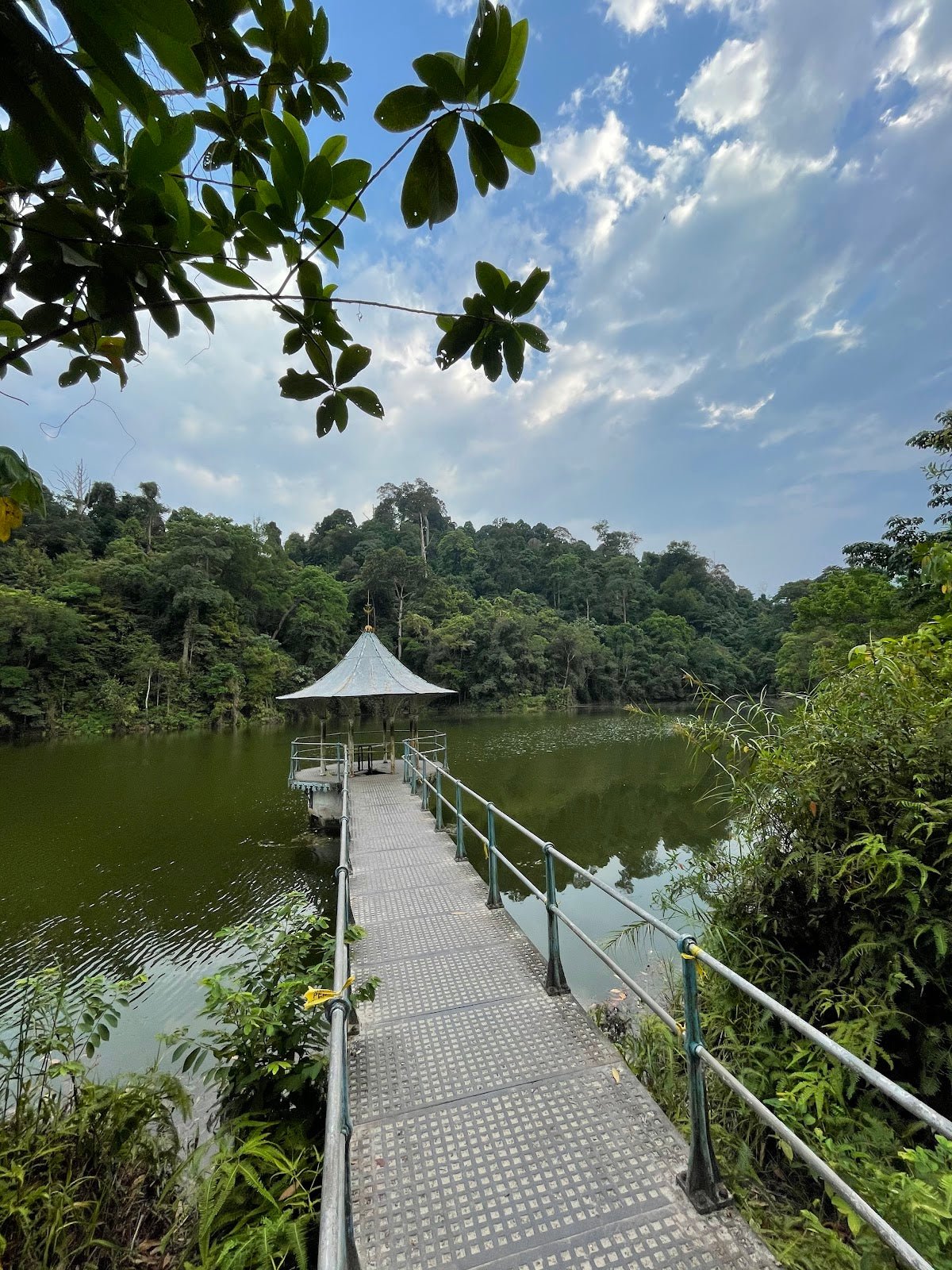
You'll cross a small stream via a bridge — straightforward in dry conditions. After this, the trail narrows and the real jungle begins. Towering trees, dense canopy, and the kind of foliage that makes you forget you're 30 minutes from KL. This is also where you start encountering exposed tree roots properly. Watch your footing. The terrain underfoot shifts constantly between red dirt, rock, and root systems.
Rope Sections & Steep Climbs
There are rope sections on the steeper climbs — use them. These aren't decorative. The ascent to the main peak is where Bukit Lagong earns its Hard rating. Elevation gain is relentless in places. Pace yourself and don't burn out chasing the person in front of you.

Bukit Nolang Rest Area (485 m)
The Bukit Nolang rest area at 485 m has signage and is a natural checkpoint to stop, eat something, and check how everyone in your group is doing. From here, pay attention to your navigation. Trail markings past Bukit Nolang have been reported as unclear by some hikers — bring a GPS track downloaded before you leave, and don't rely on mobile data being available.
Viewpoints & Descent (323 m and 302 m)
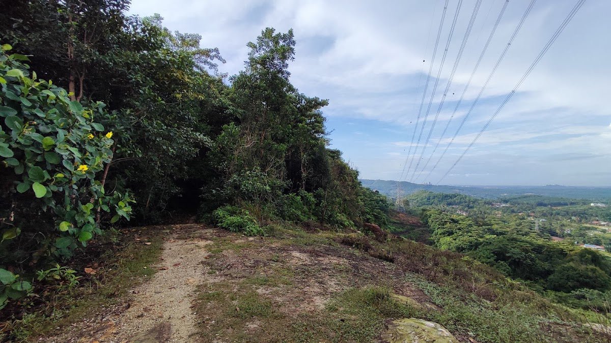
The descent from the Bukit Nolang area takes you past viewpoints at 323 m and 302 m elevation, both offering panoramic views. These are genuinely worth pausing for — open sky, wide vista, the kind of view that makes the climb feel justified. The descent here is steep, so take your time.

Water Pipe at 254 m & Return to Trailhead
At 254 m, there's a water pipe along the route that hikers consistently describe as a welcome sight. That said, do not plan your water supply around it — it is not a guaranteed refill station. The return leg takes you via a logging road back to the trailhead. It's less scenic than the jungle sections but straightforward to navigate.

Descent & Safety
The descent on Jalan Bidara deserves its own section because it's where a lot of people get into trouble. Steep red dirt and rocky trails turn treacherous when wet, and the exposed tree roots are just as unforgiving on the way down as on the way up. Knees take a beating on prolonged descents like this. If your knees are a known weak point, consider a knee guard — the TAHAN Kinetix Knee Guard With Spring Support (RM79) is worth having on routes with this much descent.
Key hazards to be aware of on all routes:
- Rope sections: Steep climbs with fixed ropes — use proper footwear with grip
- Exposed roots: Ankle-roll territory, especially on narrow jungle paths
- Mud and slippery conditions: Particularly bad on the Pipeline Trail during or after rain
- Leeches: Present in jungle sections, worse after rain and near the Orang Asli village areas on extended routes — tuck your socks over your pants and carry salt or leech socks
- Navigation past Bukit Nolang: Trail markings reported unclear — download a GPS track before you go
- Bees at the peak area: At least one recent hiker reported encountering bees near the summit. Don't swat. Stay calm and move away slowly.
- Steep descent from viewpoint area: Take it slow, especially in the afternoon when legs are tired
If the weather turns while you're on trail — heavy rain, thunderstorm incoming — turn back. Wet red dirt on a steep slope with rope sections is not where you want to test your luck. There is no prize for pushing through in those conditions.
What to Bring
Bukit Lagong is a jungle hike with real elevation gain, rope sections, and routes that run up to 8.5 hours. Pack accordingly.
- Water: Minimum 2–3 litres per person for the Jalan Bidara Loop, more in hot weather. One reviewer put it bluntly: bring at least 2 to 4 bottles, especially if you're less experienced. The water pipe at 254 m is a bonus, not a plan.
- Food & snacks: Proper lunch plus energy snacks for a 5+ hour route
- Footwear: Trail shoes or hiking boots with proper grip — not running flats, not sandals
- Leech socks or gaiters: Genuinely useful here, not just precautionary
- Trekking poles: Strongly recommended for the Jalan Bidara descent and the Via Kuang route. The TAHAN 3-Section Foldable Hiking Stick V2 (RM99) packs down small and handles variable jungle terrain well.
- GPS / offline map: Download a track before you leave — don't rely on mobile data on trail
- First aid kit: Blister plasters, antiseptic, elastic bandage
- Rain jacket or poncho: Weather changes fast in the Klang Valley
- Extra dry bag or ziplock for phone and valuables
- Headlamp: Even on a day hike — if you're slow or get delayed, you do not want to be navigating this trail in the dark without one
For a fuller breakdown of what to bring on Malaysian trails, check out our hiking gear guide.
FAQ
How hard is Bukit Lagong?
Depends entirely on which route you pick. The Big Loop and Pipeline Trail are rated Moderate — decent for hikers with some fitness who've done a few trails before. The Jalan Bidara Loop is rated Hard, with 861 m of elevation gain over 10.3 km, rope sections, and steep descents. The Via Kuang route is also Hard, with 1,256 m of elevation gain over 17.9 km — that's a full-day serious effort. Bukit Lagong is not a beginner hill on its main routes, regardless of what some reviews suggest.
How long does Bukit Lagong take?
The most popular route, the Jalan Bidara Loop, takes most hikers 5 to 5.5 hours. The Big Loop is 3 to 3.5 hours. The Pipeline Trail is around 2 hours 38 minutes. The Via Kuang route is a full day at 8 to 8.5 hours. These are moving times for reasonably fit adults — add time for breaks, photos, and slower group members.
Do I need a permit for Bukit Lagong?
Yes. A permit is required and it costs RM5 per person. Apply through the SeForest platform (forestry.selangor.gov.my) at least 48 hours before your hike. Payment must be made within 24 hours of approval. Don't skip this — the penalty for non-compliance under the National Forestry Act 1984 is up to RM30,000 or 5 years imprisonment. Step-by-step application guide: how to apply on SeForest.
Is the Jalan Idaman route open?
No. The Jalan Idaman route has been closed since July 2024 due to obstructions. As of now, there is no confirmed reopening date. Check with JPNS or the SeForest platform for the latest status before planning.
Camp Nearby?
Making a weekend of it? Bukit Lagong is doable as a day trip from KL, but if you want to stay overnight and hit the trail fresh in the early morning, there are a few good options in the surrounding area. Templer Park Rainforest Retreat is the closest in spirit — jungle setting, well within range. Further out but worth the look are Mori Leka Campsite, Serendah and Nature Escape Campsite, Hulu Langat — both give you that proper Selangor jungle edge without being too far from civilization.
Trail conditions, permit updates, and hiking buddies for the weekend — all in one WhatsApp group. Just ask; someone was probably up there last week.
💬 Join the Hiking CommunityFree, one click. No spam — the occasional promo at most.
Gear tip: How to use a trekking pole (and set the height).
Mike has been camping across Malaysia for over 10 years — from jungle treks in Taman Negara to beach camps in Perhentian. He writes about it so you don't have to find out the hard way. Follow along on TAHAN Outdoor's blog for honest campsite reviews, every week.
⛺ Featured in: The 10 Toughest Hikes in Peninsular Malaysia (2026)