Bukit Saga, Ampang: A Hiker's Guide (2026)
Bukit Saga sits in the Sungai Puteh Forest Reserve on the Selangor-KL border, about a stone's throw from Ampang and Cheras. Don't let the modest 288 m summit fool you — this isn't a stroll. The trails are steep in places, leech activity is real, and the waterfall extension will test legs that haven't been out in a while. What Bukit Saga offers in return: dense jungle canopy, a surprisingly well-kitted summit, and an optional waterfall that makes the extra effort worthwhile.

This is a popular training hill for people building up to bigger objectives like Kinabalu, and it works well for that purpose. The summit-only loop (~2.6 km) is manageable for hikers with a basic fitness base. The waterfall extension pushes it into moderately tough territory — steep, slippery descents, rope sections, river crossings. If you're a true beginner, do the summit loop first and assess from there.
Weekend crowds can be genuinely bad — narrow descents getting gridlocked, the waterfall packed wall-to-wall. A weekday morning start changes the experience completely. Plan accordingly.
Quick Facts
- Summit elevation: 288 m (Bukit Saga standalone summit)
- Elevation gain: ~281 m / 921 ft (summit loop)
- Distance: Summit loop (Trails A/C): ~2.6 km | Summit + waterfall extension: ~6.61 km | Full Bukit Saga + Bukit Apek loop: ~9.5 km
- Duration: Summit loop: 1.5–2 hours | Summit + waterfall: 2–3 hours | Full extended route: half-day | Full Saga + Apek combined loop: 6–10 hours
- Difficulty: Moderate (summit loop, Trails A/C) | Moderately tough — not for beginners (waterfall extension, Trail D)
- Permit: Yes — required before entry
- Guide required: No
Getting There & Parking
The trailhead is at Jalan Saga 24, Taman Saga, 68000 Ampang Jaya, Selangor. On Waze, search Bukit Saga Hiking Trail. GPS coordinates for the trailhead: approximately 3.112660, 101.773242. Fair warning — there's an active construction site at the entrance. Don't panic when you get there and think you're in the wrong place. You're not. Walk through the construction area; the stairs and the noticeboard are on the other side.
For parking, go to the carpark along Jalan Saga 22 beside the playground (GPS ~3.114341, 101.772201). There's additional parking near the shophouses at Jalan Saga 20. Do not park on residential streets — residents have had enough of it, and you're also blocking emergency vehicle access. On weekends, this carpark fills fast. Arrive by 7 am if you want a spot without drama.
Coming by public transport: take the LRT Ampang Line to Cempaka station (AG6), then Bus T350. Alight at GPS 3.119533, 101.769823, then walk approximately 1.3 km (about 15 minutes) to the trailhead. Alternatively, LRT to Ampang station then bus 300 or 303, or a taxi/Grab from there.

Permits & Fees
A permit is required to hike Bukit Saga. This is issued by the Selangor Forestry Department (Jabatan Perhutanan Selangor). The fee is RM5 per person (as reported by The Star, April 2025). Apply at least 48 hours before your intended hike date; payment must be made within 24 hours of approval. Apply online at forestry.selangor.gov.my. Daily visitor limits apply per trail, so don't assume you can just show up.
This is not optional. Under the National Forestry Act 1984, entering a gazetted forest reserve without a permit carries a fine of up to RM30,000 or up to 5 years in prison. Some older online sources say there's no entrance fee — those predate the formalised permit system that came into effect in 2025. The RM5 requirement stands.
Trail conditions and permit requirements change — always check with the local forestry office or park authority before you go. Checking a different gunung? Try our free permit checker — instant answer for 90+ Malaysian mountains. Or ask the TAHAN Hiking Community on WhatsApp — someone's usually been there that week.
The Trail: What to Expect
Bukit Saga has multiple trail options that combine into different routes. Trails are generally well-signposted with signboards and ribbon markers, but some junctions can still trip you up — especially on the longer routes. Pay attention at every fork.
Note: Trail B is currently CLOSED due to construction. Do not enter. No reopening date has been announced. Stick to Trails A, C, and D.

Trailhead to Checkpoint 1 (~500 m)
From Jalan Saga 24, pass through the construction site to reach the stairs. You'll notice a small noticeboard and a small waterfall on your right before you properly hit the forest. The first ~500 m brings you to Checkpoint 1 — a resting hut with tables and chairs. Here the trail splits: left is Trail C (longer, less steep, paved steps transitioning to tree-root steps), right is Trail A (shorter, steeper). Both reach the summit. If this is your first time, Trail C is slightly kinder on the way up.
Trail C: Checkpoint 2 & the Junction
Trail C has a second resting hut further along. At this checkpoint, there's another junction — left heads toward the waterfall (Trail D), right continues to the summit. Keep right for now if you're doing the summit first, which is what I'd recommend. Note this junction for later if you plan to add the waterfall.
Trails A and C Merge — Final Push to Summit
The two trails converge near the summit. The final section is where Trail A earns its reputation for steepness. Take your time, use the ropes where provided, and watch your footing on tree roots. Rushing this section after rain is how people slip.

Summit / Bukit Saga Hilltop
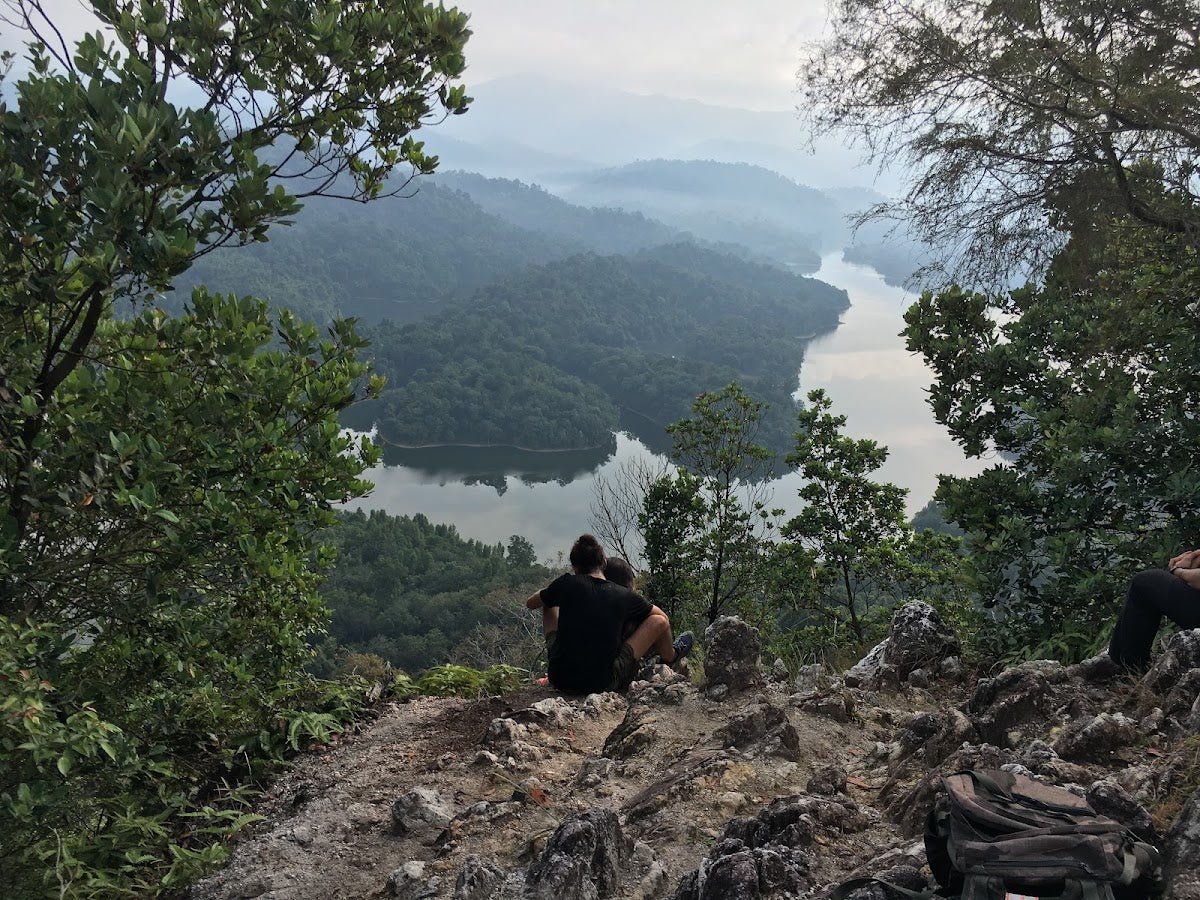
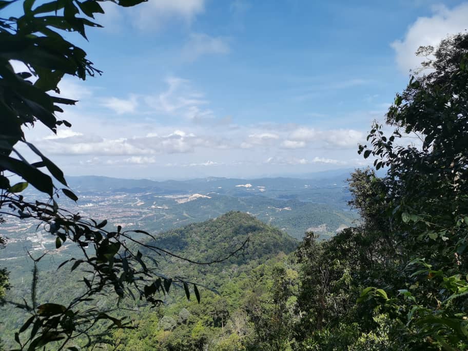
The summit is more developed than most casual hikers expect. There's an open area with a large noticeboard, rest huts with tables and chairs, hammocks, a swing playground, an exercise corner, a ladies' changing room, and even a makeshift cooking area. The trail is maintained by community volunteers and it shows — it's clean and well-kept. On a clear day, you get Kuala Lumpur skyline views from up here. Worth the climb, lah.
If you're doing the summit loop only (Trails A/C), this is your turnaround. Head back via whichever trail you didn't use on the way up for a complete loop.
Trail D: Summit to Waterfall (Sungai Putih Waterfall)
This is where it gets serious. From the summit, Trail D descends steeply to a camping area beside a small river or stream roughly mid-route, then continues to the waterfall — about 45 minutes from the summit. The descent involves steep sections, rope assists, and river crossings that require balance and attention. The last section before the waterfall is particularly steep and slippery due to soil erosion. This is not a route for flip-flops, and it's not for hikers who are already tired from the climb up.

The waterfall itself — Sungai Putih Waterfall — is small, cool, and genuinely refreshing. The water is clear and it's popular for a dip. On weekends it can be very crowded; on a weekday morning, it's a completely different vibe.
Optional Extension: Bukit Apek (Ah Pek Hill)
For those who want more, there's a junction at Station 5 that leads past a char koay teow stall (yes, really) toward Bukit Apek. The full combined Saga + Apek loop runs approximately 9.5 km and takes 6–10 hours depending on your pace and how many detours you take. On the Bukit Apek side, there are checkpoints that sell cold isotonic drinks — cashless payment accepted. Park near the 99 Speedmart on that side, not in the residential area.

Descent & Safety
The descent on Trail A is steeper than it looks on the way up — tree roots and loose soil get slippery fast, and tired legs make mistakes. Slow down, especially after rain. On Trail D back from the waterfall, the rope sections are there because they're needed. Use them.
Key hazards to know before you go:
- Leeches: High leech activity reported, especially during and after rain. Long socks, leech socks, or anti-leech spray are not overkill here.
- Slippery terrain: Trails become dangerous during rainy season — particularly Trail D and the waterfall descent. If the ground is wet, factor in significantly more time and caution.
- Steep sections: Both Trail A (ascent) and Trail D (waterfall route) have steep stretches with rope assists. Don't skip the ropes.
- River crossings: On the waterfall trail — requires steady balance. Don't attempt if water levels look elevated after heavy rain.
- Navigation: Trails branch considerably. Some hikers have gotten lost on extended routes. Stay on marked trails, and if you're doing Saga + Apek for the first time, go with someone who knows the route.
- Construction site at trailhead: Still causing confusion at the entrance. You have to walk through it — that's normal.
- Trail B is CLOSED: Don't enter, regardless of what older maps show.
- Macaques: Present in the forest. Don't feed them, don't make eye contact like you're starting something.
- Weekend crowds: Very congested on weekends and public holidays, particularly on narrow descent sections and at the waterfall. This is a real hazard — bottlenecks on steep narrow trails with tired hikers going different directions.
Turn back if the weather turns bad. The trails — especially Trail D — become dangerously slippery in rain. Don't push through it. The waterfall will still be there next time.
Avoid rainy and monsoon season (roughly October to March for Selangor's west coast) if you can. If you must hike in that window, do the summit loop only and leave Trail D for a drier day.
What to Bring
Bukit Saga is short enough that people underpack, and then suffer for it. Here's what this trail specifically warrants:
- Water: Minimum 1 litre. The stream on Trail D is not confirmed as safe drinking water — bring your own. A TAHAN TrailBladder 2L Water Bladder keeps your hands free and is perfect for this kind of half-day jungle hike.
- Hiking shoes with grip: Non-negotiable. As one recent hiker put it — proper shoes and attire are essential before you start. Wet trail roots will end you in sandals.
- Trekking poles: Optional for the summit loop, but genuinely helpful on Trail D's steep descent. The TAHAN 3-Section Foldable Hiking Stick V2 folds compact when you don't need it and deploys fast when you do — useful on a trail where you alternate between flat forest and steep drops.
- Leech protection: Long socks at minimum. Leech socks or anti-leech spray if you have them.
- Light rain jacket or poncho: Weather in this corridor can change fast.
- Snacks: For summit loop, just something light. For the full extended route, pack a proper meal.
- Change of clothes: If you're hitting the waterfall, you're probably getting wet. Plan for it.
- Charged phone with offline maps downloaded: Extended routes have navigation risk. Download the trail on AllTrails or Wikiloc before you leave the car.
For a broader breakdown of what to look for in hiking gear for Malaysian jungle trails, check out our hiking gear guide — it covers what's actually worth bringing versus what's just extra weight.
FAQ
How hard is Bukit Saga?
Route-dependent. The summit loop (Trails A and C) is moderate — confirmed by multiple sources. Trail A is steep in sections, but manageable for someone with a reasonable fitness base and proper footwear. The waterfall extension via Trail D is moderately tough and not recommended for beginners — steep, slippery descents, rope sections, river crossings. The full Saga + Apek combined loop at ~9.5 km over 6–10 hours is a serious half-to-full-day commitment.
How long does Bukit Saga take?
Summit loop: 1.5–2 hours. Summit plus waterfall: 2–3 hours. Full extended route with all trails: allow a half-day. Full Saga + Apek combined loop: 6–10 hours. Experienced hikers have completed the summit loop in around 60 minutes; first-timers should budget 3 hours for the same route. Add buffer time on weekends when trails get congested.
Do I need a permit for Bukit Saga?
Yes. A permit from the Selangor Forestry Department is required — RM5 per person. Apply online at least 48 hours before your hike at forestry.selangor.gov.my. Daily visitor limits apply per trail, so apply early, especially if you're planning a weekend hike. Entering without a permit is an offence under the National Forestry Act 1984 — fines go up to RM30,000. Step-by-step application guide: how to apply on SeForest.
Is Bukit Saga suitable for families with kids?
The summit loop on Trail C (paved steps transitioning to tree-root steps, less steep) is manageable for older kids who are comfortable in the jungle. Younger children or those with no hiking experience should stick to Trail C and turn back at the summit. Trail D to the waterfall is not suitable for young children — steep sections, rope assists, and river crossings make it genuinely hazardous for small hikers.
Camp Nearby?
Bukit Saga doesn't have overnight camping facilities of its own (beyond a basic camping area on Trail D beside the stream). If you want to make a proper weekend of it, there are campsites within reasonable driving distance worth considering.
Making a weekend of it? Nature Escape Campsite, Hulu Langat is the closest option in terms of jungle character — Hulu Langat is just east of Ampang and keeps you in the green. Templer Park Rainforest Retreat is another solid choice up north in Rawang if you want to pair Bukit Saga with a second day of activity. For something more laid-back to recover after the hike, Mori Leka Campsite, Serendah is a relaxed option worth the drive. Stay the night before for an early 6 am start — that's often the move for beating both the heat and the weekend crowd.
Trail conditions, permit updates, and hiking buddies for the weekend — all in one WhatsApp group. Just ask; someone was probably up there last week.
💬 Join the Hiking CommunityFree, one click. No spam — the occasional promo at most.
Gear tip: How to use a trekking pole (and set the height).
Mike has been camping across Malaysia for over 10 years — from jungle treks in Taman Negara to beach camps in Perhentian. He writes about it so you don't have to find out the hard way. Follow along on TAHAN Outdoor's blog for honest campsite reviews, every week.