Bukit Jugra: A Hiker's Guide (2026)
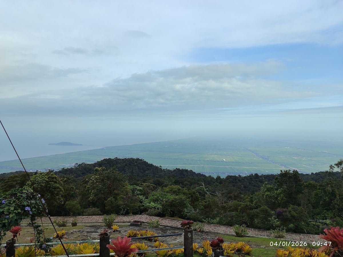
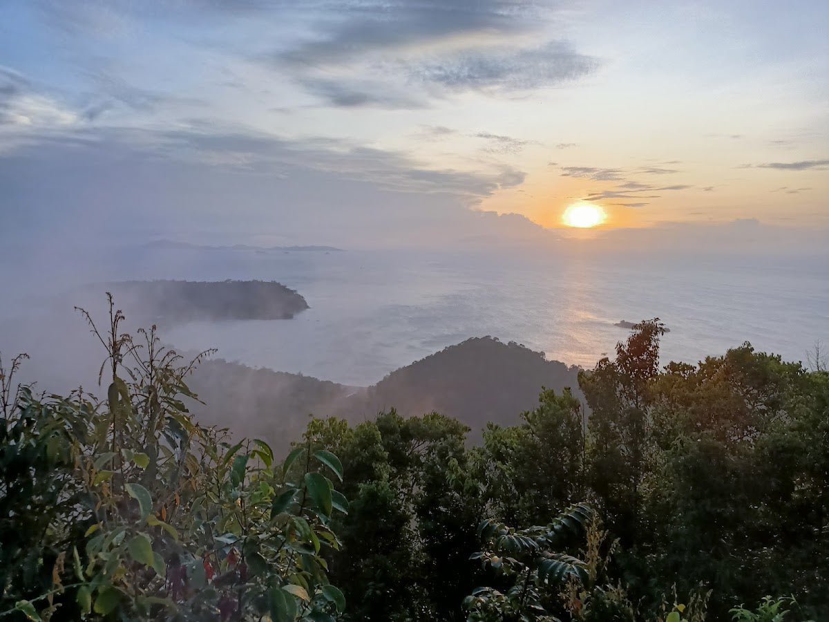
Bukit Jugra doesn't look like much on paper — a small hill in Kuala Langat, less than 150 m tall, sitting quietly between Banting and the coast. But this place punches above its weight. At the top you get a working lighthouse, a dramatic S-curve of Sungai Langat bending into the Straits of Malacca, and on good days, paragliders launching off the ridge while you catch your breath. It's also sitting in the middle of Selangor's old royal heartland — Istana Jugra, the royal mausoleum, ancient mosques — all within a short drive. For a half-day hike, the experience-to-effort ratio is genuinely hard to beat.

That said, don't let the modest elevation fool you. Bukit Jugra has rope-assisted sections, steep unexpected pitches, and slippery clay paths that catch out hikers who came expecting a casual stroll. Moderate fitness is recommended. This guide covers the standard route from Masjid Al-Muttaqin, with notes on the longer loop options if you want more.
Best suited to: families with older kids, beginner-to-intermediate hikers, day-trippers from KL. Not a good choice if it's rained heavily the night before — the trail gets seriously slippery.
Quick Facts
- Elevation: ~120–146 m (main summit near lighthouse); 243 m cited for the broader ridge/Rajawali Peak area
- Distance: ~3.8–4.8 km return (standard route); 6.9 km Jugra Hill loop; up to 9.68 km for full Rajawali loop
- Elevation gain: ~116–208 m (standard routes); ~394 m for extended Rajawali loop
- Duration: 1–1.5 hours return (standard route to lighthouse); ~2.5 hours for Jugra Hill loop; 3–4 hours including Rajawali Peak
- Difficulty: Easy to moderate (standard route); moderate (Jugra Hill loop); steeper and harder than elevation suggests — rope sections present
- Permit required: No
- Guide required: No — trail is signposted
- Entry fee: None
- Parking: Free, informal parking near Masjid Al-Muttaqin
Getting There & Parking
The trailhead is at Masjid Al-Muttaqin, Kampung Permatang Pasir, Jalan Bukit Jugra, Banting, Kuala Langat. Waze or Google Maps — search "Masjid Al-Muttaqin Bukit Jugra" and it'll get you there. From KL, expect roughly an hour's drive depending on traffic. There's no public transport to the trailhead, so you need your own wheels.
Parking is free and informal along the road near the mosque. It fills up on weekend mornings — another good reason to start early. An alternative starting point is Bukit Jugra Recreation Park if you're planning the longer loop routes.
Permits & Fees
Update (Aug 2026): JPSM's official register lists Bukit Jugra as requiring a forestry permit (no MGP guide needed). Enforcement on the popular tarmac route can differ from the official rule — check with the Selangor forestry office (SEFOREST) if in doubt.
No permit and no entry fee required for hiking Bukit Jugra. Just show up, sign nothing, pay nothing. If you're thinking about paragliding from the summit area, that's a different story — a permit from the relevant authorities is needed, though the specific authority name and fee weren't confirmed in any source I could verify.
Trail conditions and permit requirements change — always check with the local forestry office or park authority before you go. Checking a different gunung? Try our free permit checker — instant answer for 90+ Malaysian mountains. Or ask the TAHAN Hiking Community on WhatsApp — someone's usually been there that week.
The Trail: What to Expect
The standard route is straightforward to navigate — there are green "Denai Bukit Jugra" signboards along the way. Here's how it breaks down:
Start: Masjid Al-Muttaqin to Trail Entrance (~5 minutes)
From the mosque, you walk a short distance along the road to the formal trail entrance near a water treatment plant. Look for the green "Denai Bukit Jugra" signboard — that's your marker. If you miss it, just ask other hikers; there's usually someone around on weekends.

Initial Flat Section to First Steep Climb
The trail starts flat-ish through tropical rainforest — shaded, humid, and already alive with the sounds of the jungle. Enjoy it because the terrain shifts quickly into a proper steep uphill. This is where the leeches tend to find you first. Tuck your socks over your pants and do a check every 15 minutes.
~30–35 Minutes: Rest Area and Trail Junction
You'll hit a rest area and junction at roughly 30–35 minutes in. The right fork here leads to a shorter but steeper descent route — good to note for your return. Take a breather, have some water, and continue toward the lighthouse.

Rope-Assisted Sections
Multiple rope-assisted sections appear on both steep uphills and descents. These are legitimate rope aids — you'll be glad they're there. One thing nobody warns you about: ants on the ropes. It's a thing. Grab firmly, move quickly, check your hands after. Snakes are also present in the jungle sections, so watch where you put your feet on rocks and logs.
Tarmac Road Junction
Eventually the trail pops out onto a paved road near the top. This is the transition from jungle to the open, exposed upper section. The heat hits you here — especially if you've left it past 9 AM. On this stretch you might spot the abandoned RMAF air force barracks, an atmospheric ruin that adds a strange historical layer to the hike.

~50 Minutes: Jugra Lighthouse and Summit Area
The lighthouse appears at roughly 50 minutes from the start. You can't enter — it's an active Malaysian Maritime facility — but there's a viewing deck in front that looks out over the S-curve of Sungai Langat meeting the sea. On clear days, the Straits of Malacca stretch out beyond. As one recent visitor put it, the view of the river falling into the sea is genuinely worth the climb. If paragliders are active (typically 11 AM–4 PM, best season March–September), you get a free air show too.
The lighthouse sign can be easy to miss — if you're not sure you're at the right spot, ask whoever else is up there.

Optional Extensions: Bukit Jugra Peak and Rajawali Peak
From the lighthouse area, a narrow sloped trail leads to the highest point of the hill. Separately, the Rajawali Peak extension adds significant distance — the full loop from Bukit Jugra Recreation Park runs ~9.68 km with ~394 m elevation gain, and takes 3–4 hours. This is a different proposition from the standard route; plan accordingly and bring extra water.

Descent & Safety
Coming down, you have two main options: retrace the same route, or take the steeper roped descent track that leads back to the water plant perimeter fence and returns to the mosque. The steeper option is quicker but genuinely slippery when wet — take your time on the rope sections and test your footing before committing each step.
The hazards on this hill deserve straight talk:
- Leeches — common in jungle sections, especially after rain. Bring leech socks or tuck your socks high.
- Ants on rope sections — don't dawdle while holding the rope.
- Mosquitoes — insect repellent is not optional here.
- Snakes — watch your step around rocks, logs, and undergrowth.
- Slippery, muddy trail after rain — seriously consider postponing if it rained the night before. The clay gets treacherous.
- Steep unexpected sections — the elevation profile doesn't tell the full story. Some pitches are steep enough to rattle less-experienced hikers.
- Strong afternoon heat on exposed sections near the summit — start early.
- Fallen trees as trail obstacles — step over carefully, not onto.
If weather turns bad mid-hike — heavy rain, thunder — turn back immediately. The rope sections become genuinely dangerous when wet, and there's no shelter on the upper exposed section.
What to Bring
This is a short hike but the terrain and heat mean you need to be properly equipped:
- Water: Minimum 1.5 L per person — there are no water sources on trail. The nearest drinks are at a toddy shop near the trailhead (the Chelliah family place) and in Jugra town.
- Footwear: Proper trail shoes or hiking boots with grip. Sports shoes on wet clay is asking for trouble.
- Insect repellent: Non-negotiable. DEET-based for leech country.
- Leech socks or long socks: Tuck your pants in.
- Snacks: For a short hike, anything high-energy is fine — dates, nuts, energy bars.
- Trekking poles: The rope sections are fine without them, but on the steep descents poles give your knees real protection. The TAHAN 3-Section Foldable Hiking Stick V2 folds down small enough to clip to your bag on the flat sections and deploys fast when the gradient drops — practical for a route like this where you alternate between easy and steep.
- Knee support: If your knees are a weak point, the steep descents here will remind you. The TAHAN Kinetix Knee Guard with Spring Support is worth throwing in your bag for the downhill sections.
- Sunscreen and a hat: The upper section near the lighthouse is exposed. No shade once you hit the tarmac road.
- Light rain jacket: Afternoon Selangor weather is unpredictable.
First time gearing up for Malaysian hikes? Check out our hiking gear guide — covers what's actually worth bringing versus what just adds weight.
FAQ
How hard is Bukit Jugra?
The standard route to the lighthouse is rated easy to moderate, but it's consistently steeper than first-timers expect for a hill this size. There are rope-assisted sections on both the climb and descent. Moderate fitness is recommended. If you can comfortably walk fast for an hour, you'll be fine — but don't come in flip-flops.
How long does it take to hike Bukit Jugra?
The standard route to the lighthouse and back takes most hikers 1–1.5 hours. If you're doing the Jugra Hill loop, allow about 2.5 hours. The full Rajawali Peak loop from the Recreation Park is a 3–4 hour commitment. All timings assume reasonable pace — not racing, not dawdling.
Do I need a permit to hike Bukit Jugra?
No permit and no entry fee required for hiking. Just show up. (Paragliding is a different matter — that requires a separate permit, but that's not your concern as a hiker.) Step-by-step application guide: how to apply on SeForest.
Is Bukit Jugra suitable for beginners or families?
Yes, with caveats. The short distance and relatively low elevation make it accessible for beginners and families with older kids. But the rope sections and steep pitches mean it's not suitable for very young children or anyone with significant mobility issues. Start early, bring enough water, and don't attempt it after heavy rain.
Camp Nearby?
Bukit Jugra is a solid day trip from KL, but if you want to make a proper weekend of it, there are a few campsites within striking distance of Selangor worth knowing. Making a weekend of it? Templer Park Rainforest Retreat is a popular base in the north of Selangor if you're combining hikes. For something greener and quieter, Nature Escape Campsite, Hulu Langat is a good shout. Or check out Mori Leka Campsite, Serendah — solid option if you want a fuss-free setup before an early start elsewhere in the region.
Trail conditions, permit updates, and hiking buddies for the weekend — all in one WhatsApp group. Just ask; someone was probably up there last week.
💬 Join the Hiking CommunityFree, one click. No spam — the occasional promo at most.
Gear tip: Water bladder or bottle on a humid trail.
Mike has been camping across Malaysia for over 10 years — from jungle treks in Taman Negara to beach camps in Perhentian. He writes about it so you don't have to find out the hard way. Follow along on TAHAN Outdoor's blog for honest campsite reviews, every week.
⛺ Featured in: 10 Easy Hikes Near KL for First-Timers (2026)