Bukit Gasing, Petaling Jaya: A Hiker's Guide (2026)
Bukit Gasing is not Kinabalu. It is not even Nuang. What it is, though, is one of the most accessible urban forest reserves in the Klang Valley — a genuine patch of secondary jungle wedged between Petaling Jaya and Bangsar, where city folks come to sweat before breakfast and still make it to the mamak before 9 AM. At 160–169 m elevation, this is a social hike as much as a nature one, and there is nothing wrong with that.

What makes Bukit Gasing interesting is the variety. There are at least seven named trail loops inside, ranging from an easy stroll through bamboo forest to the Stairway to Heaven section — a knee-punishing series of stairs and a ravine descent that serious hikers use to train for Annapurna Base Camp. Whether you have 45 minutes or a full morning, you can calibrate this place to suit you. Families with kids, trail runners, mountain bikers, dog walkers, hashers — they all share this forest, which gives it a lively, community feel.
That said, Bukit Gasing comes with real traps for first-timers: confusing trail junctions, aggressive monkeys, slippery paths, and a trail signage situation that is genuinely inadequate. Read this before you go in, download an offline map, and you will be fine. Skip the prep and you will add yourself to the list of people who got lost and had to be talked out by a stranger's GPS.
Quick Facts
- Elevation: ~160–169 m (sources give slightly different figures; call it around 160 m)
- Route distance: Varies by loop — Bukit Gasing Loop ~4.0 km; Stairway to Heaven Loop ~3.7 km; Via Kerinchi ~2.7 km; Glitz circular ~4.3 km
- Elevation gain: Bukit Gasing Loop ~238 m; Stairway to Heaven Loop ~209 m
- Duration: 1–2 hours typical; full range 30 minutes – 3 hours depending on route combination
- Difficulty: Easy to Moderate (Stairway to Heaven section can challenge even experienced hikers)
- Permit required: No — day hiking is free
- Camping permit: Yes, pre-arrange with DBKL if you plan to camp overnight
- State: Selangor / Kuala Lumpur border (main PJ entrance is Selangor; Bangsar/Kerinchi entrances are KL)
Getting There & Parking
The main entrance is at Hutan Pendidikan Bukit Gasing, 46000 Petaling Jaya, Selangor — GPS 3.095138, 101.656131. Search "Hutan Pendidikan Bukit Gasing" on Waze or Google Maps and it will get you there. From KL, exit the Federal Highway at the EPF building (Jalan Gasing), turn left into Jalan Lembah 5/2, then fork right onto Jalan Tanjung 5/4. The main entrance has a proper archway and signboards — you will not miss it.
There are five entrances in total: the main PJ entrance, the Pantai Hill Park entrance on the Bangsar/KL side (opposite Saville @ The Park), the Taman Rimba Bukit Kerinchi entrance on the KL side, one near the suspension bridge in a residential area, and the TM Bukit Gasing / Hindu Temple entrance at the back of the TM building. Different entrances give you different starting points on the trail network, so pick based on which route you want.
Parking is the most stressful part of Bukit Gasing, honestly. The main entrance has limited spots, and on weekends they fill up fast. There is a small additional parking area about 100 m from the main entrance, and the Taman Rimba Bukit Kerinchi entrance also has parking. The Pantai Hill Park and suspension bridge entrances have no dedicated parking — they are in residential streets. Illegal roadside parking near the main entrance is common but JPJ and MBPJ do issue summons, so do not tempt fate. Weekday mornings are significantly easier. On weekends, aim for 6:30 AM or accept the parking chaos.
No direct public transport serves the main entrance. Grab or taxi is your best bet if you are coming from KL.
Permits & Fees
Day hiking at Bukit Gasing is completely free — no permit, no registration queue, just walk in. If you want to camp overnight on the Stairway to Heaven route, you need to pre-arrange a permit with DBKL (Kuala Lumpur City Hall) as the campsite falls under their jurisdiction. The exact fee was not available at time of writing, so contact DBKL directly for the latest figure.
Trail conditions and permit requirements change — always check with the local forestry office or park authority before you go. Checking a different gunung? Try our free permit checker — instant answer for 90+ Malaysian mountains. Or ask the TAHAN Hiking Community on WhatsApp — someone's usually been there that week.
The Trail: What to Expect
Bukit Gasing is not a single trail — it is a network of loops you can mix and match. The descriptions below cover the main landmarks and sections you will likely pass through, regardless of which combination you choose. Before you enter, download the AllTrails or Komoot map for Bukit Gasing offline. This is not optional advice. The in-park signage is insufficient, and trail splits appear constantly without clear markings.

Main PJ Entrance — Forest Entry
Start at the archway. There is a toilet block here, and a wooden gazebo nearby — useful for a quick stretch before you head in. The trail network begins immediately once you enter the forest. You will see the first junction within minutes. If you have not set up your offline map yet, do it here before you go any further. The bamboo forest sections appear early on some routes and are genuinely pleasant — cooler, quieter, and a reminder that this is real secondary tropical forest despite being 20 minutes from KLCC.
Abu Bakar Slope
This is a notably steep climb that features on several of the loops. It is not long, but it is sharp — the kind of section that reminds you that elevation gain in hill walking is not just about the total metres but about how concentrated those metres are. Loose soil makes it slippery after rain. Take your time going up.

Stairway to Heaven / Killer Stairs
This is the signature section and the reason serious urban hikers come to Bukit Gasing specifically. Two small hills connected by a ravine descent and a small stream crossing — the stairs themselves are steep enough that hikers training for Himalayan treks use this section as conditioning work. The "Killer Stairs" nickname is not ironic. Expect your thighs to feel it going up and your knees to feel it coming down. That stream crossing can be slippery; watch your footing. This section is genuinely challenging regardless of your fitness level, and there is no shame in slowing down.
Suspension Bridge (Currently Inaccessible)
The suspension bridge is one of Bukit Gasing's most photographed landmarks, but as of July 2025 it was temporarily inaccessible. Verify the current status before planning a route around it — other trail sections remain open. Signs at the bridge area also warn of snakes in the vicinity, which is worth keeping in mind.

Liana Steps — Viewpoint
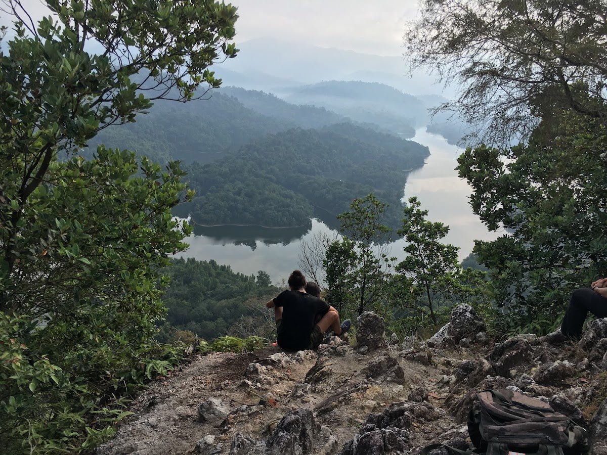
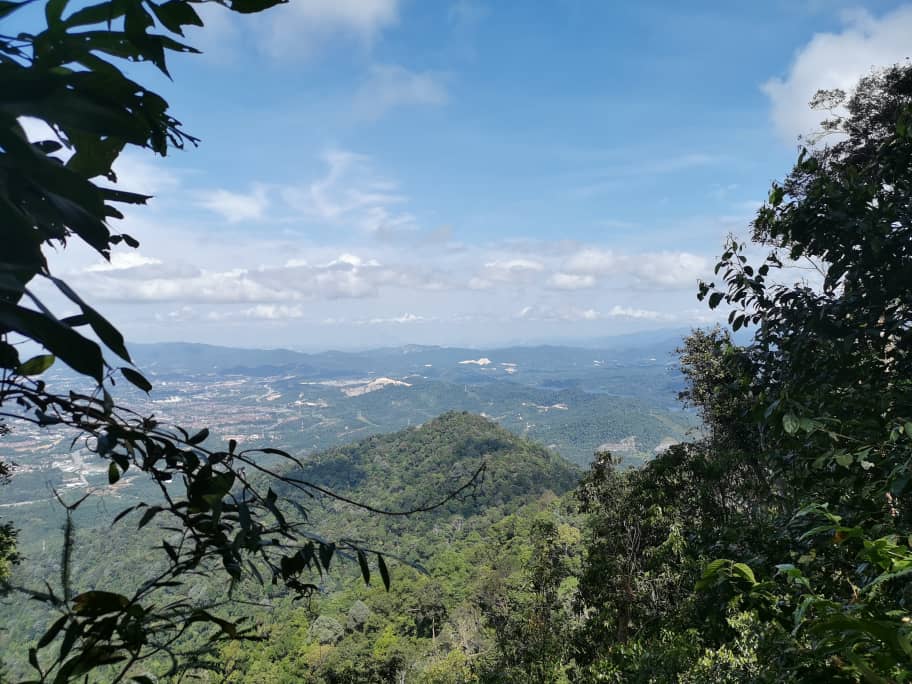
One of the more scenic stretches. The Liana Steps lead to a viewpoint along the river section, and on clear days you get views of the KL skyline from clearings along the way. Worth slowing down here rather than powering through.
Bukit Kerinchi Creek
The river-side trail along Bukit Kerinchi Creek is one of the calmer, shadier sections of the network. You can walk along the creek bed itself. No drinking water from this creek — it is scenery, not a water source. Bring your own water from home.
Bukit Gasing Peak / Peak 135
The summit area sits at roughly 160–169 m and features an abandoned watch tower platform. It is a junction of several trails, which means it is also a prime spot to get confused about which way to go down. Check your map here before continuing. The views from clearings near the top can include the KL skyline on a clear day. There have been reports of a vendor selling ice cream and drinks near the top, which is either a delightful surprise or a sign that this hill is thoroughly domesticated — probably both.

Hindu Temple (Sivan Temple) & Abandoned House
The Sivan Temple near the TM tower entrance is a notable landmark used for navigation. The area around the Hindu temple is also where monkey activity is highest — more on that in the next section. Nearby, an abandoned moss-covered house has become a popular photography stop. It is genuinely atmospheric and worth the detour if your route takes you past it.
Return to Entrance
Whichever loop you chose, you will eventually loop back to your starting entrance. If you entered from the main PJ archway, keep your offline map active all the way to the exit — junctions near the end are just as confusing as junctions in the middle. Finish before 4:00 PM; the forest gets dark quickly under canopy cover.

Descent & Safety
Descents at Bukit Gasing are trickier than the elevation suggests. Soil erosion has left many paths rocky and loose, and during or after rain they become genuinely slippery. Poles help significantly on descents, especially on the Stairway to Heaven section coming back down.
Hazards to be aware of:
- Getting lost: The highest real risk for first-timers. Many unmarked trail splits, inadequate signage. Download AllTrails or Komoot offline before entering — this is the most important safety step.
- Slippery paths: Loose rocky surfaces made worse by soil erosion, especially after rain or in the October–January monsoon period.
- Mosquitoes: Abundant throughout. Bring insect repellent and apply before you enter, not after you start scratching.
- Aggressive monkeys: Particularly near the Hindu temple area. They have learned to associate people with food and will snatch bags, food, and anything else they can grab. Do not feed them. Keep food zipped away. Stay calm if one approaches.
- Snakes and scorpions: Reported by multiple visitors; warning signs are posted at the suspension bridge area. Watch where you step and where you put your hands.
- Darkness: Aim to finish before 4:00 PM. The canopy cuts light fast and the trail network is hard enough to navigate in daylight.
- Suspension bridge: Temporarily inaccessible as of July 2025. Do not attempt to access it; verify current status before your visit.
If weather turns bad — heavy rain, thunderstorm — turn back immediately. Bukit Gasing trails become significantly more hazardous when wet, and there is no shelter inside the forest once you are in. The best time to visit is all year except monsoon season (October–January), and morning starts before 10:00 AM are strongly recommended both for cooler temperatures and better parking.
One thing Bukit Gasing is genuinely clear of: leeches. Multiple sources confirm this, which is a pleasant surprise for a lowland forest this close to KL. Small mercies.
What to Bring
Bukit Gasing is short, but do not let that make you casual about preparation. The combination of slippery descents, disorienting junctions, and genuine wildlife hazards means you should pack smart even for a 90-minute hike.
- Water: There are no drinking water facilities inside the park. Bukit Kerinchi Creek is not a drinking source. Bring at least 1–1.5 litres for a standard loop in the morning, more if you are combining routes or going midday.
- Offline trail map: Download AllTrails or Komoot before you enter, not at the trailhead. Mobile data inside the forest can be unreliable.
- Insect repellent: Non-negotiable. Apply before you start.
- Grippy footwear: Trail shoes or hiking shoes with decent rubber soles. Not sandals, not casual sneakers. The rocky eroded sections punish soft soles.
- Trekking poles: Optional for the flat sections, but genuinely useful on Abu Bakar Slope and especially on the Stairway to Heaven descent. The TAHAN 3-Section Foldable Hiking Stick V2 (RM99) folds down small enough to pack if you do not want to carry it on the easy sections — practical for a route like this where terrain varies.
- Knee support: If you have any history of knee issues, the Stairway to Heaven descent will find them out. The TAHAN Kinetix Knee Guard With Spring Support (RM79) is worth slipping on before you go down those stairs.
- Light snack: Keep food zipped inside your bag — not in an outer pocket the monkeys can see.
- Light jacket or dry bag: Weather in KL turns fast. If you are going during the shoulder months, be prepared for a sudden downpour.
For a broader breakdown of hiking gear suited to Malaysian conditions, check out our hiking gear guide — covers what is actually worth bringing versus what takes up space.
FAQ
How hard is Bukit Gasing?
Easy to Moderate overall — AllTrails rates the main loop as Moderate. Most of the trail is manageable for beginners and families with older kids. The exception is the Stairway to Heaven / Killer Stairs section, which is steep enough that hikers use it specifically to train for serious mountain treks. If you include that section, expect to work for it. If you stick to flatter loops, it is a relaxed forest walk.
How long does a Bukit Gasing hike take?
Most hikers finish in 1–2 hours. The genuine range is 30 minutes (quick in-and-out via a short route) to about 3 hours if you are combining multiple loops and stopping to explore. Pick your route before you go in and check the distances: Bukit Gasing Loop is ~4.0 km, Stairway to Heaven Loop ~3.7 km, Via Kerinchi ~2.7 km, Glitz circular ~4.3 km.
Do I need a permit to hike Bukit Gasing?
No permit needed and no entry fee for day hiking. Just show up and walk in. If you want to camp overnight at the campsite on the Stairway to Heaven route, you need to arrange a permit with DBKL in advance — contact them directly for current fees and procedures. Step-by-step application guide: how to apply on SeForest.
Is Bukit Gasing suitable for kids?
Yes, with caveats. The forest trails are genuinely fun and the shorter loops are achievable for children with some hiking experience. The path can be slippery after rain, so proper footwear matters. Keep food well out of sight near the monkey zones. Avoid the Stairway to Heaven section with very young kids — it is steep and demands careful footing. The Bukit Kerinchi Creek trail is a pleasant, lower-key option for families.
Camp Nearby?
Bukit Gasing itself is a day hike spot — most people come, hike, and head home. But if you want to make a proper outdoor weekend of it and base yourself somewhere with more nature and less city noise, there are some solid options within reasonable driving distance. Making a weekend of it? Check out Templer Park Rainforest Retreat to the north, which puts you right in proper jungle. Further out, Mori Leka Campsite, Serendah is worth the drive if you want a quieter setup, and Nature Escape Campsite, Hulu Langat is a good pick if you are heading east. Any of these makes sense as a Friday night camp before a Saturday morning at Bukit Gasing — though honestly, Bukit Gasing is close enough to KL that most people will just sleep in and drive over.
Trail conditions, permit updates, and hiking buddies for the weekend — all in one WhatsApp group. Just ask; someone was probably up there last week.
💬 Join the Hiking CommunityFree, one click. No spam — the occasional promo at most.
Gear tip: How to use a trekking pole (and set the height).
Mike has been camping across Malaysia for over 10 years — from jungle treks in Taman Negara to beach camps in Perhentian. He writes about it so you don't have to find out the hard way. Follow along on TAHAN Outdoor's blog for honest campsite reviews, every week.
⛺ Featured in: 10 Easy Hikes Near KL for First-Timers (2026)
⛺ Featured in: The 10 Best Hikes in Selangor (2026)