Bukit Batu Chondong: A Hiker's Guide (2026)
Bukit Batu Chondong sits in the Kemensah forest just behind Zoo Negara in Ampang, and it punches way above its weight for a hill that tops out around 260 m. The quartzite ridge is geologically cut from the same cloth as Bukit Tabur — same jagged, dramatic rock face, same exposed lookouts — and on a clear morning you get a panorama stretching from the Titiwangsa range all the way to the TRX skyline. It's a short hike, but short doesn't mean easy.

This is a good fit for beginners with decent fitness who want their first taste of a proper rocky scramble, and for regulars wanting a fast, rewarding early-morning hit before work. It is NOT a good fit if you have a fear of heights — the exposed summit ridge and steep scramble sections are genuinely unnerving for people who struggle with acrophobia. And before we get into the trail itself, there is a critical legal issue you need to read first.
Bukit Batu Chondong was declared strictly off-limits by the Selangor Forestry Department (JPNS) in October 2020. As of April 2025, Selangor launched the SeForest online permit system covering 52 hills including this one — and organised group trips have resumed under that framework. But the status must be verified directly with JPNS before you plan a visit. Going in without a valid permit risks a fine of up to RM30,000 or up to 5 years imprisonment under the National Forestry Act 1984. Verify first. Hike second.
Quick Facts
- Elevation: ~260 m (most consistent sources); 91 m elevation gain (AllTrails)
- Distance: ~700 m one-way to summit; loop via Batu Asah Waterfall approximately 5.4–5.9 km
- Ascent time: 15–45 minutes depending on fitness
- Descent time: 10–15 minutes
- Difficulty: Steep but short — rated Easy-Challenging (SGTREK) and Moderate (Pokok Kelapa); inclines exceeding 60° in places; not suitable for those with fear of heights
- Permit: Yes — required via SeForest system (forestry.selangor.gov.my/permit/home); verify status with JPNS before going
- Guide required: Not mandatory
- AllTrails rating: 4.6★ from 247 reviews
Getting There & Parking
The trailhead is at Jalan Taman Zooview, Kampung Kemensah, 68000 Ampang, Selangor. GPS: N3.218197, E101.786375. You pass Zoo Negara and follow the road as it winds deeper into Kampung Kemensah — it gets narrow and bendy, so take it slow, especially if there's oncoming traffic. The trailhead itself is marked by a chicken coop (reban ayam). Yes, really. Look for the coop.
There's no official car park. Roadside parking is at your own risk. A nearby private lot at Kombat Zone Paintball or the ATV Park charges around RM3 per car — fee may have shifted slightly, so check on arrival. One reviewer mentioned paying RM5 at time of writing, so just budget a few ringgit and don't be surprised either way.

Permits & Fees
This is the part you cannot skip. Bukit Batu Chondong was declared off-limits by the Selangor Forestry Department (JPNS) on 8 October 2020. The Selangor SeForest online permit system, launched 1 April 2025, lists Bukit Batu Chondong among 52 hills requiring a permit — and organised trips by operators like SGTREK in July 2024 and March 2025 suggest legal access is possible under the permit framework. Apply at forestry.selangor.gov.my/permit/home.
The exact permit fee under the new SeForest system wasn't confirmed at time of writing — check the portal directly. What IS confirmed: hiking here without a valid permit can result in a fine of up to RM30,000 or up to 5 years imprisonment under Section 47(1) of the National Forestry Act 1984. That's not a risk worth taking for a 45-minute hike.
Trail conditions and permit requirements change — always check with the local forestry office or park authority before you go. Checking a different gunung? Try our free permit checker — instant answer for 90+ Malaysian mountains. Or ask the TAHAN Hiking Community on WhatsApp — someone's usually been there that week.
The Trail: What to Expect
The trail is short but doesn't let you warm up gently — it climbs from almost the moment you leave the trailhead. Here's what you're walking into, stage by stage.

Trailhead to Three-Way Junction
From the chicken coop trailhead, you move immediately into bamboo groves and forest scrub. The path is delineated with fencing and rope in sections. It's shaded here, which you'll appreciate — but watch your head through the bamboo, and mind the spiky plants on both sides and overhead. Mosquitoes are reported along this lower section, so apply repellent before you start.
Three-Way Junction
You'll hit a junction with three options. Take the middle path for Bukit Batu Chondong summit. Left goes to Batu Asah Waterfall (worth adding if you're making a full day of it). Right is the ATV track. Don't just follow whoever is in front of you — check the direction and take the middle.
Mid-Trail ATV Intersection
The trail crosses an ATV track that also leads to Air Terjun Batu Asah. ATVs actually use this track, so keep your ears open. Step aside and let them pass — they're not stopping for you on a slope.
Steep Scramble Section
This is where the hike earns its reputation. Loose soil, slippery sections, inclines exceeding 60° — you're using hands on rock faces and tree roots, with rope support in places. Those ropes are there to help but some have been reported as frayed, so test before you commit your full weight. After rain, this section becomes significantly more dangerous. Take it slow, find solid footholds, and don't rush.

Summit Area
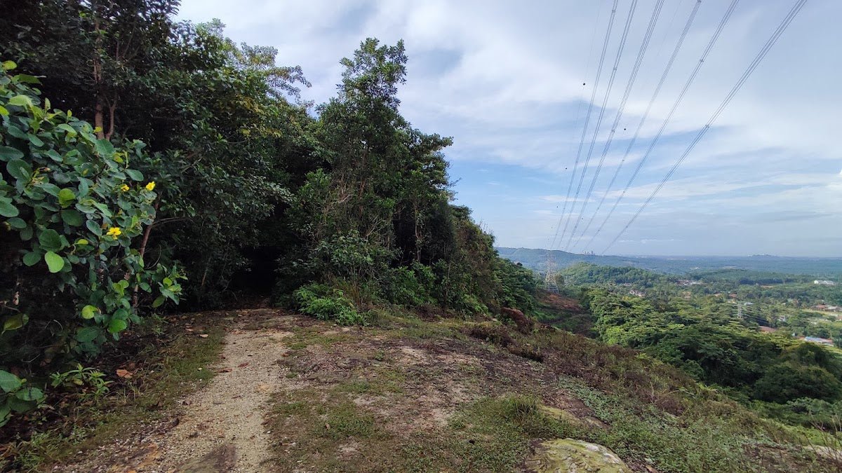
The summit area has multiple lookout points — sources report between three and six distinct spots depending on how far you explore. Walk northwest for the official signboard peak. Additional high points are accessible to the north. The views are the payoff: Titiwangsa range, Bukit Tabur's X and Extreme routes spread out across the ridge, and the TRX towers on the city skyline. Arrive by 7:15 am for sunrise — genuinely worth the pre-dawn alarm.

Descent & Safety
The descent takes around 10–15 minutes but don't treat it casually. Coming down a 60°+ slope on loose soil is where most injuries happen — knees absorb a lot of impact and footing gets sketchy fast. Face the slope on the steep sections and lower yourself carefully. If you have any history of knee issues, take this seriously.
Real hazards on this trail:
- Loose pebbles and slippery terrain — significantly worse after rain
- Inclines exceeding 60° on the scramble section
- Frayed ropes — test before trusting
- Shared trail with ATV riders
- Spiky plants along the trail
- Mosquitoes
- Exposed summit — intense sun if you linger midday
- Heights — this trail is not suitable for anyone with acrophobia
- Muddy, slick conditions post-rainfall
Turn back if the weather looks like it's closing in. A wet scramble on frayed ropes and loose soil isn't heroic — it's how people get hurt. Early morning start is the right call both for conditions and for catching the sunrise before the heat builds.

What to Bring
This is a short hike but the steep terrain makes a few things non-negotiable:
- Water: There are no water points on trail. Bring enough for the ascent, summit, and descent — a hydration bladder like the TAHAN TrailBladder 2L keeps your hands free for the scramble sections, which matters here.
- Trekking poles: Optional on the way up, genuinely useful on the descent. The TAHAN 3-Section Foldable Hiking Stick V2 packs small and deploys fast — good for a short hike where you only really want it for the down. Check our hiking gear guide if you're unsure what to look for.
- Grip gloves: Strongly recommended for the rock and root scramble section.
- Hiking shoes with grip: Trail runners or hiking boots. Not sandals, not running flats.
- Insect repellent: Apply before you start, not at the trailhead after the mozzies find you.
- Sunscreen and a hat: The summit is exposed. Midday sun up there is no joke.
- Light snack: It's a short hike but if you're doing the waterfall loop, budget for a full morning out.
- Headlamp or torch: If you're starting early for sunrise (and you should be), you'll need light for the first part of the trail.
- Permit documentation: Have your SeForest permit accessible — printed or on your phone.
FAQ
How hard is Bukit Batu Chondong?
Harder than it looks on paper. The elevation is only around 260 m but the trail throws steep, slippery scramble sections at you with inclines exceeding 60° in places. Rated Moderate to Challenging depending on the source. Reasonable fitness is needed. Not suitable for those with a fear of heights — that part is genuine, not just standard disclaimer language.
How long does it take to hike Bukit Batu Chondong?
Most hikers reach the summit in 15–45 minutes depending on fitness and how cautiously you take the scramble. Descent is typically 10–15 minutes. If you're combining with Batu Asah Waterfall via the loop (approximately 5.4–5.9 km total), budget a full morning.
Do I need a permit for Bukit Batu Chondong?
Yes. The hill was declared off-limits by JPNS in October 2020, and a permit is now required under the SeForest system (forestry.selangor.gov.my/permit/home). Hiking without one risks a fine of up to RM30,000 or up to 5 years imprisonment. Verify current access status directly with JPNS before you plan your trip. Step-by-step application guide: how to apply on SeForest.
What is the best time to hike Bukit Batu Chondong?
Early morning — start around 6:30 am, and you're at the summit for sunrise around 7:15 am. Avoid after rain (slippery scramble becomes significantly more dangerous) and avoid midday (exposed summit, intense heat). Dry season is strongly preferred.
Camp Nearby?
Making a weekend of it? Bukit Batu Chondong is a fast hike but the drive into Ampang and back makes it worth pairing with a night under canvas. For something not too far from the Klang Valley, check out Templer Park Rainforest Retreat for a classic jungle-edge camp experience. If you're willing to head a bit further out, Nature Escape Campsite, Hulu Langat is a solid pick — same Selangor forest belt, good facilities. Or head north to Mori Leka Campsite, Serendah for a quieter stay. Any of these work well as a base for an early start back into Ampang the next morning.
Trail conditions, permit updates, and hiking buddies for the weekend — all in one WhatsApp group. Just ask; someone was probably up there last week.
💬 Join the Hiking CommunityFree, one click. No spam — the occasional promo at most.
Gear tip: How to use a trekking pole (and set the height).
Mike has been camping across Malaysia for over 10 years — from jungle treks in Taman Negara to beach camps in Perhentian. He writes about it so you don't have to find out the hard way. Follow along on TAHAN Outdoor's blog for honest campsite reviews, every week.