Apek Hill (Bukit Apek): A Hiker's Guide (2026)
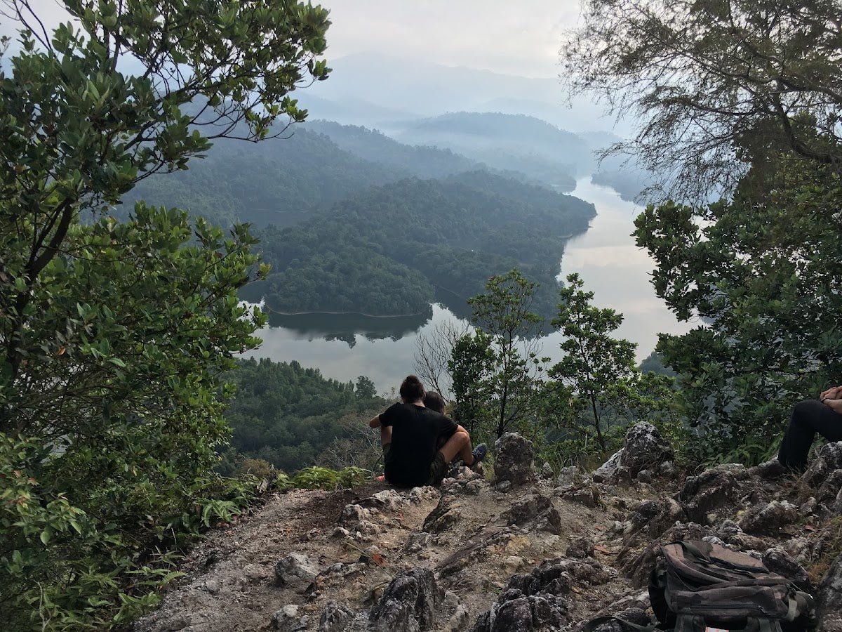
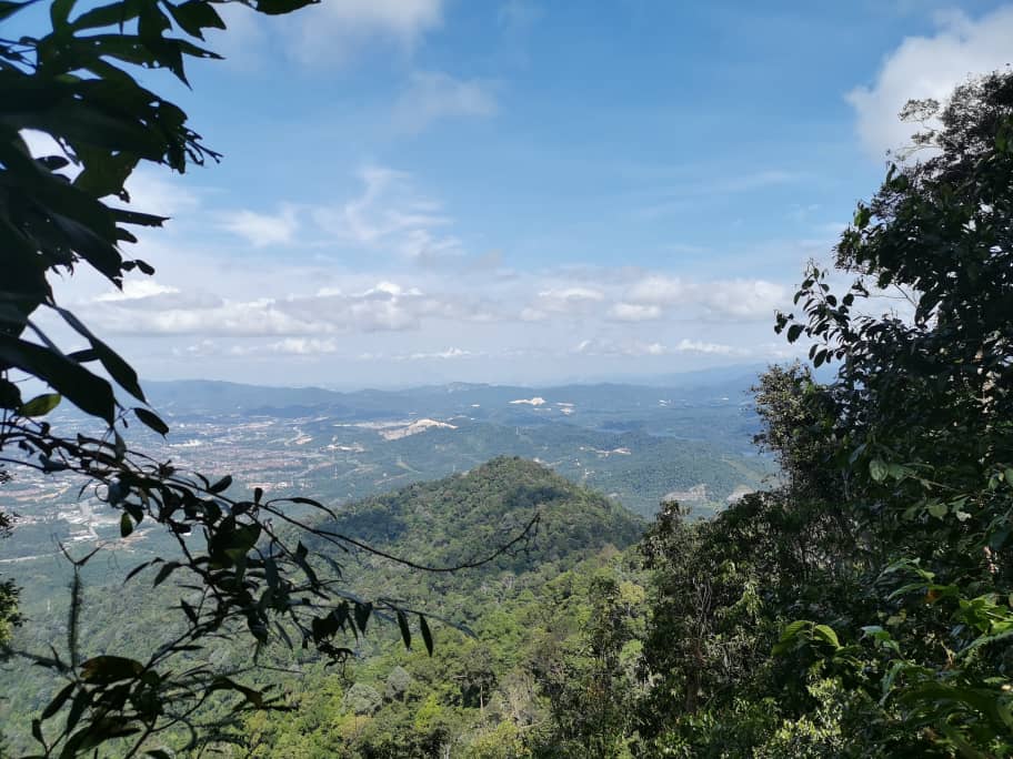
Apek Hill sits inside the Bukit Sungai Puteh Forest Reserve in Cheras, Selangor — and it has a habit of surprising people. From the outside it looks like a suburban hill walk. Inside, you get giant durian and teak trees, dusky leaf monkeys hanging about like they own the place, a multi-tiered waterfall with swimming pools, a tree house, and jungle so thick you forget you're twenty minutes from KL. That contrast is exactly why locals love it.

This is not a beginner-friendly walk by default. The shorter loops can work for fit newcomers, but the terrain is steep, ropes are involved, and the trail network is genuinely confusing without a GPS track. Route choice matters a lot here — you can do a quick 1.5-hour loop or spend a full day exploring up to 13 km with the Saga Hill extension. Know what you're signing up for before you leave the trailhead.
Apek Hill suits hikers who want a proper workout close to KL, families and casual hikers who stick to the main loop and treat themselves to the waterfall, and anyone who wants to connect through to Bukit Saga for a harder day out. There's genuinely something here for a wide range of fitness levels — as long as you pick the right route.
Quick Facts
- Location: Bukit Sungai Puteh Forest Reserve, Cheras, Selangor
- Summit Elevation: ~432 m
- Distance: 5.6–13 km depending on route (see route options below)
- Elevation Gain: 385–543 m depending on route
- Duration: 1.5–3.5 hours (Apek Hill loop only); 3.5–4 hours (Apek + Saga Hill combined); up to ~9 hours (full exploration with all detours)
- Difficulty: Moderate to Hard — entrance and route dependent; main loops rated Hard on AllTrails; Ampang/Saga approach rated easier
- Permit: Yes — required (see Permits section)
- Guide: Likely not mandatory for Apek Hill — verify with SEFOREST at time of application
- Opening Hours: 6:00 am – 6:00 pm daily
Getting There & Parking
Apek Hill has multiple entrances and which one you use changes your experience significantly. The most popular is the main Jalan Awana 23 entrance in Taman Cheras Awana, 43200 Cheras — you'll know it by the herbal tea and tung sui stalls at the foot of the hill. This is where most people start, and for good reason: it's well-connected to the full trail network.
Other entrances include the Bukit Hatamas entrance (shorter approach, easier roadside parking), the Wangsa Cheras entrance, and the Taman Saga / Ampang entrance at Jalan Saga 24, Taman Saga, 68000 Ampang Jaya (GPS: 3.114868, 101.773568) — useful if you're doing the Bukit Saga–Apek loop from the Ampang side. There's also an alternative entry at Hijuanan Residence.
Parking is the usual Malaysian hill situation: no designated car park. You're looking at roadside spots near the 99 Speedmart parking lots — do not park in the residential area. On weekends, the area reportedly fills up by 8am. Get there early, or accept that you're walking from further than you'd like.

Permits & Fees
A permit is required to hike Apek Hill. From 1 April 2025, all permits must be applied for online through the SEFOREST (Selangor Forestry e-Permit System) portal at forestry.selangor.gov.my, issued by the Selangor State Forestry Department (Jabatan Perhutanan Selangor).
Apply at least one month in advance, or no later than 48 hours before your intended hike date. Online payment is required after approval. The trail is limited to 100 hikers per day, so don't leave the application to the last minute, especially for weekend dates.
The exact permit fee wasn't confirmed in any source I could find at time of writing — check the SEFOREST portal directly when you apply. As for guides: Apek Hill appears to fall under the permit-only (no mandatory guide) category, but this is not fully confirmed — verify with SEFOREST at the time of your application. Where guides are required under Selangor's general rules, the ratio is 1 guide per 7 hikers.
Trail conditions and permit requirements change — always check with the local forestry office or park authority before you go. Checking a different gunung? Try our free permit checker — instant answer for 90+ Malaysian mountains. Or ask the TAHAN Hiking Community on WhatsApp — someone's usually been there that week.
The Trail: What to Expect
The trail system at Apek Hill is a web of interconnected paths with multiple loops and detours. Navigation is a real issue here — signboards are reportedly insufficient and junctions can be confusing. Bring a GPS track downloaded in advance (AllTrails or Wikiloc have several options for the different routes), or go with someone who's done it before. Wrong turns mean extra mileage and potential for getting properly lost.
The stages below follow the main loop from the Jalan Awana 23 entrance, which is the most documented route.

Trailhead — Jalan Awana 23
Start at the herbal tea and tung sui stalls at the foot of the hill. Stock up here if you want — cold drinks, fruits, the usual. Toilets are not available on the trail itself, so use facilities before you enter. The trail starts climbing almost immediately.
Station 1 — Small Bridge Station
First checkpoint after the trailhead. The terrain here is already showing you what the rest will be like: roots underfoot, some muddy sections if it's rained recently. Take it steady and find your rhythm.
Station 2
Climbing continues. Keep an eye on the canopy — this is a good stretch to spot dusky leaf monkeys (spectacled langurs). They're regulars on this trail.
Station 3 / Station 3A — Shelter & Open-Air Gym
A shelter here with open-air gym equipment — yes, really. Station 3A has a free water supply for hikers, which is worth knowing. There's also a small stall selling drinking water. Take a proper rest and sort your kit before the steeper sections ahead.
Station 4
The climb gets more serious between Stations 3 and 5. Exposed roots throughout, and sections steep enough that you'll be using ropes. One local hiker described slopes approaching 70 degrees — that's not an exaggeration for the steep bits. Poles help here.

Station 5 — Summit (Highest Peak)
At 432 m, this is the top. There's a snacks, drinks and hot coffee stall here — sit down, have a kopi, you've earned it. This is also the key trail fork: left goes to the Apek Waterfall, right continues the circular loop. Your route from here depends on what you planned before setting out.
Station 6 — Tree House & Second Peak
The second-highest peak on the circuit, with a tree house and a refreshment stall (weekends only). Good viewpoint. This is a popular rest stop before the descent or before heading toward the Saga Hill extension.
Gold Station (Gold Stop) & Midway Station
These checkpoints mark the latter sections of the loop as you work back toward the trailhead. Terrain remains root-heavy and can be slippery on the way down.
Apek Waterfall (via left fork at Station 5)
Multi-tiered cascading waterfall with pools suitable for a swim. Surrounded by thick greenery. This is the highlight for a lot of people and well worth the detour if conditions allow. Note: one reviewer reported spiky vegetation near the waterfall — watch where you put your hands. The waterfall route adds to your total distance; factor that into your timing.

Optional Extension: Bukit Saga (Saga Hill)
If you're doing the Apek–Saga Hill Loop (7.4 km, ~543 m elevation gain, rated Hard on AllTrails), the extension takes you over a suspension bridge at Bukit Apek, through a stream crossing — which is slippery, full stop — and up to the panoramic views at Saga Hill summit. The Bukit Saga–Apek combined loop runs ~9.5 km. The Ampang entrance approach to this combined route is rated easier, so depending on your direction of travel and fitness, there's some flexibility. Budget 3.5–4 hours for the combined Apek + Saga loop, more if you're taking your time.
Descent & Safety
The descent on Apek Hill is where people get into trouble. Steep sections that felt manageable going up become genuinely slippery on the way down, especially after rain. The rope-assisted sections require the same care descending as ascending — more, actually, because your legs will be tired.
Key hazards to be aware of:
- Leeches: Present throughout, worse in wet season and near streams. Eucalyptus spray (minyak kayu putih) on your boots and socks before you enter. Check yourself at every rest stop.
- Muddy and slippery terrain: Confirmed across multiple reviews, especially after rain. If it's been raining heavily, reconsider or at least scale back your route.
- Navigation: Insufficient signage and many junctions. A wrong turn here can add serious distance or get you properly lost. Download a GPS track before you go — this is non-negotiable for first-timers.
- Stream crossing (Saga–Apek loop): Slippery. Take it slowly, use trekking poles or a stick for balance.
- Exposed tree roots: Throughout the trail. Ankle roll risk is real, especially when tired on descent.
- Mosquitoes: Bring insect repellent, not just leech deterrent.
- Wild boars: Occasional sightings and incidents reported on trail (single source). Give them space, do not approach.
- No toilets on trail: Sort this out before you enter.
- Stall hours: Station 6 stall is weekends only. Don't count on it being open on weekdays.
If the sky is darkening, it's raining heavily, or you're moving slower than expected — turn back. The trail closes at 6:00 pm and getting caught in bad weather on slippery root-covered slopes in fading light is how trips go wrong. The hill will be there next weekend.

What to Bring
Pack for a proper jungle hike, not a morning stroll:
- Water: At least 2 litres per person. Yes, there are stalls on the trail, but don't rely on them — stall hours vary and you don't want to run dry on the steeper sections. A hydration bladder keeps you drinking without stopping; the TAHAN TrailBladder 2L Water Bladder fits most hiking packs cleanly.
- Trekking poles: Strongly recommended, especially for the rope-assisted steep sections and the stream crossing on the Saga loop. The TAHAN 3-Section Foldable Hiking Stick V2 folds down compact enough to pack if you don't want to carry it the whole way. Check our hiking gear guide for more on picking the right pole and protecting your knees on descents like this.
- Insect repellent + eucalyptus spray: Both. Leeches and mosquitoes are real here.
- Snacks and energy food: Stalls are helpful but not a replacement for your own food supply.
- Proper grip footwear: Trail shoes or hiking boots with good traction. Not flat sneakers.
- Rain jacket or poncho: KL weather does what it wants. Be ready.
- Dry bag or waterproof cover: For your phone, especially if you're doing the waterfall detour.
- Fully charged phone with GPS track downloaded offline: Not optional. Navigation on this trail is the real challenge.
- Extra cash or e-wallet: Stalls reportedly accept mobile payments, but bring some cash as backup.
FAQ
How hard is Apek Hill?
Harder than it looks on a map. The main loops are rated Moderate to Hard — AllTrails rates the Apek–Saga Hill Loop as Hard. There are rope-assisted sections on steep inclines, exposed roots throughout, and navigation is genuinely tricky without a GPS track. Shorter loops are manageable for fit beginners, but don't walk in expecting an easy stroll. The Ampang/Bukit Saga approach is rated easier if you want a gentler entry point.
How long does Apek Hill take?
Depends entirely on your route. The Apek Hill loop alone takes most hikers 1.5–3.5 hours. Add the Saga Hill extension and you're looking at 3.5–4 hours for the combined loop. If you're doing the full exploration with all detours — waterfall, Saga Hill, the works — budget up to around 9 hours. Pick your route before you start and plan your turnaround time accordingly.
Do I need a permit to hike Apek Hill?
Yes. From 1 April 2025, permits must be applied for online via the SEFOREST portal (forestry.selangor.gov.my) — issued by Jabatan Perhutanan Selangor. Apply at least a month ahead, or minimum 48 hours before your hike. The trail has a daily limit of 100 hikers, so weekend slots go fast. The exact fee wasn't confirmed at time of writing — check the portal when you apply. Step-by-step application guide: how to apply on SeForest.
Is there water available on the trail?
Yes, but don't rely on it as your only source. The trailhead stalls sell drinks and fruits. Station 3A has a free water supply for hikers. Station 5 at the summit has a snacks and drinks stall with hot coffee. Station 6 has a stall on weekends only. Stalls accept mobile payments. Carry at least 2 litres in regardless — you don't want to be rationing water on a steep descent because you assumed the stall would be open.
Camp Nearby?
Apek Hill is a day hike — there's no camping within the reserve. But if you want to make a proper outdoor weekend of it, there are decent options within the Selangor/KL region. Making a weekend of it? Nature Escape Campsite, Hulu Langat is the closest option in terms of jungle atmosphere — worth considering if you want to base yourself in greenery and do Apek Hill on day two after a proper early-morning start. Further afield but well-regarded: Templer Park Rainforest Retreat in Rawang offers proper rainforest surrounds if you're combining with other hikes in the north of the Klang Valley. And if you're happy to go a bit further north, Mori Leka Campsite, Serendah is a solid overnight option for a relaxed camp-and-hike weekend.
Trail conditions, permit updates, and hiking buddies for the weekend — all in one WhatsApp group. Just ask; someone was probably up there last week.
💬 Join the Hiking CommunityFree, one click. No spam — the occasional promo at most.
Gear tip: How to use a trekking pole (and set the height).
Mike has been camping across Malaysia for over 10 years — from jungle treks in Taman Negara to beach camps in Perhentian. He writes about it so you don't have to find out the hard way. Follow along on TAHAN Outdoor's blog for honest campsite reviews, every week.