Pine Tree Trail, Fraser's Hill: A Hiker's Guide (2026)
Pine Tree Trail is the longest and most difficult trail in Fraser's Hill — and that title is earned, not handed out. This is a ridge route through misty highland rainforest that takes you up through jungle, past viewpoints, and finally onto a summit rock face that demands a rope climb to finish. The views at the top — 360 degrees across the Titiwangsa Range, with Pahang rolling out to the right and Selangor to the left — are genuinely worth it. But this trail does not mess around.

This is a route for hikers who already have a few serious trails under their belt. Not beginners, not casual walkers, not people who think the cool highland air means the trail is easy. It's a popular training route for serious climbers because the terrain demands it — constant undulating ridge, deteriorating stairs, rope scrambles, and a near-vertical rock wall right before the summit. If you're ticking boxes toward bigger climbs, Pine Tree Trail is a proper test. If you just want a nice walk in Fraser's Hill, take one of the other trails.
CRITICAL — Read this before you plan anything: As of July 2026, Pine Tree Trail is officially closed to the public with immediate effect by the Pahang Forestry Department. The closure covers Pine Tree Trail, Twin Peak Trail, and Gunung Semangkok trails in Hutan Simpanan Kekal Raub District. All hiking and recreation activities are prohibited during this closure. Status may change — contact the Pahang Forestry Department directly before making any plans. We're keeping this guide updated for when the trail reopens.
Quick Facts
- Location: Bukit Fraser (Fraser's Hill), Pahang
- Distance: Approximately 5.5km one way (11km return; some sources cite 13.5km round trip)
- Summit Elevation: 1,456–1,500m (sources vary)
- Duration: 5–9 hours round trip; fit hikers report 3 hours up, 2.5 hours down; 7–8 hours recommended if you're taking stops
- Difficulty: Challenging — longest and most difficult trail in Fraser's Hill; not suitable for beginners
- Permit: Required (Pahang Forestry Department)
- Guide: Mandatory — one registered local guide per group of up to 7 hikers
- Best Season: May–July; trail closed November 1–January 31 (rainy season)
- Current Status (July 2026): CLOSED — verify with Pahang Forestry Department before planning
Getting There & Parking
The trailhead is on High Pines Road in Bukit Fraser, approximately 20 metres past TM Resort (Seri Intan). There is no public transport to Fraser's Hill — you need your own vehicle or a hired ride. From Kuala Kubu Bharu (KKB), it's 39km via Route 55. Taxis from KKB run around RM80 one way; from Kuala Lumpur expect around RM200 one way. The KKB–Fraser's Hill road also has a one-way system on the main gap road (odd hours up, even hours down), so check the schedule before you drive.
Parking at the trailhead itself is tight — there's no dedicated car park, just limited space near the bungalow houses along High Pines Road. If you can't park there, free parking is available at Fraser's Hill town areas: the town square, near the clock tower, or by the golf course. Factor in extra time to walk from town to the trailhead. Arrive early — and when I say early, I mean before 6am early, because spaces go fast and you want to be on trail before the afternoon clouds roll in anyway.

Permits & Fees
A permit is required from the Pahang Forestry Department. You can apply in person or online, but processing takes 2–5 working days — apply at least 7 days before your planned hike, not the day before. The permit fee is reported at RM10 per person (single source; confirm this when you apply). Payment is by Bank Draft or Postal Order made out to Pengarah Perhutanan Negeri Pahang.
A registered local guide is also mandatory — no exceptions. One guide can accompany a maximum of 7 hikers. This isn't bureaucracy for the sake of it; sections of this trail are not well-signed and the terrain is genuinely technical. Your guide is part of your safety plan.
Hiking without a permit is not a grey area. Violations under Section 47 of the National Forestry Act 1984 carry a fine of up to RM10,000, imprisonment up to 3 years, or both. Don't try your luck.
Trail conditions and permit requirements change — always check with the local forestry office or park authority before you go.
The Trail: What to Expect
The route is a ridge walk with significant undulation — don't expect a simple climb to a peak. You go up, come down, go up again, across a series of highpoints before the final summit push. The trail moves through dense highland rainforest the whole way, with mossy trees, exposed roots, and sections that degrade fast after rain. Here's what the route looks like stage by stage.
Trailhead at High Pines Road
The trail starts modestly enough — you won't know what's coming. Sign in, do a headcount, confirm your guide is with you. Brief your group here on the plan and turnaround time. Starting before 7am gives you the best chance of hitting the summit before afternoon mist and rain closes in.
Gazebos and Stone Stairs Descent
Early on, the trail drops down via stone stairs — a counterintuitive start when you're heading for a summit, but welcome it now because you'll be gaining all this elevation back later. There are gazebos along this stretch, useful landmarks. The stairs here are described as being in disrepair in sections, so watch your footing from the very beginning.

Uphill Ascent with Stone Stairs
The climb begins proper. The concrete and wooden stairs in this section are uneven and some are crumbling — treat them as obstacles, not infrastructure. Pace yourself. This is where hikers who came in too hot start to flag. Keep a steady rhythm, stay hydrated, and don't let the cool air fool you into thinking you're not working hard.
Gua Akar
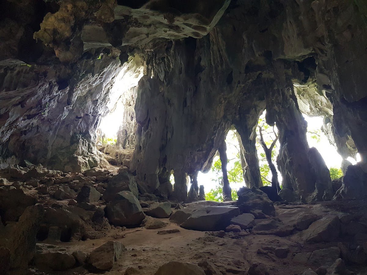
A natural feature along the route — root cave terrain where the trail narrows and the forest gets denser. Fallen branches and tree trunks are common through this stretch; expect to climb over some and crawl under others. This is normal, not a sign something has gone wrong.
Pine Hill — First Viewpoint
Your first real payoff. Pine Hill gives you views toward the Selangor mountains — a good spot to catch your breath, eat something, and take in what you've earned so far. The mist comes and goes; on a clear morning this view is excellent. Don't mistake Pine Hill for the summit — there's still significant trail ahead.

Twin Peak — 270-Degree Panoramic View
Twin Peak sits slightly lower than Pine Tree Peak but delivers a 270-degree panoramic view that's arguably more accessible than the summit. Some hikers treat this as their turnaround point if time or energy is short — no shame in that. Note that Twin Peak Trail is also included in the current (July 2026) closure, so check status before assuming you can at least reach this point.
Pacak Tepus and Kem Sungai Merah
The ridge undulates through here — this middle section is where the trail's cumulative fatigue starts to bite. Pacak Tepus is a waypoint, and Kem Sungai Merah (Red River Camp) is a landmark along the route. In wet conditions, stream bed navigation is required in this area — wet rocks and slippery mud are the main hazards. Leeches are active throughout the trail but especially in these lower, wetter sections. Leech socks or salt are your friends.
Kem Helipad
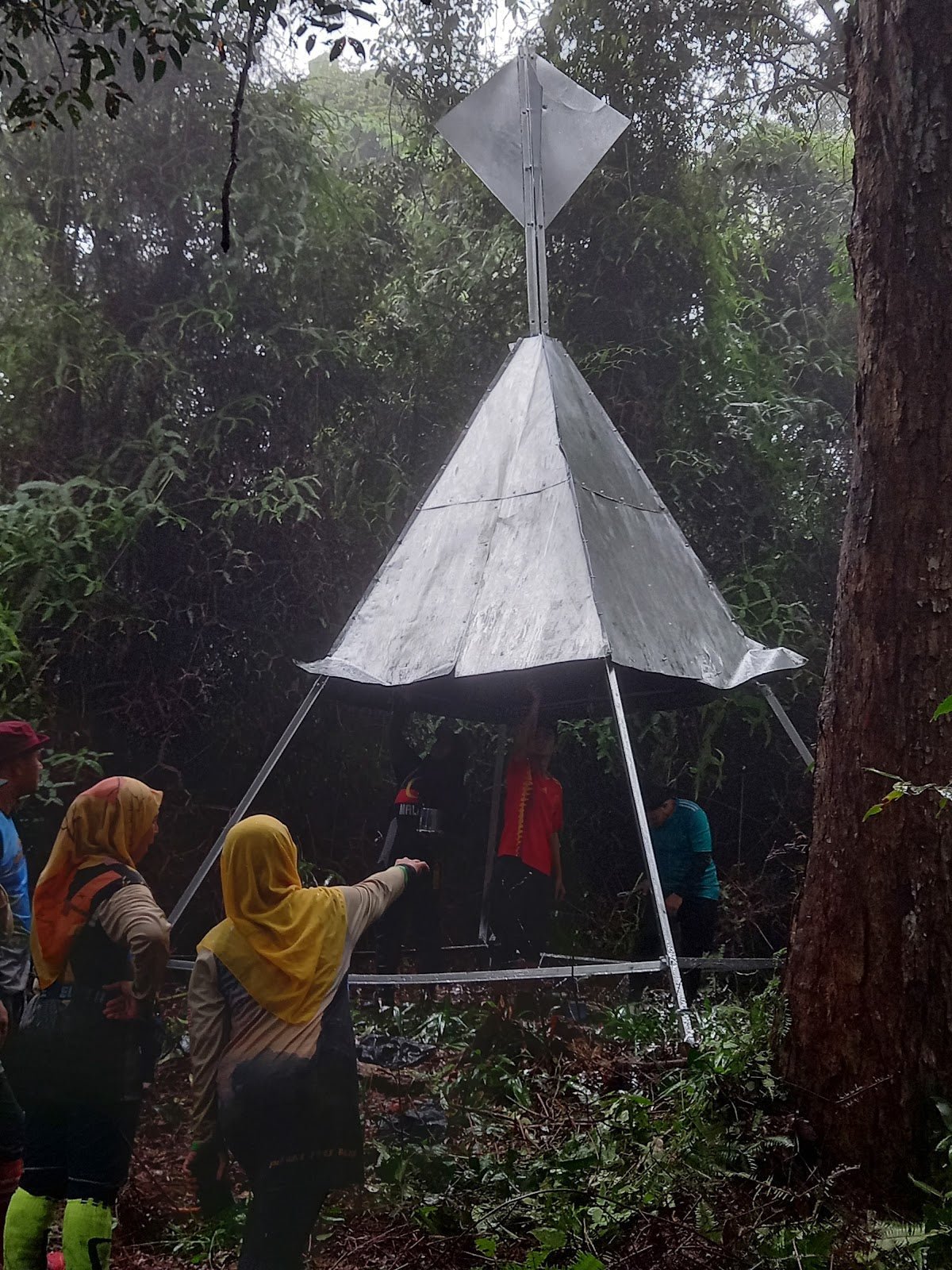
The helipad camp is a significant waypoint in the latter stages. If you've made it here and you're still feeling strong, the summit is within reach. If the group is struggling or weather is turning, this is your last sensible turnaround point before the technical finish. The helicopter landing zone also tells you something about this trail — emergency extraction is a real consideration, not just a fun feature.

Pine Tree Peak — Summit (Rope Climb)
The summit finish is a 60-degree vertical rock wall that requires a rope climb. Hands and legs both working, exposed, no margin for sloppy footwork. One hiker described it as requiring real physical strength from both hands and legs — that's accurate. Take your time, let people go one at a time, listen to your guide. The reward at the top is a 360-degree panoramic view across the Titiwangsa Range — the backbone of Peninsular Malaysia spread out in front of you. On clear days, Pahang to the right, Selangor to the left. Misty highland jungle below. Worth every step of the approach.

Descent & Safety
Multiple hikers have noted that the descent is where this trail gets honest with you. What felt like a manageable climb on the way up becomes a series of slippery, knee-grinding descents on the way back. The moss-covered roots that looked interesting on the way up are genuinely treacherous on the way down, especially if afternoon moisture has settled in. Allow at least 2.5–3 hours for descent and don't rush it.
Key hazards to be aware of throughout:
- Muddy and slippery sections after any rainfall — not optional to mention, this trail can become dangerous quickly
- Concrete and wooden stairs in disrepair throughout the route
- Rope scrambling with exposed roots
- 60-degree vertical rope climb at summit — requires upper body strength
- Steep descents with moss-covered roots (legs and hands required)
- Fallen branches and tree trunks blocking path
- Stream bed navigation in wet conditions
- Leeches — sock up and check regularly
- Poisonous animals present; long pants and covered shoes are not optional here
- Large monkeys have been observed on trail — don't feed, don't provoke
If it starts raining heavily while you're on trail, turn back. This is not a negotiable point. Moss-covered rocks and steep descents with rope sections do not get safer in rain — they get significantly more dangerous. Set a turnaround time before you leave the trailhead and stick to it regardless of where you are on the route. Your guide should also be setting this boundary; if they're not, you raise it.
Water sources along the trail are not documented despite the stream bed mention — do not rely on finding water on trail. Carry everything you need.
What to Bring
Pine Tree Trail is a full-day technical hike in highland jungle. Pack accordingly:
- Water: Carry all you need from the start — minimum 2–3 litres. A TAHAN TrailBladder 2L Water Bladder keeps your hands free for the rope sections and scrambles, which matters on this trail
- Food: Enough for a full day — energy bars, sandwiches, real food for the summit. Don't underestimate how much you'll burn on 11km of undulating ridge
- Trekking poles: Highly recommended, especially for descent. The TAHAN 3-Section Foldable Hiking Stick V2 packs away when you hit the rope sections and deploys fast when you're back on trail — practical for a route that alternates between walking and scrambling
- Footwear: Trail shoes or hiking boots with grip. No road shoes, no sandals
- Long pants and covered shoes: Mandatory — poisonous animals are present on this trail
- Leech socks or salt: You will encounter leeches
- Rain jacket: Fraser's Hill gets afternoon rain. Not optional
- First aid kit: Basic but complete — plasters, antiseptic, bandages for rope-burn or scrapes
- Headlamp: If you're slower than expected, you may be finishing in low light
- Fully charged phone with offline maps downloaded
- Emergency contacts noted and shared with someone not on the trail
For a broader rundown on what gear is worth investing in for Malaysian trails, see our hiking gear guide — covers what's useful versus what's just taking up bag space.
FAQ
How hard is the Pine Tree Trail?
Hard. It's the longest and most difficult trail in Fraser's Hill, used as a training route by serious climbers. The difficulty isn't just distance — it's the constant undulation, degraded stairs, rope scrambles, and a near-vertical 60-degree rope climb to the summit. Not for beginners. If you haven't done a full-day technical jungle trail before, this is not your first.
How long does the Pine Tree Trail take?
Most hikers report 5–9 hours round trip. Fit hikers have done it in roughly 3 hours up and 2.5 hours down, but 7–8 hours total with stops is a more realistic target for most groups. Plan around 7–8 hours and treat anything faster as a bonus, not an expectation.
Do I need a permit and guide for Pine Tree Trail?
Yes to both, and both are mandatory — not optional, not situational. The permit is from the Pahang Forestry Department (apply at least 7 days in advance). A registered local guide is required; one guide can take up to 7 hikers. Hiking without a permit risks fines up to RM10,000, imprisonment up to 3 years, or both under the National Forestry Act 1984.
Is Pine Tree Trail open right now?
As of July 2026, no — Pine Tree Trail is officially closed to the public with immediate effect by the Pahang Forestry Department. The closure covers Pine Tree Trail, Twin Peak Trail, and Gunung Semangkok trails. Beyond this closure, the trail is also closed every year from November 1 to January 31 (rainy season). Always check current status with the Pahang Forestry Department before planning any trip.
Camp Nearby?
Making a weekend of it? Fraser's Hill itself doesn't have campsite options in the usual sense, but the Pahang highlands corridor has some solid options within reasonable driving distance. For a Friday night base before an early Saturday start, the Janda Baik area is a popular staging point coming up from KL — check out Woodstock Camp Janda Baik or Glamping Valley @ Janda Baik if you want something a bit more comfortable after a hard day on the trail. Bentong side, Camp Mantap, Bentong is worth a look too — decent facilities and a good reset after a big hike. Arriving the night before means you're rested, you've got your gear sorted, and you're not rushing the drive at 5am.
Mike has been camping across Malaysia for over 10 years — from jungle treks in Taman Negara to beach camps in Perhentian. He writes about it so you don't have to find out the hard way. Follow along on TAHAN Outdoor's blog for honest campsite reviews, every week.