Gunung Bongsu, Kedah: A Hiker's Guide (2026)
Gunung Bongsu sits inside Hutan Simpan Gunung Bongsu in Kedah, a proper jungle hill that most peninsular hikers have never heard of. At 666 m, it's not the tallest peak in Malaysia by any stretch — but don't let that fool you. This is a challenging hike with steep, slippery, and muddy terrain that will humble you, especially if you show up after a few days of rain. It rewards hikers who like their jungle raw and their views earned.

The hike suits intermediate to experienced hikers who are comfortable on technical jungle terrain. Beginners can attempt it, but only if they're physically prepared and ideally going with someone who knows the route. The forest reserve itself is a beautiful slice of Kedah's interior — lush canopy, flowing rivers at the foot, diverse wildlife — and the summit reportedly opens up to scenic panoramic views worth every slippery step up.
If you're coming from Kulim or further afield in Kedah, this is a solid day trip or overnight summit camp for those who want something off the beaten track. Just go in with realistic expectations about the terrain and a healthy respect for the jungle.
Quick Facts
- Elevation: 666 m
- Difficulty: Challenging — steep, slippery, and muddy sections, especially during rainy season
- Trailhead: Kg. Seri Bongsu (K1057), approximately 28 km from Kulim Town via Federal Road 169 (FR169)
- Parking: Car parking is charged; motorbike parking is free
- Permit: Required (Hutan Simpan Gunung Bongsu is a permanent forest reserve)
- Licensed Guide: Available (Malim Gunung Perhutanan/MGP) but not explicitly mandated
- Best Time to Go: Early morning; dry season strongly preferred
- Summit Camping: Possible for experienced hikers
Getting There & Parking
The trailhead is at Kg. Seri Bongsu (marked K1057), roughly 28 km from Kulim Town. You'll take Federal Road 169 (FR169) to get there, and the final stretch involves an unpaved road — so a higher-clearance vehicle is genuinely helpful, not just nice-to-have. Don't come in a lowered Myvi and expect an easy time.

Parking is available at the trailhead area. Car parking is charged (standard Hutan Simpan Gunung Bongsu rates apply), while motorbike parking is free. Get there early — not just for parking, but because starting late on a challenging jungle trail in Kedah's heat is a bad idea regardless of season.
Permits & Fees
Gunung Bongsu falls within Hutan Simpan Gunung Bongsu, a gazetted permanent forest reserve, so a permit is required before you hike. You apply online through iForest at iforest.kedah.gov.my — this is Jabatan Perhutanan Negeri Kedah's system, so sort this out before you leave home, not at the trailhead.
The specific fee for Gunung Bongsu wasn't confirmed at time of writing, so don't assume a number from other forest reserves applies here. Check the iForest portal directly for current pricing when you apply.
Licensed forestry mountain guides (Malim Gunung Perhutanan, or MGP) are available through Jabatan Perhutanan if you want one — and honestly, on a trail with limited documented route info, having a local guide is smart, not a sign of weakness. They know the trail, they know the conditions, and they know what to do if things go sideways.
Trail conditions and permit requirements change — always check with the local forestry office or park authority before you go.
The Trail: What to Expect
Let's be straight about one thing upfront: the specific route stages for Gunung Bongsu are not well-documented in publicly available sources. Exact distance and total elevation gain figures aren't confirmed either. What is clear from hikers who've done it is that this is a genuinely challenging jungle hike — one reviewer described it as "quite a challenging mountain," and that's consistent with what the terrain profile suggests.

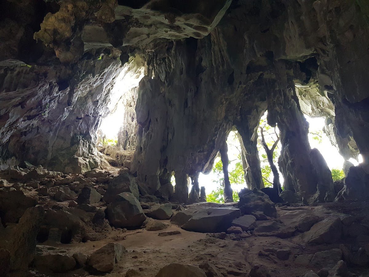
The trail passes through dense lowland to hill jungle typical of Kedah's interior. Expect roots, narrow paths, and sections where the trail gets steep enough that you're using your hands as much as your legs. After rain, the mud is serious — not "mildly inconvenient" mud, but "you will fall if you're not careful" mud.
Lower Trail — Jungle Approach & River Section
The lower section of the trail is where you'll encounter river crossings or river-adjacent terrain. The foot of the mountain is known for river trekking opportunities, which sounds scenic (and it is), but it also means wet feet early and slippery rocks. Take your time here. Rushing a river crossing is how ankles get turned.
Wildlife is active in this section — this is snake country, so eyes on the ground, especially when stepping over logs or into tall grass near the water. Most snakes will move off if they hear you coming, but give them space.

Mid Trail — The Climb Begins
This is where the gradient picks up and the trail earns its "challenging" rating. Steep sections with exposed roots and loose soil are standard. In wet conditions these become genuinely treacherous — this isn't exaggeration, it's just what steep laterite jungle soil does when wet. Trekking poles are worth their weight here, and proper grip on your footwear matters a lot.
There are no confirmed marked checkpoints or water stations on this section based on available information, so don't rely on resupply points mid-trail. Carry what you need from the start.
Upper Trail — Summit Push
The upper trail continues the steep character of the mid section. At 666 m the summit is not at altitude, but the jungle terrain makes the final push feel hard-earned. The summit reportedly opens up to scenic panoramic views — on a clear day this is the payoff for everything below it. Summit camping is possible for those who want an overnight, which would also let you catch sunrise views without the pressure of racing daylight on the descent.

Descent & Safety
Coming down Gunung Bongsu is where most incidents happen — that's true of almost every steep jungle trail in Malaysia. Your legs are tired, your focus drops, and the same slippery sections that were hard on the way up are still slippery on the way out. Slow down deliberately on the descent, even when it feels unnecessary.
Key hazards to take seriously:
- Snakes: Present in the area. Watch where you step and put your hands, especially in leaf litter and near rocky outcrops.
- Steep, muddy terrain: Highest risk during and after rain. This trail does not become "manageable" just because the rain has stopped — surfaces stay wet and slick for hours after.
- River crossings: Water levels can rise quickly after upstream rain even if it's dry where you are. If a crossing looks swollen or fast, wait it out or turn back.
- Getting lost: Route documentation for this trail is limited. Without a guide or GPS track, navigation errors are a real risk, especially on the descent when fatigue sets in.

If weather turns bad while you're on trail — heavy rain, thunder, visibility dropping — turn back. This is not optional advice. A flooded river crossing or a lightning-exposed ridgeline is not worth the summit. The mountain will be there next weekend.
Start early. If you haven't reached the summit by early afternoon and conditions are uncertain, consider whether pushing on is the right call. Finishing the descent before dark is non-negotiable without serious lighting gear.
What to Bring
Pack for a challenging, wet jungle hike with no confirmed water resupply points on trail. Here's what actually matters for Gunung Bongsu specifically:
- Footwear: Trail shoes or boots with serious grip. Running shoes from the pasar malam are not appropriate here.
- Trekking poles: On steep, muddy jungle trail, poles are not optional luxury — they save knees on the descent and keep you upright on wet roots. The TAHAN 3-Section Foldable Hiking Stick V2 (RM99) packs down small enough that there's no excuse not to bring one.
- Knee support: If you have any history of knee issues, don't skip this. The TAHAN Kinetix Knee Guard With Spring Support (RM79) is worth having in your pack — your knees will thank you on the way down.
- Water: Carry at least 2–3 litres. Streams exist on trail but water quality isn't confirmed safe without treatment.
- Food: Bring more than you think you need. Challenging terrain burns through energy fast.
- Rain gear: Lightweight poncho or rain jacket — essential, not optional in Kedah's jungle.
- Headlamp or torch: Even for a day hike. If you're moving slower than expected, finishing in the dark is a real possibility.
- First aid kit: Basic kit including blister treatment, antiseptic, and something for minor cuts.
- Fully charged phone with offline map/GPS track downloaded: Don't rely on mobile data in the jungle.
For a more complete rundown on poles and knee guards for Malaysian jungle hiking, check out our hiking gear guide — it covers what to look for and when each actually makes a difference.
FAQ
How hard is Gunung Bongsu?
Genuinely challenging. The trail is steep, slippery, and muddy — particularly during or after rain. It's rated challenging for a reason, not as a marketing claim. Intermediate to experienced hikers will find it tough but manageable. Beginners should not attempt this solo or without a guide, and should have a solid base of easier hikes first.
How long does Gunung Bongsu take to hike?
Honestly, confirmed timing isn't available for this trail. Given the difficulty level and terrain, expect to set aside a full day. Start at first light and don't assume it'll be a half-day affair. If you're planning to summit camp, plan your ascent pace accordingly.
Do I need a permit for Gunung Bongsu?
Yes. Gunung Bongsu is within Hutan Simpan Gunung Bongsu, a permanent forest reserve, so a permit is required. Apply via iForest at iforest.kedah.gov.my before your hike. Don't leave this until the day before — sort it out well in advance.
Do I need a guide for Gunung Bongsu?
A licensed guide isn't explicitly mandated, but the trail is poorly documented in public sources and the terrain is demanding. Licensed Malim Gunung Perhutanan (MGP) guides are available through Jabatan Perhutanan. If you're not confident in your navigation and don't have a GPS track from a reliable source, bringing a guide is the sensible call.
Camp Nearby?
Making a weekend of it? Gunung Bongsu works well as part of a longer Kedah or northern Malaysia trip. If you want to base yourself nearby the night before for an early start, or wind down after the hike, there are a few good options in the region worth looking at. Sedim Signature Campsite is close to this part of Kedah and a solid choice for hikers who want to stay near the action. KIF Campsite Baling is another option in the broader area if you want something a bit different. If you're open to crossing into Penang for a more comfortable base, Nadi Glamping Suites, Penang is worth a look for those who want a proper rest before or after the climb.
Mike has been camping across Malaysia for over 10 years — from jungle treks in Taman Negara to beach camps in Perhentian. He writes about it so you don't have to find out the hard way. Follow along on TAHAN Outdoor's blog for honest campsite reviews, every week.