Gunung Yong Yap: A Hiker's Guide (2026)
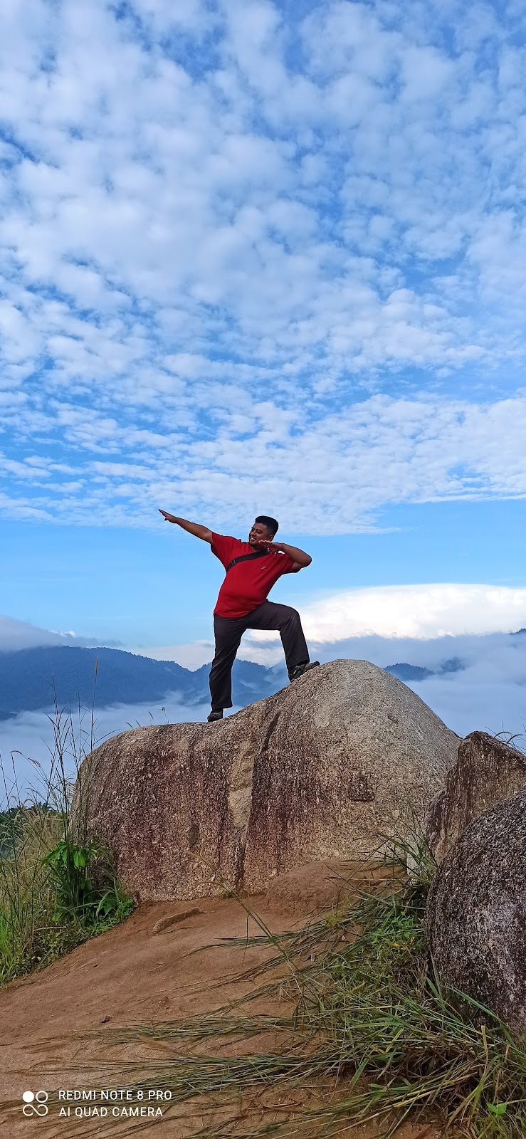
Gunung Yong Yap stands at 2,168 metres in the Titiwangsa Range, Perak — and it earns its reputation the hard way. This is not a casual weekend trail. We're talking dense jungle, perpetually muddy terrain, multiple river crossings, and a summit push that will test both your legs and your head. But those who make it up are rewarded with views across Gunung Yong Belar, Gunung Gayong, and Gunung Korbu — peaks that look even more impressive when you're standing level with them.

The mountain is best known for two approaches: the Kuala Mu route from Sungai Siput (the more popular single-peak option) and the longer southern Pos Renggil route. Serious peak-baggers also do the YYBBTN multi-peak circuit — a 42 km beast linking Yong Yap, Gunung Bubu, and beyond. Whichever route you pick, this hike is strictly for experienced, fit hikers who know what multi-day jungle trekking actually feels like. Beginners, please come back after a few more mountains.
The jungle itself is the real highlight — untouched montane mossy forest, towering trees draped in orchids and ferns, and an ecosystem that feels genuinely wild. Wild Asian elephants and tigers have been confirmed in the area (tracks and dung, mostly, though the possibility of an actual encounter is real). That alone should tell you the kind of terrain we're talking about.
Quick Facts
- Elevation: 2,168 m
- Distance: 17.7–24 km (Kuala Mu, single peak); 40.1 km (Pos Renggil); 42 km (YYBBTN multi-peak circuit)
- Elevation Gain: 1,645 m (Kuala Mu); 2,230 m (Pos Renggil); 2,900 m (YYBBTN circuit)
- Duration: 12–18 hours (Kuala Mu day hike); 3 days/2 nights (YYBBTN circuit, or 2 days with early start)
- Difficulty: Highly challenging — one of the tougher treks in Peninsular Malaysia
- Permit: Mandatory (e-Permit via Forestry Department online system)
- Guide: Mandatory — must be an Orang Asli guide familiar with the terrain
- Parking: Small paid lot at Kuala Mu trailhead
Getting There & Parking
The primary trailhead is at Kampung Gepeh Hilir / Kuala Mu village, near Sungai Siput, Perak (coordinates: 4.835847, 101.334941). Good news: the road is now accessible by ordinary car — you no longer need to arrange a 4WD just to reach the start. There's a small paid parking lot at the trailhead.

The southern Pos Renggil route starts from Pos Renggil via Kebun Durian — a longer and more remote approach, typically used for the full multi-peak traverse. Getting to Pos Renggil requires more planning; check road conditions and access before committing to this route. Your Orang Asli guide will almost certainly know the current situation better than any website will.
Permits & Fees
A permit is mandatory for Gunung Yong Yap. You apply through the Forestry Department of Malaysia's e-Permit system online — give yourself at least 3 weeks before your intended hike date, because approvals are not instant and popular weekends fill up.
On top of the forestry permit, you'll need to do a police registration — hand in your hiker list at the local police station before you head up. Your guide will usually help coordinate this, but confirm it with them early. As for fees, the specific amount varies and wasn't consistent across sources when we put this guide together, so don't budget blind. Ask your guide directly; they typically handle permit costs and may request advance payment for this.
Trail conditions and permit requirements change — always check with the local forestry office or park authority before you go. Or ask the TAHAN Hiking Community on WhatsApp — someone's usually been there that week. Checking a different gunung? Try our free permit checker — instant answer for 90+ Malaysian mountains.
The Trail: What to Expect
Below are the main route stages. Times will vary significantly depending on fitness, pack weight, and how cooperative the mud decides to be that day.

Stage 1 (Kuala Mu): Start → Camp Sungai Chinak / Pondok Camp (≈5 km)
The trail opens with a relatively flat logging track — don't let this fool you into thinking it's going to stay that way. The terrain transitions quickly into dense jungle with a steep gradient, exposed roots everywhere underfoot, and bamboo thickets that demand attention. Camp Sungai Chinak at around 5 km is your best water refill point on the Kuala Mu route — filter and top up here. Seriously, don't skip this.
Stage 2 (Kuala Mu): Camp Sungai Chinak → Summit
From camp, it's a sustained steep climb through montane mossy forest. The terrain gets significantly muddier as you gain elevation — halfway to the summit is reportedly the worst of it. Roots become slicker, footing becomes less reliable, and your pace will drop. This is where hikers who underestimated the day hike option start feeling it mentally. One hiker summed it up honestly: the track isn't impossibly technical, but the sheer length will challenge you mentally — and that's from someone who finished in 17 hours. Budget 12–18 hours total for the day hike.

Stage 1 (Pos Renggil): Kebun Durian (685 m) → Sungai Biru (750 m) → Simpang Y Junction (900 m)
The southern approach starts at a lower elevation and gains height more gradually through the lower jungle. Kebun Durian to Simpang Y is your warm-up — river crossings begin here, and the trail involves multiple stream passages throughout. Wet feet are basically guaranteed; plan your footwear accordingly.
Stage 2 (Pos Renggil): Simpang Y → Kem Puncak Kambing (1,885 m) → Puncak Kayung (1,903 m)
The climb gets serious from Simpang Y junction upwards. Kem Puncak Kambing at 1,885 m is a key camp stop before pushing to Puncak Kayung — at 1,903 m, this is high enough that the mossy forest is thick and atmospheric around you. Views start opening up.

Stage 3 (Pos Renggil / YYBBTN): Col (1,695 m) → Gunung Bubu (1,974 m) → Upper Simpang Y (1,915 m)
This stage is the multi-peak connector for the YYBBTN circuit. The col between peaks is a descent before the push up Gunung Bubu at 1,974 m — a significant climb in its own right. Upper Simpang Y at 1,915 m brings you back to the junction for the descent portion of the circuit.
YYBBTN Circuit Descent: Kem Last Water Point (1,760 m) → Kem Balak Pecah (1,675 m) → Kem Sungai Y Kecil (1,340 m) → Kem Agas (1,135 m) → Lower Simpang Y (900 m)
The clockwise circuit descent drops through a series of camps, each at progressively lower elevation. Last Water Point camp at around 1,760 m (noted in sources as approximately 1,835 m) is your final reliable water source at altitude before the descent continues. Kem Agas at 1,135 m tells you something important in its name — brace for sandflies. The descent through this section involves precarious footing on exposed roots and sharp-edged bamboo; this is where knees and ankles take the biggest beating.
Descent & Safety

Coming down Gunung Yong Yap is not a recovery walk — it's a technical exercise in not sliding down a muddy slope on your backside. The exposed root systems that made the ascent awkward become genuinely slippery on descent, especially if there's been rain (and in a montane forest, there usually has been). Take your time. Rushing descents is how ankles get broken far from help.
Specific hazards to take seriously:
- Mud: Perpetual and deep, especially at mid-elevation on the Kuala Mu route. It will slow you down more than you expect.
- River crossings: Multiple throughout all routes. Water levels rise fast in rain. If a crossing looks sketchy, wait it out.
- Roots and bamboo: Slippery on descent; bamboo edges can cut. Watch your footing and your hands.
- Leeches: Present throughout. Wear gaiters — this is not optional on a trail like this.
- Sandflies: Especially in lower camps. Cover up in the evenings.
- Wildlife: Wild Asian elephant and Malayan tiger presence is confirmed via tracks and evidence in this area. Make noise as you move through dense sections. Do not approach or investigate anything that sounds large. This is their habitat.
Turn back if the weather turns seriously bad. Flash flooding in river crossings is a real danger, and summit conditions in a storm are not safe for anyone. Your guide's call on safety conditions should be respected — they know this terrain far better than any trail app does.
What to Bring
Gunung Yong Yap demands that your gear earns its weight. Here's what actually matters for this hike:
- Trekking poles: Non-negotiable on this terrain. Muddy descents and root-covered climbs will destroy your knees without them. The TAHAN 3-Section Foldable Hiking Stick V2 packs down small enough for multi-day packs and handles the rough stuff well.
- Knee support: For a 12–18 hour day hike or multi-day circuit with this kind of elevation gain, knees need looking after. The TAHAN Kinetix Knee Guard with Spring Support is worth throwing in, especially on descent.
- Water: Carry at least 2–3 litres and refill at Camp Sungai Chinak. A water filter or purification tabs are essential — don't drink straight from streams without treatment.
- Headlamp with spare batteries: A 12–18 hour day hike means you will almost certainly be finishing in the dark. No compromise here.
- Gaiters: For leeches and mud. Seriously, just wear them from the start.
- Food: High-calorie, easy to eat. The climb is long; bonking on a remote jungle trail is miserable.
- Rain gear: Full waterproof jacket and pack cover. Montane forest means rain, and wet gear on a long trek is a cold, heavy problem.
- Trekking boots: Waterproof, ankle-supporting, with aggressive grip. Not trail runners, not sneakers.
- First aid kit: Blister treatment, antiseptic, and something for cuts — bamboo edges are sharp.
- Emergency whistle and power bank: Standard, but don't skip them this far in.
If you're still sorting out your pole and knee guard setup, check out our hiking gear guide — covers what to look for and why it matters on longer climbs.
FAQ
How hard is Gunung Yong Yap?
Very. It's rated highly challenging and considered one of the tougher treks in Peninsular Malaysia. The difficulty isn't just about gradient — it's the distance, the mud, the root terrain, and the mental grind of a 12–18 hour day hike (or multi-day circuit). This is not a trail for first-time jungle hikers or anyone who hasn't done serious multi-day trekking before.
How long does Gunung Yong Yap take?
For the Kuala Mu day hike: most hikers report 12–18 hours. The YYBBTN multi-peak circuit takes 3 days and 2 nights, though very fit groups have done it in 2 days with an early start. Plan for the longer end of any estimate — the terrain has a way of slowing people down.
Do I need a permit for Gunung Yong Yap?
Yes, a permit is mandatory. Apply through the Forestry Department of Malaysia's e-Permit system online, at least 3 weeks in advance. You'll also need to register with the local police station before the hike. A mandatory Orang Asli guide is required as well — your guide will usually help coordinate permits but confirm this with them directly.
Do I need a guide for Gunung Yong Yap?
Yes, it's mandatory — and for good reason. The trail is complex, conditions change, and this is active wildlife territory. Your guide must be an Orang Asli local familiar with the terrain. They'll likely coordinate the permit process and may request advance payment to cover permit costs.
Camp Nearby?
Making a weekend of it? If you're driving up from KL or arriving the day before for an early start, there are good options around Perak worth knowing. Seven Beret Campsite, Batu Kurau is a solid base in northern Perak — worth a look if you want to settle in before heading to Sungai Siput. Down in central Perak, The Hideout Gopeng is a popular stop for hikers in the region. And if you want something a little more developed with facilities, WildRock Campsite Padang Rengas is another Perak option worth checking before you commit. A proper night's sleep before a 12–18 hour jungle day is not a luxury — it's part of the preparation.
Trail conditions, permit updates, and hiking buddies for the weekend — all in one WhatsApp group. Just ask; someone was probably up there last week.
💬 Join the Hiking CommunityFree, one click. No spam — the occasional promo at most.
Gear tip: How to use a trekking pole (and set the height).
Mike has been camping across Malaysia for over 10 years — from jungle treks in Taman Negara to beach camps in Perhentian. He writes about it so you don't have to find out the hard way. Follow along on TAHAN Outdoor's blog for honest campsite reviews, every week.