Bukit Sikai: A Hiker's Guide (2026)
Quick heads-up before we dive in: Bukit Sikai is located in Negeri Sembilan — specifically at Kampung Pulau, Kuala Pilah — not Sarawak. If you searched for Bukit Sikai Sarawak and landed here, you're not alone. The hill in Negeri Sembilan is the one people are actually talking about, and it's the one covered in this guide.

Bukit Sikai is that rare thing: a genuinely short, genuinely rewarding hike that delivers big on views without demanding much from your legs. At 280 metres above sea level and roughly 1.8–2.4 km of trail, this is the kind of place you drive out to on a Saturday morning, summit before the sun gets cruel, and still have time for a proper nasi lemak breakfast on the way home. The main draw is the awan karpet — a carpet of low cloud that settles over the Kuala Pilah valleys in the early morning. When conditions are right, it looks like someone rolled out a white blanket across the hills. People drive two hours from KL just for that view.
Bukit Sikai is genuinely family-friendly and suits beginners well. That said, "easy" is relative — the trail has sandy, cracked ground with sinkholes and loose gravel near the top that will punish anyone in sandals or flat-soled shoes. Come properly shod, come early, and you'll have a great time.
Quick Facts
- Elevation: 280 m above sea level
- Elevation Gain: 120–122 m
- Distance: 1.8–2.4 km (sources vary slightly)
- Duration: 10–40 minutes one-way; 30 minutes to 1 hour round-trip
- Difficulty: Easy to moderately easy
- Permit Required: No formal permit. Private land — public access permitted by landowner.
- Best Time to Go: Arrive by 7:00 AM for awan karpet and cooler temperatures
- Leeches: None reported
Getting There & Parking
Bukit Sikai sits in Sri Menanti, Kuala Pilah, Negeri Sembilan — about two hours' drive from Kuala Lumpur. Use Waze or Google Maps and search for Bukit Sikai Kuala Pilah. One thing worth noting: some hikers have found the map pins online to be slightly off. Look for the birdhouse structure near the trailhead as your landmark — that's your cue you're in the right place.
Parking is roadside or at the location itself. The summit is actually visible from the parking area, which helps you get your bearings quickly. On weekends, especially during the golden hour window for awan karpet, it can get busy early — arrive by 6:30–7:00 AM if you want both a parking spot and the cloud view.

Permits & Fees
No formal permit is required for Bukit Sikai. The hill sits on private land and the owner currently allows public access. That's a privilege, not a right — so bring out everything you bring in, don't damage the farm or vegetation, and treat the place with respect. There have been occasions where access was closed by the landowner, and some hikers have used alternate routes through surrounding palm oil estates when that happened. Check recent trip reports before you make the drive.
Trail conditions and permit requirements change — always check with the local forestry office or park authority before you go. Or ask the TAHAN Hiking Community on WhatsApp — someone's usually been there that week. Checking a different gunung? Try our free permit checker — instant answer for 90+ Malaysian mountains.
The Trail: What to Expect
The trail is short but has a few distinct character changes as you go up. Here's what each section is like.
Parking Area
From the roadside parking, the summit is already visible ahead of you. Get your bearings, apply sunscreen (you'll thank yourself later — there's almost no shade on this trail), and make sure your laces are tight. The trail begins almost immediately.

Red Dirt Path Through Rubber Plantation
The opening stretch runs through a rubber plantation along a red dirt path. It's pleasant enough — some shade here from the rubber trees, relatively flat, and a good warm-up. Enjoy the cover while it lasts because it doesn't last long.
Brushy Vegetation Section
The plantation gives way to brushier, more open vegetation. The trail narrows slightly and the sun starts to hit more directly. The ground here can be cracked and sandy — heavy rain followed by dry heat does a number on this soil type. Watch your footing. There are sinkholes (lubang) along this section that have caught hikers off guard. Step deliberately, especially if you're moving fast.

Steeper Climb to Summit
This is where Bukit Sikai shows its only real teeth. The gradient picks up noticeably and the ground becomes loose gravel and sand. Grip matters here — shoes with proper tread make a meaningful difference. Take your time, especially if the trail is dry (paradoxically, dry sand is slippery in its own way on a slope). If it has rained recently, the cracked soil gets even more unpredictable. Short, deliberate steps over the loose sections.

Summit with Panoramic Views
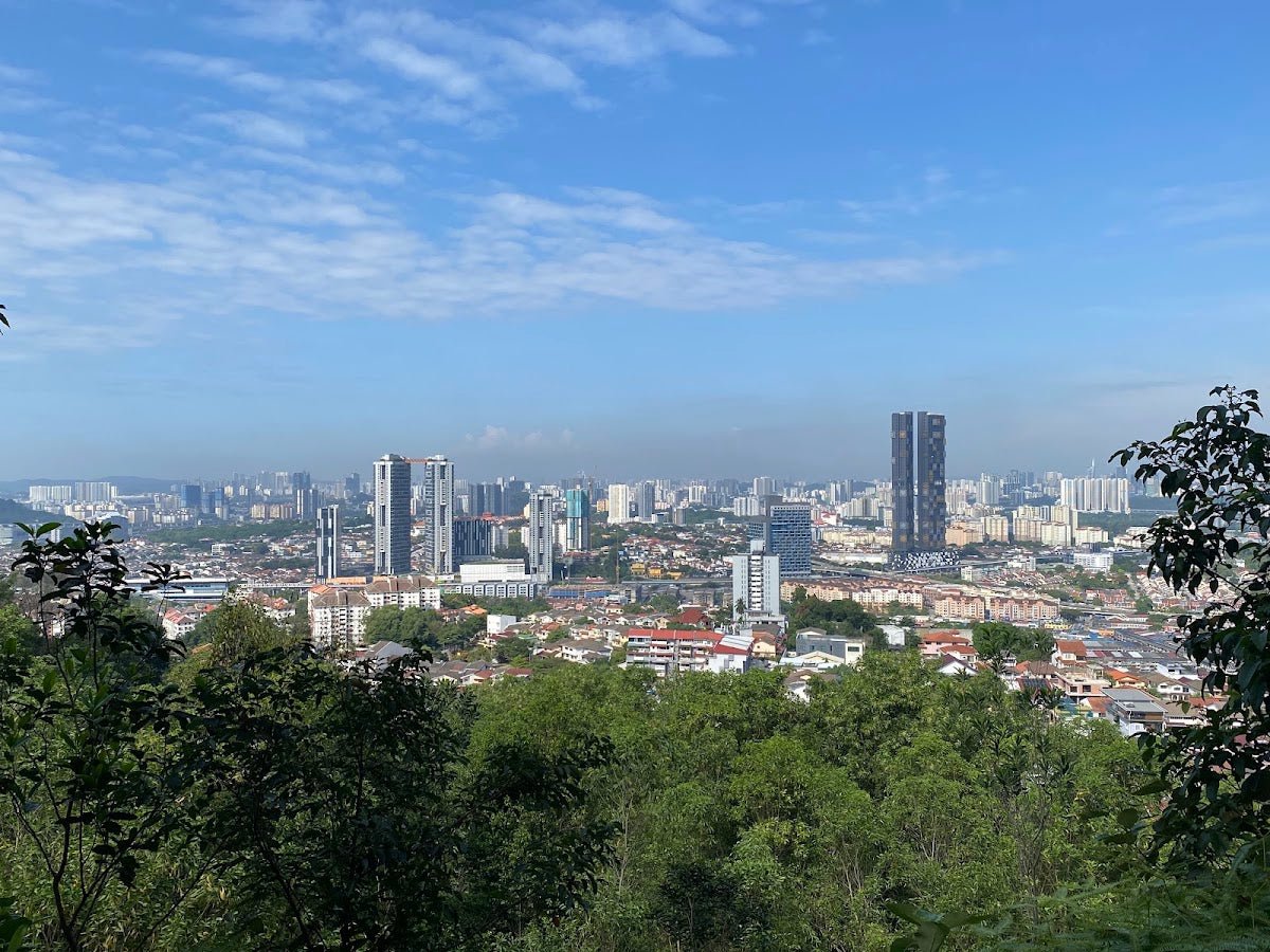
You'll know you've arrived when the view opens up in all directions. There are chairs and tables at the summit — someone has made the effort to make this a proper rest stop, and it's appreciated. On a clear early morning, the 360° panorama over the Kuala Pilah district is genuinely impressive. If you timed it right and the awan karpet is in, this is where you'll understand why people make the two-hour drive from KL. Sit, eat your packed breakfast, take your photos, and take your time before heading down.

Descent & Safety
Coming down Bukit Sikai is where most people run into trouble. The same loose gravel and sandy sections that challenged you on the way up are now under your full body weight going downhill. Slow down. Short steps. Keep your weight slightly back.
The sun is also a serious factor on descent. If you summit around 7:00–7:30 AM, by the time you're heading down the heat is already building and there is almost no shade cover on the trail. Drink water before you feel thirsty.
Key hazards on this hike:
- Loose ground and gravel near summit — high slip risk, especially on descent
- Sandy trail with sinkholes — ankle twist risk; step carefully
- No shade on most of the trail — sun exposure is intense, especially heading down in the morning heat
- Loose rocks and gravel throughout upper section
If weather turns and rain hits while you're up there, wait it out at the summit shelter if possible. Wet sandy soil on a slope is significantly more slippery than the dry version. Don't rush down in the rain just because the trail is short — that's exactly when ankle rolls happen. If there's lightning, get off the summit immediately — exposed hilltops are not where you want to be in a Negeri Sembilan afternoon storm.
What to Bring
Bukit Sikai is short, but the hazards are real enough that preparation matters. Pack for the conditions, not just the distance.
- Hiking shoes with proper grip — this is non-negotiable. The loose, sandy, gravelly terrain on the upper section and summit approach will punish trail runners or sneakers with worn soles. Multiple hikers have flagged this specifically.
- Water — there are no water points on the trail. Bring at least 500ml–1L for this short hike, more in hot weather. A hydration bladder like the TAHAN TrailBladder 2L makes hands-free sipping easy on the steeper sections.
- Sun protection — sunscreen, cap, buff. The trail is largely exposed. This matters more than people expect on a 40-minute hike.
- Trekking poles for those who need them — if your knees don't love downhill or you just want extra stability on the loose gravel, poles genuinely help here. The TAHAN 3-Section Foldable Hiking Stick V2 folds compact enough to carry in a day bag and deploys quickly when you need it on the descent.
- Snacks — summit has seating. Bring something worth eating up there.
- Fully charged phone — for navigation (remember, some map pins are inaccurate — look for the birdhouse landmark).
- Small rubbish bag — the landowner allows access out of goodwill. Pack out everything you bring in.
For a broader look at what gear is worth carrying on Malaysian day hikes, check out our hiking gear guide — covers poles, knee support, and what's actually worth the weight.
FAQ
How hard is Bukit Sikai?
Most sources rate it easy to moderately easy, and for fit hikers that's accurate. The elevation gain is only 120–122 m and the distance is short at 1.8–2.4 km. But the sandy, cracked soil with sinkholes and loose gravel near the summit means it's not a flip-flops-and-stroll kind of hill. If you're reasonably fit and wearing proper shoes, you'll find it manageable. If you haven't exercised in a while, expect the steeper section to feel harder than the distance suggests.
How long does Bukit Sikai take?
One-way to the summit: anywhere from 10 to 40 minutes depending on pace and fitness. Round-trip most hikers report 30 minutes to 1 hour. Budget an hour total including time at the summit, and you'll be fine.
Do I need a permit for Bukit Sikai?
No formal permit is required. The hill is on private land and the owner currently allows public access. That access isn't guaranteed — there have been occasional closures. Always check recent trip reports before making the drive, and when you're there, respect the property.
What's the best time to hike Bukit Sikai?
Early morning — aim to arrive by 7:00 AM. Two reasons: the awan karpet (carpet cloud) phenomenon is a morning thing and usually dissipates as the sun rises and heats the valleys. And the trail has almost no shade, so hiking in the midday heat is genuinely unpleasant. Early morning, cool air, carpet clouds, empty trail — that's the Bukit Sikai experience at its best.
Camp Nearby?
Bukit Sikai itself is a day hike — there's no camping on the hill. But if you're making a weekend of it and want to combine this with some proper Sarawak-side outdoor time, here are a few spots worth looking at: 91 Beach Campsite Miri is a solid beach camping option up north; EnChant Retreat & Glamping Telok Melano offers a more comfortable setup if glamping is your thing; and Lepau Uten Long Urun is a jungle homestay experience worth knowing about if you're heading deeper into Borneo. None of these are next door to Kuala Pilah, but if you're planning a bigger Borneo trip and Bukit Sikai is one stop among many, they're worth bookmarking.
Trail conditions, permit updates, and hiking buddies for the weekend — all in one WhatsApp group. Just ask; someone was probably up there last week.
💬 Join the Hiking CommunityFree, one click. No spam — the occasional promo at most.
Mike has been camping across Malaysia for over 10 years — from jungle treks in Taman Negara to beach camps in Perhentian. He writes about it so you don't have to find out the hard way. Follow along on TAHAN Outdoor's blog for honest campsite reviews, every week.
⛺ Featured in: The 7 Best Hikes in Sarawak (2026)