Bukit Ketumbar, Kuala Lumpur: A Hiker's Guide (2026)
Bukit Ketumbar sits right in the middle of Cheras, sandwiched between condominiums and the SUKE highway, and yet somehow it feels like proper jungle the moment you're on the trail. That contrast — city noise fading into birdsong, pitcher plants growing five minutes from a condo block — is exactly why this place has a loyal following of locals who come back two, three times a week.

This is not a summit-bagger's trophy peak. At 300 m, Bukit Ketumbar is a city hill — but don't confuse modest elevation with easy. The roots, rocks, and steep patches on a wet day will humble you. What it offers instead: multiple routes to suit your mood, genuine KL skyline views, and a community atmosphere that's hard to find on bigger mountains. Good for beginners who want something more than a park walk, trail runners, families with older kids, and anyone who needs a fix of green on a weekday morning.
A heads-up before you go: the permit situation changed in May 2023 when Selangor Forestry designated the area a forest reserve. The current status is genuinely unclear — verify before you visit. More on that below.
Quick Facts
- Summit elevation: 300 m
- Distance: 1.3–5.9 km depending on route (short viewpoint route ~1.3 km, main loop ~2.6 km, extended loop ~3.4–5.9 km)
- Elevation gain: 119–274 m depending on route
- Duration: 30 minutes to 2 hours depending on route chosen
- Difficulty: Moderate — gradual climbs with exposed tree roots, rocks, uneven terrain, some steep sections; ropes available in certain areas
- Permit: Possibly required (RM10 per person, Selangor Forestry) — status unclear, verify before going
- Parking: Free street parking (limited) or paid lot ~RM3
- Café at trailhead: Yes
Getting There & Parking
The trailhead is at the dead end of Jalan 6/95b, Taman Cheras Utama, Cheras Baru, Kuala Lumpur (GPS: 3.103150, 101.753430). Look for the area near Ketumbar Heights Condominium — there's a small shrine at the start of the trail that tells you you're in the right spot.
By Grab from downtown KL it's about 15 minutes, which is honestly the easiest option. The nearest MRT stations are Taman Mutiara, Taman Midah, Taman Pertama, and Taman Connaught — from any of these you'll need a short Grab or e-hailing ride to the trailhead. Coming fully by public transport adds up to around 1 hour 20 minutes.
Parking is a real headache on weekends. Free street parking exists along Jalan 6/95b but fills up fast — if you're arriving after 7 am on a Saturday, don't count on it. There's a paid parking lot near the entrance at around RM3 per entry, and some hikers park at Ketumbar Heights Condominium itself, which means a roughly 400 m walk to the trailhead. Come early or Grab in — that's genuinely the simpler option.

Permits & Fees
This is where it gets murky, and I want to be straight with you. In May 2023, Selangor Forestry designated Bukit Ketumbar a forest reserve and reportedly introduced a permit requirement. The fee is cited as RM10 per person — the standard Selangor forest reserve rate. However, sources conflict: some say permits are actively enforced, others note many hikers simply don't register. Do not take the second group as permission to skip it. If the requirement is in force and you're caught without one, that's on you.
The practical advice: check with the Selangor Forestry Department directly before your visit, and if a permit is required, try to obtain it the day before rather than on the morning of your hike.
Trail conditions and permit requirements change — always check with the local forestry office or park authority before you go. Or ask the TAHAN Hiking Community on WhatsApp — someone's usually been there that week. Checking a different gunung? Try our free permit checker — instant answer for 90+ Malaysian mountains.
The Trail: What to Expect
Bukit Ketumbar has a network of named sub-trails — the Yuan Bao (Ingot) trail, Dog trail, Long trail, SUKE trail (also called New Rock trail), and Cat trail among them. Most hikers do some version of the lopsided loop that takes in the Jungle Gym peak and at least one viewpoint. Here's how it flows:
Trailhead to the First Fork
From the Jalan 6/95b dead end near the shrine, the trail enters jungle almost immediately. Give it two minutes and the condo noise drops away. The path is well-worn and obvious — this is a popular trail with an active local community, so you're unlikely to get lost near the start. Watch your footing from the beginning: exposed tree roots cross the path constantly and the ground is uneven.

The Fork: Left or Right
You'll hit a fork that splits the main loop. Left goes shorter and steeper toward the peak. Right takes the longer, less steep route with flat sections mixed in. Both get you to the same place — it's just a question of whether you want the climb front-loaded or spread out. First-timers often take the right path up and return via the left for variety.
Left Path — Steeper Climb with Rest Stop
Consistent moderate inclines with some genuinely steep bits. There's a rest stop along this route with a bench and some improvised exercise equipment that the local community has put together over the years. Good place to catch your breath. Ropes are available in certain steep sections — use them, especially if the ground is damp.
Right Path — Mixed Terrain with City Views
A mix of moderate and steep inclines with flatter sections in between. There's a rest stop on this route that opens up to city views — first taste of what's waiting at the top. The path is fern-lined in sections and you'll start noticing the flora: moss-covered rocks, pitcher plants if you look carefully, curly ferns. This is proper KL jungle.

Jungle Gym Peak
The main summit landmark is a clearing with community-built exercise equipment — pull-up bars, makeshift stations, the works. This is Bukit Ketumbar's version of a summit cairn. It's social, it's a bit quirky, and it works. This is also the area where wild boar sightings are most common. Do not bring food out in the open here — more on that under hazards.
Viewpoints: Rocky Outcrop, Ingot Stone, Rainbow Umbrella
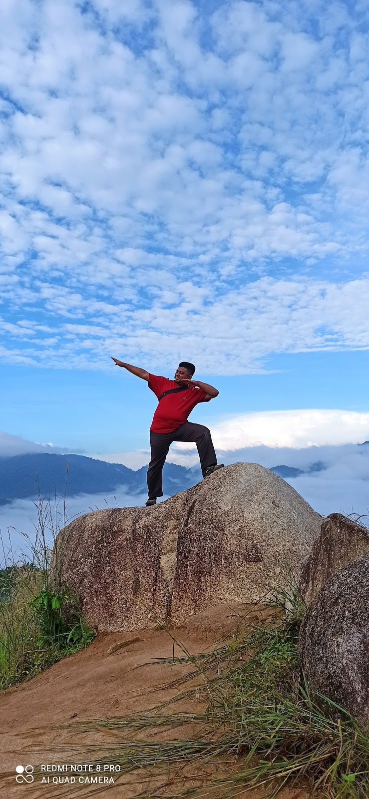
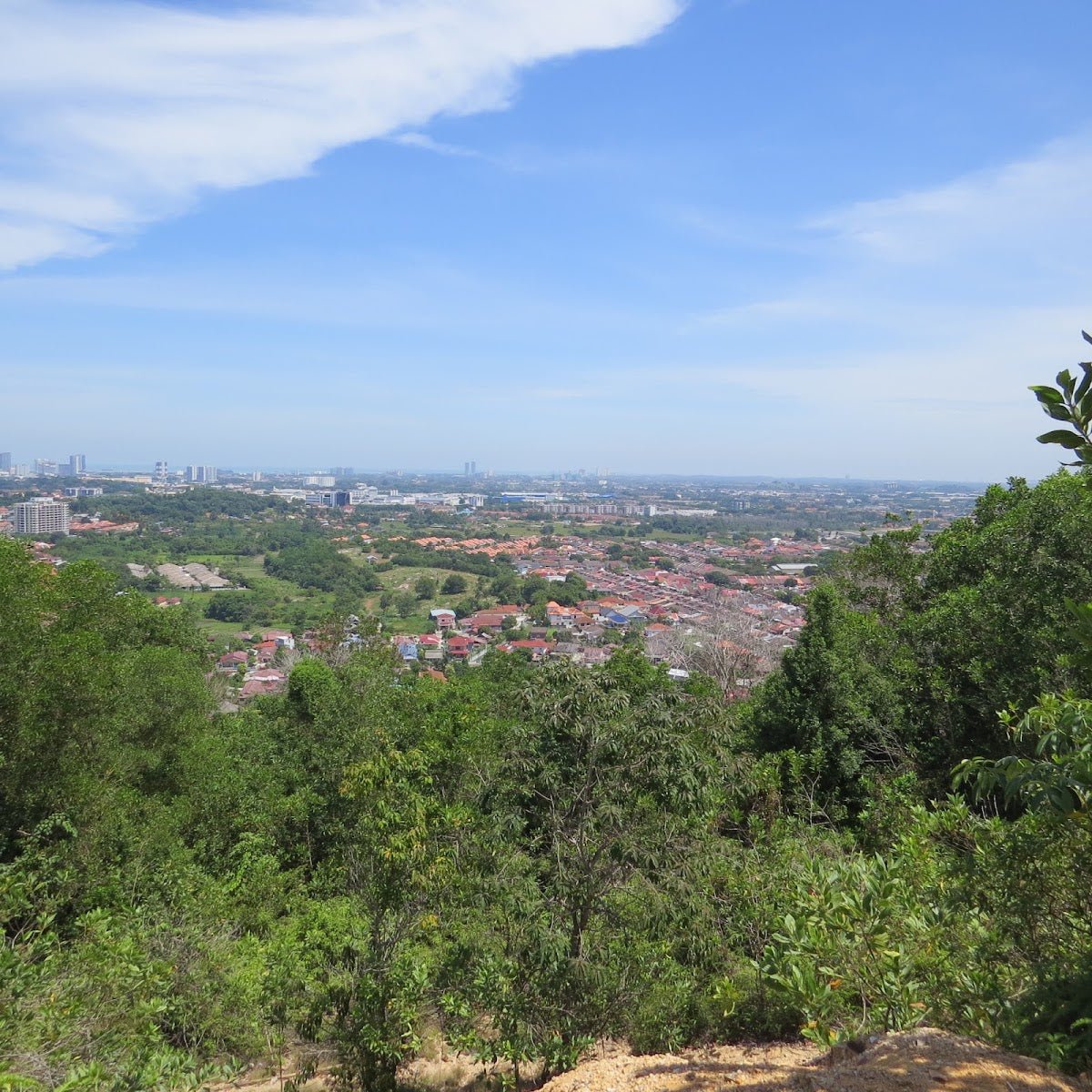
The real reward. The rocky outcrop with prayer flags gives you 270° views of the KL skyline — Petronas Towers, Menara KL, the whole spread from a hill that's somehow still inside the city. The Ingot Stone viewpoint and the Rainbow Umbrella viewpoint each offer their own angles on Cheras and greater KL. These are worth taking your time at, especially in the early morning light.

Completing the Loop
Return via the alternate path to close the loop. The named sub-trails give you options to vary the route — the SUKE trail runs near the highway side and offers views toward the highway corridor, but note that a concrete wall facing the SUKE highway near the steel tower view area has been flagged by hikers as dangerous. Stick to the main marked paths if you're not familiar with the network.
Descent & Safety
Coming down is where most people slip up — literally. The steep sections that felt manageable on the way up become significantly more treacherous on descent, especially after rain. Take it slow, use the ropes where they're provided, and don't try to jog down unless you know this trail well.
Real hazards to know before you go:
- Slippery terrain when wet: The rainy season makes sections of this trail genuinely dangerous. Steep sections become very slippery after rain — if it's been raining or is raining when you arrive, seriously consider coming back another day.
- Wild boars: They congregate around the Jungle Gym area. They have a strong sense of smell and poor eyesight, which makes them unpredictable. Don't bring food out in the open, don't run toward them, give them space.
- Monkeys and snakes: Both present on trail. Respect wildlife, don't feed, don't provoke. Watch where you're stepping, especially on rocky areas.
- Leeches: Occasional presence on trail, more common after rain. Leech socks or long pants help.
- Overgrown side trails: Some side trails are overgrown and can lead you off route. Stick to the main paths, especially if you're unfamiliar with the area.
- Concrete wall near SUKE highway: Flagged by hikers as dangerous near the steel tower view area. Avoid.
If it starts raining heavily while you're on trail, turn back. This is a city hill with a straightforward escape route — use it. There's no summit worth a twisted ankle on a wet root.

What to Bring
Bukit Ketumbar is a short hike but don't treat it like a stroll. The roots and steep sections demand proper footwear — trail shoes or hiking boots with grip, not sneakers. Here's what makes sense for this profile:
- Water: Minimum 1 litre for the short route, 1.5–2 litres for the extended loop. There is a stream on trail but its safety for drinking is unconfirmed — don't rely on it.
- Snacks: Keep them sealed and in your pack, especially around the Jungle Gym area (wild boars).
- Proper footwear: Grip is everything here when wet.
- Leech socks or long pants: Especially in wet season.
- Headlamp or torch: If you're doing a pre-dawn start (popular here — local veterans do it regularly), a proper light beats squinting at your phone screen. The TAHAN Luminate Multifunction Lantern is compact enough to double as a trail light and camp light if you're combining trips.
- Trekking pole: Optional for fit hikers, genuinely useful for anyone with knee concerns on the descent. The TAHAN 3-Section Foldable Hiking Stick V2 folds small enough to clip to your pack when you don't need it. Check out our hiking gear guide if you're still figuring out what's worth carrying.
- Rain jacket or poncho: Weather in KL changes fast. Lightweight poncho takes up almost no space.
- Sunscreen: The viewpoint clearings are exposed.
FAQ
How hard is Bukit Ketumbar?
Moderate — suitable for beginners and moderate hikers, but don't underestimate it. There are exposed tree roots, rocks, uneven terrain, and some genuinely steep sections. The difficulty steps up significantly when the trail is wet. If you can do a brisk 30–45 minute walk without stopping, you'll manage the short route fine. The extended loop demands a bit more.
How long does Bukit Ketumbar take?
Depends entirely on the route. The short viewpoint route takes 30 minutes to 1 hour. The main loop is 1 to 1.5 hours. The extended loop runs 1.5 to 2 hours. Factor in time at the viewpoints — the KL skyline views are worth more than a quick glance.
Do I need a permit for Bukit Ketumbar?
Possibly yes. Since May 2023, Selangor Forestry has designated the area a forest reserve and a permit may be required at RM10 per person. The enforcement situation is unclear based on current reports. Don't assume you can walk in without one — verify with the Selangor Forestry Department before your visit and obtain the permit the day before if it's required.
What's the best time to hike Bukit Ketumbar?
Early morning on weekdays is ideal — cooler, less crowded, and you get the sunrise views. Weekends get busy, and parking gets difficult fast. Avoid hiking right after heavy rain — the steep sections become very slippery. The trail is open year-round but the rainy season demands extra caution.
Camp Nearby?
Bukit Ketumbar isn't an overnight trail — it's a day hike, full stop. But if you're planning a longer weekend in KL and want to combine hiking with a proper camping fix, there are solid options in the area. Making a weekend of it? Check out our reviews of Campguru PJ for gear stocking up before your trip, Cecamping Services for rental options, and Woodz Camp Setapak for an actual overnight camp experience not far from the city. Do Ketumbar in the morning, sort out camp in the afternoon — solid weekend right there.
Trail conditions, permit updates, and hiking buddies for the weekend — all in one WhatsApp group. Just ask; someone was probably up there last week.
💬 Join the Hiking CommunityFree, one click. No spam — the occasional promo at most.
Gear tip: How to use a trekking pole (and set the height).
Mike has been camping across Malaysia for over 10 years — from jungle treks in Taman Negara to beach camps in Perhentian. He writes about it so you don't have to find out the hard way. Follow along on TAHAN Outdoor's blog for honest campsite reviews, every week.