Gunung Gading: A Hiker's Guide (2026)
Gunung Gading National Park sits in Lundu district, about 75 km southwest of Kuching — far enough that most tourists skip it, close enough that you have no excuse. The park was gazetted in 1983 specifically to protect the Rafflesia tuan-mudae, the world's largest flower, and that's still the main reason most people make the drive. But even on a bloomless day, this is a proper jungle hike with steep granite slopes, multiple waterfalls, river crossings, and a summit that earns its elevation.

This is a moderate to challenging hike — don't let the relatively modest elevation fool you. The terrain is relentless in places, particularly on the upper section, and mud after rain turns the slopes properly treacherous. That said, reasonably fit hikers who tackle it at a sensible pace will manage fine. If you're hoping to catch a Rafflesia in bloom, November–December and February–March are your best windows, but the flowers are unpredictable year-round — call the park office before you go.
Overnight camping is not permitted in the park, so this is strictly a day hike. Budget a full day for it. The park closes at 5:00 PM and they mean it.
Quick Facts
- Elevation: 965 m (official Sarawak Forestry Corporation figure; GPS readings from hikers suggest 880–901 m)
- Elevation Gain: 837 m
- Distance: Approximately 3.8 km from park HQ to summit one-way; up to 7.2 km with return depending on route
- Duration: 4.5–6 hours round-trip
- Difficulty: Moderate to Challenging — steep, can be slippery
- Permit Required: Yes — RM10 (Malaysians), RM20 (foreigners)
- Guide Required: Not mandatory, but highly recommended for Rafflesia spotting (approx. RM30)
- Park Hours: 8:00 AM – 5:00 PM daily
- Overnight Camping: Not permitted
Getting There & Parking
The trailhead is at Park Headquarters, Gunung Gading National Park, Lundu district. From Kuching, it's less than 2 hours by car heading southwest — straightforward drive, mostly good road. Regular bus service from Kuching to Lundu is also available if you're not driving, though you'll need to sort onward transport from Lundu town to the park.
Parking is available at park HQ. Specific layout and capacity details weren't available at time of writing, but it's a national park facility so there's dedicated parking — arrive early on weekends and during Rafflesia bloom season as the place fills up faster than you'd expect for somewhere this far from the city.
Permits & Fees
Entry fees are RM10 for Malaysians and RM20 for foreigners. Registration is required — you can do it at park headquarters or online through the Sarawak Forestry Corporation website at sfc.sarawak.gov.my. Online ticketing is available, which is worth using if you want to save time at the gate.
One thing to note: if the park closes due to bad weather, there are no refunds on pre-paid tickets. That's the policy, so go in knowing that.
If you're coming for the Rafflesia, a park guide costs approximately RM30 and is very much worth it — guides know where the active blooms are and you will almost certainly miss them on your own. Call the park office at 082-735144 in advance to check bloom status before making the trip.
Trail conditions and permit requirements change — always check with the local forestry office or park authority before you go. Or ask the TAHAN Hiking Community on WhatsApp — someone's usually been there that week. Checking a different gunung? Try our free permit checker — instant answer for 90+ Malaysian mountains.
The Trail: What to Expect
The route starts gently through lowland rainforest, gives you waterfalls early on to keep morale high, then gets progressively steeper and more demanding as you push toward the summit. The trail is well-used but not paved — expect exposed roots, granite slabs, and mud after rain. Multiple river crossings are part of the deal.

Park Headquarters (39 m) — Start
Register, pay your fees, and get your briefing at park HQ. This is also where you'll meet your guide if you've booked one. Start early — 8:00 AM opening means you should be at the gate right on time, especially if you're targeting the summit. The trail begins through classic Sarawak lowland rainforest, with strangler figs and the sounds of the jungle kicking in immediately.
Waterfall 1 (116 m) — approximately 30 minutes from HQ
First major landmark and a natural rest stop. There's water here if you need to top up, and the waterfall is genuinely beautiful — this section sets the mood for the whole hike. Pace yourself here; the real climbing comes later and beginners have a habit of burning out early on this stretch.

Waterfall 3 (235 m) — approximately 10 minutes from Waterfall 1
Quick jump from Waterfall 1 to Waterfall 3. Another water point, another swimming hole if you want to cool off — though save it for the descent, not on the way up. The trail between the waterfalls is manageable but starts showing you what the terrain is about: roots, rocks, some wet patches. Keep your footing honest.
Waterfall 7 Junction (305 m) — approximately 1 hour from Waterfall 3
This is a significant waypoint. You've covered the waterfall trail section and now the summit trail begins in earnest. There are additional water points at 295 m and 350 m on the summit trail from here. Take stock of how you're feeling at this junction — the next section to the summit is where the gradient bites. If weather is turning or anyone in your group is already struggling, this is a realistic turn-back point.

Batu Apek (195 m)
Elevation drops slightly at Batu Apek — the route has some undulation rather than a straight relentless climb, which is both a relief and a psychological trick because you're giving back height you'll need to regain. This is also a potential Rafflesia spotting zone depending on season, so slow down and look around rather than rushing through.
Summit — Gunung Gading (880–965 m) — approximately 2 hours 10–15 minutes from Waterfall 7
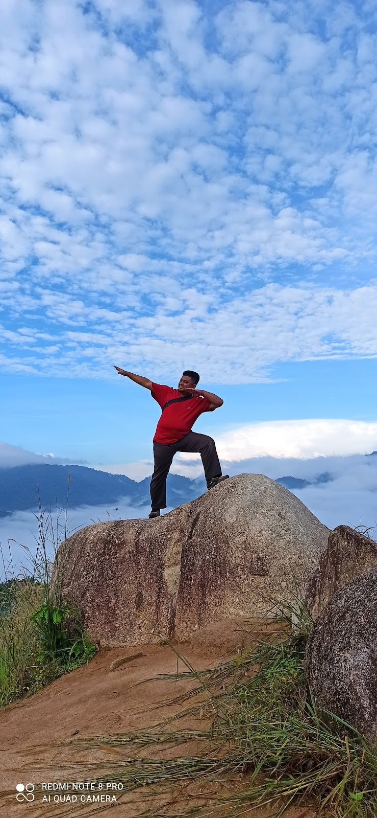
The upper section is steep. Granite slopes with limited handholds, muddy patches between rocky sections, and a gradient that will have you using your hands in places. This is where trekking poles genuinely earn their keep. Some hikers report views from the summit region; conditions vary, and cloud cover is common, so manage expectations on the panorama. The achievement of getting there on Sarawak's jungle terrain is the reward.

Descent & Safety
Coming down Gunung Gading is where most incidents happen. The granite slopes that felt grippy on the way up become proper skating rinks if wet, and tired legs on steep terrain is a bad combination. Take your time on the descent — it's not a race and the park closes at 5:00 PM, so plan your summit time accordingly to give yourself enough buffer.
Key hazards on this trail:
- Steep, slippery slopes — particularly dangerous in rainy season and after rain
- Muddy conditions — wet weather turns the trail significantly harder
- River crossings — multiple crossings; water levels rise fast after rain
- Leeches and biting insects — bring repellent, tuck in your socks, check yourself regularly
- Not recommended for children in wet conditions — the terrain is genuinely hazardous when wet
If weather turns bad mid-hike — heavy rain, darkening skies — turn back. Don't push for the summit when the slopes are becoming slippery and river levels are rising. The mountain will be there next weekend. A twisted ankle or a swollen river crossing won't care about your plans.

What to Bring
Gunung Gading is a full-day jungle hike with elevation gain, river crossings, and the possibility of wet conditions at any time of year. Pack accordingly:
- Water — minimum 2L. There are natural water points on the trail but carry enough from the start
- Food and snacks — high-energy, easy to carry. No warung on the trail
- Trekking poles — genuinely useful on the steep granite descent. The TAHAN 3-Section Foldable Hiking Stick V2 packs down small enough to clip onto your bag when you don't need it, and costs RM99 — reasonable for a stick that'll save your knees on trails like this
- Knee support — 837 m of elevation gain means 837 m coming back down on your joints. If your knees give you trouble on descents, the TAHAN Kinetix Knee Guard With Spring Support (RM79) is worth bringing along
- Leech socks and insect repellent — non-negotiable for Sarawak jungle hiking
- Waterproof or water-resistant footwear — river crossings will get your feet wet regardless, but grip is the priority on wet granite
- Rain jacket or poncho — Sarawak weather is what it is
- First aid basics — plasters, antiseptic, blister kit
- Fully charged phone — for navigation and emergency contact
Not sure what else belongs in your pack for a hike like this? Check out our hiking gear guide for a proper breakdown.
FAQ
How hard is Gunung Gading?
Moderate to challenging — and lean toward challenging if it's been raining. The elevation gain is 837 m and the upper slopes are steep granite that gets slippery fast. Fit hikers who do regular trails will manage it. If you're a first-timer or haven't hiked in a while, do some easier trails first and don't attempt this in wet weather.
How long does the Gunung Gading hike take?
Most hikers complete the round-trip in 4.5–6 hours. Some faster hikers report doing the ascent in around 2 hours 10 minutes, but the realistic range including rest stops and the descent is closer to 5–6 hours. Start at 8:00 AM when the park opens to give yourself full daylight and buffer before the 5:00 PM closing.
Do I need a permit for Gunung Gading?
Yes. Entry fee is RM10 for Malaysians and RM20 for foreigners. You register at park HQ or online at sfc.sarawak.gov.my. No permit, no entry — it's a national park with proper management.
When is the best time to see Rafflesia at Gunung Gading?
Rafflesia blooms most commonly November–December and February–March, but they're genuinely unpredictable and can appear any time of year. Blooms last only a few days once open. Call the park office at 082-735144 or check their Facebook page for current bloom status before making the trip out from Kuching.
Camp Nearby?
Overnight camping isn't allowed inside Gunung Gading National Park, but if you want to make a proper Sarawak weekend of it rather than rushing back to Kuching the same day, there are some good options nearby. Making a weekend of it? EnChant Retreat & Glamping Telok Melano is close to the Lundu area and worth checking out if you want somewhere comfortable to base yourself the night before for that early 8:00 AM start. For something wilder and more off the beaten path in Sarawak, Lepau Uten Long Urun gives you a proper jungle homestay experience. And if you're extending the trip up the coast, 91 Beach Campsite Miri is worth the detour.
Trail conditions, permit updates, and hiking buddies for the weekend — all in one WhatsApp group. Just ask; someone was probably up there last week.
💬 Join the Hiking CommunityFree, one click. No spam — the occasional promo at most.
Mike has been camping across Malaysia for over 10 years — from jungle treks in Taman Negara to beach camps in Perhentian. He writes about it so you don't have to find out the hard way. Follow along on TAHAN Outdoor's blog for honest campsite reviews, every week.
⛺ Featured in: The 7 Best Hikes in Sarawak (2026)