Gunung Tambuyukon: A Hiker's Guide (2026)
Gunung Tambuyukon sits deep in the Kinabalu Park range in Sabah, pushing up to 2,579 metres and ranking among Malaysia's highest peaks — most sources put it third or fourth, depending on how you count. It's not as famous as its neighbour Kinabalu, and that's exactly why serious hikers are drawn to it. This is a real jungle mountain: multi-day, permit-controlled, guide-compulsory, and genuinely difficult. The trail rewards you with pitcher plants, Rafflesia flowers, hornbills, and on a clear day, a view of Kinabalu from the upper ridges.

Tambuyukon is rated Hard to Very Hard. The standard itinerary is 4 days and 3 nights, and some hikers need 5 days depending on fitness. If you're expecting a day hike, this is the wrong mountain. If you're a fit, experienced hiker who's comfortable sleeping in jungle camps, navigating root-tangled terrain, and dealing with leeches — then Tambuyukon will give you one of the most raw, rewarding climbs in Malaysia.
The trail is strictly managed: only 9 climbers are allowed on the trail at any one time, and a licensed guide is compulsory. Permits book out fast, especially for the February–March dry season window. Plan at least 3 months ahead. Seriously, don't leave this to last minute.
Quick Facts
- Summit elevation: 2,579 m
- Distance: Officially 28 km round trip (4D3N standard itinerary); one-way sources vary from 12–17 km
- Duration: 4D3N standard; 3–5 days depending on fitness
- Difficulty: Hard to Very Hard — not for beginners
- Trailhead: Monggis Substation, ~60 km from Kinabalu Park HQ, ~35 km from Poring
- Permit: Required — from Kinabalu Park HQ
- Licensed guide: Compulsory
- Max climbers on trail: 9 at any one time
- Best time: February–March (drier, cooler, clearer views)
Getting There & Parking
The trailhead is at Monggis Substation (GPS: 6.200445, 116.752165), about 60 km from Kinabalu Park HQ and 35 km from Poring Hot Springs. Most hikers base themselves at Poring the night before and make their way to Monggis in the morning. The access road is manageable with an ordinary car, but the final 2 km is a stony track — drive carefully, especially after rain when the gravel road gets slippery and muddy.
Parking is available at the Monggis Substation compound. The substation itself has electricity, ablutions, a cooking area, and bunk bed accommodation at RM 10 per person per night — handy for an early start the next morning or a soft landing after you come back down. Starting elevation at the substation is around 354 m (some sources say 267 m; the exact number varies by source, but you're starting low either way).
There is a northern entry point via Serinsim Substation in Kota Marudu, which would make this a longer traverse, but as of July 2023, that route was temporarily closed. Check the current status with Kinabalu Park HQ before planning any alternative approach.

Permits & Fees
All permits are handled through Kinabalu Park HQ. You can reach them at kinabaluoperationcentre@gmail.com. Here's what the fees look like (2023 rates — verify before you go):
- Permit fee: RM 300/day (foreigners) | RM 150/day (Malaysians)
- Entrance fee: RM 50 (foreigners) | RM 10 (Malaysians)
- Campsite fee: RM 20/night (foreigners) | RM 10/night (Malaysians)
- Licensed guide: RM 175/day for up to 3 hikers — compulsory, no exceptions
Booking 3 or more months in advance is strongly recommended. With only 9 climbers allowed on the trail at any one time, slots fill up fast, especially during peak season. Don't assume you can just show up.
Trail conditions and permit requirements change — always check with the local forestry office or park authority before you go. Or ask the TAHAN Hiking Community on WhatsApp — someone's usually been there that week. Checking a different gunung? Try our free permit checker — instant answer for 90+ Malaysian mountains.
The Trail: What to Expect
Tambuyukon is a jungle climb from bottom to top. You're starting at roughly 354 m and finishing at 2,579 m — that's a serious elevation gain over multiple days through dense Bornean rainforest. The terrain changes dramatically as you climb: from lowland dipterocarp forest thick with wildlife, through mossy highland jungle, to a rocky ridge and exposed summit section that will test your hands, knees, and nerve.

Day 1: Monggis Substation to Kepuakan Camp
You start at Monggis Substation (354 m) and work your way up through lowland and hill dipterocarp rainforest. The first stretch passes through Kulat Camp and Pondok Kera — both are lean-to rest shelters where you can catch your breath and refill water. The trail has gravity-fed water pipes in the lower sections and good water sources through to Kepuakan Camp, but note this clearly: the water contains nickel and must be treated before drinking. No shortcuts on this.
Near Kampung Pinawantai, there are three small stream crossings. These are straightforward in dry conditions but require care after rain. Keep your eyes open for hornbills, wild boar, deer, and if you're lucky, signs of sun bear — claw marks on trees are not uncommon. You'll also start seeing pitcher plants along the trail edges. Kepuakan Camp sits at 1,006 m and is where most groups spend the first night.
Day 2: Kepuakan Camp to Jeneral Camp
This is where the climb starts feeling serious. From Kepuakan (1,006 m) you push up through Musang Camp at 1,524 m and continue to Jeneral Camp, which sits somewhere between 2,000 and 2,134 m depending on which source you believe — the elevation figures in the literature don't fully agree, but you'll know you're high up. The forest gets mossier, the roots get thicker, and the trail gets muddier. Leeches are a constant companion through this section.
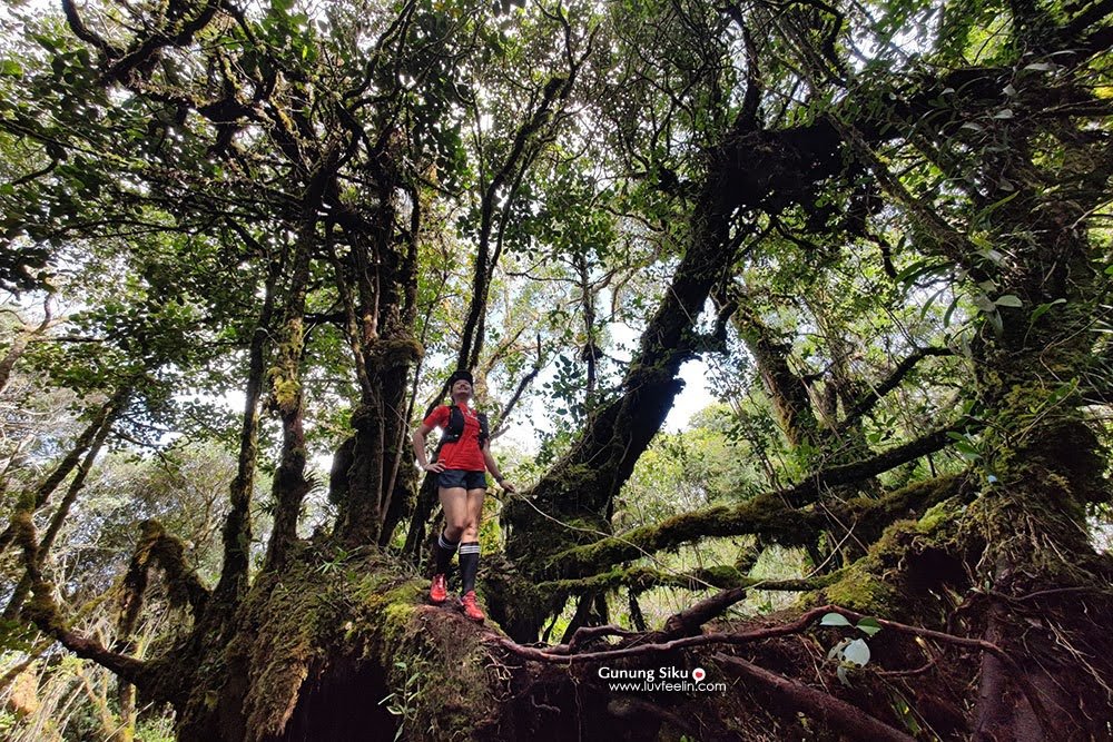
The vegetation in the upper forest is beautiful in a brutal way — dense, green, draped in moss, full of endemic flora including Rafflesia. Hikers have described this section as physically demanding but visually stunning. Jeneral Camp is your base for the summit push.

Day 3: Summit Push — Jeneral Camp to Gunung Tambuyukon Summit (2,579 m)
This is the day. From Jeneral Camp, you'll hit the Rock Garden section — steep, sharp-edged rocks, narrow ridges, and terrain that demands full concentration. You'll be using your hands. This is not technical climbing, but it is serious scrambling on jagged surfaces. The route through the Rock Garden is narrow and exposed in places. Slow down, test your footholds, and don't rush.
The final ascent through dense vegetation involves heavy root entanglement — expect to grab roots and haul yourself up sections rather than walking them. Strong wind and extreme cold at the summit are real possibilities, even in the dry season. Pack your layers and have them accessible, not buried at the bottom of your bag.
At the top: summit signage, panoramic views of surrounding ridges, and on a clear day, Kinabalu in the distance. Those who've made it describe it as one of the most satisfying summits in Malaysia — and honestly, given what it takes to get there, that tracks.

Day 4: Descent Back to Monggis Substation
Descent follows the same route back down. Most groups break it over two sessions — coming down from the summit to Musang or Kepuakan Camp, then pushing out to Monggis on day four. Knees take a beating on the descent through root-tangled terrain. Pace yourself. The trail doesn't get easier just because you're going downhill — slippery roots and steep sections on the way down have caught out plenty of hikers who pushed too fast.
Descent & Safety

Coming down Tambuyukon is not a formality. The same hazards that exist on the way up — slippery mossy roots, steep sections, jagged rocks in the Rock Garden — are just as dangerous on descent, and tired legs make them more so. Take your time, especially through the Rock Garden and any wet sections after rain.
Key hazards to know before you go:
- Leeches — present throughout the lower and mid sections of the trail. Wear gaiters and check yourself at every rest stop.
- Steep slippery trails and mossy tree roots — the primary injury risk on this trail. Never underestimate wet roots.
- Jagged rocks and narrow ridges in the Rock Garden — a fall here is serious. Move deliberately.
- Insect stings — jungle trail standard. Carry antihistamine.
- Strong wind and extreme cold at the summit — this isn't a tropical beach summit. It gets genuinely cold. Dress for it.
- Stream crossings near Kampung Pinawantai — three crossings; check water levels after rain before committing.
- Muddy gravel road access during rainy season — can affect your ability to get in and out by car.
- Dense vegetation and root entanglement on the final ascent — hands required. Gloves help.
- Water must be treated — nickel content in water sources. Treat everything, no exceptions.
If weather closes in on summit day — heavy rain, low cloud making navigation difficult, strong gusts on the Rock Garden section — turn back. The mountain will still be there. A summit attempt in bad conditions on exposed rocky ridges at 2,500+ metres is not a calculated risk, it's a bad idea. Your guide will have the final say on whether to proceed, and listen to them.
What to Bring
Tambuyukon is a multi-day jungle and mountain hike with significant elevation gain, root scrambling, cold summit conditions, and leeches throughout. Pack accordingly:
- Trekking poles — non-negotiable on this terrain. The Root Garden and steep descents will wreck your knees without them. The TAHAN 3-Section Foldable Hiking Stick V2 packs down small enough for your bag and handles Sabah jungle terrain well.
- Knee support — seriously consider the TAHAN Kinetix Knee Guard With Spring Support if your knees have ever complained on long descents. Four days of this trail is a lot of load.
- Water treatment — tablets, filter, or steripen. The water on this trail contains nickel. Treat everything.
- 3–4 litres water carrying capacity — water is available along the lower trail but gaps between sources exist higher up.
- Warm layers and windproof jacket — summit temperatures can drop sharply. Don't leave this to chance.
- Rain gear and dry bags — assume rain. Pack everything in dry bags inside your pack.
- Leech socks or gaiters — mandatory, not optional.
- Gloves — for the Rock Garden and final root scramble section.
- Headlamp with spare batteries — multi-day camp; also useful for early starts on summit day.
- First aid kit including antihistamine — insect stings, minor cuts from rocks.
- High-calorie food for the trail — your guide will advise on camp meals, but carry snacks for the ascent days.
- Sleeping bag suitable for 10–15°C or lower — Jeneral Camp at 2,000+ m gets cold at night.
Not sure what to look for in poles and knee support for Malaysian trails? We put together our hiking gear guide covering what actually matters for local conditions.
FAQ
How hard is Gunung Tambuyukon?
Genuinely hard. AllTrails rates it Hard, Wikiloc users give it 8/10 difficulty. It's a multi-day jungle climb with significant elevation gain, root-tangled and muddy terrain, leech country throughout, a technically demanding Rock Garden section near the summit, and cold exposed conditions at the top. This is not a hike for beginners or first-timers. You should have completed several hard single-day hikes in Malaysia before attempting this one.
How long does it take to climb Gunung Tambuyukon?
The standard itinerary is 4 days and 3 nights (4D3N). Fitter groups sometimes complete it in 3 days; hikers who need more recovery time may take 5 days. The official round-trip distance is listed as 28 km. Build your itinerary around 4D3N and adjust with your guide based on your group's actual pace on the ground.
Do I need a permit and guide for Gunung Tambuyukon?
Yes to both, and there are no exceptions. A permit from Kinabalu Park HQ is required before you set foot on the trail, and a licensed guide is compulsory throughout. Only 9 climbers are allowed on the trail at any one time. Book at least 3 months ahead. Contact Kinabalu Park HQ at kinabaluoperationcentre@gmail.com to start the process.
When is the best time to climb Gunung Tambuyukon?
February and March are the recommended window — drier, cooler, and better chances of clear skies for summit views. March and July are noted as popular attempt months. That said, Sabah weather is Sabah weather — rain can happen any time of year. The trail is open year-round but check current conditions and access road status before you go, especially during the wetter months.
Camp Nearby?
Making a weekend of it — or building a Sabah adventure around the climb? The area around Kinabalu Park and the east Sabah interior has some good basecamp options worth knowing. For something immersive in the Sabah jungle setting, check out Tungog Rainforest Eco Camp, Sabah — it's the kind of place that gets you in the right headspace before a serious mountain. If you're coming from the Kota Belud direction or need somewhere to decompress after the descent, take a look at Dingin Batu Campsite, Kota Belud and Nulinau Glamping Garden, Kota Belud — the latter especially good if your legs are done and you want a proper sleep before the drive back.
Trail conditions, permit updates, and hiking buddies for the weekend — all in one WhatsApp group. Just ask; someone was probably up there last week.
💬 Join the Hiking CommunityFree, one click. No spam — the occasional promo at most.
Mike has been camping across Malaysia for over 10 years — from jungle treks in Taman Negara to beach camps in Perhentian. He writes about it so you don't have to find out the hard way. Follow along on TAHAN Outdoor's blog for honest campsite reviews, every week.
⛺ Featured in: The 7 Best Hikes in Sabah (2026)