Gunung Siku: A Hiker's Guide (2026)
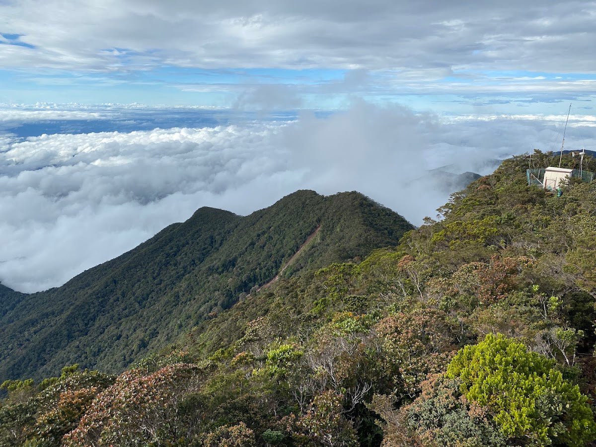
Gunung Siku sits at 1,916m on the Pahang-Perak border, tucked into the highlands near Cameron Highlands but well off the tourist circuit. Most visitors to Cameron Highlands never even hear of it — which is exactly what makes it worth doing. This is a proper jungle trail: mossy forest, wild orchids, endemic birds, and summit views of the Titiwangsa Range from an angle you won't get from Gunung Irau or Brinchang's telecoms tower. If you want solitude and real forest, Siku delivers.

The hike is rated moderate to hard. It's short — most hikers reach the summit in 1.5 to 2.5 hours — but don't let that fool you. The ascent is steep and relentless, involving scrambling over roots and stone structures, fallen logs, and fixed ropes on the sharpest sections. Suitable for beginners who are fit and take it seriously. Not suitable for people who think Cameron Highlands is a stroll because it's a highland resort.
A mandatory guide is required, which actually works in your favour here — the guide network keeps this trail well-managed and the experience more personal. Plan ahead, sort your permit and guide early, and you'll have one of the quieter, more beautiful mornings you can find in the highlands.
Quick Facts
- Elevation: 1,916m (6,286 ft)
- Elevation Gain: Approximately 600m from starting point (sources vary slightly)
- Distance: Approximately 3.3 km one way (sources vary between 3.3 km and 5 km — treat as a guide, not gospel)
- Duration: 1.5–2.5 hours to summit; average reported around 2.5 hours, some strong hikers report under 2 hours
- Difficulty: Moderate to hard — steep ascent, scrambling, fixed ropes involved
- Permit Required: Yes — Pahang Forestry Department
- Guide Required: Yes — mandatory, not optional
- Trail Type: Out and back
Getting There & Parking
The trailhead is at Blue Valley Dam, near a BHP petrol station close to Kampung Raja, about 10 km from Brinchang in Cameron Highlands. To get there from KL, take the North-South Highway and exit at Tapah, then follow the old road up to Cameron Highlands — budget 3 to 4 hours by car depending on traffic. The old road is narrower and more winding than the Simpang Pulai route, so if you're not used to highland driving, take it slow especially in the morning mist.
Parking is roadside or at a small designated area near the trailhead. It's not a proper car park, so arrive early to get a decent spot. Don't leave valuables visible in your car.
Permits & Fees
You need a permit from the Pahang Forestry Department before you hike. Even though Gunung Siku straddles the Pahang-Perak border, the permit authority sits with Pahang. You must register in person at the forestry office before your hiking date — as of 2023, postal payment is no longer accepted, so don't try to sort this remotely at the last minute. The permit fee amount wasn't confirmed in any source we could verify, so contact Pahang Forestry directly for the current figure.
A registered local guide is also mandatory. Hiking without one is a legal offense, not just a guideline. Your guide will help you arrange registration and typically manages camp setup if you're staying overnight. Some guides also offer half-hike options for families or less experienced groups.
Trail conditions and permit requirements change — always check with the local forestry office or park authority before you go. Or ask the TAHAN Hiking Community on WhatsApp — someone's usually been there that week. Checking a different gunung? Try our free permit checker — instant answer for 90+ Malaysian mountains.
The Trail: What to Expect
The trail is well-marked throughout, which helps given how dense the forest gets in the upper sections. Your guide will lead, but it's still worth knowing what's coming.

Kampung Raja Start
You begin from Kampung Raja, in the shadow of vegetable farms that carpet the lower slopes around this part of the highlands. The surroundings feel more agricultural than wild at this point — but that changes fast once you're into the forest proper. Don't underestimate the approach: you're warming up legs that need to be ready for what comes next.
Blue Valley Dam Entrance
The dam marks your proper entry into the trail. There's a winding river in this lower section — take note of it, because water sources on this trail are not well-documented. Don't rely on finding water en route. Carry everything you need from here.

BHP Blue Valley Cliff (10m section)
This is where the trail starts to show its character. A short but sharp cliff section — roughly 10 metres — that introduces you to the hands-on nature of this hike. It's not technical climbing, but it's not walking either. Footwear with grip matters here.
Old Logs Section (45m)
One of the more demanding stretches. You're scrambling over, under, and around fallen logs — some of them slippery with moss, some unstable. Take your time here. This is where rushing causes ankle rolls and falls. Your guide will show you the better lines through, but stay focused.

Y Junction (30m)
A route split. Your guide handles navigation here — follow their lead. This is not a place to make assumptions about which way is correct.
Mossy Forest Zone Approach
This is what people come for. As you gain altitude, the forest transforms. The trees get shorter, gnarlier, draped in thick moss. Wild orchids appear along the trail edges. The air gets noticeably cooler and damper. The soundscape shifts — birds you won't hear at lower elevations, the kind of quiet that genuinely feels separate from the world below. One recent hiker described it simply as feeling peace and quiet from the city hustle, and that's about right. No amount of describing it properly prepares you for how otherworldly the mossy forest looks in person.

Peak Summit (final 10m push)
The final push to the summit is short but steep. On a clear day, you get views of the Titiwangsa Range from a rare angle — Gunung Irau and the wider Cameron Highlands spread out in front of you. Cloud can close in fast up here, so if you get a clear window, don't waste it. Take your photos, eat, drink, and then prepare for the descent.

Descent & Safety
Coming down Gunung Siku is where most incidents happen. The same sections that challenged you on the way up — the cliff face, the old logs, the root scrambles — are worse when your legs are tired and the trail is wet. Take the descent at least as seriously as the climb.
Key hazards to keep in mind throughout the hike:
- Fallen logs requiring scrambling — unstable and slippery when wet
- Steep sections requiring hands-on clambers over stone and root structures
- Fixed ropes and cables on the steepest sections — use them, but don't put your full weight on them blindly
- Slippery trail surfaces throughout, especially in the mossy forest zone
- Tropical storms can arrive with very little warning, any time of year
- Hot, wet, and humid during the day; temperature drops significantly near the summit
If the weather turns while you're on trail — dark clouds building, thunder in the distance, rain starting to sheet — turn back. The summit is not worth a lightning exposure on an open ridge or a fall on a rain-soaked log section. Your guide will make this call with you, but trust the mountain over your schedule.
What to Bring
Given the steep terrain, the scrambling, and the elevation gain, this isn't a trail where you want to be underprepared. Here's what actually matters for Gunung Siku specifically:
- Water: Carry at least 2 litres. Water sources on this trail are not reliable — don't bank on refilling en route. A TAHAN TrailBladder 2L Water Bladder keeps your hands free for the scrambling sections, which matters on this trail more than most.
- Trekking pole: On the steeper descent sections and the log scrambles, a good pole saves your knees. The TAHAN 3-Section Foldable Hiking Stick V2 folds compact when you need both hands free for the ropes and cliff sections, then deploys when you're back on trail.
- Proper hiking footwear: Grip is non-negotiable. Trail runners or hiking boots with actual tread — not running shoes, not sandals.
- Rain gear: Lightweight packable rain jacket. Tropical storms don't give much notice.
- Warm layer: The summit and mossy forest zone get genuinely cold, especially if cloud rolls in. A thin fleece or thermal layer takes up almost no space and you'll want it.
- Snacks and lunch: High-energy food. The hike is short in distance but the effort is real.
- First aid basics: Plasters, antiseptic wipe, and an elastic bandage at minimum.
- Headlamp: Even for a dayhike — if your timing slips or weather slows you, forest dark comes fast.
- Fully charged phone: For emergencies. Don't rely on it for navigation — your guide handles that, but having a working phone matters.
If you're newer to highland hiking and want a broader rundown on poles and knee support for Malaysian trails, check out our hiking gear guide — covers what's worth bringing and what's not.
FAQ
How hard is Gunung Siku?
Moderate to hard, depending on your fitness. The distance is short — around 3.3 km one way — but the ascent is steep and involves real scrambling over roots, rocks, and fallen logs, with fixed ropes on the steepest sections. Fit beginners can manage it, but go in prepared. This is not a casual walk.
How long does Gunung Siku take?
Most hikers report 1.5 to 2.5 hours to reach the summit. AllTrails averages around 2.5 hours; stronger hikers report closer to 1.5 hours. Add your descent time and a proper rest at the top — budget a full half-day at minimum from trailhead to return.
Do I need a permit for Gunung Siku?
Yes. You need a permit from the Pahang Forestry Department, obtained in person before your hike date. You also need a registered local guide — this is legally mandatory. Contact the Pahang Forestry office directly for current permit fees and guide contacts, as the fee wasn't confirmed in available sources and requirements can change.
Is Gunung Siku worth it?
For the mossy forest alone, yes. This is one of the less-visited highland peaks in the Cameron Highlands area, so you get genuine quiet, proper Upper Montane Forest ecosystem, wild orchids, endemic birds, and summit views of the Titiwangsa Range. If you're ticking off popular peaks, this isn't for you. If you want a trail that actually feels like wilderness — it's worth the planning.
Camp Nearby?
Making a weekend of it? Gunung Siku is a day hike, but staying overnight nearby before an early start makes the drive much easier — especially if you're coming from KL or the coast. A few campsites worth considering in the broader Perak region:
- Seven Beret Campsite, Batu Kurau — a well-regarded option in Perak if you want a proper campsite with facilities before or after your hike.
- The Hideout Gopeng — Gopeng is a solid base for Perak adventures; check our full review to see if it suits your group.
- WildRock Campsite Padang Rengas — another Perak option worth considering for a relaxed recovery night after the hike.
Booking a night before the hike also means you arrive at the trailhead fresh instead of driving up from KL at 4am. Worth it.
Trail conditions, permit updates, and hiking buddies for the weekend — all in one WhatsApp group. Just ask; someone was probably up there last week.
💬 Join the Hiking CommunityFree, one click. No spam — the occasional promo at most.
Gear tip: How to use a trekking pole (and set the height).
Mike has been camping across Malaysia for over 10 years — from jungle treks in Taman Negara to beach camps in Perhentian. He writes about it so you don't have to find out the hard way. Follow along on TAHAN Outdoor's blog for honest campsite reviews, every week.