Gunung Stong: A Hiker's Guide (2026)
Gunung Stong sits deep in the Kelantan interior, tucked inside a 21,950-hectare state park near Dabong — and most West Malaysians have never heard of it. That's honestly part of the appeal. This is not a weekend warrior's Instagram hill. The full Baha–Ayam–Stong (BAS) traverse is a serious, physically demanding undertaking with steep muddy terrain, river crossings, and a summit that will test your fitness start to finish. But it pairs something rare: a legitimate multi-peak jungle ridge with one of Southeast Asia's tallest waterfalls sitting right at the base of the trail. The Jelawang Waterfall alone — seven tiers, roughly 300 m tall — would be worth the journey even if you turned around at the campsite.

Who is this hike for? The waterfall trail up to Kem Baha is rated Moderate — doable for fit beginners with decent preparation. The full BAS summit loop is a different beast entirely: Hard, requiring solid fitness, full overnight kit, and a licensed guide. Most hikers do this as a 2 days, 1 night trip minimum, camping at Kem Baha and tackling the ridge on day two. Anyone trying to rush it as a long day trip is making their guide's job very difficult.
The approach via the KTM Jungle Railway from Gua Musang or Kota Bharu is one of the more atmospheric ways to arrive at any Malaysian trailhead. Slow, yes. Worth it? Absolutely. Gunung Stong rewards the patient hiker.
Quick Facts
- Summit elevation: Gunung Stong ~1,422 m | Gunung Ayam ~1,504 m | Gunung Baha 1,309–1,450 m (sources conflict — see trail notes)
- Trailhead to Kem Baha (Jelawang Waterfall trail): ~3.4 km one way, ~392 m elevation gain
- Full BAS loop from Kem Baha: ~14.4 km, ~1,612 m total elevation gain
- Time — trailhead to Kem Baha: 1.5–2 hours
- Time — Kem Baha to Stong summit (one way): 3–4 hours
- Recommended trip format: 2 days / 1 night minimum
- Difficulty: Moderate (waterfall trail to Kem Baha) | Hard (full BAS traverse)
- Permit: Mandatory
- Licensed guide: Mandatory
- Best season: March to October; mid-year June–August is driest
- Location: Gunung Stong State Park, near Jelawang village, Dabong, Kelantan
Getting There & Parking
The trailhead is at Gunung Stong State Park entrance, roughly 1 km from Jelawang village and about 6 km southwest of Dabong town. The starting point is at or near Stong Hill Resort at the park entrance — there's a short 10-minute walk from the road to where the trail actually begins.
By road, approach via Route 66 toward Dabong or via Gua Musang on the D241/Jelawang road. Parking at the trailhead reportedly fits several cars and a few buses, and vehicle entry is reported as free — you pay admission per person separately. That said, parking info can change, so confirm when you contact the park in advance.
By train, take the KTM Jungle Railway (Keretapi Hutan) to Dabong station, then arrange the ~6 km transfer to the park entrance through your guide, a homestay in Dabong, or kedai kopi near the station. Some guides can also arrange pickup from Gua Musang or Kota Bharu — ask when you book. The Jungle Railway is slow but genuinely beautiful through the Kelantan interior. Factor in the timetable and don't cut it close.

Permits & Fees
A permit is mandatory for Gunung Stong State Park, issued by the Kelantan State Forestry Department (Pejabat Hutan Jajahan Kelantan Barat, 17500 Tanah Merah, Kelantan — Tel: 09-9556 055). Permit fee is RM 5 per person per month for Malaysians, and RM 30 per person per month for foreigners. One TripAdvisor reviewer also mentioned a RM 2 gate entrance fee, but this is unconfirmed — check directly when you apply.
On top of the permit, hiring a licensed local guide is mandatory — not optional, not something you can skip if you "know the trail". Guides can be arranged through Stong Hill Resort, registered tour operators, or via the forestry office. Current guide fees are not published anywhere we could verify, so contact the forestry office or resort directly for current rates. Kem Baha campsite has limited capacity, so advanced booking is strongly recommended.
Whether an online E-Permit portal applies to this specific park has not been confirmed — contact the office directly before assuming you can register online. Trail conditions and permit requirements change — always check with the local forestry office or park authority before you go. Checking a different gunung? Try our free permit checker — instant answer for 90+ Malaysian mountains. Or ask the TAHAN Hiking Community on WhatsApp — someone's usually been there that week.
The Trail: What to Expect
The trail divides into two clear phases: the waterfall approach to Kem Baha, and the BAS ridge traverse above camp. They're very different animals. Here's what each section actually involves.
Trailhead / Stong Hill Resort (Park Entrance)
This is where you register, meet your guide, and sort yourself out before moving. There are food stalls, a toilet, and a surau at the entrance. Eat here if you haven't already — there's nothing hot on the trail. Note: multiple recent visitors have flagged that the chalets at Stong Hill Resort are aged and lacking maintenance. Verify current accommodation conditions directly with the resort or your guide operator before counting on it for your stay.

Descent to Jelawang Waterfall Base
Counterintuitively, the trail starts by going down — a descent via cement steps to the base of the lower Jelawang Waterfall tier. There's a bridge viewpoint over the lower falls here. Take your photos now while you still have dry boots. These natural swimming pools at the waterfall base are genuinely stunning, and this is as accessible as the park gets for casual visitors. For hikers continuing up, this is just the start.
Ascending the Jelawang Waterfall (Trailhead to Kem Baha)
From the lower falls, the trail climbs steeply alongside the full multi-tiered Jelawang Waterfall — seven tiers reaching roughly 300 m in total height, making it one of Southeast Asia's tallest waterfalls. This section takes most hikers 1.5 to 2 hours to reach Kem Baha at the top. The terrain is steep and can be slippery when wet, which in a jungle environment means almost always. This is rated Moderate overall, but "moderate" here means sustained uphill on uneven, humid jungle trail — not a casual stroll. Watch your footing on wet rocks near the waterfall sections.
Leeches are present in the lower trail sections. Reports vary on severity — some hikers barely notice them, others get hit regularly. Leech socks or gaiters are a sensible call.

Kem Baha (Base Camp)
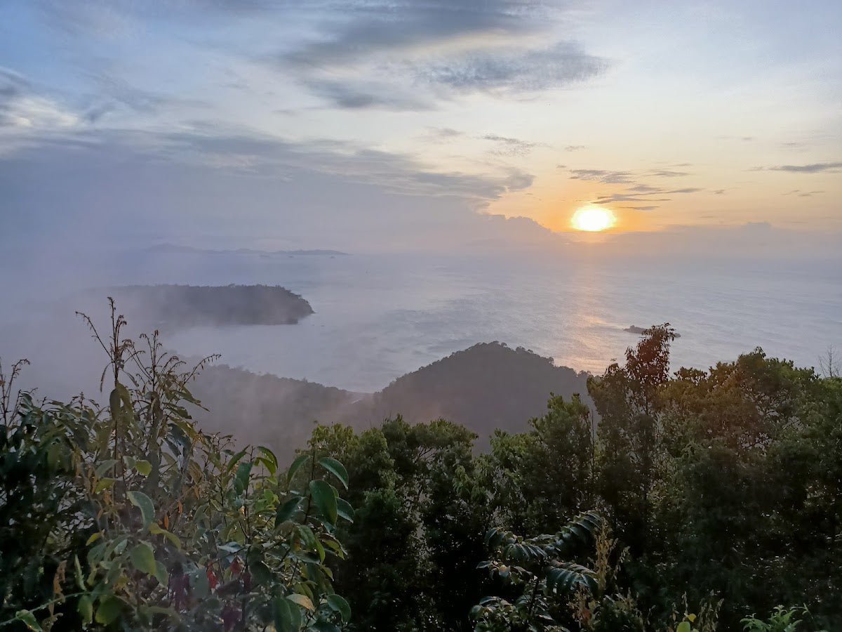
Kem Baha sits at the top of the Jelawang Waterfall, at around 450 m elevation. The campsite has a river water source suitable for drinking and cooking, a cooking hut, sleeping huts, and a basic toilet. This is where you spend your night before the summit push. The sunrise viewpoint here is the reason people set alarms for 5am — worth every minute of effort to get there. A recent hiker summed it up well: "Camped for one night here and watched a beautiful sunrise."
From Kem Baha, there are optional side trips to Telaga Tujuh (Seven Wells) and Kolam Puteri (Princess's Pond) — natural waterfall pools about an hour each from camp. If you have the afternoon free after arrival, these are worth exploring. Open fires are not permitted at the campsite; bring a lightweight stove for cooking.
Sungai Rantai River Crossing
About 30 minutes from Kem Baha on the BAS route, you'll hit the Sungai Rantai crossing. River crossings in Malaysian jungle terrain deserve respect — water levels can change fast, especially after rain. Your guide will assess conditions here. If it's been raining heavily, this is one of the places where you need to genuinely listen to your guide's call.
Sungai Baha and the Ridge Climb
The trail continues to Sungai Baha at roughly 1.5 hours from Kem Baha, then pushes upward toward the ridge. This is where the Hard rating starts making itself felt. Steep, often muddy, with sections requiring hands-and-feet scrambling. The terrain between river crossings and the ridge is consistently demanding. Pace yourself — you still have three peaks ahead.

Gunung Baha Peak
Gunung Baha is the first of the three main peaks, reached at roughly 2.5 hours from Kem Baha. There's a notable conflict in elevation figures across sources — 1,309 m from one trekking source versus 1,450 m from GPS data. We can't resolve this from available information; what's consistent is that it's a significant climb to get here and the trail continues to get tougher from this point.
Gunung Ayam Peak (~1,504 m)
Gunung Ayam, at approximately 1,504 m, is actually the highest point on the BAS traverse — higher than Gunung Stong itself. Reached at around 4 hours 10 minutes from Kem Baha. By this point your legs are already talking to you. This is a real summit, and the effort to reach it is real.
Gunung Stong Summit (~1,422 m)
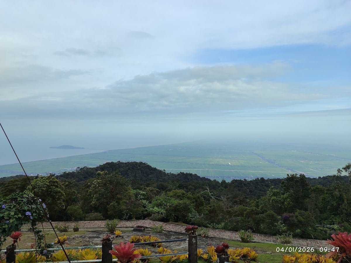
The namesake summit, at approximately 1,422 m, is reached at roughly 7.5 hours from Kem Baha based on GPS tracking data. Be aware: multiple hikers confirm that tree cover limits views at the Gunung Stong summit itself. The journey and the full ridge traverse IS the experience — don't go expecting a panoramic reward at the top. The return from Stong summit back to Kem Baha takes approximately 2 hours.

Descent & Safety
Coming down the Jelawang Waterfall trail is where knees take the real punishment. The steep descent on wet jungle trail alongside the falls demands attention — tired legs and slippery surfaces are a bad combination. Take it slow, use your poles, and step deliberately.
Real hazards on this trail that you need to know about:
- Slippery terrain throughout — steep muddy sections and wet rock near the waterfall; some sections require hands. This is confirmed by multiple sources, not a one-off warning.
- River crossings — Sungai Rantai and others on the BAS route. Water levels change with rain. Never cross against your guide's advice.
- Flash flood risk — especially November to February during the northeast monsoon. Do not hike this trail during monsoon season. This is not a precautionary statement — it's a genuine safety issue.
- Leeches — lower trail sections especially. Leech socks recommended.
- Mosquitoes — long sleeves and trousers are the sensible call, not optional comfort advice.
- Physical exhaustion — the full BAS loop is a full-day hard effort after already hiking to Kem Baha the day before. Know your fitness honestly before committing.
- Park closure for Stong Climbathon — the park closes annually for this event. Exact dates are not publicly confirmed. Check with the Kelantan State Forestry Department before booking.
If weather turns during the ridge section — heavy rain, thunderstorm, rising rivers — turn back. The peaks will still be there next season. The monsoon window (November–February) is a hard no for this trail. March to October, with June to August being the driest window, is when you want to be here.
What to Bring
This is a 2D1N jungle and ridge hike with river crossings and steep slippery terrain. Pack accordingly:
- Trekking poles — non-negotiable on this trail. The descent alongside the waterfall is where poles earn their keep. The TAHAN 3-Section Foldable Hiking Stick V2 (RM99) packs down well for the overnight bag and handles mixed jungle terrain without complaint.
- Knee support — if your knees have any history at all, add the TAHAN Kinetix Knee Guard With Spring Support (RM79). The descent with an overnight pack on slippery trail is exactly the situation these are made for.
- Water — carry enough for the ascent to Kem Baha; you can refill from the river source at camp. On the BAS ridge, there are reportedly two water sources between the summit and Kem Baha, but do not rely on this as your only plan.
- Overnight camping gear — sleeping mat, sleeping bag or liner (it can get cool at elevation), tent or check if sleeping hut space is available when you book
- Lightweight stove + fuel — open fires are not permitted at Kem Baha
- Rain gear — full waterproof jacket and pack cover, not optional
- Leech socks / gaiters
- Long sleeves and trousers for mosquitoes and trail vegetation
- Headlamp + spare batteries — for an early summit start from camp
- Food for 2 days — there's food at the resort entrance; pack enough for the trail and camp
- First aid basics — plasters, antiseptic, rehydration salts
If you're newer to multi-day hiking and not sure what else to throw in, check out our hiking gear guide — it covers the kit decisions that matter most on Malaysian jungle terrain.
FAQ
How hard is the Gunung Stong hike?
Depends which part. The trail from the park entrance to Kem Baha via the Jelawang Waterfall is rated Moderate — steep and can be slippery, but manageable for fit hikers with decent preparation. The full BAS traverse (Baha–Ayam–Stong ridge loop) is rated Hard. Terrain is consistently steep, often muddy, involves river crossings, and requires hands-on scrambling in sections. Serious fitness is required. Don't plan the full BAS if you're still building your hiking legs.
How long does Gunung Stong take?
The waterfall trail to Kem Baha takes 1.5 to 2 hours one way. From Kem Baha to the Gunung Stong summit is another 3 to 4 hours one way, with the full BAS loop from Kem Baha taking a full day (under 10 hours) according to multiple sources. Most hikers strongly recommend the 2 days / 1 night format — camp at Kem Baha, summit on day two. There is a single-source account of completing the summit and back in around 4 to 5 hours total, but this is not the typical experience and shouldn't be used for planning purposes unless you have confirmed that fitness level.
Do I need a permit for Gunung Stong?
Yes, a permit is mandatory. It's issued by the Kelantan State Forestry Department (Pejabat Hutan Jajahan Kelantan Barat — Tel: 09-9556 055). The fee is RM 5 per person per month for Malaysians and RM 30 per person per month for foreigners. On top of the permit, a licensed guide is also mandatory — this is not a self-guided hike. Contact the forestry office or Stong Hill Resort to arrange both before you travel.
What is the best time to hike Gunung Stong?
March to October is the recommended window, outside the northeast monsoon season. June to August is cited as the driest period by multiple hikers. Avoid November to February — heavy rain and flash flood risk make this trail genuinely dangerous during monsoon season. Also check with the forestry department whether the annual Stong Climbathon closure falls during your planned dates.
Camp Nearby?
Making a weekend of it? If you want to add an extra night in the Kelantan interior before or after Gunung Stong, there are a few options worth knowing about. Campsite Kenerong 108 is a solid base camp option in the Kelantan region worth checking out. If you're coming from the Tanah Merah direction (where the forestry office is located), Lata Hujan Training Centre, Tanah Merah is a convenient overnight option. And if you're making a full Kelantan trip of it with family or a group, D'Jiwa Campsite & Picnic, Bachok on the coast is a pleasant contrast to the jungle interior before heading home.
Trail conditions, permit updates, and hiking buddies for the weekend — all in one WhatsApp group. Just ask; someone was probably up there last week.
💬 Join the Hiking CommunityFree, one click. No spam — the occasional promo at most.
Gear tip: Water bladder or bottle on a humid trail.
Mike has been camping across Malaysia for over 10 years — from jungle treks in Taman Negara to beach camps in Perhentian. He writes about it so you don't have to find out the hard way. Follow along on TAHAN Outdoor's blog for honest campsite reviews, every week.
⛺ Featured in: The 10 Toughest Hikes in Peninsular Malaysia (2026)
⛺ Featured in: Air Terjun Kelantan: 6 Latas and the Jelawang Giant (2026)