Gunung Semanggol: A Hiker's Guide (2026)
Gunung Semanggol is one of Perak's best-kept secrets — a compact little hill tucked behind the village of Simpang Ampat Semanggol that punches well above its modest 390 m elevation. Don't let the numbers fool you. The summit views stretch across Bukit Merah Laketown, the green padi fields of the valley, and on a clear morning, all the way to Bukit Larut. That panorama for roughly 2 hours of effort? Pretty good deal.

This hike suits beginners who want a genuine taste of forest trail climbing — not a leisurely walk in the park, but nothing that requires ropes-and-rescue experience either. Difficulty ratings across the internet are all over the place (AllTrails calls it Hard, Wikiloc gives it a 3/10 Easy), so let me be straight: the trail is steep, particularly in the upper 75%, and it gets genuinely slippery when wet. Fit beginners manage the summit in 1.5 to 2 hours. If you're just starting out, budget up to 4 hours round trip and don't rush.
The big draw for most people is the sunrise hike. Catch the mist lifting off Tasik Merah as the sun comes up over the valley, and you'll understand why regulars keep coming back. Dog-friendly trail too, for those who hike with a four-legged companion.
Quick Facts
- Summit elevation: 390 m
- Elevation gain: 357–380 m
- Distance: 3.2–3.7 km out-and-back
- Duration: 1–4 hours depending on fitness; typically 1.5–2 hours to summit
- Difficulty: Easy to moderate (steep sections; beginners can do it but expect a workout)
- Permit required: Yes — RM 10 per person + RM 20 processing fee
- Guide required: No, but advisable for early morning hikes
- Dog-friendly: Yes
Getting There & Parking
The trailhead is at Masjid An-Nur Kampung Bukit Semanggol, Jalan Kampung Tengah, Simpang Empat, Semanggol, 34400, Perak. GPS coordinates: 4.9519°N, 100.6503°E. Plug that into Waze or Google Maps and it'll get you there.
From the North–South Expressway, exit at either Bukit Merah or Kamunting. From Taiping, you're looking at roughly 30 minutes. Follow signboards for Jalan Semanggol. The last stretch runs through village roads — drive slowly, and watch for the occasional wild boar crossing (seriously, there have been reports, more on that below).
Parking is roadside near the mosque, with room for around 30 vehicles. Park courteously — this is a residential area and the locals are allowing hikers to use their space. There's also an open carpark about 1 km before the trailhead, opposite Sek Ren Islam All-Ehya Asshariff, if the mosque area is full. No official facilities at either spot, so sort out your toilet situation before you arrive.

Permits & Fees
You need a permit for Gunung Semanggol. The fee is RM 10 per person with a RM 20 processing fee, issued by the Jabatan Perhutanan Negeri Perak (Perak State Forestry Department). Apply online through their ePermit system on the department website and pay via JomPay. Sort this out before you show up at the trailhead — don't be that person.
Trail conditions and permit requirements change — always check with the local forestry office or park authority before you go.
The Trail: What to Expect
The route is straightforward out-and-back. Follow the red and yellow trail markers — they're your best friend when the path forks or gets confusing, especially in patches of dense forest. Don't ignore them.

Stage 1: Trailhead to Oil Palm Plantation
You start just beside Masjid An-Nur and immediately transition from village lane to trail. The first 10 minutes or so are the gentlest part of the entire hike — flat-ish, easy to warm up. Enjoy it while it lasts. You'll pass through an oil palm plantation here. It's open, can get warm even in the morning, and there's no shade. If you're doing the sunrise hike, you'll likely be walking this section by torchlight — bring a headlamp.
Stage 2: Entering the Forest
Once the plantation is behind you, the forest closes in. The path narrows and the terrain changes — exposed roots and small rocks underfoot now, so watch your footing. There are reportedly two small streams (anak sungai) visible in this stretch after the plantation, though this comes from a single source so don't rely on them as water points. Bring your own water regardless.
Trail markings become more important here. On sunny days, dappled light makes it harder to spot where the trail continues; on wet days, mud and leaf litter disguise the path. Stick to the markers.

Stage 3: The Steep Section (This Is the Real Hike)
Here's what most trail descriptions underplay: roughly 75% of this route is steep. Not "a bit of a climb" — properly steep, with knotted ropes fixed to assist on the sharper pitches. Use them. This section is where fitness levels split the group and where slower hikers will want to take breaks. That's fine — just keep moving at your own pace and don't skip the ropes because you think you don't need them.
Wet rock and exposed roots here are the main injury risk. One hiker put it well: the first 10 minutes are easy, then it's pretty much relentless incline for 50 minutes or more. Honest assessment, that. If it's rained recently — including the night before — this section gets seriously slippery. In that case, consider turning around. A bruised ego heals faster than a twisted ankle.

Stage 4: Summit Plateau
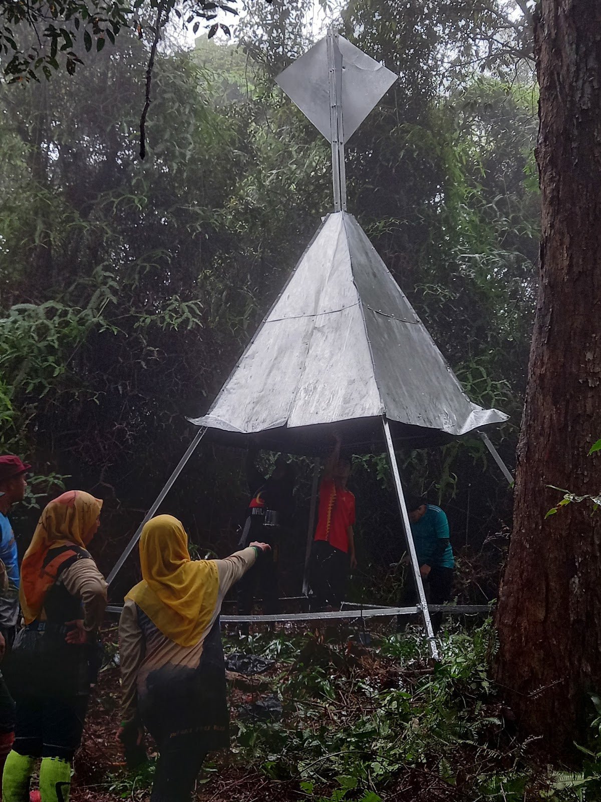
Push through the steep section and you arrive at a small flat plateau shaded by fern trees. There's a flat prayer area at the top — locals use it, keep it clean and respect the space. The 360-degree view opens up here: Bukit Merah Laketown, the rice fields of the valley, and Bukit Larut on a clear day. For sunrise hikers, the view over Tasik Merah as the mist lifts is the kind of thing you remember. Worth every metre of that climb.
Geologically, Gunung Semanggol sits on Permian–Triassic sediment formations — the Semanggol Formation — which makes it of interest beyond just the view.

Descent & Safety
Coming down is faster but don't get careless. The steep sections with ropes are just as technical on descent — arguably more so, because tired legs and gravity are working against you. Take your time on those rope sections. Most trail injuries happen on the way down, not up.
A fit hiker can descend in 45 minutes to an hour. If you're newer to hiking, budget closer to 1.5 hours going down.
Real hazards on this trail:
- Slippery conditions when wet — this is the big one. Do not hike on rainy days or right after heavy rain. The rocky, rooty sections become genuinely dangerous.
- Exposed roots and small rocks — ankle-rolling terrain throughout the forest section.
- Confusing trail junctions — the path can be unclear in forested sections, especially in poor light or after rain. Follow the red/yellow markers.
- No shade on the plantation and lower section — afternoon heat here is brutal. Start early.
- Wild boar on the access road — reported crossing. Rare, but worth knowing. Don't panic, give them space.
Turn back if weather rolls in unexpectedly. Gunung Semanggol will still be there next weekend. A 390 m hill in the rain with slippery ropes is not the place for bravado.
What to Bring
This is a short hike but don't under-prepare just because it's under 4 km. The steep terrain and sun exposure demand a proper kit:
- Water: Minimum 1 litre per person. There are no reliable water sources on trail. More if you're hiking in heat.
- Trekking poles: The steep rope sections and rooty descent are much kinder to your knees with poles. The TAHAN 3-Section Foldable Hiking Stick V2 packs down small enough to throw in a daypack — good option for a short hike like this where you don't always want to carry poles the whole way.
- Knee support: If your knees feel the descent on trails, consider the TAHAN Kinetix Knee Guard With Spring Support — particularly worth it on steep descents. More on choosing the right gear in our hiking gear guide.
- Headlamp or torch: Essential for sunrise hikes. You'll be on trail before first light.
- Non-slip footwear: Trail shoes or hiking boots with grip. Not running shoes, not sandals.
- Light rain jacket: Weather in Perak can shift fast. A packable layer takes up almost no space.
- Snacks: Short hike but you'll want something at the summit.
- Permit: Have your ePermit confirmation ready on your phone.
- Fully charged phone: For navigation, photos, and emergency contact.
FAQ
How hard is Gunung Semanggol?
Honestly, harder than it looks on paper. The elevation gain of 357–380 m over a short distance means it's steep — roughly 75% of the trail is uphill slog with knotted ropes on the sharper bits. Fit beginners can handle it, but if you've never hiked before, this will feel tough. AllTrails rates it Hard; Wikiloc gives it a 3/10 Easy. The honest answer is somewhere in between — easy to moderate, but with sections that demand proper footwear and some leg strength.
How long does Gunung Semanggol take?
Most hikers reach the summit in 1.5 to 2 hours from the trailhead. Fitter hikers have done it in under 1 hour 15 minutes. Total round trip is typically around 2 hours, but budget up to 4 hours if you're taking it easy, stopping for photos, or it's your first time on this kind of terrain.
Do I need a permit for Gunung Semanggol?
Yes. The permit is RM 10 per person plus a RM 20 processing fee, issued by the Jabatan Perhutanan Negeri Perak. Apply through their ePermit system online and pay via JomPay. Get this done before you head out — don't assume you can sort it at the trailhead.
Is Gunung Semanggol suitable for beginners?
Generally yes, with caveats. The trail is well-marked, relatively short, and doesn't require technical climbing. But the steep sections are real, and wet conditions make it genuinely slippery. Come with proper footwear, decent fitness, and do not attempt it after rain. Bring someone experienced along if it's your first jungle trail, especially for early morning hikes before full daylight.
Camp Nearby?
Making a weekend of it? Gunung Semanggol is an early start hike, so spending the night nearby makes a lot of sense — you're not trying to drive from KL at 3 AM just to catch a sunrise. A few campsites worth looking at in the broader Perak region: Seven Beret Campsite, Batu Kurau is the closest option to Semanggol and a solid base for this kind of trip. If you want something with a bit more character, check out WildRock Campsite Padang Rengas — Padang Rengas is just down the road. Further south but worth the drive if you're exploring more of Perak, The Hideout Gopeng is a favourite for those who like their campsites with some scenery.
Mike has been camping across Malaysia for over 10 years — from jungle treks in Taman Negara to beach camps in Perhentian. He writes about it so you don't have to find out the hard way. Follow along on TAHAN Outdoor's blog for honest campsite reviews, every week.