Gunung Machinchang, Langkawi: A Hiker's Guide (2026)
Gunung Machinchang is not your average weekend hike. At around 701 m (sources put it anywhere from 701 to 713 m depending on who measured it), it's one of the oldest mountains in Southeast Asia — geologists put the rock at 550 million years old. That alone makes it worth the sweat. But what really draws hikers here is the full package: dense rainforest, a genuinely challenging ascent, and a summit view of Langkawi's islands and the Andaman Sea that you won't forget in a hurry.

This is a hike that suits fit, experienced hikers — not casual strollers. The final section involves rope-assisted climbing on exposed rocky terrain. If you've been doing moderate jungle trails and want your first serious step up, Machinchang is a solid choice. If you're still finding Cameron Highlands a stretch, come back after more training. Either way, you're in a UNESCO World Geopark, and the mountain will be here waiting.
The Seven Wells waterfall (Telaga Tujuh) at the base is also a bonus — cool off in the pools after the descent and you'll feel like a completely different person. This guide covers everything you need to plan your Machinchang hike properly, from permits to the rope section near the top.
Quick Facts
- Summit elevation: ~701 m (readings vary: 701–713 m depending on source)
- Distance: Approximately 6.3 km out-and-back (sources vary; one-way may be around 5.8 km)
- Elevation gain: ~645 m to over 700 m (sources disagree — expect a significant climb either way)
- Ascent time: 2–4 hours up; total round trip 3.5–4+ hours
- Difficulty: Challenging — steep ascent with exposed sections, rope-assisted near the top
- Trailhead: Seven Wells Waterfall (Telaga Tujuh), Teluk Burau, Langkawi
- Permit: Required — RM10 per person
- Access hours: 8:30 AM – 6:00 PM
- Guide required: No
Getting There & Parking
The main access point is Oriental Village at Teluk Burau on the northwest side of Langkawi. From there, you have two parking options. Free parking is available at Oriental Village itself, but it's a 15-minute walk to the paid entrance. Alternatively, you can park directly at the Telaga Tujuh Waterfall entrance (paid parking) and save yourself that walk.
From the parking area, 638 concrete steps lead up to the Seven Wells pools — that's your warm-up before the actual trail even starts. Don't underestimate it. Most people reach Langkawi by ferry from Kuala Perlis, Kuala Kedah, or Penang, then rent a car or scooter on the island. Public transport around Langkawi is limited, so having your own wheels makes life a lot easier. The trailhead area can get busy, especially on weekends and during school holidays — arrive early.

Permits & Fees
A permit is required to hike Gunung Machinchang. Apply online through the Kedah Forestry Department portal at iforest.kedah.gov.my before your visit. The fee is RM10 (~USD2.45) per person, paid at the entrance on the day.
The trail is open from 8:30 AM to 6:00 PM. No permit, no entry — don't try to wing it. The system exists to manage visitor numbers in a protected Geopark, and rangers do check. Note: if you're thinking of combining this with the Langkawi Sky Bridge cable car, that facility has its own separate operating hours and closes roughly two days a month for maintenance — check their schedule independently.
Trail conditions and permit requirements change — always check with the local forestry office or park authority before you go. Or ask the TAHAN Hiking Community on WhatsApp — someone's usually been there that week. Checking a different gunung? Try our free permit checker — instant answer for 90+ Malaysian mountains.
The Trail: What to Expect
The trail is well-marked and has assistance ropes at the critical sections. That said, "well-assisted" doesn't mean easy. The terrain changes significantly as you gain altitude, from a comfortable riverside walk at the bottom to a steep, rocky scramble near the top. Here's how it breaks down stage by stage.
Stage 1: Seven Wells Waterfall & Trail Start
Your hike begins at the Seven Wells pools (Telaga Tujuh) — a series of natural rock pools fed by a river. After climbing those 638 concrete steps from the carpark, the main jungle trail begins here. The area is beautiful and popular with tourists too, so expect company at the base. Sign in, get your permit checked, and head into the forest.

Stage 2: River Trail with Bridge Crossings
The initial section follows the river upstream through lowland dipterocarp forest — big trees, decent shade, manageable gradient. There are several bridge crossings along this stretch. The bridges are in place, but take care, especially if it's been raining recently. The river has water throughout, but don't drink untreated from it. Pace yourself here — this is the easiest part of the hike and people burn energy too fast trying to rush through it.
Stage 3: Kem Saintis Campground
Kem Saintis (Scientists' Camp) is your first proper waypoint. It's a campground, so if you spot tents, there are overnight hikers around. Take a short break here, check in on how you're feeling, and make sure everyone in your group is still good to push on. The forest gets denser and the trail starts climbing more noticeably from here.
Stage 4: Tokayah Camp — Where the Forest Changes
Tokayah Camp is the second waypoint and is marked by impressive large buttress roots — the kind that make you stop and take photos. By this point, you've transitioned from lowland forest into more montane terrain. The trees are smaller, there's more moss, and the air feels slightly cooler. It's a good place to eat something and hydrate properly before the hard part begins.

Stage 5: The Steep Section — Ropes Required
After Tokayah, the trail kicks up hard. This is the section that filters out underprepared hikers. The gradient is serious and the terrain is rocky and rooty. There are assistance ropes in place here and you will use them — not as a nice option, but because the incline demands it. Take your time, test your footing before committing your weight, and don't rush anyone behind you. Wet conditions make this section genuinely dangerous. If it has rained recently or rain starts while you're on this section, the call to turn back is a sensible one, not a weakness.
Stage 6: Rocky Final Section to Summit
The final push is a rocky scramble. Use your hands where needed. The exposure here is real — you're on open rock with drop-offs nearby in sections. This is where fitting, sturdy footwear earns its keep. Some hikers report this final rocky climb taking close to an hour. Budget accordingly. Don't cut corners on time — you also need daylight for the descent.

Stage 7: Summit Observation Deck
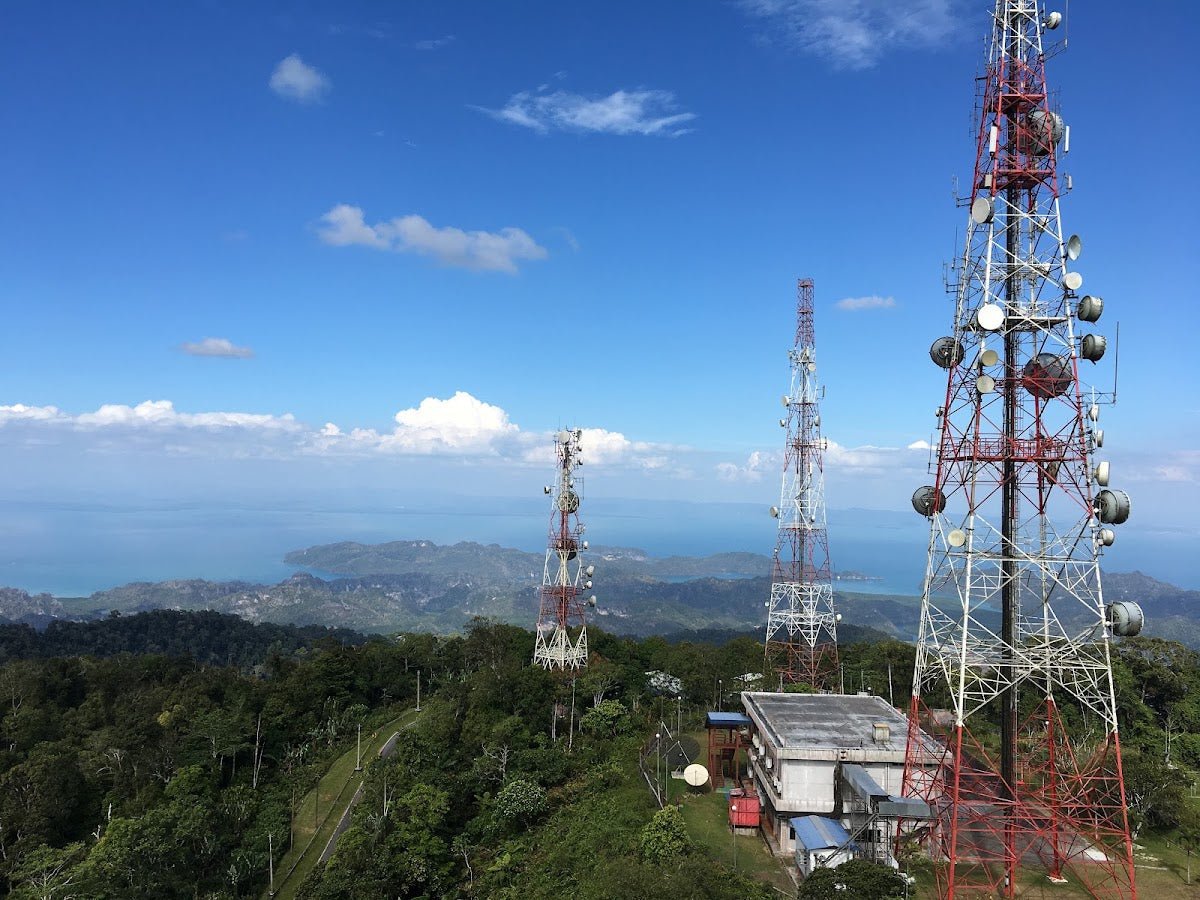
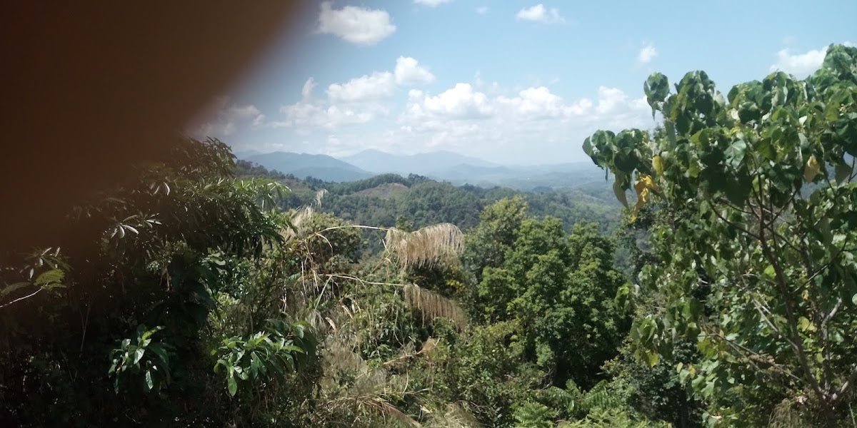
The summit has an observation deck and on a clear day the view is everything — Langkawi's islands spread out below you, the Andaman Sea beyond that, and on really clear days you can see the Malaysian mainland. The 550-million-year-old rock under your feet is the oldest exposed geology in Southeast Asia. Take it in. You earned it.

Descent & Safety
Coming down Machinchang is where knees take punishment and ankles roll. The same steep sections that challenged you on the way up are now wet with your sweat and worn smooth by boots. Take your time — most trail accidents happen on the descent, not the ascent. Use the ropes on the way down too, facing into the slope on the steepest sections.
Key hazards to know before you go:
- Leeches: Active during the rainy season (approximately November to May). Wear long socks, use leech socks or leech repellent. They're harmless but a nuisance.
- Steep and exposed sections: Especially the final ascent. No place for sandals or loose footwear.
- Tropical heat and humidity: Even in dry season, exertion in a Malaysian jungle is brutal. Start early.
- Slippery conditions in wet weather: Avoid this hike during or after rain. This is not a soft caution — the rocky sections become genuinely hazardous.
- Macaques: Groups of dusky leaf monkeys are reported along the trail and some can be aggressive. Don't feed them, don't make direct eye contact, and keep food stored away.
- River crossings: Bridges are in place but exercise care, particularly after rainfall.
Turn back if: rain starts while you're on the exposed rocky sections, anyone in your group is struggling seriously, or you're running out of daylight. The trail closes at 6:00 PM — plan your start time to give yourself a full buffer. Starting at first light or by 8:30 AM when the gate opens is strongly recommended.
What to Bring
- Footwear: Proper hiking boots or grippy trail runners. Not trail sandals, not sneakers. Non-negotiable on this terrain.
- Water: Carry at least 2 litres per person. You can refill at the Seven Wells pools at the trailhead. A hydration bladder keeps your hands free on the scramble sections — the TAHAN TrailBladder 2L works well for a hike at this duration and intensity.
- Food: Energy bars, dates, nuts — calorie-dense and light to carry. A proper meal for after.
- Knee support and trekking poles: The descent is hard on knees especially. If you have any previous knee issues (or want to protect them), trekking poles help a lot on the steep sections — our hiking gear guide covers what to look for and the TAHAN 3-Section Foldable Hiking Stick V2 folds down small enough to clip to your bag when you're using both hands to scramble.
- Rain jacket or poncho: Even in dry season, afternoon showers happen in Langkawi. Pack light but pack it.
- Leech socks or repellent: If you're hiking between November and May.
- Headlamp: Useful if you start at first light or in case the descent runs long.
- Sun protection: Hat, sunscreen — the summit is exposed.
- Permit confirmation: Have your iForest permit confirmation on your phone or printed.
FAQ
How hard is Gunung Machinchang?
Challenging. That's the honest answer. The lower trail through the forest is manageable, but the upper sections — particularly after Tokayah Camp — are steep, exposed, and require rope assistance. The final rocky scramble to the summit demands good fitness, confidence on uneven terrain, and appropriate footwear. If you're a regular weekend hiker in decent shape, you'll get there. If you're a beginner, train up first.
How long does it take to hike Gunung Machinchang?
Ascent takes most hikers between 2 and 4 hours depending on fitness and how many breaks you take. Total round trip is typically 3.5 to 4+ hours. Add buffer time for photos at the summit and cooling off at Seven Wells on the way back. Don't start late — the trail closes at 6:00 PM.
Do I need a permit to hike Gunung Machinchang?
Yes. You must register and apply online in advance via the Kedah Forestry Department portal at iforest.kedah.gov.my. The fee is RM10 per person, paid at the entrance. Access is from 8:30 AM to 6:00 PM only. There's no walk-in permit option as far as current information shows — sort it out before you arrive at the trailhead.
What's the best time to hike Gunung Machinchang?
Dry season (roughly November to April) gives you the best conditions — sunny skies, no leeches, firmer trail. Start as early as the gate allows (8:30 AM) to beat the heat and afternoon crowds. Avoid hiking during rain or immediately after heavy rain — the rocky upper sections become seriously slippery and the risk of a bad fall goes up considerably.
Camp Nearby?
Making a weekend of it? Machinchang is worth more than a day trip. If you want to base yourself on the mainland side of things, check out our review of Sedim Signature Campsite in Kedah — it's a solid base if you're combining trips in the region. Penang's within reach too: Nadi Glamping Suites, Penang is a good call if you want comfort between hikes. And if you're exploring inland Kedah, KIF Campsite Baling is worth a look. Staying the night before an early morning start is always the smarter play — Langkawi is a beautiful island and the 8:30 AM gate opening rewards those who are already on the island and rested.
Trail conditions, permit updates, and hiking buddies for the weekend — all in one WhatsApp group. Just ask; someone was probably up there last week.
💬 Join the Hiking CommunityFree, one click. No spam — the occasional promo at most.
Gear tip: Water bladder or bottle on a humid trail.
Mike has been camping across Malaysia for over 10 years — from jungle treks in Taman Negara to beach camps in Perhentian. He writes about it so you don't have to find out the hard way. Follow along on TAHAN Outdoor's blog for honest campsite reviews, every week.