Gunung Korbu: A Hiker's Guide (2026)
Gunung Korbu stands at 2,183 m — the second highest peak in Peninsular Malaysia and the highest in Perak. That sounds impressive on paper, and it is. But what makes Korbu genuinely hard isn't the number. It's the cumulative punishment: days of heat and humidity with a full overnight pack, six river crossings before you've even warmed up, deep mud that swallows your boots on the steep upper sections, and a pre-dawn summit push that starts at 2 or 3am from camp. This is not a weekend day hike. It is a multi-day expedition into serious jungle terrain.

Most people tackle Korbu over 3 days and 2 nights — and that's the sensible approach. Day-trippers and fast-packers do make the return journey in 10–12 hours, but that's a small minority of very fit, very experienced hikers. The draw here is real: Perak's highest summit, a shot at the KorGa double (Korbu + Gunung Gayong at 2,173 m — the 4th highest peak in Peninsular Malaysia), and a place in the Malaysia G7 logbook. If you're chasing the G7, Korbu is one of the harder ones — don't underestimate it.
This guide is for anyone planning the standard 3D2N route from Ulu Kinta Dam. Whether you're solo-planning or going with a licensed guide (which you should be), read all of this before you book anything.
Quick Facts
- Elevation: 2,183 m (Gunung Korbu); Gunung Gayong 2,173 m (optional extension)
- Total distance: Approximately 20–26 km out-and-back for Korbu only (sources disagree — budget for the longer end); Korbu + Gayong combined approximately 25.7 km out-and-back
- Elevation gain: Approximately 2,408 m for the Korbu + Gayong combined route
- Duration: Standard trip 3 days / 2 nights; one-way to summit averages 6–7 hours from Kem Seroja; fast-packers can do a full return in 10–12 hours (not recommended for most)
- Difficulty: Hard / Challenging — considered one of the toughest G7 trails; not suitable for first-time hikers
- Trailhead: Ulu Kinta Dam (Empangan Sultan Azlan Shah), Ulu Kinta, Perak — approximately 25 km from Ipoh city centre
- Permit required: Yes — two separate permits (Forestry Department + dam site access)
- Guide required: Officially compulsory; treat it as non-negotiable until you confirm otherwise with Perak Forestry Department
Getting There & Parking
The trailhead is at Ulu Kinta Dam (Empangan Sultan Azlan Shah), roughly 25 km from Ipoh city centre. You drive through the dam gate to reach the actual trailhead — note that gate hours are quoted as 6am–7pm by one source, but another reported the gate only opening at 9–10am. Don't assume. Confirm the current dam gate hours directly with the dam authority before you plan your arrival.
There's no public transport out here. You need your own vehicle or an arranged pickup — hire car from Ipoh is the most practical option for most hikers. Stock up on last supplies near Institut Pendidikan Guru (IPG) before heading to the dam; once you pass that point, there's nothing. From the forestry or park office area, it's roughly another 15 minutes' drive to the actual trailhead start.
Parking at the trailhead is limited. Carpool wherever possible. There are no public facilities at the trailhead — sort out your toilet stop earlier.

Permits & Fees
You need two separate permits for Gunung Korbu, and sorting both out in advance is non-negotiable.
First, the Forestry Department permit from Jabatan Perhutanan Negeri Perak (Perak State Forestry Department). This can be registered and paid online through the Forestry Department of Malaysia e-Permit portal. Apply at least 3 weeks before your planned trip — don't leave this to the last minute.
Second, a dam site access permit to enter through Empangan Sultan Azlan Shah / Ulu Kinta Dam. The exact issuing authority — check directly with the dam operator or state water authority when you apply for your forestry permit.
Exact permit fees in RM are not published in any source I can confirm — check the Perak State Forestry Department e-Permit portal directly for current rates. Also be aware: Gunung Korbu has a history of sudden, unannounced closures by Perak forest authorities, including a closure in 2022 with no stated reopening date. Always verify current trail status before you book transport, guides, or permits. Trail conditions and permit requirements change — always check with the local forestry office or park authority before you go. Or ask the TAHAN Hiking Community on WhatsApp — someone's usually been there that week. Checking a different gunung? Try our free permit checker — instant answer for 90+ Malaysian mountains.
The Trail: What to Expect
The standard route is an out-and-back from Ulu Kinta Dam. Here's the trail broken into stages.
Stage 1: Trailhead to Kem Seroja (Day 1)
Most hikers reach Kem Seroja in 2.5 to 5 hours depending on pace and pack weight. The lower valley section involves six river crossings — this is where navigation trips up first-timers. The trail transitions from river walking to forest trail, and that junction is genuinely confusing. Follow your guide. If you miss the turn onto the forest trail, you will get lost. All crossings had markers as of 2018, but don't count on that being current.
Along the way, there's a detour left off the main trail to Kem Balak Waterfall (Big Log Waterfall) — worth a look if you have the energy and time early on.

Leeches start here and don't stop. The lower section near Sungai Ulu Kinta is particularly bad — do your leech checks at every break, not just at camp. Sandflies and sweat bees are also reported at the riverside camps. Kem Seroja itself is a large camp by the river, with space for multiple groups on busy weekends. You can bathe in the river and refill water here. Treat all water.
Stage 2: Kem Seroja to Kem Kijang
The second campsite, Kem Kijang, is your next milestone and has a river water point. This is also one of your last comfortable rest stops before the terrain starts to bite harder. Fill up your water here — seriously.

Stage 3: Last Water Point
Above Kem Kijang, you'll reach the Last Water Point — a stream or river crossing that is the final resupply before the ridgeline. There is no water above this point. None. Carry as much as you realistically can. This is not the place to be optimistic about your water needs at altitude at 3am.
Stage 4: Bukit Botak and the Upper Ridge
After the Last Water Point, the trail hits Bukit Botak — an open, cleared section where on a clear day you get your first proper views of Korbu's ridgeline. Don't let the view distract you from what's coming: the section beyond Bukit Botak is steep, exposed, and has been flagged as very dangerous by experienced operators. Deep, slick mud is a constant companion on these upper slopes. Take your time. There are metal ladders on the final section to the summit — treat these with full respect in wet conditions.

Stage 5: Anak Korbu to Summit
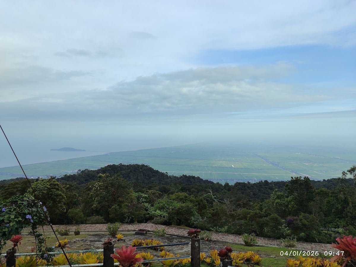
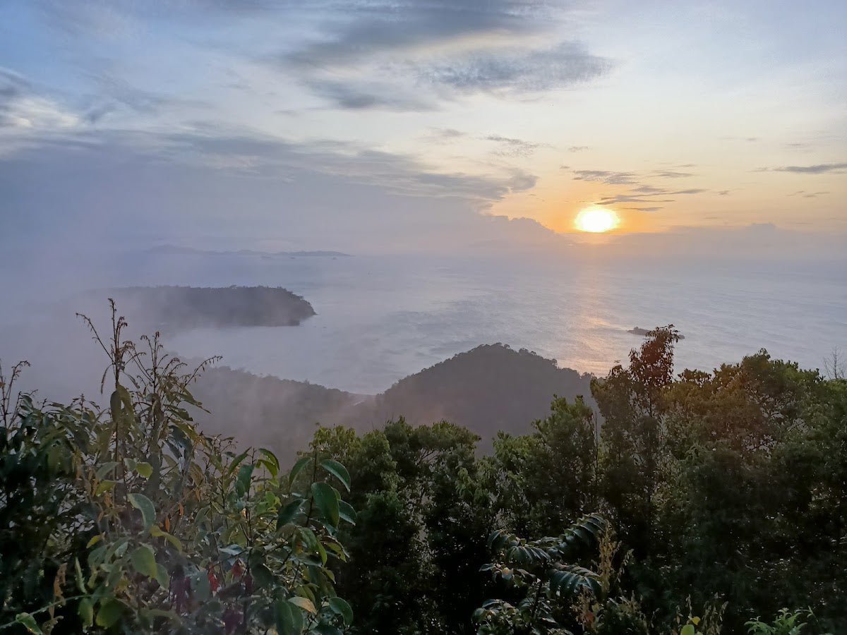
You'll pass Anak Korbu — a sub-peak — before reaching the main summit. The pre-dawn push from Kem Seroja (typically starting 2–3am on Day 2) means you'll be doing most of this section in headlamp light. Budget 2–3 hours from Kem Seroja to the summit for a fit group. The summit sits at 2,183 m and is frequently cloud-covered — sunrise views when they do appear are apparently worth the suffering.
Optional Extension: Gunung Gayong (2,173 m)
The KorGa combination — adding Gunung Gayong after Korbu — is about 1 to 1.5 hours each way from the Korbu summit across a rugged saddle. It bags Peninsular Malaysia's 4th highest peak and is part of the G7 challenge. One hiker quoted above made it to Korbu and admitted Gayong was a step too far that day — that's an honest assessment and not unusual.
Critical navigation warning for the Gayong section: about 3–5 minutes before Gayong summit (on your left when heading Korbu→Gayong), there is a junction known as 'Simpang Proton'. This leads to the V2/Trans-Titiwangsa trail and has led hikers seriously off-route. Do not take that left turn. If you're doing Gayong without a guide, you need to know this junction exists before you leave camp.
At least one tour operator enforces a cut-off time of 13:30 at Korbu summit — if you're not there by then, you turn back regardless. Even if you're not with that specific operator, that's a reasonable benchmark for self-managed groups given the descent time required.

Descent & Safety
The descent retraces your ascent route. Tired legs on steep, muddy trail — this is where most accidents happen. The mud that slowed you going up is just as slick coming down, and the metal ladder section near the summit needs the same care in descent.
Key hazards summary for this trail:
- Six river crossings in the lower valley — flash flooding risk in wet weather; do not attempt crossing swollen rivers
- Deep, slick mud on steep upper sections — gaiters and trekking poles are not optional
- Steep and exposed ridge between Bukit Botak and summit — take extra care in wet conditions
- Metal ladders near summit — slippery when wet
- Navigation hazard at river-to-forest trail transitions — easy to miss without a guide
- 'Simpang Proton' junction near Gayong — wrong turn leads to Trans-Titiwangsa; potentially dangerous misdirection
- Leeches throughout — bring repellent, salt, leech socks; check constantly
- Cold ridge and summit temperatures — approximately 5–10°C at night, potentially below 5°C after 3am at higher elevation camps; a warm layer is essential
- Heat and humidity in the lower sections — significant dehydration risk even before you gain elevation
- Summit cloud cover — views not guaranteed; cloud can close in fast
If weather turns bad — heavy rain, thunderstorm, rapidly rising rivers — turn back. The river crossings become genuinely dangerous in high water. There is no summit view worth a flash flood crossing. This trail has no emergency shelter above camp level.
What to Bring
This is a multi-day jungle and alpine hike. Your packing has to cover humid rainforest valley walking, river crossings, cold ridgeline nights, and a pre-dawn summit push. Here's what this specific trail demands:
- Trekking poles: Non-negotiable on this trail. The mud on the upper sections and the knee strain on a long descent make poles essential — I rate the TAHAN 3-Section Foldable Hiking Stick V2 for the price point; it packs down small and handles the mud well
- Knee support: Two nights of camp sleeping and then a 2–3am summit push means your knees are going into Day 2 already worked. The TAHAN Kinetix Knee Guard With Spring Support is worth throwing in your pack, especially for the descent
- Water capacity: Carry enough to cover the section from Last Water Point to summit and back — that's a significant dry stretch at altitude. A hydration bladder makes drinking while moving easier; treat all water from river sources
- Headlamp with fresh batteries: A pre-dawn start at 2–3am means hours of hiking in darkness. Bring a backup light source. The headlamp is not optional
- Warm layers: 5–10°C at the ridgeline at night. A fleece or insulated jacket is essential — don't talk yourself out of packing it to save weight
- Gaiters: The mud on this trail is serious. Gaiters keep mud out of your boots and reduce leech entry points
- Leech protection: Leech socks, salt, insect repellent. Check your body at every stop, not just at camp
- Rain gear: Full waterproof jacket; pack liner for your bag
- 3 days of food: No resupply on trail. Cook simple, calorie-dense meals; camp fuel and stove if you're cooking
- First aid: Blister treatment, antiseptic for leech wounds, any personal medications
- Permit documents: Both permits, printed or accessible offline
For a broader look at poles and knee support for Malaysian trails, check out our hiking gear guide — it's worth reading before you pack.
FAQ
How hard is Gunung Korbu?
Officially rated Hard / Challenging, and that rating is accurate. Korbu is considered one of the toughest trails in the G7 list — not because of raw elevation but because of the combination: multi-day heavy pack, six river crossings, relentless mud, steep ridgeline, and a pre-dawn summit push. It is not recommended for first-time hikers. Come with at least a few multi-day jungle hikes under your belt first.
How long does it take to hike Gunung Korbu?
The standard trip is 3 days and 2 nights. Day 1 is trailhead to Kem Seroja (2.5–5 hours). Day 2 is the pre-dawn summit push and return to Kem Seroja. Day 3 is the walk out. One-way to the summit averages 6–7 hours from the trailhead for most hikers, or 4–5 hours for the very fit. Fast-packers complete the full return in 10–12 hours, but that's not a typical scenario. Adding Gunung Gayong to the summit day is an additional 1–1.5 hours each way from the Korbu summit.
Do I need a permit for Gunung Korbu?
Yes — two of them. A Forestry Department permit from Jabatan Perhutanan Negeri Perak (available via the Forestry Department of Malaysia e-Permit portal), and a separate dam site access permit for Empangan Sultan Azlan Shah. Apply at least 3 weeks in advance for the forestry permit. Exact fees — check the e-Permit portal directly. Also verify the trail is currently open before you apply; unannounced closures have happened before.
Do I need a guide for Gunung Korbu?
Officially, yes — a certified guide is compulsory per Visit Perak and AllTrails' listing of the Korbu-Gayong route. The trail has some sections where navigation genuinely requires experience, particularly at the river crossings and the Simpang Proton junction near Gayong. Some experienced hikers have managed without, but the official position is that a guide is required. Confirm current enforcement with Jabatan Perhutanan Negeri Perak before you go. Named guides mentioned in trip reports include Cik Fizi and licensed guide Elsa — but do your own research for current availability.
Camp Nearby?
Making a weekend of it? If you want to overnight near Ipoh before an early-morning drive to the dam, or recover properly after the hike, there are solid options nearby. Check out our review of The Hideout Gopeng — Gopeng is well placed for pre-Korbu logistics. WildRock Campsite Padang Rengas is another Perak option worth knowing about. And if you're willing to go a bit further north into Perak, Seven Beret Campsite, Batu Kurau is a good base for exploring the state. None of these are at the trailhead, so plan your drive time accordingly — an early start for the dam gate means your accommodation needs to be close enough for a realistic morning departure.
Trail conditions, permit updates, and hiking buddies for the weekend — all in one WhatsApp group. Just ask; someone was probably up there last week.
💬 Join the Hiking CommunityFree, one click. No spam — the occasional promo at most.
Gear tip: Water bladder or bottle on a humid trail.
Mike has been camping across Malaysia for over 10 years — from jungle treks in Taman Negara to beach camps in Perhentian. He writes about it so you don't have to find out the hard way. Follow along on TAHAN Outdoor's blog for honest campsite reviews, every week.
⛺ Featured in: The 10 Toughest Hikes in Peninsular Malaysia (2026)