Gunung Gayong: A Hiker's Guide (2026)
Gunung Gayong is not a hike you stumble into. At 2,173m, it's the fourth highest peak in Peninsular Malaysia — a G7 mountain that demands a minimum three days, a licensed guide, two separate permits, and the kind of fitness that comes from actually training, not just thinking about it. Most people who do Gayong do it as part of the KORGA traverse — Korbu and Gayong back to back — and that combination is one of the most respected multi-day routes in the country.

This mountain suits experienced hikers who are comfortable with river crossings, deep jungle mud, steep exposed ridges, and nights in the forest. If your longest hike so far has been Broga or Bukit Tabur, Gayong is not your next step. But if you've done serious multi-day jungle treks and you want a genuine summit challenge, Gayong delivers — moss forest, pitcher plants, wild orchids, and views of the Titiwangsa range that make the suffering worthwhile.
The route goes in from Ulu Kinta, Perak, past Seroja Waterfall and through camp stops before the big ridgeline push. Your guide will know the route. Your job is to show up fit, geared up, and with your permits sorted well in advance.
Quick Facts
- Summit elevation: 2,173m
- Total distance: 25.6 km (full Korbu-Gayong traverse)
- Elevation gain: 2,300–2,408m (sources vary)
- Duration: Minimum 3 days / 3 nights (enforced by Perak Forestry Department); 3–4 days typical for full KORGA traverse
- Difficulty: Extreme
- Permit required: Yes — two mandatory permits (Forestry entry + Dam access)
- Licensed guide: Mandatory
- Trailhead: Ulu Kinta, Perak (Sultan Azlan Shah Dam gate)
- Drive from KL: Approximately 4–5 hours
Getting There & Parking
The main access point is the Sultan Azlan Shah Dam gate (Empangan Sultan Azlan Shah) at coordinates 4.668629, 101.198148, with the main trailhead at 4.64957, 101.24106. You're coming in from Ulu Kinta, Perak. The mountain is also accessible from Kampung Raja on the Cameron Highlands side, depending on your route plan.
Important: the dam gate operates on restricted hours — reports put it at around 9–10am. This means getting an early start on Day 1 from outside is tricky. Some groups arrange to camp inside the dam area the night before to get moving at first light. Talk to your licensed guide about logistics — they'll know what's currently workable.
Parking at the trailhead is limited, so coordinate with your group. Don't leave valuables in the car.
Permits & Fees
You need two separate permits for this hike, and you need to sort them out at least two weeks before your trip.
- Forestry entry permit (Form 6): Required for entry into the Permanent Reserved Forest. Apply online via the Perak Forestry Department e-Permit system at perakforestry.gov.my. Fee is RM10–20 per person for Malaysians. Online payment via JomPay available. Group size is typically capped at 10 participants per permit.
- Dam access permit: Required separately for access along the Ulu Kinta Dam road. Your guide can advise on the current process for this one.
- Licensed guide: Not optional. You must hike with a certified guide (pemandu arah berlesen). The e-Permit portal provides a list of certified guides.
The Perak Forestry Department strictly enforces the 3-day minimum requirement. Single-day attempts and time-compressed itineraries are banned — not discouraged, banned. Don't try to game this.
Trail conditions and permit requirements change — always check with the local forestry office or park authority before you go. Or ask the TAHAN Hiking Community on WhatsApp — someone's usually been there that week. Checking a different gunung? Try our free permit checker — instant answer for 90+ Malaysian mountains.
The Trail: What to Expect
The full KORGA traverse covers approximately 25.6 km with 2,300–2,408m of elevation gain. This is relentless jungle terrain — not a gentle incline with occasional steep bits. Budget your energy across the full three-plus days, not just for summit day.

Stage 1: Sultan Azlan Shah Dam to Seroja Waterfall
You start at the dam gate and head into primary rainforest. The early trail is relatively manageable jungle walking, but don't be lulled — conditions underfoot can deteriorate quickly after rain. Seroja Waterfall is a notable landmark along this section and one of the few confirmed water points on the route. Fill up here. Beyond this point, specific water sources are not well-documented, so treat Seroja as a reliable stop and plan accordingly.
Stage 2: Seroja Waterfall to Camp Seroja
Camp Seroja is your first overnight stop. River crossings feature on this section — the number and difficulty depend heavily on recent rainfall. Wet feet are basically guaranteed. Your guide sets the pace here; this is not the section to push ahead alone.

Stage 3: Camp Seroja to Camp Kijang
This is where the terrain starts to earn its reputation. The trail gets steeper and the mud gets serious — deep, slick, thigh-burning mud on inclines that don't give you a break. Camp Kijang is a relief when you reach it. Rest properly. You're going to need it for what comes next.
Stage 4: Camp Kijang to Botak Hill and Korbu Raya
The trail climbs toward Botak Hill, an open section that gives you a taste of the ridge exposure ahead. From Botak Hill, you push on toward Korbu Raya. The elevation gain is relentless through here. Watch your footing on root-covered steep sections — this terrain punishes tired legs.

Stage 5: Korbu Raya to Chuban Summit and Gunung Korbu
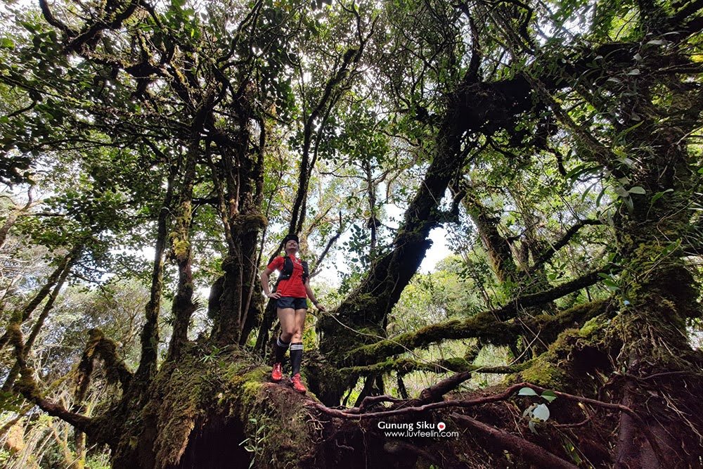
Chuban Summit sits on the approach to Gunung Korbu. By the time you're here, you're in genuine moss forest — trees draped in thick green moss, pitcher plants clinging to the slopes, wild orchids in the undergrowth. It's spectacular, and also demanding. The Gunung Korbu summit is a major milestone on the KORGA traverse.
Stage 6: Gunung Korbu to Gunung Gayong Summit
The Korbu-to-Gayong leg is approximately 1–2 hours one way from Korbu. The terrain on this final push to Gayong involves exposed ridge sections with steep, root-covered ground. Pay attention to the Simpang Proton junction — this is a critical waypoint approximately 5 minutes before the Gayong peak. Hikers have missed turns here. Do not rely solely on your phone GPS; stay close to your guide.

On a clear day from the Gayong summit, you can see Gunung Korbu, Yong Yap, Bubu, Tok Nenek, Yong Belar — the full sweep of the Titiwangsa range. That view is the payoff for everything the trail put you through.

Descent & Safety
Going down Gayong is not easier than going up — it's differently dangerous. Steep sections that were already slippery on the ascent become more treacherous on tired legs coming down. Knee strain is a real risk on the long descent, especially over multiple days.
Key hazards on this trail:
- Deep, slick mud — especially on steep inclines leading to the ridgeline
- Multiple river crossings, difficulty varies with rainfall
- Extremely steep paths throughout the upper sections
- Exposed ridge sections near the final Gayong climb
- Slippery root-covered terrain at higher elevations
- High elevation exposure and rapidly changing weather
If weather turns bad — and in the highlands it can turn fast — trust your guide's call to turn back or shelter. Summit fever kills people. Gayong will still be there on your next trip.
The dam gate hours add a hard logistical constraint on your exit timing. Factor this into your day-by-day itinerary with your guide before the trip starts, not when you're already on the mountain.
What to Bring
Gayong is a minimum 3-day jungle expedition. Pack accordingly — not ultralight weekend-trip, but not over-stuffed either. Your guide will advise on group gear (camping equipment is mandatory under permit conditions), so coordinate with them first.
- Footwear: Trail shoes or jungle boots with serious grip. Not the ones you use for city walks.
- Trekking poles: Mandatory for this terrain, in my opinion. The descents will destroy your knees without them. The TAHAN 3-Section Foldable Hiking Stick V2 packs down small for the river crossings where you need your hands free, and it handles the steep sections well.
- Knee support: Three days of steep terrain adds up. If your knees have ever given you trouble, bring the TAHAN Kinetix Knee Guard with Spring Support — the spring mechanism takes meaningful load off on descents.
- Water capacity: Carry at least 2–3 litres between water points. Water sources beyond Seroja Waterfall are not well-documented, so err on the side of more.
- Water treatment: Tablets or filter. Treat all natural water sources.
- Rain gear: Full waterproof jacket and pack cover. Not optional in the highlands.
- Layers: Temperature at 2,000m+ can drop significantly, especially at camp overnight. Bring a fleece or thermal layer.
- Headlamp with spare batteries: Three nights in the jungle means reliable light is non-negotiable.
- First aid kit: Blister treatment, antiseptic, anti-diarrheal, pain relief, rehydration salts.
- Food: High-calorie, lightweight. Your guide can advise on quantities for the itinerary.
- Dry bags: For electronics, sleeping gear, and anything that cannot get wet.
- Complete camping gear: Tent, sleeping bag, sleeping mat — required under permit conditions.
For a full breakdown of poles and knee guards for Malaysian jungle hikes, read our hiking gear guide.
FAQ
How hard is Gunung Gayong?
Extreme — that's the honest rating, and it's not marketing language. The full KORGA traverse involves 25.6 km of jungle terrain with 2,300–2,408m of elevation gain over multiple days. Deep mud, steep climbs, river crossings, and exposed ridges are all part of the package. This trail is for experienced hikers with multi-day jungle trekking experience.
How long does Gunung Gayong take?
The Perak Forestry Department enforces a minimum of 3 days / 3 nights — that requirement is in your permit. The full Korbu-Gayong traverse typically takes 3–4 days at a realistic pace. Single-day attempts are banned outright. The Korbu to Gayong leg alone is approximately 1–2 hours one way once you're at that section of the ridge.
Do I need a permit for Gunung Gayong?
Yes, and actually you need two. A Forestry entry permit (Form 6) from the Perak Forestry Department applied via the e-Permit system at least 2 weeks before your trip, and a separate dam access permit for the Ulu Kinta Dam road. Fees are RM10–20 per person for Malaysians. Group size is capped at 10 per permit. Apply early — don't leave this to the week before.
Do I need a guide for Gunung Gayong?
Yes, a licensed guide (pemandu arah berlesen) is mandatory under the permit conditions. This isn't just bureaucracy — the trail is genuinely complex, the Simpang Proton junction near the Gayong summit is a known navigation challenge, and having an experienced guide on technical terrain has saved people from serious trouble. The e-Permit portal provides a list of certified guides registered with the Perak Forestry Department.
Camp Nearby?
Making a weekend of it? If you're driving up from KL or the Klang Valley and want a comfortable base before you head in, or you need somewhere to decompress after the trail, there are a few good options in the Perak region. Check out our review of Seven Beret Campsite, Batu Kurau for a laid-back spot in northern Perak. If you're coming through Gopeng, The Hideout Gopeng is a solid choice with good facilities. And WildRock Campsite Padang Rengas is worth knowing about if you want somewhere scenic to wind down after the expedition. An early arrival the night before your permit start date also makes the dam gate timing much less stressful — some groups camp inside the area, but confirm this with your guide.
Trail conditions, permit updates, and hiking buddies for the weekend — all in one WhatsApp group. Just ask; someone was probably up there last week.
💬 Join the Hiking CommunityFree, one click. No spam — the occasional promo at most.
Mike has been camping across Malaysia for over 10 years — from jungle treks in Taman Negara to beach camps in Perhentian. He writes about it so you don't have to find out the hard way. Follow along on TAHAN Outdoor's blog for honest campsite reviews, every week.