Gunung Berembun: A Hiker's Guide (2026)
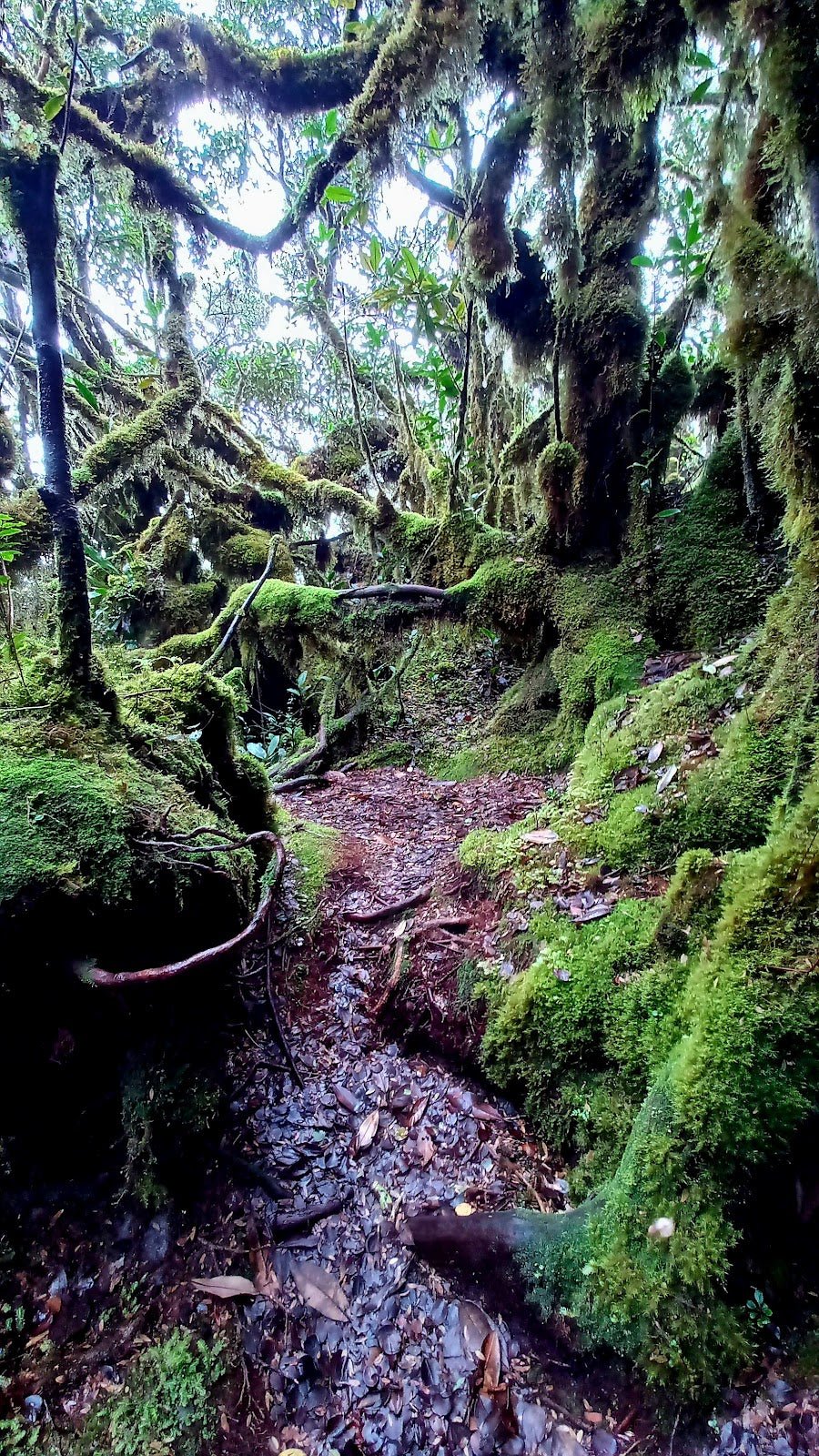
Gunung Berembun sits inside the Berembun Forest Reserve in Jelebu, Negeri Sembilan — one of those forests that escaped the chainsaw because it doubles as a water catchment area. That decision, made by engineers rather than conservationists, accidentally preserved some of the best primary rainforest you can walk through in the peninsula. The trail rewards you with ancient trees, orchids, a genuine waterfall rest stop, and if you push further along the ridge, the scattered wreckage of a WWII RAF B-24 Liberator bomber. That crash site alone draws hikers from all over Malaysia.

This is a Hard-rated hike. Not in the dramatic "only for extreme athletes" sense, but in the honest sense — the section between Gua Kambing and the summit involves very steep climbing with fixed ropes, the trail gets seriously muddy after rain, and leeches are a permanent feature of the experience. If you're still building your fitness, there are better starter mountains in Negeri Sembilan. If you've already done Gunung Angsi or Datuk and found them a bit short, Berembun is the natural next step up.
The summit-only return takes most hikers 4–5.5 hours. Add the WWII crash site and you're looking at 7–7.5 hours. The full traverse to Gunung Telapak Buruk? Budget 9–12 hours depending on conditions. Plan your day accordingly — afternoon thunderstorms are not optional around here.
Quick Facts
- Summit elevation: 1,014 m (most consistently cited for the Berembun Jelebu peak specifically)
- Distance (summit only, one-way): ~9.7–10.3 km
- Distance (WWII Crash Site route): ~15.9 km
- Distance (full Berembun–Telapak Buruk traverse): ~21.6 km
- Elevation gain (summit only): ~762–877 m
- Duration (summit return): 4–5.5 hours
- Duration (WWII Crash Site): 7–7.5 hours
- Duration (full traverse): 9–12 hours depending on conditions
- Difficulty: Hard — not recommended for beginners
- Permit: Required (see below)
- Trailhead: Loji Rawatan Air Pantai, Kampung Pantai, Jelebu, Negeri Sembilan
- Drive from Seremban: ~1 hour
Getting There & Parking
The main trailhead is at the Loji Rawatan Air Pantai (Pantai Water Treatment Plant) in Kampung Pantai, Jelebu — about an hour by car from Seremban town centre. Head for Kuala Klawang first, then follow signs toward Kampung Pantai.
Here's the bit that catches people off guard: there's reportedly a 2 km stretch from Kampung Pantai Baru to the actual trailhead that may require a 4WD, or you walk it. A 2018 trip report flagged 4WD as necessary — road conditions may have improved since, but don't show up in a low-clearance car without checking first. Call the Pejabat Renjer Hutan Jelebu beforehand and ask about current road conditions. Parking at the trailhead itself isn't confirmed in detail across sources, so build some buffer time into your morning for logistics.
A second entrance exists via the Gunung Telapak Buruk side (near the TM telecommunications tower), but most hikers use the Kampung Pantai entrance and the water treatment plant as the starting point.

Permits & Fees
A permit is required to hike Gunung Berembun. The current fee structure listed by malaysia.travel is RM 5 for Malaysians and RM 20 for international visitors. An older 2019 blog reported a flat RM 5 walk-in rate at the gate — that may be outdated, so don't rely on it.
Permits must be obtained at least one week before your intended hike date — that's not a suggestion, that's the stated requirement. The issuing authority is the Negeri Sembilan Forestry Department / Pejabat Renjer Hutan Daerah Jelebu, Kuala Klawang. In-person purchase during weekdays is also possible — call ahead before making the trip. Guide services are available through the Negeri Sembilan Forestry Mountain Guide Association (PMGPNS) at listed rates, though a guide is not mandatory.
Trail conditions and permit requirements change — always check with the local forestry office or park authority before you go. Checking a different gunung? Try our free permit checker — instant answer for 90+ Malaysian mountains. Or ask the TAHAN Hiking Community on WhatsApp — someone's usually been there that week.
The Trail: What to Expect
The route follows a logical progression from flat river path to waterfall rest stop to cave shelter to steep roped climb. Each checkpoint is distinct enough that you always know roughly where you are. Here's what to expect at each stage.
Stage 1: Trailhead to Lata Berembun (Checkpoint 1)
From the ranger station at the water treatment plant, the trail begins wide and relatively flat — a tarred or cleared path along the left bank of the river. It's an easy warm-up and should take roughly 40–45 minutes to reach Lata Berembun waterfall. Don't let the easy start fool you into setting a pace you can't sustain — the hard stuff comes later.
Lata Berembun (Berembun Waterfall) is Checkpoint 1. There's a campsite here, a water point, and on the return trip, it becomes a very welcome swimming spot. Before you can continue forward, you'll need to ford the Batang Penar stream. Waterproof or quick-dry footwear is not optional — this is a proper crossing, not stepping stones. The area around the waterfall is damp and shaded, which means leeches. Do your leech checks here before moving on.

Stage 2: Lata Berembun to Gua Kambing (Checkpoint 2)
This middle section of the trail is where the forest really opens up. You're walking through primary rainforest — the kind with trees wide enough that three people can't link arms around them. Birdlife, orchids, large insects. It's worth slowing down here even if your legs want to push on.
Gua Kambing (Goat Cave) is reached roughly 1 hour 48 minutes from the trailhead (based on Wikiloc data). It's a giant boulder overhang that hikers have turned into a proper shelter over the years — tarpaulin roofing, benches, and cooking equipment left for communal use. There's a small stream nearby. This is confirmed as the last water point before the summit. Fill up here. Seriously, fill up completely — there is no water at the top.
From Gua Kambing onwards, the trail steepens significantly. The easy part of this hike is behind you.

Stage 3: Gua Kambing to Gunung Berembun Summit
This is the section that earns Berembun its Hard rating. The climb from Gua Kambing to the peak involves very steep terrain with fixed ropes — you'll be pulling yourself up in places. It's not technical climbing, but it's physical and demands respect. Wet conditions make this section genuinely dangerous; muddy slopes and fixed ropes don't mix well if you're not careful with your footing.
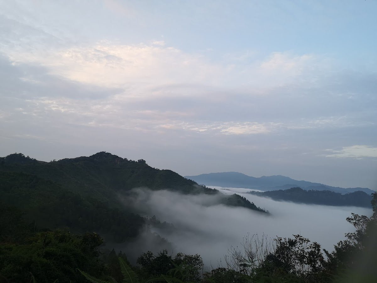
Wikiloc puts the summit at roughly 2 hours 45 minutes from the trailhead for a fit pace. The summit sits at 1,014 m and is often foggy or misty — visibility at the top is hit or miss. Enjoy the clouds if they're there, but don't hang around expecting them to clear quickly. There's no water here, there's no dramatic open view guaranteed, but there's the honest satisfaction of having climbed something that pushed you.

Stage 4: WWII RAF B-24 Liberator Crash Site (Optional Extension)
This is why a lot of people add the extra kilometers. About 2.5 km along the ridge from the Berembun peak toward Gunung Telapak Buruk, the wreckage of an RAF B-24 Liberator bomber that came down during WWII lies scattered across the jungle floor. Engines, fuselage sections, other recognisable aircraft parts — it's an unexpectedly moving thing to come across in the middle of a rainforest. Wikiloc data places it at roughly 3 hours 42 minutes from the trailhead.
The ridge trail descends from the summit before undulating toward the crash site — it's not flat walking. Budget an additional 2.5–3 hours return to the summit just for this extension, and factor that into your total day. One hiker reported not returning to the trailhead until 8pm after attempting the crash site — that's not where you want to be without proper preparation and a headlamp.
Stage 5: Full Traverse to Gunung Telapak Buruk (Full-Day Option)
The complete Berembun–Telapak Buruk traverse covers ~21.6 km and averages 9 hours on a good day, stretching to 11–12 hours in adverse conditions. The Telapak Buruk summit has a TM telecommunications tower which serves as a useful navigational landmark. This route involves ~1,517 m of total elevation gain across the full distance.
Important: The trail to Gunung Telapak Buruk has been closed at least once in the past. Verify current trail status with the Negeri Sembilan Forestry Department before attempting this option — do not assume it's open.

Descent & Safety
The descent on Berembun is where people get into trouble. The steep, rope-assisted section that was hard going up becomes a genuine slip risk on the way down — especially if rain has come through while you were at the summit, which it frequently does in the afternoon. Take the roped sections slowly, face into the slope when necessary, and don't let tiredness rush your footwork.
Know these hazards going in:
- Leeches — from the trailhead to the waterfall and beyond. Wear leech socks, tuck pants in, do regular checks. This isn't something you can avoid, just manage.
- River crossings — at least two crossings including the Batang Penar ford at Lata Berembun. After heavy rain, stream levels rise fast. Waterproof footwear is strongly advised.
- Steep, muddy slopes — particularly between Gua Kambing and the summit. Good-grip shoes are non-negotiable.
- Fixed ropes — test each rope before committing weight to it. They're community-maintained, not officially inspected.
- Afternoon thunderstorms — standard highland Malaysia. One group's trip extended to 12 hours due to rain. Start at the trailhead by 6:30 am if you're doing anything beyond the summit return. Plan to be descending by early afternoon.
- No water at the summit — dehydration risk is real. Fill up completely at Gua Kambing.
If it's raining heavily when you reach Gua Kambing and hasn't let up, seriously consider whether the summit push is worth it. The mountain will be there next month. A bad fall on those roped slopes will mess up your year.
What to Bring
Pack for a Hard tropical highland hike with river crossings, steep roped sections, and no summit water source. Here's what matters for this specific trail:
- Water — bring more than you think you need. The last reliable water point is Gua Kambing, well before the summit. A hydration bladder keeps your hands free for the roped sections — the TAHAN TrailBladder 2L is a solid, affordable option for this.
- Footwear — trail shoes or hiking boots with real grip. Waterproof is a big advantage given the stream crossings and mud.
- Leech socks — not optional on this trail.
- Trekking poles — especially useful on the steep muddy descent. The TAHAN 3-Section Foldable Hiking Stick V2 packs down small enough to clip to your bag for the roped sections where you need both hands free.
- Headlamp with fresh batteries — if you're doing the crash site extension or the full traverse, you may well be finishing in low light. This is not a maybe.
- Rain jacket — not just for comfort, for safety. Wet + exposed ridge is not pleasant.
- Food — you'll burn through it on the steep sections. Pack more than usual.
- First aid basics — blister kit, antiseptic, any personal medication.
- Fully charged phone with offline maps downloaded — GPS signal can be patchy under the canopy.
Check our hiking gear guide if you're unsure what to prioritise for a hike at this difficulty level.
FAQ
How hard is Gunung Berembun?
Hard — that's the consensus rating across AllTrails and most trip reports. Wikiloc gives it a 6/10. The main challenge is the steep section with fixed ropes between Gua Kambing and the summit, combined with slippery, muddy slopes on descent. TripAdvisor reviewers rate it Moderate to Hard depending on fitness. Not suitable for beginners. If you've done Angsi and Datuk and found them manageable, you're ready to attempt Berembun.
How long does Gunung Berembun take?
Summit return: 4–5.5 hours for most hikers. Add the WWII crash site: 7–7.5 hours. Full Berembun–Telapak Buruk traverse: 9–12 hours. These are real-world ranges — rain, fitness level, and how long you linger at Gua Kambing all affect the total. Start early regardless of which option you're doing.
Do I need a permit for Gunung Berembun?
Yes. A permit is required and should be applied for at least one week before your hike date. The issuing authority is the Negeri Sembilan Forestry Department / Pejabat Renjer Hutan Daerah Jelebu, Kuala Klawang. Fees at the time of writing: RM 5 for Malaysians, RM 20 for international visitors (malaysia.travel). Confirm current rates and booking method directly with the forestry office — fee structures can change.
Do I need a guide for Gunung Berembun?
No — a guide is not mandatory for this trail, as confirmed by the Negeri Sembilan Forestry Mountain Guide Association (PMGPNS). That said, if you're attempting the full traverse to Telapak Buruk for the first time, hiring a guide through PMGPNS is worth considering. The ridge trail has been closed before and the route is less straightforward than the summit-only path.
Camp Nearby?
Making a weekend of it? Staying somewhere nearby the night before means you can hit the trailhead at first light without a brutal pre-dawn drive. A few options worth checking out in Negeri Sembilan: Last Post D'Rimba Campsite, Negeri Sembilan is the closest in spirit to a proper outdoor setup. If you want something more comfortable after a big hike, De Star Glamping, Lenggeng is worth a look. And if you're exploring the wider Jempol/Jelebu area, Berhulucamp, Jempol is another solid option not too far from the region.
Trail conditions, permit updates, and hiking buddies for the weekend — all in one WhatsApp group. Just ask; someone was probably up there last week.
💬 Join the Hiking CommunityFree, one click. No spam — the occasional promo at most.
Gear tip: How to use a trekking pole (and set the height).
Mike has been camping across Malaysia for over 10 years — from jungle treks in Taman Negara to beach camps in Perhentian. He writes about it so you don't have to find out the hard way. Follow along on TAHAN Outdoor's blog for honest campsite reviews, every week.
⛺ Featured in: The 10 Toughest Hikes in Peninsular Malaysia (2026)