Gunung Irau: A Hiker's Guide (2026)
Gunung Irau is Cameron Highlands' highest peak at 2,110 m — and one of the most visually striking hikes in Peninsular Malaysia. The trail takes you through a Mossy Forest so thick with ferns, pitcher plants, and fog that it genuinely looks like something from a fantasy film. That's not marketing. That's just what it's like up there.

The popular Mossy Forest route starts from the top of Gunung Brinchang and is accessible enough that families and casual hikers attempt it — but don't let the short distance fool you. Deep mud, leech country, slippery roots, and cold summit temperatures mean this trail punishes the underprepared. If you're coming from KL for a quick weekend tick, plan properly. If you're considering the longer Corybas or Mawar Tepian Desa routes, those are full-on jungle expeditions for experienced hikers only.
Gunung Irau is the 15th highest mountain in Malaysia and ranked by Lonely Planet as one of the most Instagrammable forests in the world. But before any of that — there's a critical caveat for 2026 hikers. Read the Permits section before you do anything else.
Quick Facts
- Summit elevation: 2,110 m
- Route distance (Mossy Forest): ~4.4–7 km round trip (sources vary; GPS tracks differ)
- Route distance (Mawar Tepian Desa): ~15 km out-and-back
- Route distance (Corybas/Sempadan): ~16.85–18 km round trip
- Elevation gain (Mossy Forest route): ~321–500 m+ (sources disagree)
- Duration (Mossy Forest route): 2–2.5 hrs at fast pace; realistic average 5–7 hrs round trip including breaks; full 8-hr day reported in challenging conditions
- Duration (Corybas/Sempadan route): ~10–12 hrs
- Difficulty (Mossy Forest route): Moderate to Very Challenging — weather and fitness dependent
- Difficulty (Mawar/long route): Hard — experienced adventurers only
- Permit required: Yes
- Guide required: Not legally mandatory, but strongly advised for first-timers
- State: Pahang
Getting There & Parking
The Mossy Forest trailhead sits at the top of Gunung Brinchang — you drive up via the paved road from Brinchang town in Cameron Highlands. The GPS coordinates for the Mossy Forest entrance are 4.524219, 101.381979. There's no public transport that goes directly to the summit road, so you'll need your own vehicle or a tour that includes transport up. Plenty of day-tour operators in Cameron Highlands cover this.
Parking is available at the Mossy Forest entrance at the top of Gunung Brinchang. There are no public toilet facilities at the trailhead itself, so sort that out before you head up.

Permits & Fees
⚠️ IMPORTANT — CHECK CLOSURE STATUS BEFORE YOU PLAN ANYTHING: As of October 2025, the Mossy Forest was closed indefinitely due to landslides and significant boardwalk damage from heavy rain. Whether this closure has been lifted by the time you're reading this is unconfirmed. Do not drive up and assume the trail is open.
Gunung Irau sits within Pahang's Hutan Simpanan Kekal (HSK). A permit from the Pahang State Forestry Department (Jabatan Perhutanan Pahang) is required before you hike. The online portal is http://forestry.pahang.gov.my/ekorimba. Daily quotas apply — book early, especially on weekends and public holidays. Some hikers obtain permits through local agents; that's a legitimate option if the online system gives you trouble.
The forestry permit fee was RM10 per person as of 2023 — exact 2026 fees should be confirmed directly with the forestry office. Separate from that, there's a Mossy Forest boardwalk entry fee: RM10 for adults, RM5 for seniors and children, and RM30 for foreign visitors. Your permit gets checked at a hut at the end of the boardwalk before the actual trail begins.
Trail conditions and permit requirements change — always check with the local forestry office or park authority before you go. Checking a different gunung? Try our free permit checker — instant answer for 90+ Malaysian mountains. Or ask the TAHAN Hiking Community on WhatsApp — someone's usually been there that week.
The Trail: What to Expect
The description below covers the Mossy Forest (short) route — the standard route most hikers take. The Corybas and Mawar routes follow separate logistics and are not covered in the same detail here; if you're considering those, go with an experienced guide.

Stage 1: Mossy Forest Entrance & Car Park → Boardwalk
You start at the entrance to the Mossy Forest at the top of Gunung Brinchang. The boardwalk takes you through the forest before the actual hiking begins — this part is tourist-friendly and relatively flat. The mist here is real and frequent; on a good morning, you'll understand immediately why this place gets the attention it does. Orchids, ferns, pitcher plants lining the path. It genuinely looks like a film set.
Stage 2: End of Boardwalk → Permit Hut → Trail Begins
At the end of the boardwalk, there's a permit-checking hut. Have your documents ready. From here the trail proper starts, and the terrain changes completely. The polished boardwalk ends and the jungle begins — mossy vegetation everywhere, exposed roots underfoot, and if there's been any rain recently, mud. Lots of it. We're talking ankle-to-knee-deep in places. Gloves are not optional on this trail; you'll be grabbing roots and branches constantly.

Stage 3: Trail to Mini Irau (Intermediate Peak)
This section is where the trail earns its reputation. The 'LOTR section' — a photogenic stretch of dense mossy forest — appears along the way and it's worth a moment. But stay focused: the terrain is consistently slippery, roots are everywhere, and leeches are active in damp conditions. Pack salt or a good repellent and do leech checks regularly. One recent hiker described it as "majestic, mystic, and mist" — accurate, but also muddy and physically demanding. Mini Irau is an intermediate peak and a useful checkpoint; check the cut-off time that comes with your permit and be realistic about your pace.
Stage 4: Mini Irau → Gunung Irau Summit (2,110 m)
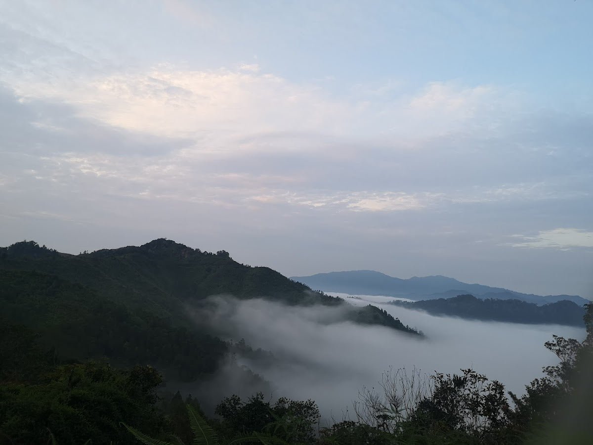
The push to the summit from Mini Irau involves ropes and ladders on the steeper sections. These aren't decorative — you need them. The mud continues. The cold intensifies as you climb; summit temperatures sit around 15–20°C, and with wet clothing from the effort, hypothermia is a real risk if you're underdressed. On a clear morning the summit rewards you with panoramic views of the Titiwangsa peaks, valleys, and tea plantations. Don't count on a clear view every time though — mist rolls in fast and afternoon rain is extremely common.

Stage 5: Optional Extension — Gunung Pass & Gunung Yellow
Beyond the Irau summit, the trail continues to Gunung Pass and Gunung Yellow. This extension adds significant time and difficulty. Only consider it if you're fit, you have daylight buffer, and you're not already exhausted from the main climb. Most day-hikers stop at Irau summit and turn back.
Long Route Note: Corybas/Mawar Checkpoints
If you're on the longer Corybas or Mawar routes, the trail passes through Cold Check Point → Kem Valley (river — the last water point on the route) → Champion → Paradise → Bonk (one of the harder sections) → Bald Peak → Irau Peak. These routes run 10–12 hours and are described as hard and for experienced adventurers only. Don't attempt them without a guide.
Descent & Safety

Coming down is where most incidents happen. The mud that was hard work going up is treacherous going down — especially on the steeper sections with roots and ropes. Take your time. Use the ropes even if you think you don't need them.
Keep an eye on the time and your permit's cut-off requirements. Afternoon rain in Cameron Highlands is not occasional — it's routine. If the sky starts building clouds and you haven't hit the summit yet, seriously consider whether to continue or turn back. Getting caught in heavy rain on a muddy slope with visibility dropping is not a situation you want to manage.
Full hazard list for this trail:
- Deep mud — ankle to knee-deep in places, especially after rain
- Leeches — present in damp conditions; bring salt or repellent
- Exposed tree roots and branches — constant tripping and bruising risk
- Slippery moist terrain throughout
- Afternoon rain and frequent mist/fog
- Cold summit temperatures (~15–20°C) — hypothermia risk if you're wet and underdressed
- Landslides during heavy rain and monsoon season — the road up and the trail are both vulnerable
- Fallen and uprooted trees on trail — elevated risk here as this is the highest point in the area and exposed to strong winds
Best months to hike: March to September for more stable weather; driest months reported are February, June, and July. The Mossy Forest is historically closed November to January during monsoon season — and as noted above, the closure that began in October 2025 may still be in effect. Verify before you go.
What to Bring
Packing for Gunung Irau is not the same as packing for a hill walk. The mud, cold, and technical terrain demand proper gear.
- Gloves — non-negotiable. You will be using your hands on this trail constantly
- Trekking poles — the mud and roots make pole use tricky, but on open sections and the descent they earn their keep. The TAHAN 3-Section Foldable Hiking Stick V2 (RM99) is compact enough to stash when you need both hands free and solid when you need support
- Knee support — the descent on muddy roots is rough on the knees. If yours are at all sensitive, the TAHAN Kinetix Knee Guard with Spring Support (RM79) is worth throwing in your pack
- Water — minimum 2L — no water sources on the Mossy Forest route; carry everything you need from the start
- Warm layer and rain jacket — summit temperatures around 15–20°C; wet clothing makes it feel colder fast
- Gaiters or waterproof pants — serious mud requires serious protection
- Good hiking boots — waterproof, with ankle support and a grip sole. Trail runners are not appropriate here
- Headlamp — if your pace is slower than expected, you may finish after dark
- Salt or leech repellent
- Snacks and proper food — no facilities on trail
- Permit documents — physical or digital, ready to show at the hut
For a broader breakdown of what to look for in hiking gear for Malaysian trails, check out our hiking gear guide.
FAQ
How hard is Gunung Irau?
It depends on conditions and your fitness. AllTrails and Summits.com rate the Mossy Forest route as moderate. But experienced hikers who've done it in wet weather describe it as very challenging and not suitable for beginners — deep mud, technical terrain, and cold temperatures are the main factors. If it hasn't rained in a few days and you're reasonably fit, it's a tough but manageable day hike. After rain, it's a different trail entirely. The longer Mawar and Corybas routes are hard, full stop — experienced adventurers only.
How long does Gunung Irau take?
For the Mossy Forest route: AllTrails reports 2–2.5 hours at a fast pace, but the realistic average including breaks is 5–7 hours round trip. In challenging conditions, full 8-hour days have been reported. Start early — before 9 am if possible — to give yourself buffer before afternoon rain. The Corybas/Sempadan route runs 10–12 hours.
Do I need a permit to hike Gunung Irau?
Yes. Gunung Irau is within Pahang's Hutan Simpanan Kekal and a permit from the Pahang State Forestry Department is required. Apply via http://forestry.pahang.gov.my/ekorimba. Daily quotas apply so book early, especially on weekends. The permit fee was RM10 per person as of 2023 — confirm the current fee directly with the forestry department. There is also a separate Mossy Forest boardwalk entry fee (RM10 adult, RM5 senior/child, RM30 foreigner).
Is the trail open right now?
This is the most important question to ask before planning. As of October 2025, the Mossy Forest was closed indefinitely due to landslides and boardwalk damage. Whether it has reopened by 2026 is unconfirmed. Check with the Pahang Forestry Department or the Mossy Forest management directly before booking anything.
Camp Nearby?
Making a weekend of it? Cameron Highlands itself is the obvious base, but if you want a proper camp experience before or after your hike, there are some solid options in the broader Pahang region worth knowing. Woodstock Camp Janda Baik and Glamping Valley @ Janda Baik are both good calls if you want to extend the trip into a full highlands weekend — Janda Baik is cooler country and gives you that alam semula jadi feel without committing to a jungle floor. If Bentong direction works better for your route, Camp Mantap, Bentong is worth a look too. Staying the night nearby before an early Gunung Irau start is smart — it gets you on the trail before 8 am, which makes a real difference on a fog-and-weather-dependent mountain like this.
Trail conditions, permit updates, and hiking buddies for the weekend — all in one WhatsApp group. Just ask; someone was probably up there last week.
💬 Join the Hiking CommunityFree, one click. No spam — the occasional promo at most.
Gear tip: How to use a trekking pole (and set the height).
Mike has been camping across Malaysia for over 10 years — from jungle treks in Taman Negara to beach camps in Perhentian. He writes about it so you don't have to find out the hard way. Follow along on TAHAN Outdoor's blog for honest campsite reviews, every week.