Bukit Sungai Long: A Hiker's Guide (2026)
Bukit Sungai Long is one of those urban escape hikes that Klang Valley folks tend to discover by accident — a friend mentions it, you see a sunrise photo on Instagram, and suddenly you're here on a Sunday morning wondering why you hadn't come sooner. Sitting on the eastern edge of the KL metropolis near Bandar Baru Sungai Long, Selangor, this hill is close enough to the city that you can be lacing up your boots before 6am and back home for breakfast. But don't let the proximity fool you — depending on which route you take, this place can bite.

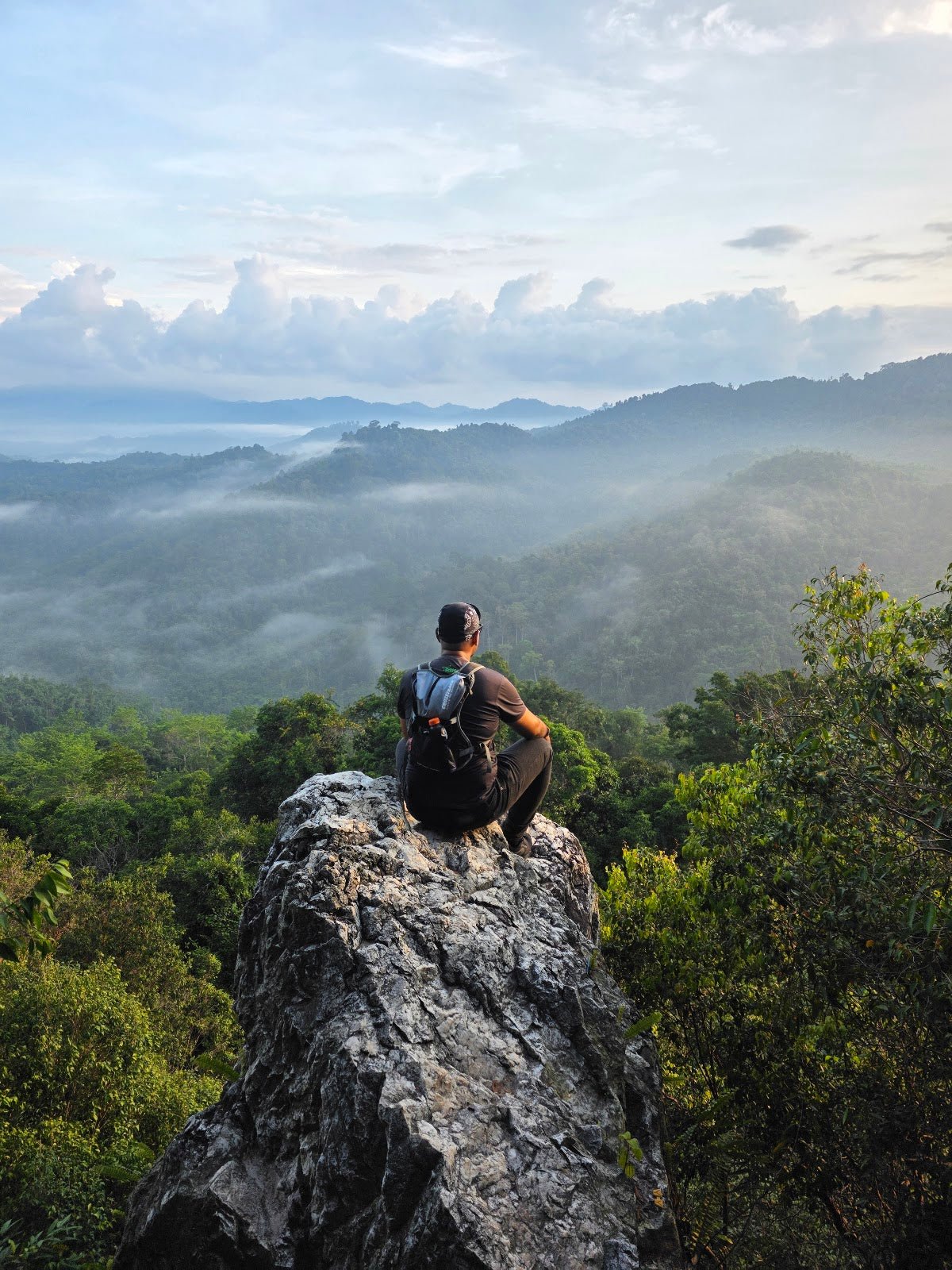
The hike suits active beginners on the gentler Via Desa Budiman variant, but the Sungai Long Hill Loop and main trail are rated Hard — steeper, less maintained, and not the kind of thing you want to attempt unprepared. What draws people here are the viewpoints: art installations, a hilltop lookout over a sea of surrounding greenery, and if you time it right, a sunrise or sunset that makes the slog worthwhile. There's also a waterfall, a small lake, and enough jungle trail to feel like you've actually gone somewhere.
Know this going in: parts of the main route are on hot tarmac road with quarry traffic nearby — not exactly the wilderness experience. The move is to get off that road and into the jungle trails as early as possible. That's where Bukit Sungai Long actually earns its reputation.
Quick Facts
- Location: Jalan Desa Budiman, Kampung Bukit Paya, near Bandar Baru Sungai Long, Selangor
- Peak Elevation: 237–305 m (varies by route variant)
- Elevation Gain: 69–495 m depending on route
- Distance: 2.1–8 km depending on route variant
- Duration: 0.5–3.5 hours depending on route variant
- Difficulty: Moderate (Via Desa Budiman) to Hard (Sungai Long Hill Loop and main trail)
- Permit Required: No formal permit — see Permits section below
- Best Time to Go: Year-round; sunrise and sunset for the best views
Getting There & Parking
The trailhead is at Jalan Desa Budiman, Kampung Bukit Paya, near Bandar Baru Sungai Long — a residential neighbourhood on the eastern fringe of greater KL. If you're driving in from KL or Cheras, it's a straightforward run out. Plug "Bukit Sungai Long trailhead" or "Jalan Desa Budiman" into Waze and it'll get you close enough.
Parking is roadside in the residential area. No formal carpark, but hikers report no summons issues. Be considerate — park sensibly, don't block driveways, and remember you're in someone's neighbourhood. If you're planning an early sunrise hike, arrive early because spots do fill up on weekends.

Permits & Fees
This is the unusual bit about Bukit Sungai Long: it appears to pass through private residential property. There's no formal permit authority, no ticket booth, and no ranger station. Access seems to be tolerated informally — the understanding being that hikers behave appropriately, stay respectful of the surrounding community, and don't cause problems. That said, this situation can change at any time.
Trail conditions and permit requirements change — always check with the local forestry office or park authority before you go. Or ask the TAHAN Hiking Community on WhatsApp — someone's usually been there that week.
The Trail: What to Expect
There are multiple route variants here with noticeably different distances, elevation gains, and characters. The GPS data across sources doesn't always agree — elevation figures range from 237 m to 305 m depending on which variant and which GPS log you trust. What follows is based on the documented landmarks and stages. Pick your route based on your fitness level and how much time you have.

Stage 1: Trailhead at Jalan Desa Budiman
You start in the residential area and the trail kicks off simply enough. The early section on the Via Desa Budiman variant is more forgiving — a reasonable warm-up. The main route, however, pushes you onto tarmac road fairly quickly, and this stretch is exposed and warm once the sun is up. Quarry trucks have been reported in the area, so stay alert. The strong advice from experienced hikers here: ditch the main road whenever you spot a jungle trail branching off. Those are the sections worth your time.
Stage 2: Rainforest Sections
Once you're into the jungle, the character of the hike changes completely. Paths are narrow, some sections are overgrown, and the canopy gives you shade — which you'll appreciate. Expect spider webs across the trail, especially early morning. Mosquitoes can be a nuisance in these sections, though some hikers report fewer than expected. There are ropes on some of the steeper slopes — use them. The terrain here earns the Hard rating on the longer variants.

Stage 3: Lion Hill, Sunset Hill, and Sea of Clouds
These named landmarks — Lion Hill, Sunset Hill, the Sea of Clouds viewpoint — are the highlights that get shared on hiking forums and social media. The views over surrounding greenery and the broader Klang Valley are genuinely good, and timed right (early morning for cloud sea, late afternoon for sunset light), they deliver. Art installations have been set up at certain viewpoints, which makes for interesting photo stops. Soil erosion has been noted at the peak area, so watch your footing — it's looser than it looks, particularly after rain.
Stage 4: Waterfall and Small Lake
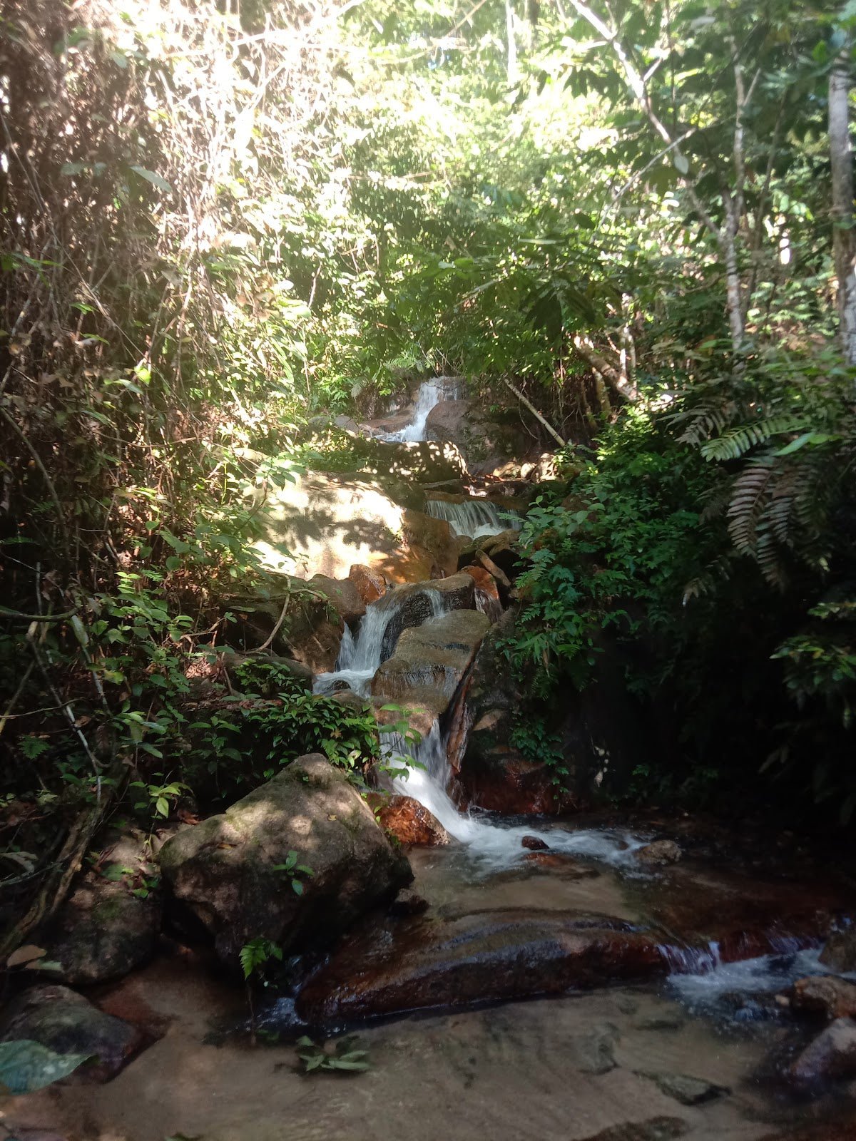
Sungai Long Waterfall features on most route variants, either as an endpoint or an intermediate point depending on which loop you're doing. Fair warning: the water has been described as brownish by some hikers, so don't plan on drinking it untreated. The trail also crosses a small stream and passes a small lake. Scenic, yes — but treat all water sources with appropriate caution.

Stage 5: Peak at Sungai Long Hill
The peak sits at 779–999 ft (237–305 m) — the range in figures reflects genuine variation between route variants and GPS sources, not sloppy reporting. Either way, you'll know when you're there. The payoff is the view: city skyline in one direction, rolling jungle hills in the other. Worth the effort, especially on a clear morning.
Optional: Durian Farm and Hill 6 Waterfall Descent
On some variants, descent can route through a durian farm and past a Hill 6 waterfall. If you're up for extending the adventure and the trail is clear, this adds texture to the day. Be aware trail upkeep on these secondary paths is minimal — fallen trees and overgrowth are part of the deal.
Descent & Safety

Coming down steep jungle trails after exertion is where people get hurt — slippery soil, tired legs, lapse in concentration. Take the descent seriously. Steep and slippery sections exist on multiple variants, and soil erosion near the peak makes footing unpredictable, especially after rain. Use ropes where provided. Slow down.
Key hazards on this trail:
- Steep and slippery terrain, especially post-rain
- Soil erosion at and near the peak
- Narrow, poorly maintained paths on secondary trails
- Fallen trees and heavy overgrowth on some sections
- Mosquitoes and spider webs in jungle sections
- Significant sun exposure on the tarmac stretches and open viewpoints
- Not recommended for solo hiking — bring at least one buddy
On the solo hiking point: this is flagged specifically for this trail, and it's worth taking seriously. The trail is not heavily trafficked, sections are poorly maintained, and if you twist an ankle in an overgrown section, you want someone with you. Go with a group or at minimum a friend.
If you arrive and the trail is wet, the sky is dark, or visibility is poor — turn back. No viewpoint is worth a nasty fall. The hill will still be there next weekend.
What to Bring
This isn't an overnight hike, but some routes are harder than they look on paper. Pack accordingly:
- Water: More than you think you need. The exposed tarmac sections get hot fast, and natural water sources on this trail are not safe to drink without treatment.
- Sun protection: Sunscreen, a cap, and a buff for the road sections. The tarmac stretch is genuinely exposed.
- Insect repellent: Non-negotiable for the jungle sections.
- Proper footwear: Trail shoes or hiking boots with grip. Not sandals, not running flats.
- Trekking poles: On the harder variants with steep descents and loose soil, poles make a real difference. The TAHAN 3-Section Foldable Hiking Stick V2 (RM99) is compact enough to throw in your bag and worth having on the steep sections.
- Knee support: If your knees are the first thing to complain on descents — and on this terrain they might — the TAHAN Kinetix Knee Guard With Spring Support (RM79) is worth considering, especially on the longer Hard variants.
- Snacks: Light — energy bars, nuts, a banana. You don't need a full meal for a 3.5-hour hike but you do need fuel.
- Light jacket or buff: Minimal, but useful if you're catching sunrise and waiting around at the viewpoint.
Not sure what else to pack for hikes like this? Check out our hiking gear guide for a more complete breakdown.
FAQ
How hard is Bukit Sungai Long?
Depends entirely on your route. The Via Desa Budiman variant is rated Moderate and suits active beginners — elevation gain on the shorter routes can be as low as 69 m. The Sungai Long Hill Loop and main trail are rated Hard, with elevation gain up to 495 m and terrain that includes steep, slippery slopes and poorly maintained paths. Know which route you're doing before you start.
How long does the Bukit Sungai Long hike take?
Anywhere from 30 minutes to 3.5 hours depending on route variant and your pace. The shorter, gentler variants are genuinely quick. The full loops with multiple landmarks and waterfalls will take most hikers 2–3.5 hours. Build in extra time if you want to linger at the viewpoints — that's the whole point of coming at sunrise or sunset.
Do I need a permit for Bukit Sungai Long?
There's no formal permit system and no ticket to buy. The trail appears to pass through private property where access is informally tolerated, provided hikers behave respectfully. This situation could change, so check before you go — and when you're there, act accordingly. Leave no trace, be quiet in the residential areas, and don't give anyone reason to close it off.
Is Bukit Sungai Long suitable for beginners?
On the Moderate Via Desa Budiman variant, yes — it's a reasonable intro hike with manageable elevation gain and a satisfying view payoff. On the Hard variants, no — not without a reasonable base fitness and the right footwear. Either way, don't go solo. This trail is flagged as not suitable for solo hiking, and that's worth respecting regardless of your experience level.
Camp Nearby?
Bukit Sungai Long is very much a day hike — you're not camping on the hill itself. But if you want to make a proper weekend of it and explore the wider area, there are good options nearby. Making a weekend of it? Nature Escape Campsite, Hulu Langat is the closest option and worth a look if you want to stay in the same general corridor. Further afield but worth the drive, Templer Park Rainforest Retreat gives you proper jungle camping not far from KL. Or head north to Mori Leka Campsite, Serendah for a quieter overnight before or after your hike. Any of these pairs well with an early-morning start on the hill.
Trail conditions, permit updates, and hiking buddies for the weekend — all in one WhatsApp group. Just ask; someone was probably up there last week.
💬 Join the Hiking CommunityFree, one click. No spam — the occasional promo at most.
Gear tip: How to use a trekking pole (and set the height).
Mike has been camping across Malaysia for over 10 years — from jungle treks in Taman Negara to beach camps in Perhentian. He writes about it so you don't have to find out the hard way. Follow along on TAHAN Outdoor's blog for honest campsite reviews, every week.