Bukit Batu Sawa: A Hiker's Guide (2026)
Bukit Batu Sawa sits quietly in the Jelebu District of Negeri Sembilan, a short drive from Kuala Klawang Town — and honestly, not enough people know about it. At 333m above sea level, it's not going to test your limits the way a Gunung Nuang or Gunung Datuk would, but don't let the numbers fool you. The trail has real character: lush forest, striking red-barked trees, two roped sections that demand some effort, and if you time it right, a summit draped in awan karpet — that carpet-of-clouds effect that makes for genuinely jaw-dropping photos.

This is a beginner-friendly trail with a gradual warm-up that gets progressively steeper as you go — a good introduction to jungle hiking without throwing you into the deep end. Experienced hikers often use it as a trail run or a quick weekend morning hit before breakfast. The spacious summit with its large boulder is good for sitting, eating, and staring at the Jelebu valley below. Some groups even camp up there overnight.
Best suited for beginners, families with older kids, and anyone wanting a satisfying half-day outing within striking distance of KL. The drive alone — about 1.5 hours from the city — takes you through cool highland scenery that sets the mood nicely.
Quick Facts
- Summit elevation: 333m
- Elevation gain: 173–237m (sources vary; expect something in that range)
- Distance: 3.7–4km round-trip
- Duration: 45 minutes up, 35 minutes down for most hikers; allow 2–3 hours total for a relaxed pace with summit time
- Difficulty: Easy to Moderately Challenging — sources genuinely disagree on this. MyRehat rates it 2/10 Easy; AllTrails calls it moderately challenging. The first stretch is flat and chill, but it steepens steadily and the roped sections are real. Don't underestimate it.
- Permit required: Yes — RM5 per person
- Parking fee: RM3
- Guide required: Optional for Malaysian citizens; Mandatory for non-Malaysian nationals
- Best time to start: 6–7 AM for sea-of-clouds views
- Year-round access: Yes
Getting There & Parking
The trailhead is at Kampung Belai, Jelebu District, Negeri Sembilan — a few minutes from Kuala Klawang Town. From KL, most hikers report roughly a 1.5-hour drive with some nice highland scenery along the way. Navigate to Kampung Belai and look for a hut with clear trail signage marking the entrance — it's reasonably well-signed and hikers on weekends make it easy to spot.

Parking is available right at the trailhead for RM3. Arrive early on weekends if you want a spot close to the entrance — this place is gaining popularity fast.
Permits & Fees
You need a permit from the Negeri Sembilan Forestry Department — specifically the Jelebu District Forestry Office. The fee is RM5 per person for Malaysian citizens. Non-Malaysian nationals are charged separately — one recent visitor reported being charged RM20 at the gate, so internationals should budget for that and verify the current rate before going.
You can obtain your permit in advance via the N9PAY government platform, or contact forestry officer Puan Shima at +6012 942 5094 to arrange it. There is also an on-site permit counter at the trailhead if you're going walk-in — but don't rely on that being open at 6 AM. Sort it out beforehand to save the stress.
Guides are optional for Malaysian citizens but mandatory for non-Malaysians. The standard mandatory ratio is 1 guide per 7 hikers; where guides are optional, 1:10 is recommended. If your group is larger, additional guides are required accordingly.
Trail conditions and permit requirements change — always check with the local forestry office or park authority before you go. Or ask the TAHAN Hiking Community on WhatsApp — someone's usually been there that week.
The Trail: What to Expect
The route is straightforward with no confusing junctions, but the terrain shifts meaningfully as you gain elevation. Here's what to expect stage by stage.

Stage 1: Trailhead to Rubber Plantation
The hike begins on a narrow dirt road leading through a small rubber plantation. This is your warm-up — flat, easy walking, nothing demanding. Good time to check your laces, adjust your pack, and get your legs going. Enjoy it while it lasts.
Stage 2: Flat Areas and Open Grassland
The trail transitions through mostly flat areas and gentle slopes before opening into a flat grassland patch. This is approximately 20 minutes into the hike and it's fully exposed — no shade, and if you're out after 8 or 9 AM, the sun here is brutal. Push through and get into the forest proper. Carry water and don't linger here in the midday heat.

Stage 3: Forest Entry and Steepening Trail
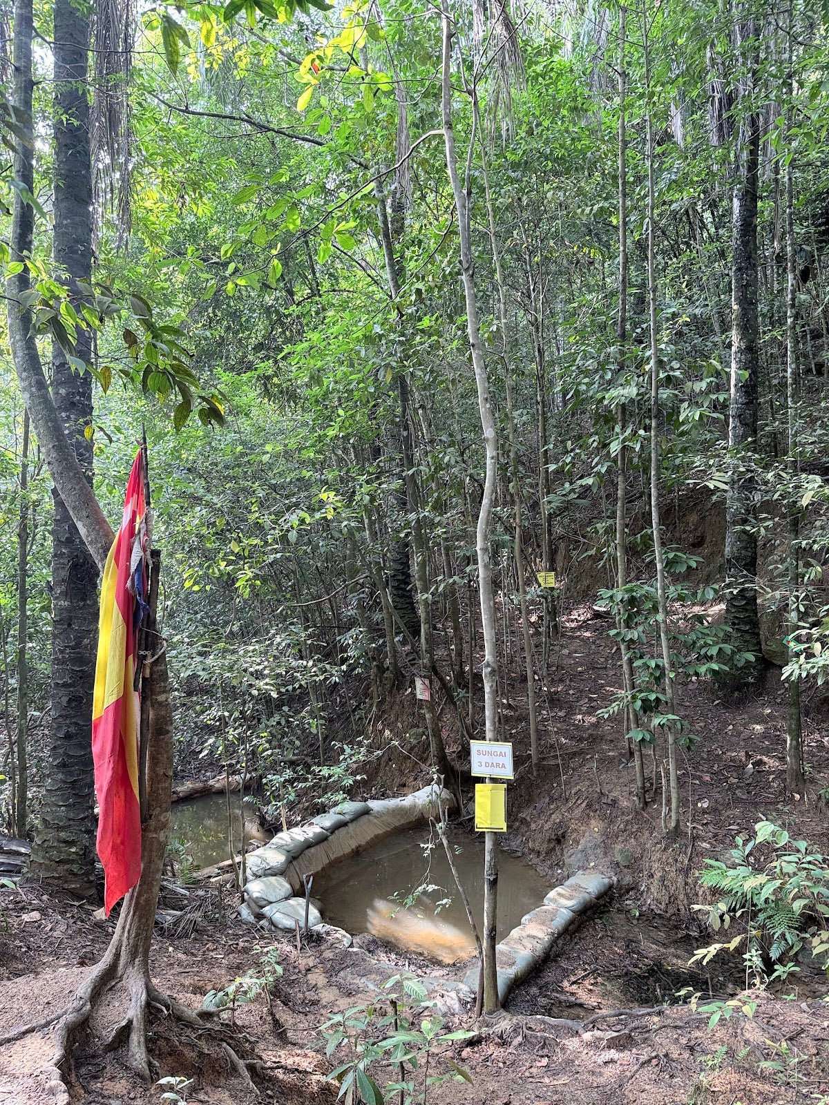
Once you pass through what hikers describe as the "gate" of the forest, the incline starts climbing steadily — and keeps climbing. The gradient increases every few minutes. This is where the moderately challenging rating starts to make sense. The forest itself is beautiful here — lush canopy, those striking red-barked trees that give the trail a slightly otherworldly feel. Keep a steady pace and don't burn yourself out.
Stage 4: Two Roped Sections
The trail hits two roped sections at approximately 40-degree incline. These are the crux of the climb. Use the ropes — they're there for a reason. Take your time, keep three points of contact, and don't rush the person ahead of you. This is where less confident hikers sometimes struggle, especially on wet days when the dirt gets slippery.

Stage 5: CP2 Checkpoint to Summit
After the roped sections you'll hit CP2 checkpoint, and from there it's a manageable push to the top. The summit area is spacious, anchored by a large boulder that's practically made for sitting and taking in the view. On a clear early morning, you're looking at blue mountain ridges, green valleys, paddy fields, and — if conditions are right — that sea of clouds rolling through the valley below. It's genuinely worth the alarm clock.

Descent & Safety
Most hikers come down in around 35 minutes. The roped sections that were tricky on the way up are trickier going down — wet or muddy conditions make them significantly more dangerous. Take your time on the descent, face into the slope on steep sections, and use the ropes properly.
Key hazards to know before you go:
- Wild boar: Abundant in the area. Don't approach, don't feed, and if you encounter one, give it space calmly. Don't run.
- Roped incline sections: 40-degree gradient — underestimating these is how people get hurt. Wet weather makes them genuinely dangerous.
- Exposed grassland: Around 20 minutes in, there's a shadeless open section. In hot weather, this drains energy fast. Hydrate before you hit it.
If it's raining heavily or the trail is waterlogged, turn back — the roped sections in wet conditions are not worth the risk on a 333m hill. There will be another weekend. Don't push it.
What to Bring
Bukit Batu Sawa is a short hike but the exposed section and steeper incline mean you should pack smart, not light-and-sorry.
- Water: There are no noted water points on trail — bring enough from the car. Minimum 1.5L per person; more if you're going mid-morning or later. A hydration bladder like the TAHAN TrailBladder 2L keeps your hands free for the roped sections.
- Trekking poles: Optional on the way up, genuinely useful on the descent especially on the steeper sections. The TAHAN 3-Section Foldable Hiking Stick V2 packs down small enough to throw in your bag and pulls out when you need it.
- Trail shoes or hiking sandals with grip: Not a sandal-in-flip-flops kind of trail. The roped sections and forest floor need proper grip.
- Sun protection: Hat, sunscreen, arm sleeves — that exposed grassland section is no joke.
- Light snacks: Energy bars, nuts, whatever you carry. The summit is a great spot to eat.
- Headlamp: If you're starting at 6 AM, you'll want one for the first stretch before the sun is fully up.
- Rain jacket: Malaysian weather changes fast. Lightweight packable shell, always.
For a more complete rundown of what to bring on Malaysian trails, have a look at our hiking gear guide — covers poles, knee support, footwear and more.
FAQ
How hard is Bukit Batu Sawa?
Honestly, depends who you ask — and that's not a cop-out, it's genuinely what the data shows. MyRehat rates it 2/10 Easy; AllTrails calls it moderately challenging. The first stretch is flat and beginner-friendly. But the trail steepens steadily past the forest gate, and the two roped sections at 40-degree incline are real. First-time hikers can absolutely do it — just don't treat it as a casual stroll.
How long does Bukit Batu Sawa take?
Most hikers report around 45 minutes to the summit and 35 minutes down. That said, total times range widely — anywhere from 30 minutes (trail runners) to 2–3 hours (relaxed pace with breaks and summit time). Budget at least 2 hours for a comfortable outing including the summit stop.
Do I need a permit for Bukit Batu Sawa?
Yes. The permit costs RM5 per person for Malaysian citizens and is issued by the Jelebu District Forestry Office. You can get it via the N9PAY government platform in advance, or contact Puan Shima at +6012 942 5094. There's a counter at the trailhead but don't bank on it being open at dawn — sort it beforehand.
Is Bukit Batu Sawa good for sunrise or sea-of-clouds views?
Yes — this is actually one of the main draws. The sea-of-clouds (awan karpet) and morning mist are best seen from the summit in the early morning. A 6–7 AM start is the standard recommendation. The mist typically dissipates by mid-morning, so sleeping in means you'll likely miss it. Note that the cloud effect is more pronounced after recent rain — dry spells may just give you a clear sunrise, which is still a good time.
Camp Nearby?
Making a weekend of it? The Jelebu area and surroundings have some solid options for camping and glamping. De Star Glamping, Lenggeng is a comfortable option if you want to base yourself nearby without roughing it. For something with more of a farm and nature feel, check out our review of Laman Eden Campsite Farm and Homestay. Or if you want to pair Bukit Batu Sawa with a Broga Hill run, Nature Haven Glamping, Broga puts you nicely between both trails. Staying the night before gets you an early start without a 4 AM alarm from KL.
Trail conditions, permit updates, and hiking buddies for the weekend — all in one WhatsApp group. Just ask; someone was probably up there last week.
💬 Join the Hiking CommunityFree, one click. No spam — the occasional promo at most.
Gear tip: Water bladder or bottle on a humid trail.
Mike has been camping across Malaysia for over 10 years — from jungle treks in Taman Negara to beach camps in Perhentian. He writes about it so you don't have to find out the hard way. Follow along on TAHAN Outdoor's blog for honest campsite reviews, every week.