Bukit 527, Sepang: A Hiker's Guide (2026)
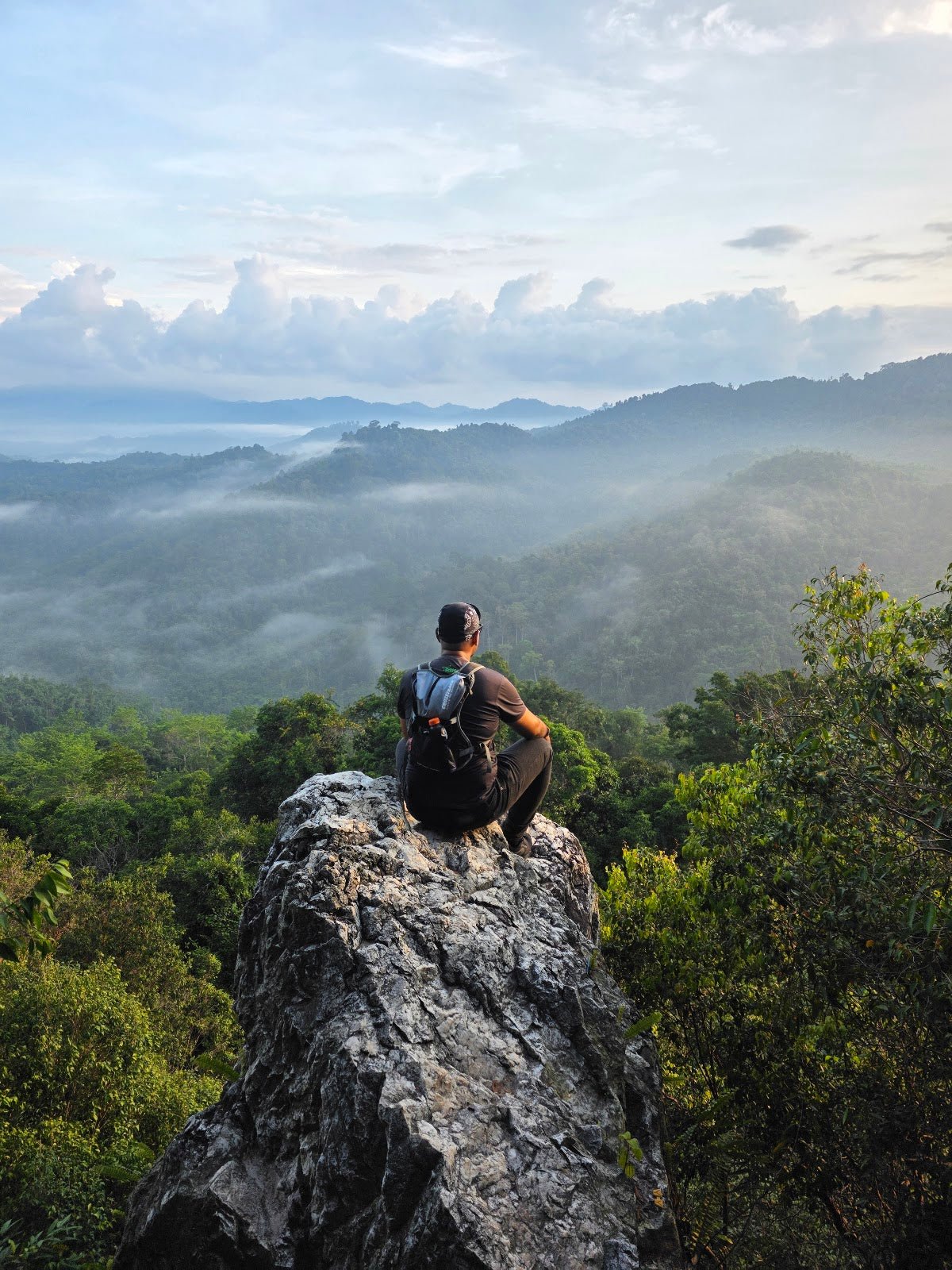
Bukit 527 doesn't look like much on paper — 192 metres, tucked into the Sepang area near Bandar Baru Salak Tinggi, surrounded by oil palm. But this little hill punches above its weight. The summit opens up to a genuine 360-degree panoramic view of Salak Perdana township, the trail itself is well-maintained by a community group called Tebas Hikers, and on a misty morning the clearing feels properly atmospheric. It's the kind of place locals know and outsiders overlook.

This hike suits first-timers, families with kids, and anyone wanting a quick green fix without burning a full day. The standard out-and-back to the summit takes most people around 1 to 1.5 hours. If you want more, extended loop variants stretch things out to 4 hours, with bonuses like a tree house, rope sections, inscribed rock, and what hikers call the "avatar tree" along the Trans Unggul trail. The base route is easy; some of the extended routes push into moderate territory.
One honest heads-up: finding the trailhead takes a bit of figuring out. The parking situation is not well-signposted, and more than one hiker has had to circle around before landing in the right spot. Worth sorting before you leave home.
Quick Facts
- Summit Elevation: 192 m
- Elevation Gain: 68–95 m depending on route (standard route ~68 m)
- Distance: 2.3 km out-and-back to summit; extended loops range from 1.8–5 km
- Duration: 30–45 min to summit; 1–1.5 hours standard out-and-back; 1.5–4 hours with extended loops
- Difficulty: Easy to Moderate; beginner-friendly, suitable for families with children
- Trailhead: Ladang Brook Side, Sepang, Selangor (near Bandar Baru Salak Tinggi / Salak Perdana)
- Permit: Unclear — check before you go (see Permits section below)
- Trail Management: Community-managed by Tebas Hikers
- Best Time: Early morning; avoid rainy season (November–March)
Getting There & Parking
The trailhead is in the Ladang Brook Side area, Sepang, close to Bandar Baru Salak Tinggi and Salak Perdana. Exact GPS coordinates aren't confirmed in any source we've seen — this is one of those community trails where the pin on Google Maps might not land you exactly right. Search for "Bukit 527 Sepang" or "Ladang Brook Side trail" and cross-reference with the Tebas Hikers community for the most current directions before heading out.
Parking is reportedly free at the community-managed trailhead area, but don't expect a proper car park with clear signage. As one hiker put it, you need some tricks to find the parking. Give yourself extra time on your first visit, arrive early, and don't rely on a single map source.

Permits & Fees
This one's genuinely unclear. Selangor operates the SeForest e-permit system under Jabatan Perhutanan Selangor (Selangor Forestry Department) for 52 peaks in the state, with a reported fee of RM5.00 per person. Whether Bukit 527 falls under that system is not explicitly confirmed — the hill is community-managed by Tebas Hikers, which may or may not change the requirement. A guide is not confirmed as mandatory here, but again, that's unconfirmed.
Trail conditions and permit requirements change — always check with the local forestry office or park authority before you go. Or ask the TAHAN Hiking Community on WhatsApp — someone's usually been there that week.
The Trail: What to Expect
The trail is well-marked and maintained — credit to Tebas Hikers for keeping it in solid shape. That said, "well-maintained" doesn't mean easy in wet conditions. The red soil on this hill gets properly slippery after rain, so don't let the short distance fool you.

Stage 1: Trailhead Through Oil Palm
The hike starts through an oil palm plantation area. Not the most scenic opening, but it's flat and gets you warmed up. Stay on the marked path — the plantation sections can feel samey, so follow the trail markers carefully. Mosquitoes are active here, especially in the morning, so get your repellent on before you start.
Stage 2: Into Secondary Forest
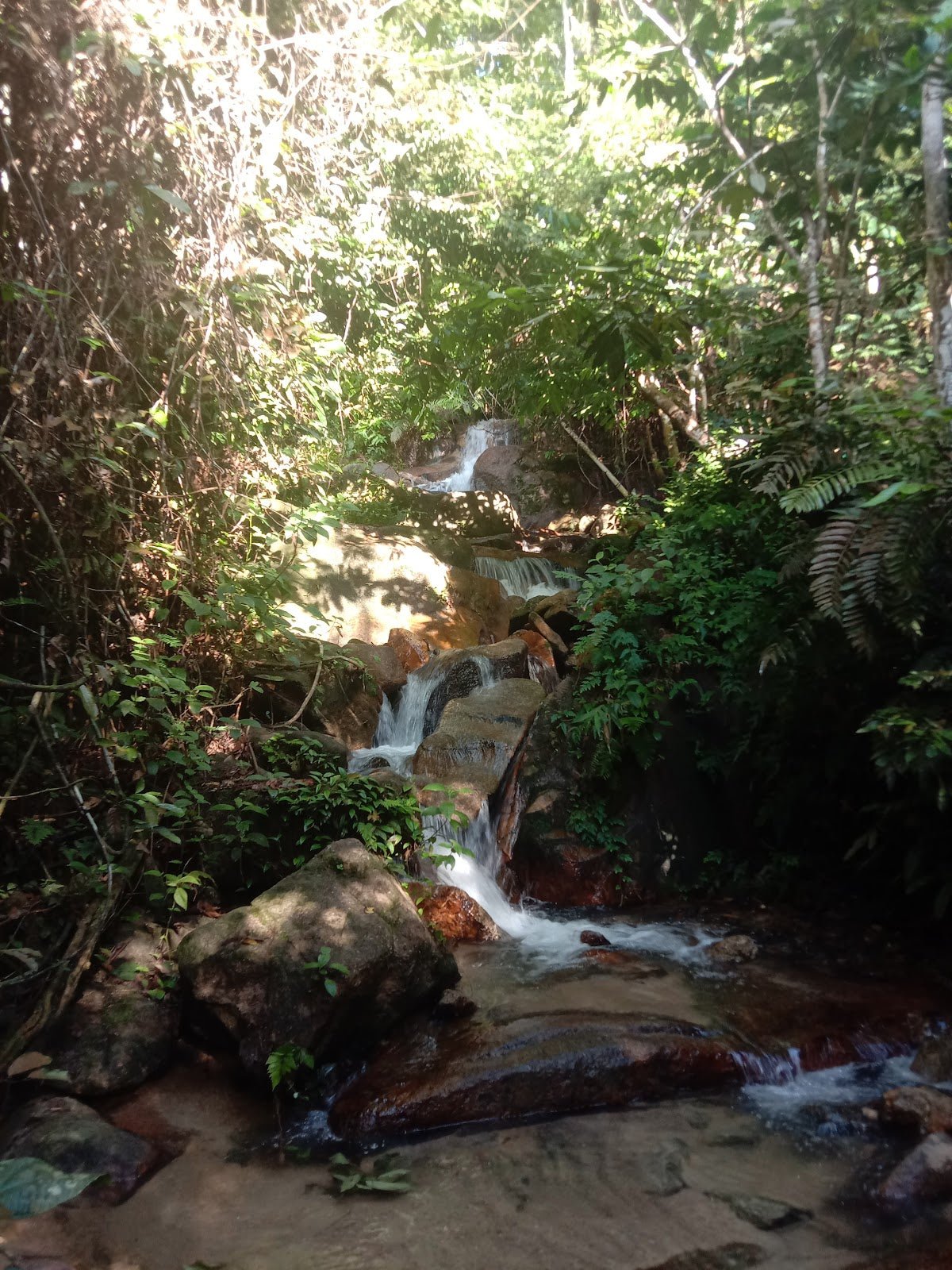
The trail transitions into secondary forest via a red dirt track. This is where Bukit 527 starts feeling like a proper jungle hike rather than a plantation walk. The canopy provides shade, which you'll appreciate once the sun gets up. The red soil here is the main hazard — wet or dry, it deserves respect on the steeper parts.

Stage 3: Steep Sections Mixed with Gentler Ground
The climb alternates between steep pushes and more relaxed forest sections. The steep bits are short but require you to watch your footing, particularly on descent. If you're bringing younger kids, this is the section where you'll want to hold hands. Nothing technical, but slipping on red clay is not fun.
Stage 4: Summit Clearing
The summit opens into a clearing with 360-degree views over Salak Perdana township and Bandar Baru Salak Tinggi. On a clear early morning, the view is genuinely worth it — and if there's mist sitting in the valleys, sunrise photography here is something special. There are tables and chairs at the top, and a small community stall serving light snacks and drinks (water tap, hot water, tea, coffee) — open from around 10am. Don't count on the stall being open if you're doing an early sunrise hike; bring your own water and snacks.

Stage 5: Return or Extended Loops
Standard out-and-back means heading back the same way. If you have time and energy, the extended loop options add serious value — the Trans Unggul trail adds roughly an hour and leads to the famous "avatar tree" (big draw for photographers). Other loop variants include a tree house, rope sections, an inscribed rock, and farmland sections. Total loop distances range from 1.8 km up to 5 km depending on how far you want to extend. The "3 Dara river" junction appears on some trail descriptions — recent hiker feedback suggests it's three small ponds and not particularly worth the detour if time is tight.
Descent & Safety
Going down Bukit 527 is where people get lazy and then slip. The steep sections that felt manageable on the way up become more demanding on your knees on the way down, and that red soil gives very little grip when it's damp. Take it slow, especially after any rain.

Key hazards to keep in mind:
- Slippery red soil — the main danger on this trail, especially wet or post-rain
- Rocky sections — require careful foot placement going down
- Mosquitoes — active throughout; insect repellent is not optional
- Muddy trail in rainy season (November–March) — conditions can deteriorate significantly
- Steep descent sections — test stamina and put stress on knees
If it's been raining recently or rain starts while you're on trail, turn back or wait it out at the summit. The red clay descent becomes genuinely risky when wet. This is a community trail, not a managed park — if something goes wrong, you're largely on your own to manage it.
What to Bring
For a hike this short, people underpack and then regret it. Here's what actually matters for Bukit 527:
- Water — carry enough for the whole hike. The summit stall only opens around 10am; there are no water points on the trail itself. A hydration bladder like the TAHAN TrailBladder 2L keeps your hands free and ensures you won't run dry on a warm morning.
- Insect repellent — non-negotiable on this trail
- Grippy trail shoes or boots — not sandals, not running flats. Red clay demands proper grip.
- Light snacks — summit stall is a bonus, not a given
- Rain jacket or poncho — weather in Sepang shifts fast
- Trekking poles — if you're doing the extended loops or your knees feel the descents, a pair of poles makes a real difference on the steep red-soil sections. The TAHAN 3-Section Foldable Hiking Stick V2 is compact enough that it doesn't feel like overkill for a short hike but saves your knees when you need it.
- Sun protection — the summit clearing has no shade
- Fully charged phone — the trailhead is not easy to find; you may need GPS throughout
If you're newer to hiking and not sure what else you need, have a read through our hiking gear guide — covers the basics so you're not figuring it out on the hill.
FAQ
How hard is Bukit 527?
Easy to Moderate overall. The summit route is beginner-friendly and suitable for families with children. The steep sections are short, the trail is well-marked, and the summit takes most people 30–45 minutes to reach. That said, the red soil gets treacherous after rain, and the extended loop variants with rope sections push things into moderate territory. Don't arrive in flip-flops.
How long does the Bukit 527 hike take?
Most hikers reach the summit in 30–45 minutes. A standard out-and-back including rest time at the top takes 1–1.5 hours. If you take the extended loops (Trans Unggul trail, tree house route, etc.), budget 1.5–4 hours depending on how far you go.
Do I need a permit for Bukit 527?
Honestly, it's unclear. Selangor has a SeForest e-permit system covering 52 peaks under Jabatan Perhutanan Selangor, with a reported fee of RM5.00 per person, but Bukit 527 is not explicitly confirmed to be on that list. The trail is community-managed by Tebas Hikers. Check with the Selangor Forestry Department before your trip to confirm current requirements.
When is the best time to hike Bukit 527?
Early morning is the call — cooler temperatures, better views, and you catch the mist in the valleys if you're going for photos. The trail is open year-round but avoid it during and immediately after heavy rain, and be especially cautious during the rainy season from November to March when the red soil gets dangerously slippery.
Camp Nearby?
Bukit 527 is a day hike rather than an overnight, but if you want to make a proper weekend of it in the region, there are solid campsite options within reasonable driving distance in Selangor. Making a weekend of it? Check out our reviews of Mori Leka Campsite, Serendah, Nature Escape Campsite, Hulu Langat, and Templer Park Rainforest Retreat — all good bases if you're exploring Selangor's green spaces over a few days. Staying the night nearby also makes an early summit start far more realistic than driving from KL at 5am.
Trail conditions, permit updates, and hiking buddies for the weekend — all in one WhatsApp group. Just ask; someone was probably up there last week.
💬 Join the Hiking CommunityFree, one click. No spam — the occasional promo at most.
Gear tip: How to use a trekking pole (and set the height).
Mike has been camping across Malaysia for over 10 years — from jungle treks in Taman Negara to beach camps in Perhentian. He writes about it so you don't have to find out the hard way. Follow along on TAHAN Outdoor's blog for honest campsite reviews, every week.