Bukit Sri Bintang, Kepong: A Hiker's Guide (2026)
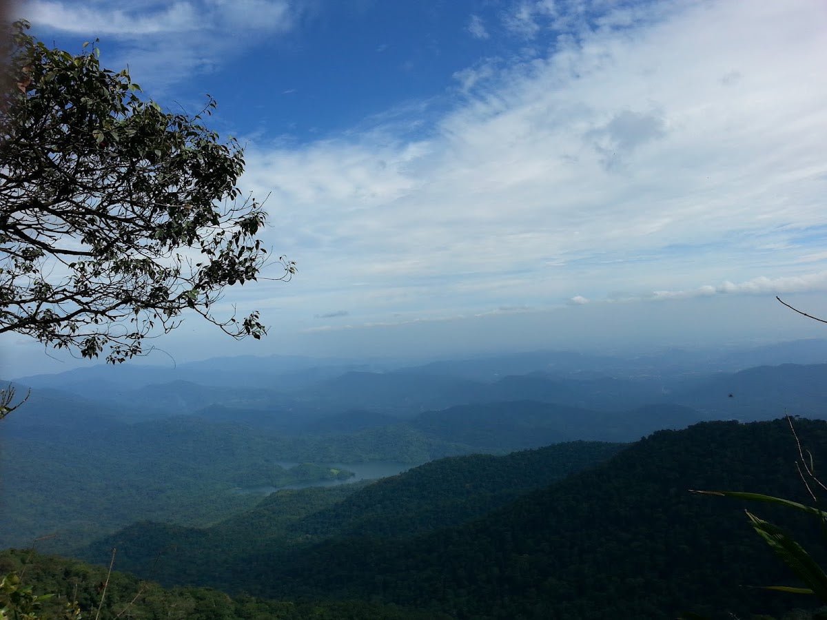
Bukit Sri Bintang is one of those hidden-in-plain-sight hills that KL locals either swear by or have never heard of. Tucked into the residential fringes of Kepong in northern KL, this compact two-peak hill punches above its weight — on a clear morning, you're rewarded with a 270° sweep of the KL skyline, Petronas Twin Towers and KL Tower included. For a hill that takes under two hours to complete, that's a pretty solid return on investment.

This is primarily a neighbourhood exercise trail. You'll share it with seniors doing their morning rounds, families with kids, and the occasional mountain biker. But don't let that lull you — Peak 2 has a rope-assisted steep section that earns its moderate rating, and after rain, those earthen paths get properly slippery. It's an easy hike overall, but it still demands your attention.
Bukit Sri Bintang suits beginners, families, and anyone wanting a quick outdoor hit without leaving the city. It also makes a solid warm-up trail if you're working your fitness up toward bigger mountains. Just go early — afternoon KL heat on exposed hilltops is no joke.
Quick Facts
- Elevation: 212 m
- Elevation Gain: 198 m
- Distance: 2.3–3.5 km loop (varies by route taken)
- Duration: 45 minutes to 2 hours (most hikers complete the full loop with both peaks in 1–1.5 hours)
- Difficulty: Easy to moderate (easy for the short loop; moderate for the Peak 2 rope section)
- Permit Required: No. Free entry, no gate, no registration needed.
- Guide Required: No
- Best Time: Early morning for cooler temps and clearest city views
Getting There & Parking
The primary trailhead is on Jalan 11/36, Kepong, northern Kuala Lumpur. There's also a secondary entrance along Ridgewood in Desa Park City, but for a first visit, stick to the Jalan 11/36 entrance — it's more straightforward. Use Waze and search for Bukit Sri Bintang or the street name directly; the residential streets in the area can genuinely confuse you if you're navigating by instinct.
Parking is limited. There's roadside parking on Jalan 11/36 and nearby Jalan 4/36, but spaces fill up fast on weekends and early mornings. Overflow parking is available at nearby shop lots — less than a 5-minute walk. If you're parking roadside, don't block driveways. This is a residential neighbourhood and the locals live there; respect that.

Permits & Fees
No permit, no fee, no registration. There's no official DBKL or Forestry Department permit system in place for Bukit Sri Bintang. You walk up to the trailhead and you start. That's it.
Trail conditions and permit requirements change — always check with the local forestry office or park authority before you go. Or ask the TAHAN Hiking Community on WhatsApp — someone's usually been there that week. Checking a different gunung? Try our free permit checker — instant answer for 90+ Malaysian mountains.
The Trail: What to Expect
The route is a loop, and there are multiple sub-trails threading through the hill — most of them eventually connect back to the same destinations. On your first visit, stay on the main, most-worn track and you'll be fine. Here's how it typically plays out.
Trailhead to First Climb
From the Jalan 11/36 entrance, you'll hit a fork almost immediately. Take the main path heading uphill. The first couple of minutes are flat, then it's continuously uphill from there. The terrain is a mix of concrete stairs, earthen steps, and hard-packed dirt — classic urban jungle trail stuff. Nothing technical yet, but the gradient is consistent. Don't rush the first section; let your legs warm up.

Peak 1 — The Flag Clearing (~20 minutes from trailhead)
About 20 minutes in, you'll reach a wide clearing — benches, chairs, some shade, and a Malaysian flag planted at the top. This is Peak 1, and it's where most casual visitors stop. The city views from here are already excellent on a clear morning. This clearing has a community feel to it; you'll often find the same regulars here every day. Worth a rest and a photo before continuing.

Peak 1 to Peak 2 — The Rope Section (~10–15 minutes further)
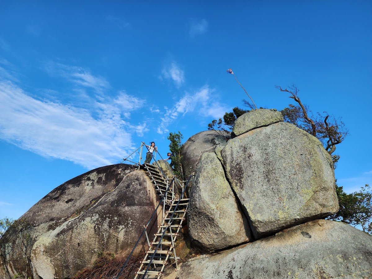
From Peak 1, a further 10–15 minutes gets you to Peak 2. This section is where the difficulty steps up. There's a steep climb with ropes provided to help you pull yourself up — these are there for a reason. Take your time, test your footing before committing your weight, and don't rush past other hikers on a narrow section. This is the bit that some sources call easy and others call moderate; honestly, it depends on your fitness level and whether it's been raining. After rain, this section becomes significantly more hazardous.
En route you'll pass a mini farm and a makeshift rest hut — both add to the character of this place. The trail also follows power cables toward Peak 2, so it's fairly intuitive to navigate.
Peak 2 — 'Botak' Summit
Peak 2 is known locally as 'Botak' — the top was cleared for power line pylons and remains largely deforested and grassy. The stacked rocks here are a landmark and a popular photo spot. The panoramic city views from this exposed hilltop are arguably better than Peak 1's, though you'll be more exposed to sun and wind. On a clear day, the Petronas Twin Towers and KL Tower are both visible from here.

Return Loop
Head back via the loop trail on a different path to the trailhead. Multiple alternative routes exist — most reconnect and get you back to the bottom. One thing worth noting: if you're hiking in the evening, make sure you start your descent before dark. With multiple trail offshoots leading to different exits, it's easy to end up at the wrong end of the hill at night. The trail is technically open 24 hours, but navigating it in the dark without familiarity is an unnecessary complication.

Descent & Safety
Going down is where most people have issues on Bukit Sri Bintang. The descent is faster, but the uneven ground and earthen slopes demand more attention than the climb up. Here's what to keep in mind:
- After rain: Trails become muddy and slippery across the board. The rope section near Peak 2 is especially risky when wet. If there's been heavy rain, either postpone or be extremely careful — slow down and use the ropes and tree roots deliberately.
- Steep descent from Peak 2: Use the same rope-assisted sections on the way down. Face the slope if you need to — there's no shame in it.
- Exposed hilltop sun: The Botak area near Peak 2 has direct sun exposure with no tree cover. In peak afternoon hours this is genuinely unpleasant and can lead to overheating. Go early.
- Mountain bikers: Some sections of the trail are shared with bikers. Stay alert, especially on downhill stretches where bikes move fast. Give way.
- Uneven ground throughout: Watch your footing consistently — this isn't a manicured park path.
- No toilets: Not at the trailhead, not on the trail. Plan accordingly before you leave home or the car.
- No water points on trail: Bring everything you need from the start.
If weather turns bad — thunderstorm incoming, rain starting — turn back. KL afternoon storms can arrive fast and make exposed hilltops dangerous and trails treacherous very quickly. This hill will still be here tomorrow.
What to Bring
Bukit Sri Bintang is a short hike, but that doesn't mean you show up unprepared. This is a tropical hill with exposed sections and a rope-assisted technical bit. Here's what actually makes sense for this trail:
- Water: 500 ml to 1 L is sufficient for the standard loop. There are zero water points on trail. Don't skip this.
- Shoes with grip: Trail shoes or hiking shoes, not road runners. After rain especially, you'll want proper grip on the earthen sections.
- Sun protection: Sunscreen, cap, or buff. The Botak summit area is fully exposed.
- Gloves (optional but useful): If you want grip on the ropes at Peak 2 — a light pair makes a difference.
- Hiking pole: Sounds like overkill for a 212 m hill, but on the steep descent after rain it genuinely helps. The TAHAN 3-Section Foldable Hiking Stick V2 folds down small enough that there's no reason not to throw it in your bag — RM99 and it's earned its keep on trails far trickier than this.
- Knee support: If your knees complain on descents, the TAHAN Kinetix Knee Guard With Spring Support is worth having for the downhill sections, especially the steep bit from Peak 2.
- Snacks: Optional for such a short hike, but a light snack for the summit is always a good idea.
- Phone, fully charged: For navigation (multiple sub-trails), photos, and emergency contact.
If you're putting together a more complete hiking kit for trails beyond Bukit Sri Bintang, have a read through our hiking gear guide — covers what's worth spending on and what isn't.
FAQ
How hard is Bukit Sri Bintang?
Easy to moderate, depending on which section you take. The short loop to Peak 1 is genuinely easy — concrete and earthen stairs, nothing technical. The section from Peak 1 to Peak 2 has a steep rope-assisted climb that pushes it into moderate territory. Beginners can do it, but don't underestimate the rope section, especially after rain.
How long does Bukit Sri Bintang take?
Most hikers complete the full loop including both peaks in 1 to 1.5 hours. If you're moving quickly or just doing Peak 1, you can be done in 45 minutes. If you're taking your time, stopping for photos, and exploring side trails, allow up to 2 hours. The distance is 2.3–3.5 km depending on the route you take.
Do I need a permit for Bukit Sri Bintang?
No. Free entry, no gate, no registration required. There's no official permit system from DBKL or the Forestry Department for this trail as of 2026. Just show up and hike.
Can I bring kids to Bukit Sri Bintang?
Yes, for the most part. The main trail to Peak 1 is manageable for kids who are reasonably fit and steady on their feet. The rope section toward Peak 2 requires more caution — assess your child's ability honestly before attempting that stretch. Avoid bringing very young children after rain when trails are slippery.
Camp Nearby?
Bukit Sri Bintang is a day hike — there's no camping on the hill itself. But if you want to make a proper outdoor weekend out of your trip to the KL area, there are solid options not too far away. Making a weekend of it? Check out our review of Dangau Jungle Herb Sauna & Taman Melawati Campsite for something unique close to the city. For a proper escape into the hills, both Woodstock Camp Janda Baik and Glamping Valley @ Janda Baik are worth the short drive out of KL — great options if you want to wake up in the forest and stay overnight before or after your hike.
Trail conditions, permit updates, and hiking buddies for the weekend — all in one WhatsApp group. Just ask; someone was probably up there last week.
💬 Join the Hiking CommunityFree, one click. No spam — the occasional promo at most.
Mike has been camping across Malaysia for over 10 years — from jungle treks in Taman Negara to beach camps in Perhentian. He writes about it so you don't have to find out the hard way. Follow along on TAHAN Outdoor's blog for honest campsite reviews, every week.
⛺ Featured in: 10 Easy Hikes Near KL for First-Timers (2026)