Bukit Mertajam: A Hiker's Guide (2026)
Bukit Mertajam — or Cherok Tokun as the forestry folks call it — is the highest point on Penang's mainland, sitting at 545 m. It's not Kinabalu. It's not even Nuang. But don't let the numbers fool you: this hill has proper jungle, genuinely steep sections, aggressive macaques, and enough trail variety to keep you coming back. With 34 trails in the park ranging from a casual family walk to a full-day loop, Bukit Mertajam is one of the most underrated hiking spots in northern Peninsular Malaysia.

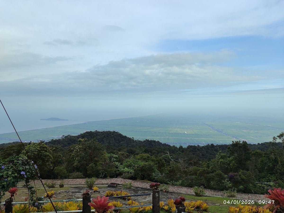
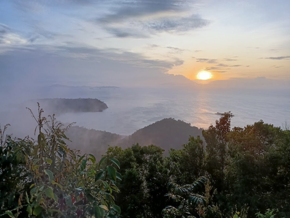
The park suits a wide range of hikers. Families with kids can do the paved lower trail to the famous Big Tree in about 20 minutes and call it a good morning out. Fit hikers chasing a proper sweat can push to the summit and back in a few hours, or string together the Trek 700/800 loop for a more serious day. The views from the top — Mengkuang Dam on a clear day, mainland Penang spread out below you — are worth every steep step. Just know what you're signing up for before you start.
The park was closed for roughly two years (from February 2022) for slope stabilisation and trail upgrade works, and it reopened to full public access in early 2024. The 3.6 km pedestrian trail from base to peak was structurally upgraded during that closure. Things are better than they've been in years — but the jungle is still the jungle, and the slopes are still steep.
Quick Facts
- Summit elevation: 545 m (highest point on Penang mainland)
- Main summit route (one-way): ~3.5–3.6 km
- Most popular loop (Cherok Tokun Viewing Point): ~5.6 km
- Elevation gain: ~414 m on the popular loop; range across routes ~183 m to ~505 m depending on trail
- Duration (main summit, one-way): ~2 hours up, ~1 hour down
- Duration (popular loop): 2.5–3 hours
- Difficulty: Hard (main loop and summit routes); Moderate (paved Station 2 sections); beginner paved trail available
- Permit required: No
- Entry fee: Free
- Parking: Free
- Number of trails in park: 34
Getting There & Parking
The main trailhead is at Jalan Kolam, 14000 Bukit Mertajam — about 6 km from Bukit Mertajam town. If you're coming via the North-South Expressway, exit at Tol Juru, head towards Bukit Mertajam town, then take the road towards Kulim. On Google Maps, search for Cherok Tokun Nature Park (National Forest) — that'll get you there more reliably than a street address alone. GPS coordinates: 5.366735, 100.483353.
There's no bus service to the trailhead, so you need a private vehicle or taxi. There are two free car parks at the main trailhead — a lower car park and a second (upper) car park. Both are free for cars and motorcycles. Spaces can get limited on weekends and public holidays, so arriving early (before 8 am) is smart.
There's also an alternative trailhead at Jalan Kampung Besar, next to a Taoist temple called 玉封震山阁老佛庙. From Bukit Mertajam town, take Jalan Kulim and turn left at SJKC Kim Seng school. Ample parking is available beside the temple. Note that trail details for the Kampung Besar route come from a single source, so verify locally before committing to that approach.
Permits & Fees
No permit is required to hike Bukit Mertajam. Entry to Cherok Tokun Nature Park is free. The park is managed by Jabatan Perhutanan Negeri Pulau Pinang (JHN Penang), located at Pejabat Renjer Hutan, Jalan Kolam Air, 14000 Bukit Mertajam. Toilets are available near the car park area — one reviewer reported a small charge of around 30 sen, so bring a few coins.
One source lists unofficial operating hours as 8 am–5 pm, but this hasn't been confirmed by JHN Penang officially. Don't start your hike late and expect the park to accommodate you past late afternoon regardless.
Trail conditions and permit requirements change — always check with the local forestry office or park authority before you go. Or ask the TAHAN Hiking Community on WhatsApp — someone's usually been there that week. Checking a different gunung? Try our free permit checker — instant answer for 90+ Malaysian mountains.
The Trail: What to Expect
The main summit route is the 3.5–3.6 km trail from the Cherok Tokun trailhead to the 545 m peak. Most people do the popular ~5.6 km Viewing Point loop. Below is the main summit route broken down by stage, with notes on the Trek 700/800 extension and the alternative Old Dam route.

Stage 1: Lower Car Park to the Big Tree Junction (~20 min)
From the Jalan Kolam entrance, you walk through the lower car park area — there's a fruit stall near the second car park if you need a last-minute top-up. The first section follows a paved trail through a bamboo grove. It's easy walking, good for warming up your legs, and perfectly manageable even for kids. After roughly 20 minutes on this paved section, you'll hit the junction for The Big Tree — the Mengkundor tree (Tetrameles nudiflora), which is the largest buttress-root trunk in Penang state, estimated at over 100 years old. It's signposted; follow the diversion to the left. Even if you're not doing the full summit, the Big Tree alone is worth the trip.
Stage 2: Big Tree Junction to Station 2 (~40 min)
Past the Big Tree, the trail switches from paved to proper jungle. This section takes roughly 40 minutes and involves a moderate incline with noticeably steeper bits thrown in. Roots, rocks, humidity — the works. You'll arrive at the Station 2 rest area, which serves as the midpoint. From here you have a choice: descend via the tarred road back to the second car park if you've had enough, or push on to the summit. If the weather's turning or someone in your group is struggling, this is your sensible exit point.

Stage 3: Station 2 to the Viewpoint and Dragon Moustache Tree
Continuing upward, the trail brings you to the Bukit Mertajam Viewpoint — a proper rest stop with panoramic views. Stop here, catch your breath, and look out over mainland Penang. From this section onward, keep an eye out for the Dragon Moustache Tree along the Three Red Chair route — an ancient twisted-branch tree that's been growing here for over a century. It's one of those things you see and immediately take five photos of.
Stage 4: Three Red Chair to Summit (545 m)
The Three Red Chair landmark is a well-known rest area near the summit — you'll know it when you see it. From here, the summit is close. The peak at 545 m has two Telekom towers and an observatory. On a clear day, you can see Mengkuang Dam from the top. On a hazy day, you still get a solid view over the mainland. Recent hikers have mentioned spotting hornbills, kingfishers, and eagles along the way — worth keeping your eyes (and ears) open.

Optional: Trek 700/800 Loop Extension
If you want more, the Trek 700/800 loop extension adds significant distance. From the Trek 350/700 junction, the route passes an old dam and a Mengkuang Dam viewpoint before looping back via Trek 800 to the second car park — roughly three-quarters of an hour one way for this extension. This combination is recommended for experienced hikers only. Navigation signage on some trails has been flagged as insufficient, so if you're attempting this for the first time, go with someone who knows the route or download an offline map before you set off.
Alternative: Cherok Tokun Old Dam Route (from Second Car Park)
Starting from the second car park, this route takes you past the Cherok Tokun Old Dam — an 81-year-old dam that's a genuine historical landmark — through a jungle trail up a forested slope, past a viewing deck, and up to the peak. Expect about 2 hours to ascend this way. There's a small waterfall and cascade along this route too. A good alternative if you want something different from the main trail.

Descent & Safety
Going down sounds easier but that's where people get hurt. The tarred road section has a fairly steep gradient — step carefully, especially if it's wet. The jungle trail is slippery even in dry conditions thanks to humidity; in the rain, it becomes genuinely hazardous. If there's heavy rain during your hike, the tarred road descent is the safer option over the jungle trail.
Key hazards to know before you go:
- Landslide risk: The park was closed in February 2022 specifically due to slope instability from heavy rainfall. The terrain has been upgraded, but heavy rain still means real risk. Do not hike during or after prolonged heavy rain.
- Slippery trails: Humidity keeps the paths slick year-round. Proper grip footwear is non-negotiable.
- Aggressive monkeys: Long-tailed macaques and Dusky Leaf Monkeys are present throughout the park and can be bold. Do not leave food exposed. Do not feed them. Secure your bag zips.
- Navigation difficulty: Signage is reportedly insufficient on some trails, which can disorient first-time hikers. Download AllTrails or a similar offline map before entering the jungle sections.
- Steep tar road descent: Take it slow. Slipping on tarmac on a slope is not fun.
- Rainy season (year-end): Trails become especially hazardous during the northeast monsoon. Bring a rain coat and extra dry clothing if you're hiking November through January.
General rule: if the sky is darkening and it hasn't rained yet, turn back. Bukit Mertajam will still be there next weekend.
What to Bring
This is a genuine jungle hike with steep sections, heat, and humidity. Pack accordingly:
- Water: Carry more than you think you need. One hiker reported drinking about 2 litres on the ascent alone. Do not rely on trail water sources — they're unverified and you shouldn't be treating jungle water on a day hike.
- Footwear: Trail shoes or hiking boots with good grip. Not running flats, definitely not sandals.
- Trekking poles: The steep tarred descent and the slippery jungle trail sections are exactly where poles earn their place. The TAHAN 3-Section Foldable Hiking Stick V2 (RM99) folds down small enough to throw in a daypack and is solid enough for proper trail use.
- Knee support: If you've got any history of knee issues, the steep descents here will remind you quickly. The TAHAN Kinetix Knee Guard With Spring Support (RM79) is worth having — especially on the tar road going down.
- Rain jacket: Year-end especially, but honestly useful any time. Malaysian weather does not negotiate.
- Snacks: Keep them sealed and out of sight. Macaques are watching.
- Sun protection: Hat, sunscreen — the exposed sections near the summit get hot fast.
- First aid basics: Plasters, antiseptic wipes, muscle rub.
- Fully charged phone: Offline maps downloaded before you enter the jungle. Not after.
For a more detailed look at what poles and knee guards actually make a difference on Malaysian trails, check out our hiking gear guide.

FAQ
How hard is Bukit Mertajam?
Honestly — harder than it looks on paper. The main summit loop is rated Hard on AllTrails, and that's fair. The paved lower section is easy and family-friendly, but past the Big Tree junction it becomes a proper jungle trail with steep inclines, roots, and slippery ground. The Trek 700/800 combinations are for experienced hikers only. There is a beginner-friendly paved trail option if that's what your group needs, but don't attempt the summit route if you're genuinely new to hiking and not physically prepared.
How long does it take to hike Bukit Mertajam?
For the main summit route, expect roughly 2 hours up and about 1 hour down. The most popular Cherok Tokun Viewing Point loop takes most hikers 2.5–3 hours total. A short loop can be done in 1–1.5 hours. The Trek 700/800 full-day combination takes significantly longer — plan for a 3–4+ hour outing at minimum if you're going that route.
Do I need a permit to hike Bukit Mertajam?
No permit required, and entry is free. The park is managed by JHN Penang. Toilets are available near the car park (bring small change — around 30 sen reported). Parking at both car parks is also free.
When is the best time to hike Bukit Mertajam?
Early morning — around 7–8 am — is the consensus for cooler temperatures and fewer crowds. Trails are open year-round, but the year-end rainy season (northeast monsoon, roughly November to January) makes conditions significantly more challenging and hazardous. If you're going during that period, pack a rain jacket, bring dry layers, and be honest with yourself about turning back if the weather deteriorates.
Camp Nearby?
Making a weekend of it? Penang has some solid options nearby. Brew Valley Retreat, Bukit Mertajam is the closest option and worth checking out if you want a base right in the area. On the island side, 406 Dusun Durian Balik Pulau is a lovely kampung-style setup in Balik Pulau — great for winding down after a hard hike. And if you're bringing a bigger group or scouts, PusKeP Butterworth is a solid organised campsite on the mainland side. Any of these works as a base for an early morning start at Cherok Tokun.
Trail conditions, permit updates, and hiking buddies for the weekend — all in one WhatsApp group. Just ask; someone was probably up there last week.
💬 Join the Hiking CommunityFree, one click. No spam — the occasional promo at most.
Gear tip: Water bladder or bottle on a humid trail.
Mike has been camping across Malaysia for over 10 years — from jungle treks in Taman Negara to beach camps in Perhentian. He writes about it so you don't have to find out the hard way. Follow along on TAHAN Outdoor's blog for honest campsite reviews, every week.