Bukit Keluang, Terengganu: A Hiker's Guide (2026)
Bukit Keluang is one of those rare hikes where you get jungle, sea caves, dramatic cliffs, and a South China Sea panorama — all in under two hours. It sits right on the coastline near Kampung Raja in the Besut district, and it has a well-earned reputation as one of Terengganu's most scenic short hikes. Don't let the modest elevation fool you, though. The route has some genuinely exposed sections that demand your full attention.

This hike suits beginners and families, and it's a solid option if you're making your way up or down the East Coast and want to stretch your legs somewhere memorable. That said, "suitable for beginners" does not mean "walk in the park" — the descent in particular has a reputation for catching people off guard. More on that below.
Weekdays are noticeably quieter here, and if you time it with low tide, you get access to the sea caves properly. Come on a weekend morning and you'll be sharing the trail with a crowd. Plan accordingly.
Quick Facts
- Peak elevation: 141 m (sources conflict — one report cites approximately 300 m from sea level, likely a different reference point)
- Elevation gain: 152 m (498 feet) on the main route; 184 m (603 feet) on the alternative route
- Distance: Approximately 2.25 km round trip (main route); alternative route approximately 1.9 km; some sources report up to 3 km total
- Moving time: 0.5–1 hour to summit; descent typically 30 minutes; total time including breaks approximately 2 hours
- Difficulty: Moderate — rated "easy but perilous" in sections
- Permit: None required. Free entrance.
- Guide required: No. Optional guided tours available.
- Managed by: Majlis Daerah Besut (Besut District Council)
Getting There & Parking
Bukit Keluang is located near Kampung Raja, Terengganu, approximately 4–6 km from Kuala Besut town. From Kuala Terengganu, you're looking at about 1 hour 30 minutes by road heading north past Kampung Peng Teras. Coming from Kota Bharu, head south through Kuala Besut and turn off shortly after Air Tawar on the coast road. Roads are in good condition — just use Waze or Google Maps and you'll get there without drama.
There's a proper parking lot at the beach at the foot of the hill. From the car park, it's about 1 km on foot before you even reach the trailhead proper, so factor that into your timing. Toilets are available at the car park — use them before you head up, because there's nothing on the trail itself.

Permits & Fees
Entrance is free and no permit is required to hike Bukit Keluang. The hill is managed by Majlis Daerah Besut. If you prefer a guided experience, optional group guided hikes are available through Klook — these run approximately 2 hours 30 minutes for groups of 2–8 people with an English-speaking local guide, and free cancellation is offered with 48 hours' notice. But for most hikers, self-guiding is perfectly fine here.
Trail conditions and permit requirements change — always check with the local forestry office or park authority before you go.
The Trail: What to Expect
The route takes you through a genuinely varied bit of terrain for such a short hike — stairs, jungle path, a wooden walkway clinging to sea cliffs, sea caves, and then a summit with open ocean views. Here's how it breaks down stage by stage.
Stage 1: Car Park to Staircase Trailhead
From the beach car park, walk along the beach roughly 1 km to reach the trailhead. The staircase entrance is opposite the toilets — you won't miss it. This flat beach walk is pleasant in the early morning. If you're arriving on a weekday, you may well have the place largely to yourself.

Stage 2: Concrete Stairs — the Main Ascent
The trail begins with concrete stairs that ascend steeply. Ropes are provided along this section for safety, and you'll want to use them — especially if the steps are wet. Don't rush this part. The stairs are well-constructed but the gradient is serious enough that your calves will know about it.
Stage 3: Wooden Walkway Above the Waterline
This is the section that makes Bukit Keluang genuinely distinctive. A wooden walkway is built directly onto the rock face, running above the waterline along the hillside. The views out to sea from here are spectacular. At low tide, you can walk around the base of the caves. At high tide, this walkway is your only option — and it demands careful footing. Check tide times before you go if exploring the caves is part of your plan.

Stage 4: Sea Caves
The walkway leads you past sea caves inhabited by bats. It's a proper highlight — multi-coloured rock cliffs, the sound of the sea below, and the occasional flutter of wings overhead. Don't disturb the bats. Just take it in and move carefully along the walkway.
Stage 5: Jungle Path with Rolling Hills
Past the caves, the trail transitions into a jungle path with 3–4 up-and-down sections. It's shaded in parts which you'll appreciate on a hot day. Keep an eye out for wildlife — squirrels, monitor lizards, and colourful birds are regularly spotted along this stretch. Watch where you step; loose rocks on this section can roll downhill and create a hazard for anyone below you.

Stage 6: Summit and Viewpoint
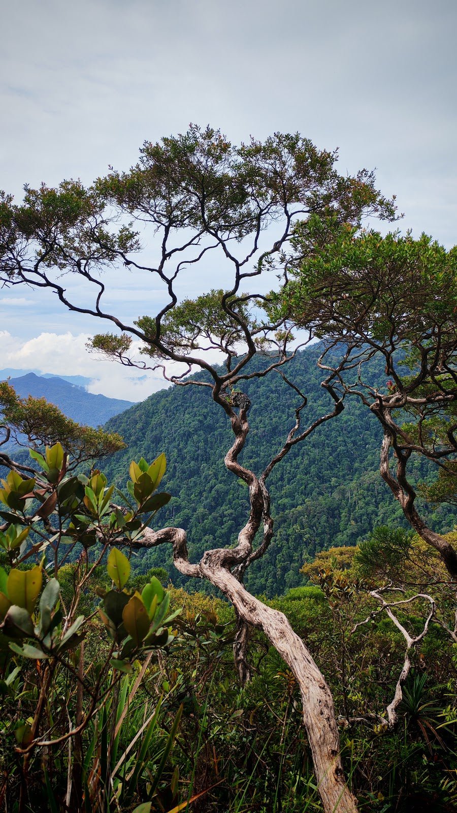
There's a shelter at the peak and a panoramic viewpoint looking out over the South China Sea and the East Coast islands. On a clear day it's a genuinely rewarding view — worth every steep step. Sunrise and sunset are particularly good here if you can time it. Take a breather, hydrate, and enjoy it before you head back down.

Stage 7: Return via Same Route
The descent follows the same path back. Most hikers report the descent takes around 30 minutes. Read the next section before you set off — the descent has a real reputation for being the trickiest part of the whole hike.
Descent & Safety
One hiker put it plainly: the walk up is beautiful, but coming down the steeper sections is "a bit hairy." That tracks with what most people report about Bukit Keluang. The steep final descent toward the staircase is slippery, especially if you've had morning dew or any rain. Take your time. Use the ropes. Don't let the short total distance make you complacent.
Real hazards on this trail:
- Steep and slippery descent toward the staircase — this is where people come unstuck
- Cliff edges along the route — watch your footing and keep away from the edge
- Loose rocks that can be dislodged and roll downhill onto hikers below
- Exposed sections on the steeper climbs — ropes are provided but use them properly
- Wooden walkway above the waterline is high-tide sensitive — check tides before you go
If weather turns bad — rain, dark clouds, rough sea — turn back. The exposed cliff sections and wooden walkway become genuinely dangerous when wet. This is a short enough hike that there's no glory in pushing through bad conditions here.
Start early. The heat on a Malaysian afternoon on exposed rock and stairs is no joke. Early morning also gives you the best light for the views.
What to Bring
Bukit Keluang is a short hike but the terrain is real — steep, exposed in places, and potentially slippery. Pack accordingly even if you're only going for two hours.
- Water: There are no water sources on the trail. Food stalls and toilets are at the car park, but nothing once you start climbing. Bring at least 1–1.5 litres per person. A hydration bladder keeps your hands free on the rope sections.
- Footwear: Proper grip is essential. Trail shoes or hiking shoes with decent rubber soles. Not sandals, not flip-flops — people do attempt this in sandals and the descent will punish them for it.
- Trekking poles: Optional on the way up, genuinely useful on the way down. The TAHAN 3-Section Foldable Hiking Stick V2 is compact enough to toss in a daypack and earns its keep on slippery descents like this one.
- Knee support: If your knees are not what they used to be, the descent is the kind of terrain that reminds you of that fact. The TAHAN Kinetix Knee Guard With Spring Support is worth considering for anyone with dodgy knees or joint concerns.
- Sun protection: Hat, sunscreen, sunglasses. The summit and walkway sections are exposed.
- Light snack: You don't need a full packed meal for a 2-hour hike, but bring something. Energy dips on short hikes too.
- Dry bag or waterproof layer for your phone: Sea spray near the walkway is a real thing.
For a more complete rundown on what gear to carry for Malaysian day hikes, have a read through our hiking gear guide — covers the essentials without overcomplicating it.
FAQ
How hard is Bukit Keluang?
It's rated moderate and genuinely suitable for beginners and families — but "easy" is not the full story. The steep sections with rope assistance and the slippery descent put it above a casual stroll. Come with proper footwear and don't rush the descent. Kids can do it, but they need to be supervised carefully on the cliff-edge sections.
How long does the Bukit Keluang hike take?
Moving time to the summit is typically 0.5–1 hour. Descent is around 30 minutes. Total time including stops, the sea caves, and the summit viewpoint is approximately 2 hours. Some very fit hikers report reaching the top in 15–30 minutes, but don't treat that as a target — this isn't a race and the terrain rewards care over speed.
Do I need a permit to hike Bukit Keluang?
No permit required and entrance is free. Managed by Majlis Daerah Besut. Just show up, park, and go.
What's the best time to hike Bukit Keluang?
Early morning is strongly recommended — cooler temperatures and better light for views. If exploring the sea caves is a priority, check tide times and aim for low tide. Weekdays are significantly quieter than weekends. Sunrise and sunset both offer good viewing conditions from the summit if you're planning around those.
Camp Nearby?
Making a weekend of it? The East Coast has solid camping options within range of Bukit Keluang. For island camping with proper South China Sea views, check out the SEM Campsite Lang Tengah Island review — Lang Tengah is one of the quieter islands off this stretch of coast. If you want to base yourself in the city before an early start, TWCampstay Kuala Terengganu is worth a look. And further down the coast, Shukor Campsite, Dungun makes a decent overnight stop if you're road-tripping the East Coast route.
Mike has been camping across Malaysia for over 10 years — from jungle treks in Taman Negara to beach camps in Perhentian. He writes about it so you don't have to find out the hard way. Follow along on TAHAN Outdoor's blog for honest campsite reviews, every week.