Bukit Genting Penang: A Hiker's Guide (2026)
Bukit Genting sits quietly in the Balik Pulau interior — the greener, slower, less-touristy side of Pulau Pinang that most visitors never bother with. At 340 metres, it's not going to test your lungs the way Gunung Nuang or Gunung Ledang would, but don't let the numbers fool you. The loop trail is a proper jungle hike through fruit orchards and dense rainforest, with some genuinely steep, root-tangled sections that will humble you if you show up in flat shoes and half a bottle of mineral water.

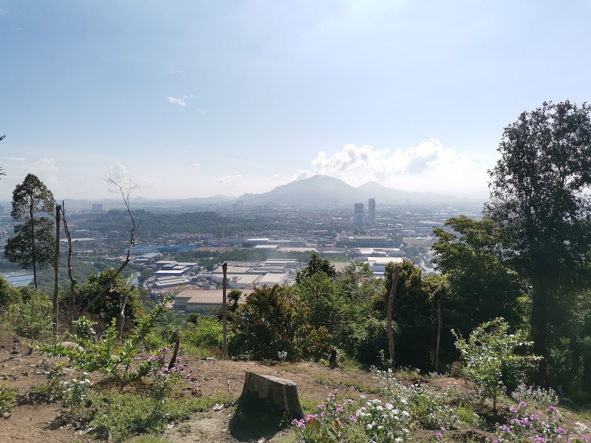
This is a hike that suits day-trippers from Georgetown, families with older kids who can handle moderate terrain, and trail runners looking for a quick sweat session on Penang island's quieter side. The viewpoint at the top delivers solid sight lines across the island — worth every muddy step. And if you're the type who thinks a 2-hour loop is too tame, there's a trans-peak route connecting multiple bukit that'll keep you busy for 5 hours and then some.
It has picked up some viral attention lately, but it's still relatively quiet on the ground — a good sign. Just go prepared, because the trail markings are patchy and getting turned around in Penang's interior hills is more common than people admit.
Quick Facts
- Elevation: 340 m
- Elevation gain: 272 m
- Distance: 2.4 miles (3.86 km) loop; 11 km for the trans-peak route
- Duration: 1.5–2 hours (loop); 5 hours (trans-peak route)
- Difficulty: Moderate (loop); Hard (viewpoint-only variant / trans-peak)
- Permit: Check with the local forestry office or park authority before you go — status is unclear
- Guide required: Not officially, but guides are available through hotels or Penang National Park
- Water on trail: None confirmed — bring your own
Getting There & Parking
The primary trailhead is in Balik Pulau, on the southwest side of Penang island. Look for the corner near Sekolah Rendah Al-Itqan — the trail entrance is via a 'Jalan Kampung' road directly opposite the school. When searching on maps, look for 'Bukit Genting' and watch for a green banner gate and a restaurant banner as your markers. Those are your landmarks — don't overthink it.
Getting to Balik Pulau from Georgetown takes roughly 30–45 minutes depending on traffic. The hill road heading in is narrow, so drive carefully and don't race anyone coming the other way. As for parking, space is very limited and there's no documented proper parking facility here. Come early, park sensibly, and don't block the kampung access roads. If you're coming by motorcycle, you'll have an easier time finding a spot.

Permits & Fees
This is where things get a bit murky. Penang Hill trails are generally free, but Bukit Genting sits in Balik Pulau and may fall under a different management authority. No confirmed fee or permit requirement is documented at the time of writing — but that doesn't mean walk in blind. Trail conditions and permit requirements change — always check with the local forestry office or park authority before you go.
The Trail: What to Expect
The loop is compact but it packs in real jungle terrain. Here's how the route plays out stage by stage.
Stage 1: Sekolah Rendah Al-Itqan Starting Area
You begin at the trail entrance near the school corner. The first stretch sets the tone — you're immediately in kampung-edge territory, transitioning quickly from tarmac to dirt. Pay attention here because some early trail junctions are not clearly marked. If you're starting early morning, lighting under the canopy can be dim, so a headlamp is handy even if sunrise is technically up.

Stage 2: Through the Fruit Orchards (Dusun Buah-Buahan)
The trail passes through traditional fruit orchards — durian, rambutan, the usual Balik Pulau suspects. It's a genuinely pleasant section, shaded and fragrant depending on the season. Enjoy it while it lasts, because the terrain gets more demanding after this. Watch your footing — exposed roots start showing up here, and the path can get narrow and overgrown in patches.
One thing worth knowing: some hikers have reported litter starting not far from the entrance. It's frustrating, but it's reality. Pack out what you bring in.
Stage 3: Little Genting Checkpoint
Little Genting is your mid-point reference. By here, the gradient has picked up noticeably. The forest is denser, paths are narrower, and this is where the trail starts feeling less casual and more like an actual hike. If someone in your group is already struggling at this point, that's useful information — the climb to the viewpoint from here is steeper, not easier.

Stage 4: Bukit Genting Viewpoint Summit (1.3–1.4 km from start)
The viewpoint is reached at roughly 1.3–1.4 km from the trailhead. At 340 m with 272 m of gain, the ascent is punchy for the distance — you're going up sharply, not gradually. The reward is real: sight lines across Penang island, and if timing and conditions are right, you'll catch a quality sunset from up here. Bring a camera, not just your phone — the view deserves proper treatment.
If you're attempting the trans-peak route, this is where you continue rather than turn around. The extended route takes in Bukit Bakar Kapur, Bukit Pisang, Bukit Pulau Betong, Bukit Candan, Bukit Pari, Bukit Kimpul, Bukit Gemuruh, and Bukit Bidara — an 11 km, 5-hour commitment on much rougher terrain. Don't attempt that without experience, full water, and someone who knows where they're going.

Stage 5: Return via Highway Section
The loop return brings you back via a highway section before closing the circuit. It's less scenic than the jungle climb but gives your legs a break on firmer ground. Stay aware of any traffic where the trail touches the road edge.
Descent & Safety
Coming down is where most people get into trouble on Bukit Genting. The steep sections that felt manageable on the way up become genuinely slippery on the descent, especially if any rain has come through. Muddy, root-covered slopes are not the place to rush.
Real hazards you need to know about:
- Steep muddy sections — serious slip risk, especially in rainy season
- Dense rainforest with narrow, unclear paths — getting lost is a documented problem on Penang interior trails
- Exposed roots and thorny vegetation — ankles and shins take a beating if you're not careful
- Poor trail marking — some sections are genuinely confusing
If the weather turns bad — heavy rain, thunder, anything sketchy — turn back. The viewpoint will still be there next weekend. A slippery descent in a storm is not worth the selfie. Tell someone where you're going before you start, and keep your phone charged.

What to Bring
For a 1.5–2 hour moderate loop this might feel like overkill, but the terrain here justifies proper preparation:
- Water: Minimum 1.5L — there are no water sources on the trail. A hydration bladder like the TAHAN TrailBladder 2L keeps your hands free and makes it easy to sip without stopping
- Footwear: Trail shoes or hiking boots with grip — not running flats, definitely not sandals
- Trekking pole: Genuinely useful here given the steep, rooty descent. The TAHAN 3-Section Foldable Hiking Stick V2 packs down small enough to stash in a daypack and deploys fast when the trail drops away under you
- Light rain jacket: Penang weather changes fast
- Snacks: Bring enough for the duration plus buffer
- Headlamp: If you're starting early or pushing close to sunset
- Fully charged phone with offline maps downloaded — given the poor trail marking, this is not optional
- Insect repellent: You're in dense jungle, act accordingly
Not sure what else to prep for Malaysian trail hikes? Check out our hiking gear guide for a more complete breakdown.
FAQ
How hard is Bukit Genting?
The standard loop is rated moderate — manageable for most people with a reasonable baseline of fitness. But moderate doesn't mean easy. The 272 m elevation gain is steep for the distance, and the rooty, sometimes muddy terrain demands proper footwear and some caution. The viewpoint-only variant is rated hard. If you're attempting the 11 km trans-peak route, treat it as a serious hike requiring experience and full preparation.
How long does Bukit Genting take?
Most hikers complete the loop in 1.5 to 2 hours. The trans-peak route is a 5-hour commitment. Add buffer time if you're a slower hiker, stopping for photos, or hiking in a group with mixed fitness levels.
Do I need a permit for Bukit Genting?
No confirmed permit requirement is documented, but the management authority here is unclear. Don't assume it's free just because no one's stopped you at the gate. Check with the local forestry office or Penang National Park before your visit — requirements can change without much online fanfare.
Is there parking at Bukit Genting Balik Pulau?
Parking is very limited and there are no documented facilities. Come early, park responsibly, and don't block the kampung roads. Motorcycle is a more practical option if you're coming solo or as a pair.
Camp Nearby?
Making a weekend of it? Balik Pulau and the surrounding area have some solid options worth considering. 406 Dusun Durian Balik Pulau is right in the neighbourhood and a natural fit — durian country camping, which is exactly as good as it sounds. On the mainland, Brew Valley Retreat, Bukit Mertajam is worth the short hop across if you want something more set-up. And if you're looking for a proper campsite base, PusKeP Butterworth rounds out the Penang-area options. Staying the night nearby and hitting the trail fresh at first light is always better than a groggy morning drive from Georgetown.
Mike has been camping across Malaysia for over 10 years — from jungle treks in Taman Negara to beach camps in Perhentian. He writes about it so you don't have to find out the hard way. Follow along on TAHAN Outdoor's blog for honest campsite reviews, every week.