Bukit Jana, Kamunting: A Hiker's Guide (2026)
Bukit Jana isn't going to make your legs burn for days or end up on anyone's bucket list of epic Malaysian summits. That's kind of the point. This is a short, accessible trail near Kamunting, Perak — sitting close to the Bukit Larut range — that rewards you with a proper jungle stream, a small waterfall, and a natural pool you can actually swim in. Think less "conquer the mountain", more "escape the heat for a few hours".

It suits families, beginners, trail runners looking for a quick leg-stretch, or anyone who wants a low-key weekend outing without a 4am alarm and a two-hour drive. The trail is short — somewhere between 1.8 and 2.7 km out-and-back depending on which source you trust — and most hikers wrap it up in 1 to 1.5 hours. Don't let the "Easy to Moderate" label make you careless though. The stream runs directly from the Maxwell Hill catchment area, and in rainy season that water level can rise fast and without much warning.
Visitor numbers are low, which is a genuine selling point. You're not going to be queuing behind tour groups here. The flip side: fewer eyes on trail conditions, so a bit of common sense goes a long way.
Quick Facts
- Distance: 1.8–2.7 km out-and-back (sources conflict — plan for the longer end)
- Elevation Gain: 10–235 m (sources conflict significantly; terrain may be steeper than it looks on paper)
- Duration: 1–1.5 hours
- Difficulty: Easy to Moderate
- Trailhead: Kamunting, Perak, near Bukit Larut range
- Parking: Available near the trailhead
- Permit: Unclear — check before you go
- Best Time: Year-round, but avoid during or after heavy rain
Getting There & Parking
The trailhead is in Kamunting, Perak, conveniently close to the Bukit Larut range. It's accessible enough that locals treat it as a casual weekend spot — which tells you a lot about how easy the approach is. Parking is available near the trailhead, though hikers have noted the space is limited and can fill up on weekends. If you're going on a Sunday morning, arriving earlier is smarter than arriving later. Waze "Bukit Jana Kamunting" and cross-reference with recent social media posts to confirm the latest access point, since there's no formal signage documentation available at time of writing.

Permits & Fees
Here's the honest answer: permit requirements for Bukit Jana are not clearly documented anywhere reliable. The area may fall within Perak's Permanent Reserved Forest under Jabatan Perhutanan Negeri Perak jurisdiction, which could mean registration is required — but the specific status hasn't been confirmed. No entrance fee information is available either.
Don't assume it's free and open just because it feels like a casual community spot. Trail conditions and permit requirements change — always check with the local forestry office or park authority before you go.
The Trail: What to Expect
The route is straightforward — one path in, same path out. No navigation stress, no junction confusion. What you do need to pay attention to is the terrain underfoot and the stream behaviour, especially if there's been rain in the days before your visit.

Stream Entrance
You'll hit the stream early. This is your first read of conditions — check the water level and flow here before committing further. Clear and calm? Good sign. Murky and fast-moving? Have a serious think about whether today is the right day. The water in this stream comes down from Maxwell Hill, and it responds quickly to upstream rainfall even if skies above you look fine.
Picturesque Stream Corridor with Waterfall
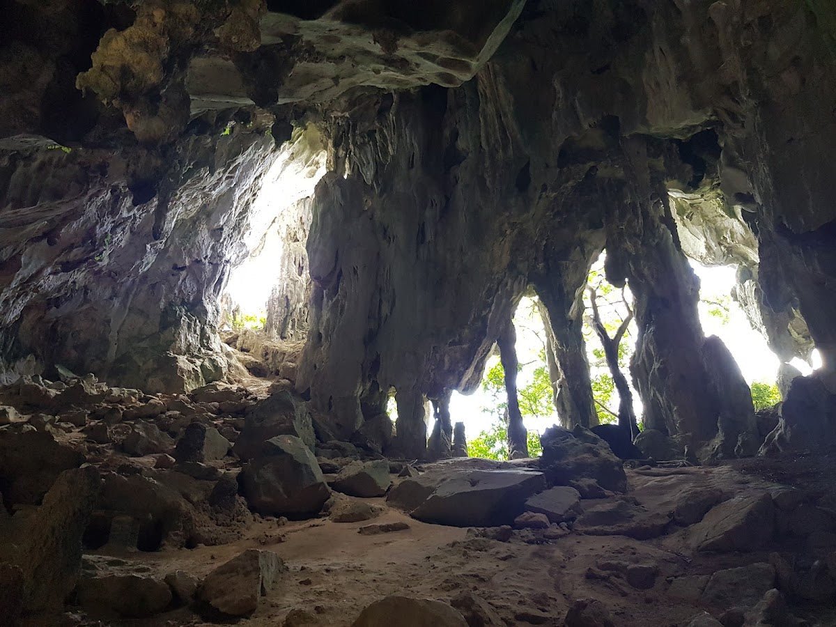
This stretch is the scenic core of the trail. You're walking alongside (and likely crossing) the stream, through genuine jungle canopy. It's genuinely pretty in here — clean water, green surroundings, low hiker traffic. Take your time. Watch your footing on wet rocks; they will be slippery.

Small Waterfall with Refreshing Pool
This is what most people come for. The waterfall feeds a natural pool that's clean and cool — proper relief on a hot Perak afternoon. It's a legitimate swimming spot. One reviewer summed it up simply: clean water, good quality stream. Enjoy it, but please take your rubbish out with you. The pool has a litter problem from inconsiderate visitors, and that's not something anyone should be adding to.

Water Catchment Remains at Trail End
The trail ends at old water catchment infrastructure. It's an interesting historical feature — this area has been used for water collection serving the surrounding region. Nothing much to do here beyond take a look and turn around, but it contextualises why the stream quality is generally good.
Return via Same Route
Head back the way you came. Same hazards apply on descent — wet rocks, stream crossings. If water levels have risen while you were in there (it happens fast during afternoon storms), take extra care.
Descent & Safety

The descent is short but the real safety consideration here isn't elevation — it's the stream. Water from Maxwell Hill catchment can surge with minimal warning during the monsoon season or after heavy afternoon rain. Don't underestimate this. One local hiker put it plainly: the river can be very dangerous during rainy season. That's not drama, that's hydrology.
A few things to keep in mind:
- Flash flood risk: If you hear roaring water or see the stream change colour or speed, get to higher ground immediately. Don't wait to see what happens.
- Slippery rocks: Wet rocks along the stream corridor and at the waterfall pool are genuinely slippery. Footwear with grip matters here — sandals are a bad idea.
- Leeches: No formal hazard documentation exists for this trail, but you're in Malaysian jungle next to a stream. Treat leeches as a given and take your usual precautions (socks over pants, salt or tobacco leaves, check your ankles).
- Monsoon season caution: November through January the northeast monsoon brings heavier rainfall to Perak. The trail is technically open year-round, but check conditions actively during these months.
- Turn back in bad weather: If it starts raining heavily while you're on trail, don't push on to the waterfall. The stream crossing back is harder with rising water than the distance suggests.
What to Bring
For a 1 to 1.5 hour trail, you don't need expedition gear. But you do need the right basics:
- Footwear with grip: Trail shoes or proper hiking sandals with ankle support. Not flip-flops.
- Water: Bring your own even though there's stream water available — you're not going to want to rely on filtering here given the litter situation.
- Change of clothes: If you're going to swim — and you probably will — pack a dry set.
- Rubbish bag: Carry your waste out. The pool doesn't need more soiled diapers and tin cans.
- Leech socks or long socks: Stream terrain, Malaysian jungle. Just bring them.
- Light trekking pole: If your knees are sensitive or you want extra stability on wet stream crossings, the TAHAN 3-Section Foldable Hiking Stick V2 packs down small enough that there's no excuse not to throw it in your bag. It's genuinely useful on slippery surfaces.
- Basic first aid: Plasters, antiseptic. Stream rocks bite.
If you're newer to hiking and want a broader rundown of what gear actually matters on Malaysian trails, our hiking gear guide covers the essentials without the waffle.
FAQ
How hard is Bukit Jana?
Officially rated Easy to Moderate. The distance is short — 1.8 to 2.7 km out-and-back — and most people complete it in 1 to 1.5 hours. The elevation gain figures conflict between sources (anywhere from 10 m to 235 m), so don't assume it's completely flat. The bigger challenge isn't the climb, it's the stream terrain — wet rocks and potential water level changes are what demand your attention, not your fitness.
How long does Bukit Jana take?
Most hikers do it in 1 to 1.5 hours including time at the waterfall pool. If you're going for a swim and a proper rest, budget two hours comfortably. Trail runners can cover it faster, obviously.
Do I need a permit for Bukit Jana?
Genuinely unclear. The area may fall under Jabatan Perhutanan Negeri Perak, which could mean registration is required. No confirmed permit documentation exists at time of writing. Check with the local forestry office before you go — don't just assume it's open access because it feels casual.
Is the waterfall pool safe for swimming?
In good conditions, yes — reviewers describe clean, good quality water. But "good conditions" is key. After rain, water level and flow can change dramatically because this stream drains from Maxwell Hill. Always check conditions at the stream entrance before heading in, and don't swim if flow is fast or water is murky.
Camp Nearby?
Making a weekend of it? Bukit Jana itself is a day-hike — there's no camping on trail — but Perak has decent options within driving range. WildRock Campsite Padang Rengas is the closest match geographically and worth checking out. If you're open to ranging a bit further into Perak, Seven Beret Campsite, Batu Kurau is another option in the state. Or swing south toward The Hideout Gopeng for a nature camp with a different character entirely. Any of these work as a base if you want to hit Bukit Jana in the morning and have somewhere proper to set up for the night.
Mike has been camping across Malaysia for over 10 years — from jungle treks in Taman Negara to beach camps in Perhentian. He writes about it so you don't have to find out the hard way. Follow along on TAHAN Outdoor's blog for honest campsite reviews, every week.