Bukit Guling Ayam: A Hiker's Guide (2026)
Bukit Guling Ayam sits on the edge of Batu Caves in Selangor, a small but surprisingly dramatic quartz ridge hill that punches well above its modest 159-160m elevation. It's part of the same Klang Gates quartz ridge formation as the famous Bukit Tabur — same fractured white rock, same character, just way more accessible from KL. Most people are at the peak in under 20 minutes.

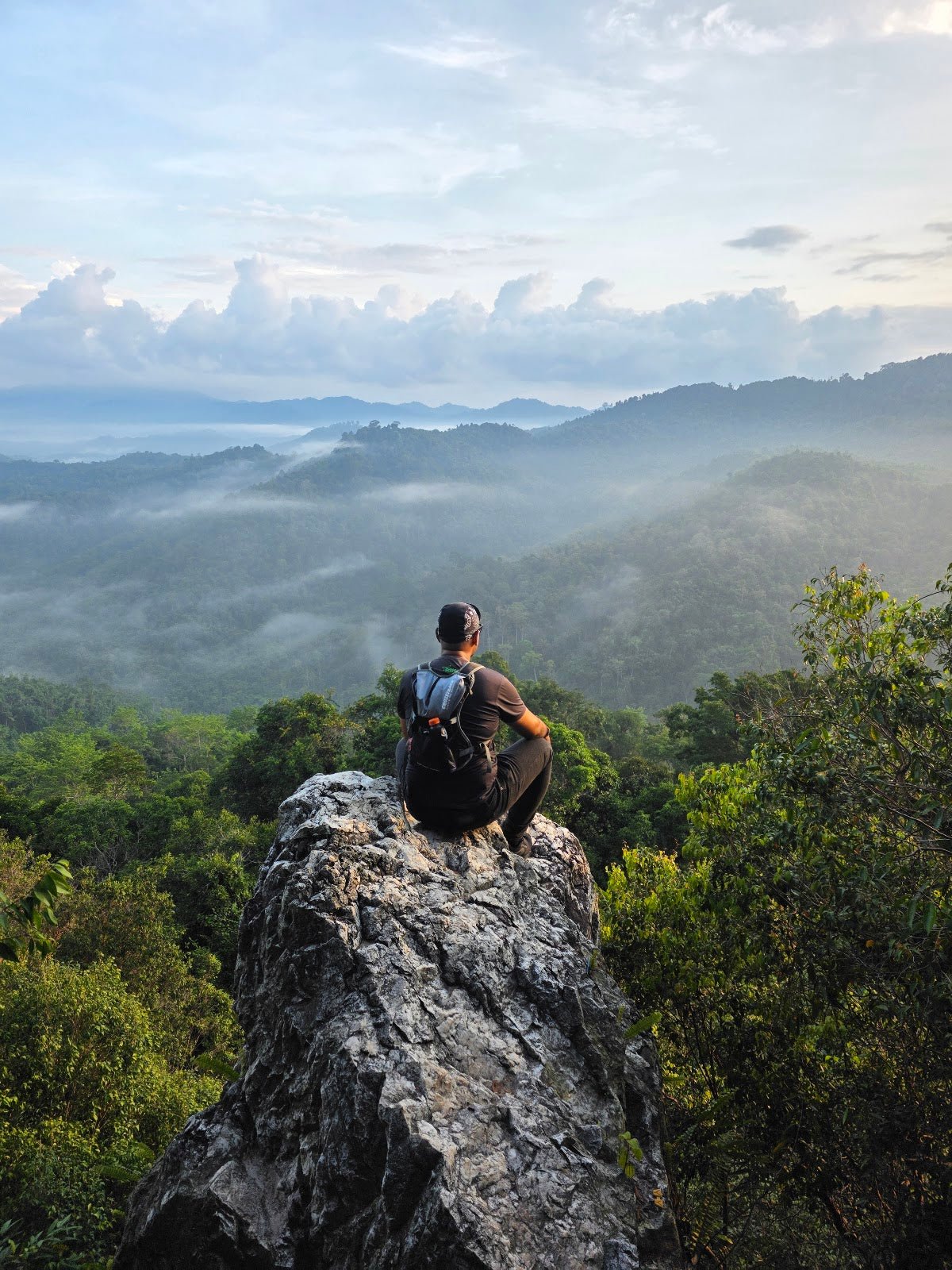
This is a popular spot for early morning hikers chasing sunrise views, and it delivers — 360-degree panoramas taking in the KL skyline, Batu Caves, Bukit Tabur, and the Selangor-Pahang border mountains on a clear day. Don't let the short distance fool you though. The upper section is a proper boulder scramble with rope-assisted sections, and the soil on this hill is notoriously unstable. It's quick, but it demands respect.
Best suited for: beginners looking for their first taste of technical terrain, experienced hikers wanting a quick weekday fix, or anyone who wants a proper view without a full-day commitment. Not great for elderly hikers, young children, or anyone who struggles with uneven rocky ground — the bouldering near the peak genuinely requires hands and feet.
Quick Facts
- Elevation: 159-160m
- Elevation gain: ~85m (278 ft via loop route)
- Distance: 0.6 miles out-and-back; 0.8 miles for the full loop
- Time to peak: 15-20 minutes; full loop 30-60 minutes
- Difficulty: Moderate to challenging near the summit (steep, rocky, some technical scrambling); direct route is beginner-friendly on paper, but fitness and experience matter
- Permit required: No
- Entrance fee: Free
- Guide required: No
- Open: Year-round
Getting There & Parking
The trailhead is along Jalan Lingkaran Tengah 2, Batu Caves — look for the Petronas petrol station near the Lingkaran Karak / MRR2 junction. That Petronas is your landmark. From central KL, expect 30-45 minutes depending on traffic. Grab it on Waze rather than Google Maps — Bukit Guling Ayam is marked incorrectly on Google Maps, so don't trust the pin.
Parking is generally ample around the Petronas station and nearby areas. On weekends and public holidays though, it fills up fast. Arrive early — especially if you're going for sunrise. Weekend morning hikers in the Klang Valley do not play around.

Permits & Fees
No permit required, no entrance fee. Access is free and open year-round. No management authority has been formally identified for this hill, which means no one is officially monitoring conditions or controlling access. That's good for spontaneous visits, but it also means you're fully responsible for your own safety up there.
Trail conditions and permit requirements change — always check with the local forestry office or park authority before you go. Or ask the TAHAN Hiking Community on WhatsApp — someone's usually been there that week.
The Trail: What to Expect
The route comes in two flavours — a straightforward out-and-back (0.6 miles) or the longer loop (0.8 miles) that gives you more variety. Both reach the same peak. Here's what you'll encounter on the way up.

Stage 1: Petronas Trailhead to Ecolife Hilltop Cafe
You start at the Petronas petrol station and immediately hit a steep cement-pour road heading uphill. This section has some shade, but don't expect relief for long. You'll pass Ecolife Hilltop Cafe on the way — a welcome checkpoint and honestly not a bad excuse to grab something before or after the hike.
Stage 2: Into the Forest — Planting Beds and Bamboo Alley
Past the cafe, the trail enters proper forest. You'll walk through planting beds featuring grape vines and fig trees — a bit unexpected, but that's part of what makes this hill quirky. The route mixes tarmac road sections, jungle trekking, and a bamboo alley stretch. Enjoy the shade here. It runs out.

Stage 3: The Boulder Scramble
This is where Bukit Guling Ayam earns its moderate-to-challenging label. The upper section is all giant coarse quartz rock — no shade, exposed, and steep. There are rope-assisted sections, and you will be using both hands and feet to navigate narrow passages between boulders. Take your time, test your footing before committing weight, and don't rush this part. One reviewer put it plainly: needs some flexibility, might not be suitable for the elderly.
Stage 4: The Peak
You'll know you're there when you see the Malaysian flag. The 360-degree view from the top is genuinely rewarding — KL city skyline, Batu Caves temple complex below, Bukit Tabur ridge, Kampung Sungai Chinchin, and on clear days the Selangor-Pahang border mountains in the distance. Watch for the swallow population up here — they're a regular feature of the summit. Sunrise and sunset are both excellent if you time it right.

Descent & Safety
Coming down the boulder section is where most hikers get into trouble. Loose quartz rock and sandy soil do not forgive overconfidence. Face inward toward the rock when descending steep sections, use the ropes, and go slow. Wet conditions make everything dramatically worse — the rocks become slick fast.
This hill has a documented landslide history. A major incident occurred on the north side in 2001, and the geological cause hasn't gone away — unstable sandy soil over fractured quartz rock is the nature of this ridge. If it's been raining heavily or continuously, do not attempt the north side, and seriously consider coming back another day entirely.
Key hazards to know before you go:
- Landslide risk on north side — especially after heavy or prolonged rain. This is not a hypothetical.
- Loose soil and fractured quartz rock — underfoot conditions are unpredictable
- Zero shade on the upper trail — full sun exposure during the day; heat exhaustion is a real risk if you go at noon
- Slippery when wet — wet quartz rock has almost no grip
- Narrow passages near summit — require careful foot placement, not just enthusiasm
- No documented water points on trail — bring everything you need from the start
Turn back if: it starts raining heavily, the rocks are visibly wet and you don't have grip footwear, or visibility drops significantly. The summit view is not worth a slip on exposed quartz.

What to Bring
Short hike, but the exposure and rocky terrain mean you can't completely phone it in on gear.
- Water — at least 500ml-1L. No water points on trail, no shade on upper section, and even 20 minutes in Malaysian morning heat will have you sweating. Bring more than you think you need.
- Proper footwear — trail shoes or hiking shoes with grip. Do not attempt the boulder section in sandals or flat sneakers. It will end badly.
- Gloves — optional but useful for the rope-assisted rocky sections. Quartz is coarse.
- Sun protection — sunscreen, cap, sunglasses. The upper trail has zero shade.
- Trekking poles — genuinely useful on descent if your knees feel the rocks. The TAHAN 3-Section Foldable Hiking Stick V2 (RM99) is compact enough to stuff in a bag and deploy for the descent — exactly the kind of trail where you'll thank yourself for bringing it.
- Knee support — if you have dodgy knees, the steep boulder descent is not gentle. Worth wearing the TAHAN Kinetix Knee Guard With Spring Support (RM79) for that extra stability on the way down.
- Snacks — optional for such a short hike, but the Ecolife Hilltop Cafe is right there if you want a proper sit-down after.
- Phone, fully charged — for navigation (use Waze, not Google Maps) and emergencies.
New to hiking gear and not sure what else to pack? Check out our hiking gear guide for a proper rundown.
FAQ
How hard is Bukit Guling Ayam?
Honest answer: it depends. The direct route to the peak is short and marketed as beginner-friendly, and many people complete it in 15-20 minutes. But the boulder scramble near the summit is steep, exposed, unshaded, and requires using both hands and feet. Someone who hikes regularly will find it easy. Someone who rarely walks uphill will find it genuinely tough. The difficulty rating ranges from moderate to challenging depending on the route and who you ask — don't dismiss the harder end of that range.
How long does Bukit Guling Ayam take?
Most hikers reach the peak in 15-20 minutes on the direct route. The full loop takes 30-60 minutes. Factor in time at the summit for views, and maybe a stop at Ecolife Hilltop Cafe, and you can comfortably do the whole thing in under 2 hours.
Do I need a permit for Bukit Guling Ayam?
No permit required and no entrance fee. The hill is free and open year-round. Just park near the Petronas station on Jalan Lingkaran Tengah 2 and walk to the trailhead.
Is Bukit Guling Ayam safe after rain?
No — avoid it during or immediately after heavy or prolonged rain. The hill has unstable sandy soil and fractured quartz rock with a documented landslide history, particularly on the north side. Wet quartz is also extremely slippery. When in doubt, postpone. The hill isn't going anywhere.
Camp Nearby?
Bukit Guling Ayam is a quick day trip from KL, but if you want to make a proper weekend of it in Selangor, there are some solid campsite options in the region. Making a weekend of it? Check out Templer Park Rainforest Retreat for a lush jungle camping experience not far from Batu Caves, or head further out to Mori Leka Campsite, Serendah for something more kampung in feel. If you're willing to cross into Hulu Langat, Nature Escape Campsite, Hulu Langat is a good base for a multi-day Selangor hiking and camping combo. Staying over the night before means you can hit Bukit Guling Ayam at first light — best decision you'll make for this one.
Trail conditions, permit updates, and hiking buddies for the weekend — all in one WhatsApp group. Just ask; someone was probably up there last week.
💬 Join the Hiking CommunityFree, one click. No spam — the occasional promo at most.
Mike has been camping across Malaysia for over 10 years — from jungle treks in Taman Negara to beach camps in Perhentian. He writes about it so you don't have to find out the hard way. Follow along on TAHAN Outdoor's blog for honest campsite reviews, every week.