Updated October 2026
Bukit Dinding is a free, no-permit hill in Seksyen 5 Wangsa Maju / Setiawangsa, Kuala Lumpur (the Kazumi side is at Waizuri 1, Seksyen 5 Wangsa Maju, 54200 KL). It tops out at roughly 291 m above sea level, which sounds modest until you attempt the Kazumi Trail and your legs start filing a formal complaint. You get three main ways up: an easy tarmac road (about 5.3 km out-and-back, 2–2.5 hours), the hard Kazumi Trail (about 5.5 km, 2.5–3 hours, with rock scrambles), and the long Mini Tahan + KL See See loop for experienced hikers (plan around 6 hours). The trails are open year-round.
There are three entrances: the south trailhead on Jalan 6/27A by the Warung Pekaki U-Turn coconut stall (tarmac road), the north gate at the Surau Au-Jumaat An-Nain carpark, and the Kazumi / Mini Tahan trailhead behind the fish-eye mirror on Jalan 1/27C. There's no dedicated car park, so parking is roadside and limited, and Grab is often less stress on weekends. The hill runs through secondary forest on a former rubber estate (you'll still spot tapped trees), with a colour-coded trail network that goes from a breezy jog to steep, boulder-scrambling forest that'll humble you fast.

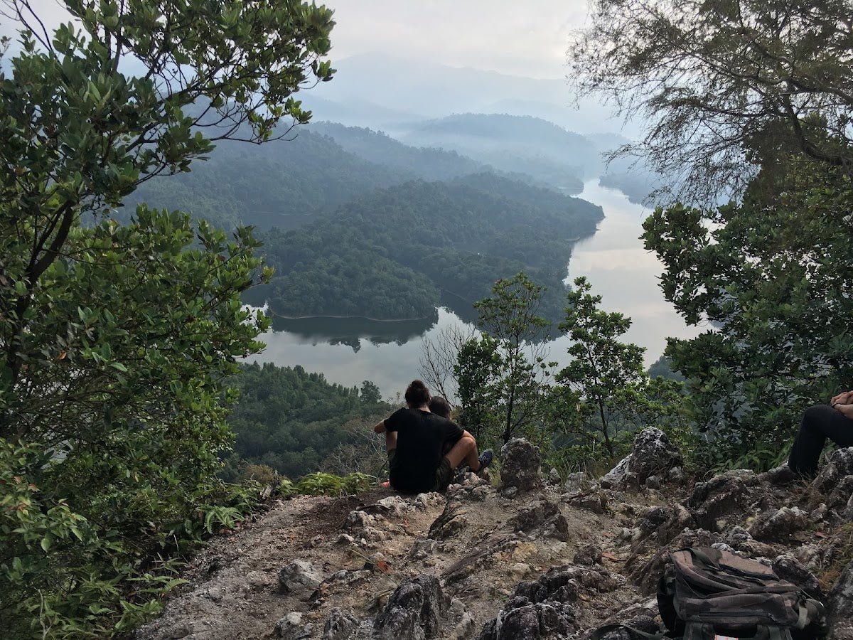
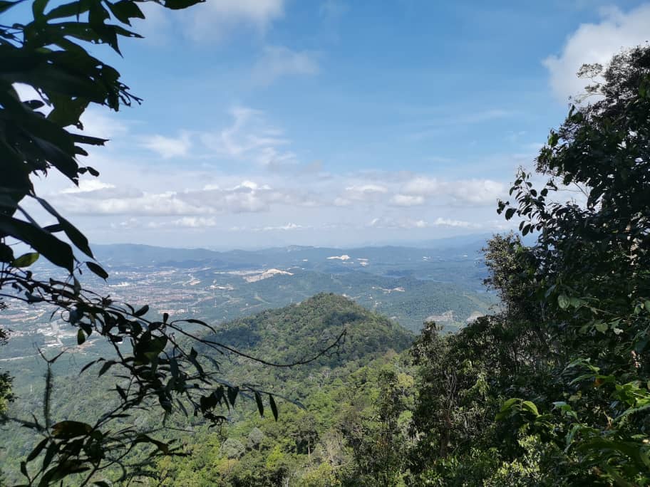
Who is this hike for? Almost anyone, depending on which trail you pick. The main tarmac road is genuinely easy, joggers and retirees do it daily. The Kazumi Trail is a proper hard workout with rock-climbing sections. The full Mini Tahan + KL See See loop is moderate-to-challenging and not suitable for beginners. If you're training for Mount Kinabalu, regulars here use three laps of the full loop as a readiness benchmark. The payoff at the top: panoramic views of the KLCC Twin Towers, Menara KL, and Merdeka 118, plus sightlines toward the Klang Gates Quartz Ridge and, on a clear day, Genting Highlands.
Bukit Dinding is community-managed by Friends of Bukit Dinding (FoBD), a volunteer group. The land isn't gazetted as a forest reserve, which means it remains one of KL's most threatened green spaces. Hike it, appreciate it, and if you feel strongly, support the community pushing to gazette it.
Quick Facts
- Location: Seksyen 5 Wangsa Maju / Taman Setiawangsa, 54200 Kuala Lumpur
- Peak elevation: ~291 m (Trailforks records 283 m, slight difference likely due to measurement point)
- Distance: Main trail out-and-back: ~5.3 km | Kazumi Trail out-and-back: ~5.5 km | Kazumi loop variant: ~3.2 km (2 mi) | Mini Tahan full loop: ~7–10 km (sources disagree) | Full Bukit Dinding 2.0 loop (Kazumi + Mini Tahan): 11.16 km
- Elevation gain: Main trail: ~296 m | Kazumi Trail: ~400 m | Kazumi loop variant: ~295 m (967 ft) | Full 2.0 loop: 866 m (figures vary by route and source)
- Duration: Main trail: 2–2.5 hr (most hikers) or just over 1 hr at a fast/jogging pace | Kazumi Trail: 2.5–3 hr | Kazumi loop variant: 1.5–2 hr | Full Mini Tahan loop: plan ~6 hr
- Difficulty: Main tarmac road: Easy–Moderate | Kazumi Trail: Hard (loop variant: Moderate) | Mini Tahan loop: Moderate–Challenging, intermediate to advanced hikers only
- Permit / fee: None, free and open access
- Opening: Open year-round; no official closing hours published, so plan to finish before dark
- Facilities: None on the trail itself; petrol stations and eateries nearby
- Guide required: No, trails are colour-coded, but the Mini Tahan section has confusing junctions (see below)
- Best time: Early morning, May–September (dry season)
Trail Colours at a Glance
The trails are labelled by colour, which makes life a lot easier once you know what's what:
- Tarmac / cement road: the main route up, shared with joggers. A separate wide forest trail runs alongside for downhill bikers.
- Yellow markers: Mini Tahan trail.
- Purple markers: Purple Trail, which Mini Tahan joins before the tar road junction.
- Pink markers: KL See See, from the peak to the KLCC/City View Look-Out Point.
- Orange markers: Kazumi Otai Trail, from Setiawangsa Viewpoint back down to the Kazumi trailhead.
Getting There, Entrances & Parking
There are three main access points depending on which trail you're doing.
South trailhead (main tarmac road): Head to Jalan 6/27A near the Warung Pekaki U-Turn coconut stall, Taman Setiawangsa, 54200 KL. The coconut stall is a good landmark, and a good reason to reward yourself post-hike. Waze search "Bukit Dinding Hiking Trail" works reliably.
North trailhead: Gate at the Surau Au-Jumaat An-Nain carpark.
Kazumi Trail / Mini Tahan trailhead: Behind the fish-eye mirror on Jalan 1/27C, Seksyen 5, Wangsa Maju (Waizuri 1 area). GPS: 3.19292, 101.7464. This one is easy to drive past the first time, so slow down once you're on Jalan 1/27C and look for the mirror.
Parking: The usual KL story, limited, no dedicated car park. Most hikers park near Surau Au-Jumaat An-Nain, and for the Kazumi side you're parking on residential streets. Be courteous: don't block gates, driveways or the surau entrance, and avoid prayer times (especially Friday afternoon) if you can. Officially the hill is free, though some online reviewers mention being asked for a parking or entry fee, so bring a bit of cash just in case. Coming by Grab is honestly the less-stressful option, especially on weekends when the roadside fills up early.

Permits & Fees
No permit required. No registration system. Bukit Dinding is free to hike, managed informally by the Friends of Bukit Dinding volunteer community, not by a government agency. FoBD occasionally organises free guided hikes; follow them on social media to catch those. If you're planning a bigger mountain that does need paperwork, our gunung permit checker sorts out which hills need what.
Trail conditions and permit requirements change, always check with the local forestry office or park authority before you go. Checking a different gunung? Try our free permit checker — instant answer for 90+ Malaysian mountains. Or ask the TAHAN Hiking Community on WhatsApp — someone's usually been there that week.
The Trail: What to Expect
The main tarmac road and the forest trails are very different experiences. Choose based on your fitness and goals, not what sounds most impressive at the mamak afterwards.
Stage 1: South Trailhead → Tarmac Road Ascent
Starting from the coconut stall at Jalan 6/27A, you hit tarmac and concrete road immediately. It's steep. People underestimate this: the sustained gradient on tarmac burns your calves and shins more than a dirt trail at the same angle. There's also landslide scarring along the road, so the terrain around the edges is degraded. Joggers use this road daily, so expect to share it, and note that traffic fumes from the nearby DUKE and MRR2 highways drift up occasionally.

Stage 2: Tarmac Road → Summit (291 m)
The tarmac road takes you up to the summit area, where you'll find a Telekom Malaysia communications mast and telecoms tower. The tower itself is restricted access, so don't try to enter. The main road route is what most beginners and joggers do. Most hikers report 2–2.5 hours for this out-and-back; if you're moving at a proper pace, just over 1 hour is realistic. On some days you'll find mobile drinks stalls partway along, convenient, but don't rely on them. Carry your own water.
Stage 3: Kazumi Trail (Jalan 1/27C Trailhead → Peak)
This is where Bukit Dinding stops being a casual stroll. The Kazumi Trail starts behind a fish-eye mirror on Jalan 1/27C. From there, you'll encounter cascading small waterfalls and proper boulder-climbing sections where you'll be using your hands. AllTrails rates the full trail as Hard, with ~400 m of elevation gain over ~5.5 km out-and-back. Expect 2.5–3 hours. There's also a shorter Kazumi loop variant (about 3.2 km, ~295 m gain, 1.5–2 hours) rated Moderate, a decent option if you want the forest without committing your whole morning.
One section of the Kazumi Trail has been sealed off and marked: there's a snake's nest there. Take that seriously. Don't go off the marked path looking for shortcuts or adventure. The trail passes through the Lookout Setiawangsa Viewpoint and the Bidayuh Bridge before reaching the peak or looping back.

Stage 4: Full Mini Tahan + KL See See Loop
This is the full Bukit Dinding 2.0 experience, and the reason people search "mini tahan trail". Enter the Mini Tahan trail (yellow markers). It lives up to the name with relentless steep uphills and downhills, muddy patches, narrow paths and plenty of fallen trees to climb over or under. Your knees will feel it on the way down. It's meant for intermediate to advanced hikers; beginners should not start here.
Navigation warning: after the Mini Tahan 1 sign, the trail drops through ditches with unmarked stretches, and there are three-way and two-way junctions where hikers regularly get lost. Download an offline GPS track before you go, keep your phone charged, and if you're not sure which way, stop and check instead of guessing. Better still, do it the first time with someone who knows the route or join an FoBD guided hike.
Mini Tahan converges with the Purple Trail before you emerge at a tar road junction where mobile drinks stalls sometimes appear (welcome sight). From there, tar road takes you to the peak.
At the peak, enter KL See See (pink markers) toward the KLCC/City View Look-Out Point. This is the money shot: KLCC Twin Towers, Menara KL, Merdeka 118, all laid out in front of you. Then continue to Setiawangsa Viewpoint (tables and chairs here, sit down sikit, you've earned it) for views of the KL skyline and the Klang Gates Quartz Ridge. From Setiawangsa, orange markers (Kazumi Otai Trail) take you back down to the Kazumi trailhead.
The full Mini Tahan loop distance is somewhere between 7–10 km depending on whose GPS log you trust, sources genuinely disagree on this one. The full Bukit Dinding 2.0 loop (Kazumi + Mini Tahan combined) is logged at 11.16 km with 866 m elevation gain, based on a single Wikiloc GPS source. Plan for around 6 hours, and start early.

Emergency Exits
On the full 2.0 loop, there are emergency exit gates at approximately 6.73 km and 6.97 km. Good to know if someone in your group needs to bail early.
Descent & Safety
Coming down the tarmac road is a calf-burner in a different way. Coming down the forest trails, especially Mini Tahan, is where your knees get their revenge for every squat you skipped at the gym. Take it slow on the descents.
Real hazards you need to know about:
- Snakes and wildlife: One sealed section is marked as a snake's nest. A hiker's account of encountering a Banded Malaysian Coral Snake on the trail is not just colour, it's a real reminder. Stay on marked trails. Watch where you step and where you put your hands, especially in undergrowth and on the boulder sections.
- Slippery terrain after rain: The forest trails are uneven, steep and full of roots, and they become genuinely dangerous when wet. If it's been raining, either stick to the tarmac road or come back another day.
- Getting lost on Mini Tahan: Unmarked sections and multiple junctions after the Mini Tahan 1 sign. Carry an offline track and don't hike it solo on your first try.
- Mountain bikers: A Bukit Dinding Downhill Race (international MTB event) runs here annually, which tells you something about the speed these trails see. There's a hiker-MTB separation policy in place, but stay alert on shared sections, bikers descend fast.
- Dehydration: KL heat is no joke, especially on exposed tarmac. Early morning start is not a suggestion, it's genuinely better for your safety, not just comfort.
- Evening hikes: Advised against going alone in low light. Bring a headlamp and go in a group if you're finishing late.
- Landslide scarring: Visible along the road sections, stick to the marked path.
Turn back if: heavy rain starts during your hike, visibility drops, you lose the trail markers, or you're on a steep forest section and the trail is wet. The KL skyline view is not worth a twisted ankle or worse.

What to Bring
- Water: Minimum 1–2 L for forest trails. Don't bank on mobile stalls being there. For the full loop in dry-season heat, carry more.
- Snacks/energy: Especially for the 6-hour Mini Tahan loop, this isn't a quick jaunt.
- Trail shoes or hiking sandals: Proper grip matters on the boulder sections of Kazumi and on wet forest trails. Running shoes work for the tarmac road.
- Trekking pole: The steep ascents and knee-punishing descents on Mini Tahan are exactly what trekking poles were invented for. The TAHAN 3-Section Foldable Hiking Stick V2 folds compact enough to stash when you need both hands for Kazumi's rocks, and extends to 130 cm for the descents.
- Knee support: If your knees talk to you on stairs, they'll shout on Mini Tahan's downhills. The TAHAN Kinetix Knee Guard with Spring Support is worth considering for the full loop, especially if you're doing multiple laps as Kinabalu training.
- Phone with offline map + power bank: For the Mini Tahan junctions.
- Headlamp: If there's any chance you'll be out past golden hour. Non-negotiable.
- Rain gear/dry bag: Afternoon storms can come fast in KL.
- Sunscreen and cap: Tarmac road section has significant sun exposure.
- Change of clothes and a bag for muddy shoes: There's no proper toilet or shower block. Some hikers report a water hose near the exit for a quick rinse, but don't count on it.
For a full breakdown of what gear makes sense for Malaysian trail conditions, check out our hiking gear guide.
Camp Nearby?
Bukit Dinding is a day hike, there's no camping on the hill itself. But if you want to make a proper outdoor weekend of it around KL, there are good options within striking distance. The Dangau Jungle Herb Sauna & Taman Melawati Campsite is the closest nature-immersion option near the city. If you're willing to drive a bit, Woodstock Camp Janda Baik and Glamping Valley @ Janda Baik are both solid choices for an overnight stay before or after your hike: cool highland air, good reset, and close enough that a morning at Bukit Dinding followed by a night in Janda Baik makes for a genuinely good KL weekend. More ideas in our campsites near KL roundup.
Looking for other hikes near you? Our list of easy hikes near KL covers gentler options, and if you'd rather end your hike with a dip, check out waterfalls near KL.
Common Questions
Where is the Bukit Dinding entrance?
There are three. For the easy tarmac road, start at Jalan 6/27A next to the Warung Pekaki U-Turn coconut stall in Taman Setiawangsa. The north gate is at the Surau Au-Jumaat An-Nain carpark. For the Kazumi Trail and Mini Tahan, go behind the fish-eye mirror on Jalan 1/27C, Seksyen 5 Wangsa Maju (GPS 3.19292, 101.7464).
Where do I park for Bukit Dinding and the Kazumi Trail?
There's no dedicated car park. Most hikers park near Surau Au-Jumaat An-Nain or along the residential roads near the trailheads. Don't block gates or driveways, avoid prayer times at the surau, and come early on weekends. Grab saves you the headache.
Do I need a permit for Bukit Dinding?
No permit, no registration, no official fee. Bukit Dinding is managed by the Friends of Bukit Dinding volunteer community and is free to access. Some reviewers mention being asked for a parking or entry fee, so carry small cash, and confirm current access before you head out.
How hard is Bukit Dinding, and how long does it take?
Depends entirely on the trail. Main tarmac road: Easy–Moderate, 2–2.5 hours out-and-back (just over 1 hour if you're fast). Kazumi Trail: Hard, 2.5–3 hours with boulder scrambles. Full Mini Tahan / Bukit Dinding 2.0 loop: Moderate–Challenging, plan around 6 hours. Pick based on honest self-assessment, not optimism.
What is the Mini Tahan trail at Bukit Dinding?
Mini Tahan is the yellow-marked forest trail on Bukit Dinding, named (cheekily) after Gunung Tahan for its non-stop steep ups and downs. Expect mud, narrow paths, fallen trees and unmarked junctions after the Mini Tahan 1 sign. It's for intermediate to advanced hikers, not beginners, and you should carry an offline GPS track.
What are KL See See and the Kazumi Otai Trail?
KL See See is the pink-marked trail from the peak to the KLCC/City View Look-Out Point, the best spot for the Twin Towers and Merdeka 118. Kazumi Otai is the orange-marked trail from Setiawangsa Viewpoint back down to the Kazumi trailhead on Jalan 1/27C, usually the last leg of the full loop.
Is Bukit Dinding good for Kinabalu training?
It's widely used for exactly this. Regulars consider completing three laps of the full loop a solid readiness benchmark for Mount Kinabalu. The elevation gain, steep terrain, and trail variety make it one of the better urban training options in KL.
Trail conditions, permit updates, and hiking buddies for the weekend — all in one WhatsApp group. Just ask; someone was probably up there last week.
💬 Join the Hiking CommunityFree, one click. No spam — the occasional promo at most.
Gear tip: How to use a trekking pole (and set the height).
Mike has been camping across Malaysia for over 10 years, from jungle treks in Taman Negara to beach camps in Perhentian. He writes about it so you don't have to find out the hard way. Follow along on TAHAN Outdoor's blog for honest campsite reviews, every week.