Bukit Botak, Selangor: A Hiker's Guide (2026)
Bukit Botak is actually three different hills in Selangor — same name, very different hikes. You've got the Puncak Alam route (the most popular one, and the most rewarding), a shorter Jeram route that's currently partially closed, and the easy Dahlia route in Sepang. Each one pulls a different crowd. This guide covers all three honestly, so you know what you're signing up for before you lace up.

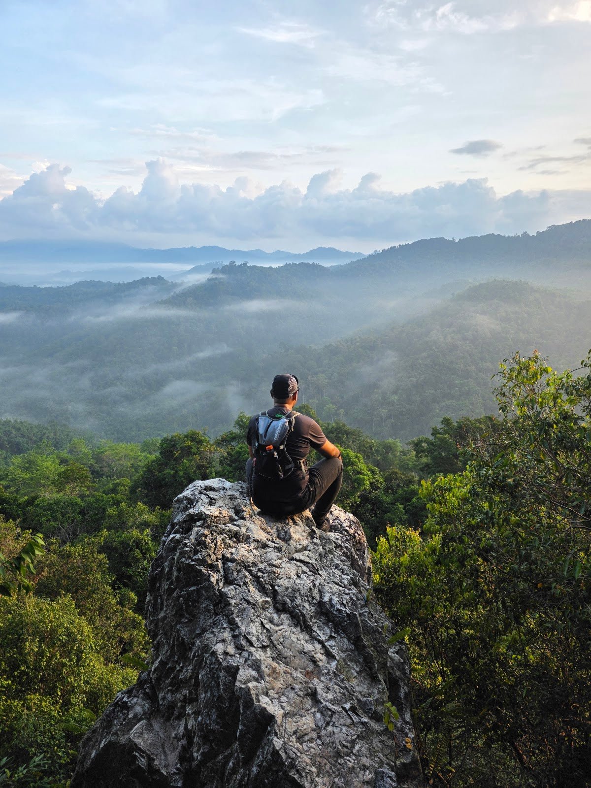
The Puncak Alam route is the one worth planning your morning around. It's a moderate trail that takes you across two peaks — Bukit Cherakah and Bukit Botak — with rocky paths, some rope-assisted climbing, and a genuine 360-degree panoramic view at the top. Nothing technical, but not a casual stroll either. If you're a beginner who's done a few short trails and wants a step up, this is a solid choice. Families with older kids do it. First-timers who are reasonably fit can manage. But go early — the sun exposure on this trail is real.
The Jeram and Dahlia routes are shorter, easier options. The Jeram trail has a famous Bodhi Tree worth seeing, but as of April 2026, the trail from the Bodhi Tree to Bukit Botak peak is closed due to land-clearing and development — so manage your expectations if you're heading that way. Dahlia is the gentlest of the three, good for a quick weekend leg-stretch with the family.
Quick Facts
- Peak Elevation: 180 m (590 ft) — Puncak Alam route; Jeram and Dahlia peaks are lower
- Elevation Gain: 240–250 m (787–823 ft) for Puncak Alam; 105 m (344 ft) for Jeram; 83 m (272 ft) for Dahlia
- Distance: 4.5 km for Puncak Alam (Bukit Cherakah to Bukit Botak); 1.9 km for Jeram; 2.3 km for Dahlia
- Duration: 1.5–2 hours for Puncak Alam; 0.5–1 hour for Jeram and Dahlia
- Difficulty: Moderate (Puncak Alam and Jeram); Easy (Dahlia)
- Permit Required: No permit required for any route (all below 600 m elevation)
- Best Time to Go: Early morning — sun exposure is serious on the upper trail and summit
- CLOSURE ALERT (as of April 2026): Jeram trail from the Bodhi Tree to Bukit Botak peak is CLOSED due to land-clearing. Only the lower Bodhi Tree area remains accessible.
Getting There & Parking
For the Puncak Alam route, the trailhead is in Bandar Puncak Alam. From the entrance, you'll walk past a water tank, through oil palm plantations, and past a transmission tower — that's how you know you're in the right place. It's not the most glamorous start to a hike, but the trail picks up quickly after that.
Parking is roadside along Bandar Puncak Alam on weekends, and hikers report it's generally manageable — arrive early to get a decent spot, especially on weekend mornings when this place gets busy. No dedicated car park, so be prepared to walk a bit from where you leave the car.
For the Jeram and Dahlia trailheads, specific parking and access details aren't well-documented — check with locals or current trail apps before you head out, as the situation on the ground may differ from what's online. And given the Jeram route closure, confirm access before making the trip.

Permits & Fees
Good news: no permit is required for any of the Bukit Botak routes in Selangor. All three trails sit below 600 m elevation, which means you're not legally required to register or pay entry fees. That said, a licensed guide (Malim Gunung) is highly recommended even if not mandatory — especially for the Puncak Alam route where the terrain gets steeper and more exposed. There are no toilets or changing facilities at the trailhead, and no entry fees have been confirmed for any of these routes.
Trail conditions and permit requirements change — always check with the local forestry office or park authority before you go. Or ask the TAHAN Hiking Community on WhatsApp — someone's usually been there that week.
The Trail: What to Expect
This section focuses on the Puncak Alam route, which is the main event. Jeram and Dahlia routes are shorter and more straightforward, but given the Jeram closure, treat those as secondary options.

Start: Water Tank, Oil Palm Plantations, Transmission Tower
The trail begins unglamorously — you're walking through working oil palm plantation land with a water tank and transmission tower marking the entry point. It's flat and open here, which sounds easy, but the wide exposed path means zero shade and serious heat if you start late. Get moving early.
~10 Minutes In: Open Area at the Transmission Tower
About 10 minutes from the start, you hit an open area near the transmission tower. Good spot to get your bearings and take stock of conditions. If it's already blisteringly hot at this point, take that as a sign to push the pace or reconsider if you've come underprepared. Signage along the trail is reportedly clear, so navigation isn't the main challenge here — heat and footing are.
The Steep Climb: Ropes Required
Here's where the trail earns its Moderate rating. There's a short but genuinely steep section that requires rope assistance. Don't underestimate it — the red laterite soil on this trail turns treacherous when wet, and even on dry days, the footing demands attention. Grip the ropes properly, don't rush, and if anyone in your group is nervous about heights or has weak knees, this is where they'll need support. A trekking pole makes the approach to this section more manageable.

Rocky Paths and Scenic Cliffs
Past the steep climb, the trail opens up onto rocky paths with genuine cliff views. This is the most scenic stretch of the route. The terrain is still demanding — loose rock, uneven footing — but the views start paying you back here. Take it steady and enjoy it rather than rushing to the summit.
Bukit Cherakah Peak
Bukit Cherakah is your first summit, and there are makeshift benches here. Use them. Catch your breath, hydrate, and assess how everyone in your group is doing before continuing. If anyone's struggling, this is a reasonable turn-around point — there's no shame in treating this peak as the destination.
The Unique Tree Between Peaks
Between Cherakah and Botak, you'll pass a distinctive-looking tree that's become something of a landmark on the route. Worth a photo stop. The trail continues to be rocky through this section.

Bukit Botak Summit: 360-Degree Views
The Bukit Botak summit delivers what the name promises — a wide, unobstructed panoramic view in all directions. On a clear morning this is genuinely rewarding. The summit is steep and exposed, which is worth knowing before you scramble up — it's not a casual picnic spot. Spend some time at the top, but don't linger too long in strong sun without shade cover. Have your water ready and get down before midday heat sets in.
Descent & Safety
The descent on the Puncak Alam route uses the same path, which means you're coming back down that steep rope section. This is where most accidents happen on trails like this — tired legs, overconfidence, and gravity all conspiring against you. Take the ropes seriously on the way down, face the slope if needed, and go slow.
Key hazards to know:
- Slippery red soil: After rain or even morning dew, the red laterite trail becomes dangerously slick. If it's rained recently, strongly consider rescheduling. This is not a trail to push through wet conditions on.
- Sun exposure: The upper trail, summit, and descent are largely unshaded. Heat exhaustion is a real risk if you go late or underprepared. Start before 7am.
- Steep open summit: The summit is not suitable for very young children or complete beginners. The exposure is real.
- Rope sections: Use them correctly. Don't bypass them. Don't rush them.
- No water on trail: No water sources confirmed along the route. Whatever you bring is what you've got.
If weather turns bad — sudden thunderstorm, heavy rain incoming — turn back immediately. The red soil goes from manageable to genuinely dangerous very quickly when wet, and the exposed summit and cliff sections are no place to be in lightning weather. Bukit Botak will still be there next weekend.
What to Bring
- Water — bring more than you think: No water points on this trail. For the Puncak Alam route in Malaysian heat, 1.5–2L minimum per person. The TAHAN TrailBladder 2L Water Bladder is a clean hands-free solution that clips into most daypacks — worth having.
- Trekking pole or hiking stick: The steep section and rocky descent genuinely benefit from a stick. The TAHAN 3-Section Foldable Hiking Stick V2 folds down compact enough to not be a burden on the flat sections, and earns its keep on the climbs.
- Shoes with proper grip: Trail shoes or hiking shoes with lugged soles. Sneakers are marginal, sandals are a no.
- Sun protection: Sunscreen, buff or hat, UV-protective shirt. The exposed sections will cook you without it.
- Snacks and food: No stalls confirmed at the trailhead or on trail. Bring your own.
- First aid basics: Blister kit, antiseptic, bandage. Red soil means any scrape gets muddy fast.
- Fully charged phone: For navigation and emergencies. Download offline maps before you leave the house.
For a more complete breakdown of what to carry on a Malaysian day hike, check out our hiking gear guide — covers everything from poles to knee support for the descent.

FAQ
How hard is Bukit Botak?
Depends on which route. The Puncak Alam route is Moderate — there's a steep rope-assisted climb, exposed rocky terrain, and significant sun exposure. Fit beginners can handle it, but it's not a walk in the park. The Dahlia route in Sepang is Easy — suitable for families and casual walkers. The Jeram route was Moderate but is currently partially closed (as of April 2026).
How long does Bukit Botak take?
For the Puncak Alam route, most hikers report 1.5–2 hours return. Some faster hikers do it in under an hour, but factor in rest time at Bukit Cherakah and the summit, and budget 2 hours to do it without rushing. The Jeram and Dahlia routes are 0.5–1 hour each.
Do I need a permit for Bukit Botak?
No permit is required. All Bukit Botak routes in Selangor are below 600 m elevation, so no permit registration is legally mandatory. You don't need to pre-register anywhere. That said, requirements can change — check before you go.
Is the Jeram Bukit Botak trail open?
As of April 2026, no — the section from the Bodhi Tree to the Bukit Botak peak at Jeram is closed due to land-clearing and development. The Bodhi Tree on the lower ridge is still accessible, but the peak is not. Check for updates before heading there, as the closure has no confirmed end date.
Camp Nearby?
Bukit Botak is a day hike — there's no camping at the trailhead. But if you want to make a proper weekend of it and explore more of Selangor's outdoor scene, there are some good options within range. Check out Mori Leka Campsite, Serendah and Nature Escape Campsite, Hulu Langat for jungle-adjacent camping that pairs well with a morning hike. If you want something with a bit more infrastructure, Templer Park Rainforest Retreat is worth a look too. Stay over the night before, start your hike fresh, and you've got yourself a proper outdoor weekend.
Trail conditions, permit updates, and hiking buddies for the weekend — all in one WhatsApp group. Just ask; someone was probably up there last week.
💬 Join the Hiking CommunityFree, one click. No spam — the occasional promo at most.
Mike has been camping across Malaysia for over 10 years — from jungle treks in Taman Negara to beach camps in Perhentian. He writes about it so you don't have to find out the hard way. Follow along on TAHAN Outdoor's blog for honest campsite reviews, every week.